Rafah camp was established in 1949 after the influx of refugees to the Gaza Strip from the territories of historic Palestine which were occupied by Israel after the 1948 war. Today, Rafah camp is inhabited by 91.000 refugees. It is located at the most southern part of the Gaza Strip and is almost indistinguishable from the adjacent town of Rafah. The camp is divided into 17 blocks; where about 20 percent of the shelters have concrete roofs and 80 percent have asbestos roofs. Table 1:- Number of refugees Officially & Unofficially registered in Rafah Camp
|
|
Officially registered |
Unofficially registered |
Total |
|||
|
Area |
Center |
Families |
Person |
Babies |
||
|
Rafah |
Rafah Camp |
18,181
|
91,600
|
2,232
|
1,136
|
92,736
|
Source: UNRWA.
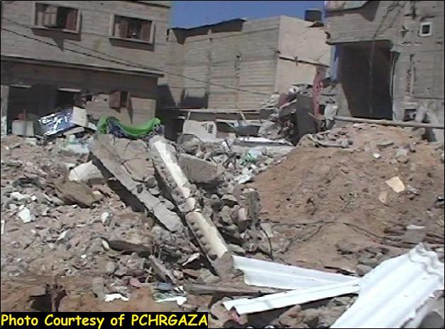
Since the outbreak of Al-Aqsa Intifada in September 28, 2003 and in contradiction to international laws, the Israeli occupation forces (IOF) escalated their violations against Palestinians in the Occupied Palestinian Territories (OPT) resulting in a huge campaign of house demolitions and confiscation of land. Rafah camp has suffered from the continuous Israeli campaigns which had made hundreds of families homeless and caused a severe devastation to their properties since most of the Israeli attacks were carried out without any pre-warning. At the same time, the random shelling of houses has put the life of the residents in danger due to their closeness to the border line where most of the Israeli military installation are located. See Photo 1
On the 11th of October 2003, a new Israeli military operation in the Gaza Strip was carried out under the pretext of searching for and shutting down what Israelis refer to as ''arms-smuggling tunnels'', claiming the existence of 13 secret tunnels along the Egyptian border area.
The IOF incurred into the Palestinian areas of Rafah city from several directions, mainly through Rafah crossing point and Moraj settlement to reach Tal Al Sultan and Zourob areas in the west. The IOF based in Tal Zourob military base shelled with tanks Palestinian houses in both areas. The house of Shede Zourob was completely burnt due to the shelling and all his properties were destroyed. In addition, the IOF razed 160 dunums, of which 100 dunums of green houses planted with vegetables, citrus, Palm and fruit trees and destroyed a water well and a number of irrigation networks and agricultural pools in the area.
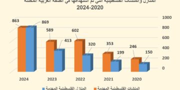
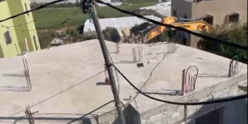
The IOF then spread through different parts of Rafah city to escalate their violations against Palestinians living in the neighborhoods of Al Barazil, Tal Al Sultan and Yebna refugee camp. Twenty Palestinian homes were hit by tank shells and heavy machine gunfire on the first day of the military operation and were completely destroyed. About 50 families who lived in the houses were left homeless. In addition, they destroyed the infrastructure of the city including sewage pipes, electric and telephone lines, and razed vast areas of agricultural lands estimated at 400 dunums. See Photo 2 & Photo 3
The Israeli occupying forces also closed the road between Rafah and Khan Yunis governorates and prevented farmers from reaching their lands to work at their fields.
The IOF often allude to a variety of justifications for its colonial activities in the Gaza Strip and the West Bank, mainly for security reasons, seeking the protection of settlers in the Israeli settlements. While the military operation aimed at creating a buffer zone to increase the Israeli control in the area through demolition operations, at the same time, facilitating the building of the Segregation Wall alongside the Egyptian border to the south of Rafah town and to cut any connection between the Palestinian territories and any neighboring Arab country. See map 1: Map of incident
Area identified by ARIJ's partner, PCHRGAZA.
The IOF started executing a segregation concrete wall a year and half ago aiming at creating new geographical features in the area. The Wall is 7 Km long and 8 meters high, similar to the wall that Israel is currently erecting in the West Bank. Until recently, a segment of 1.7 km in length was erected along the Israeli controlled border to Egypt. The Egyptian border has a width of 100 meters and was previously constructed by the Israeli forces after expropriation and destruction of Palestinian lands and private properties; in addition to uprooting of 750 thousand of fruitful trees mainly citrus and banana and destroying a considerable number of plastic houses which resulted in paralyzing the Palestinian agriculture sector in the Gaza Strip. See map of concrete Wall in Rafah.

Map 2: a map showing the part of the Segregation Wall in Rafah city
The Israeli military operation in Rafah to uncover what the Israelis refer to '' arms smuggling tunnels'' was completed after two days of continuous shelling and the IOF pulled out its troops leaving about 1240 people (250 to 300 families) homeless after demolishing 114 houses in the area according to the United Nations Relief and Work Agency (UNRWA) estimates. Thus, raising the number of Palestinian homeless to nearly 7,523 refugees, compared to 11,987 homeless citizens throughout the Gaza Strip.
References
- United Nations Relief and Work Agency (UNRWA)
Prepared by:
The Applied Research Institute – Jerusalem


