Hebron Governorate is located at the southern part of the West Bank. It has a total area of 1067.5 km square, of which 83.6 km square makes the Palestinian built-up area. The Governorate is a home to 579331 inhabitants (PCBS-2006) distributed over 120 Palestinian communities, the largest of which is Hebron city.
Land Classification of Hebron Governorate
In the Oslo II Interim Agreement that was signed in September 1995 between the Palestinians and Israelis, the Palestinian areas in the West Bank were categorized into three areas A, B and C which aimed at a phased withdrawal of the Israeli military forces from these areas until a final status agreement is negotiated and concluded. Area A constitutes the areas where the Israeli army has pulled out fully and Palestinians have complete autonomy over administrative and security issues. Area A, according to the Oslo II agreement, covered the main cities of the West Bank, except for Hebron. In Area B, Palestinians have full control over the civil responsibilities and Israel continues to have overriding responsibility for security; while Area (C): Palestinians have responsibility for civil life such as economics, health and education; however, Israel retains full control over security and administration related to territory.
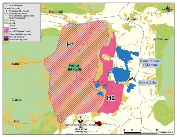
On 17 January, 1997, the Hebron Protocol was signed between Israel and the Palestinian Liberation Organization for redeployment of Israeli forces in Hebron in accordance with Oslo II Interim Agreement of September 1995. The Protocol divided the city of Hebron into Hebron 1 and Hebron 2, better known as (H1 & H2). H2 Area covered some parts of Hebron Municipal area which included the Old city and Kiryat Artba's settlement. See Map 1 (H1 & H2)
|
Table 1: Classification of Hebron Governorate's lands According to Oslo II Agreement of September 1995 |
||
|
Classification of Area |
Area |
% of the Governorate's |
|
Area A |
254149 |
24 |
|
Area B |
239218 |
22 |
|
Area C |
507200 |
47 |
|
H 2 |
4290 |
1 |
|
Nature Reserve |
62681 |
6 |
|
Total Area |
1067538 |
100 |
ARIJ GIS Database 2007
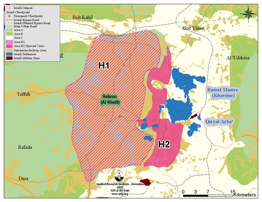
The Hebron Protocol has proved to devastative to the lives of the Palestinian Hebronites as it divided the city into two parts, which made very difficult for Palestinians to move across the city without encountering the vicious acts off the Israeli settlers there and that of the Israeli Army. Palestinian Hebronites try to avoid passing through the area that falls under the Israeli settlers control or even pass by it. However, those who live by that area have to go through all kinds of humiliation go in and out of their residences. Schoolchildren live in constant fear of the settlers, in fact, ambulances, fire trucks have a hard time getting there, and some time they do not get there at all.
The Israeli Segregation Wall eating up the lands of Hebron Governorate
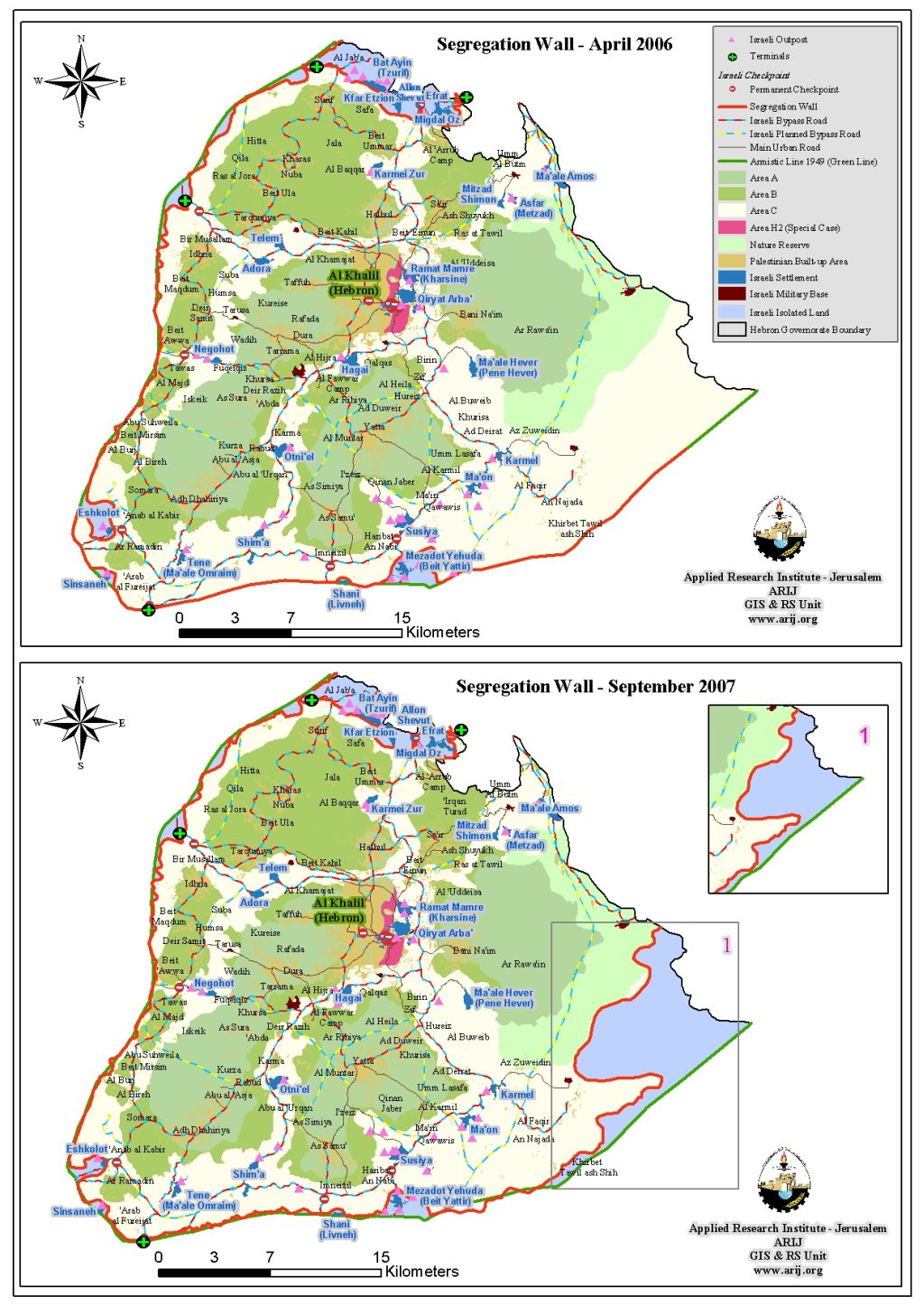
In September 2007, the Israeli Ministry of Defense issued an updated map of the Israeli Segregation Wall in the West Bank on its website. The new map showed an increase of 63.5% (66.2 km square) in the area to be isolated between the Segregation Wall and the 1949 Armistice Line in comparison to 38.1 km² in 2006. Accordingly, some 10% (104.3 km²) of Hebron governorate area became isolated behind the Segregation Wall. In addition, the new route of the Segregation Wall in Hebron showed an increase in the Segregation Wall's length by 26.2% (34 Km) to the 96 km recorded in April 30, 2006, by which the new length of the Segregation Wall became 130 Km, out of which, only 3.3 km (3 % of the Wall's total length in Hebron Governorate) run on the 1949 Armistice Line (the Green Line). See Map 2
|
Table 2: Land Use Land Cover (LULC) in Hebron Governorate |
|||
|
Land classification
|
LULC inside Hebron Governorate (dunums) |
LULC of the area that will be isolated by the wall ( dunums) |
Percentage of land isolated |
|
Agricultural Lands |
544608 |
15069 |
1.4 % |
|
Forest |
14007 |
5333 |
0.6% |
|
Open Spaces |
396998 |
78999 |
7.4% |
|
Palestinian built- up area |
83632 |
156 |
0.2% |
|
Israeli Controlled areas |
28293 |
4697 |
0.4 % |
|
Total |
1067538 |
104254 |
10 % |
Source: ARIJ – GIS Database 2007
The Status of the Israeli Segregation Wall in Hebron Governorate
At the northern part of Hebron Governorate, the Wall loops in Kfar Etzion, Beit 'Ayn (Tszurif) and Migdal Oz settlements located in Hebron Governorate within the Gush Etzion settlements bloc where most of the settlements there are located in Bethlehem Governorate.
As the Segregation Wall continues southwards along the 1949 Armistice Line (Green Line) to include Eshkolot and Sinsaneh settlements toward Israel, it then moves eastwards along the 1949 Armistice Line and annexes two other Israeli settlements (Shani and Beit Yatir) before it finally reach the southeastern part of the Governorate where it grabs considerable open space behind it.
So far, the Israeli Army has completed the construction of nearly 50% of the Segregation Wall total length in Hebron Governorate while the remaining 50+% are still in preparation-planning phase, to be completed by mid 2009. See Table 3 & Map 1
|
Table 3: Wall status in Hebron Governorate |
||
|
Wall Status |
Length ( Km) |
Percent of Total Wall length in Hebron Governorate |
|
Existing Sections |
64 km |
49.2 |
|
Planned Sections |
66 km |
50.8 |
|
Total Wall Length |
130 km |
100 |
Source: ARIJ – GIS Database 2007
To Conclude
The Israeli Unilateral activities in the occupied Palestinian Territory as in Hebron Governorate constitute a belligerent breach against the Palestinians population and rights to adequate standard of living. The encroachment of the Israeli Segregation Wall on Hebron lands is a growing danger that threatens the development, the sustainability, and the very existence of the Palestinian people throughout the occupied Palestinian territory. It does not only deprive the Palestinians from their valuable agricultural and grazing lands; but it also puts physical barriers to their natural growth and disconnects them from each other, and deny them their rights to their lands.
Prepared by
The Applied Reserach Institute – Jerusalem


