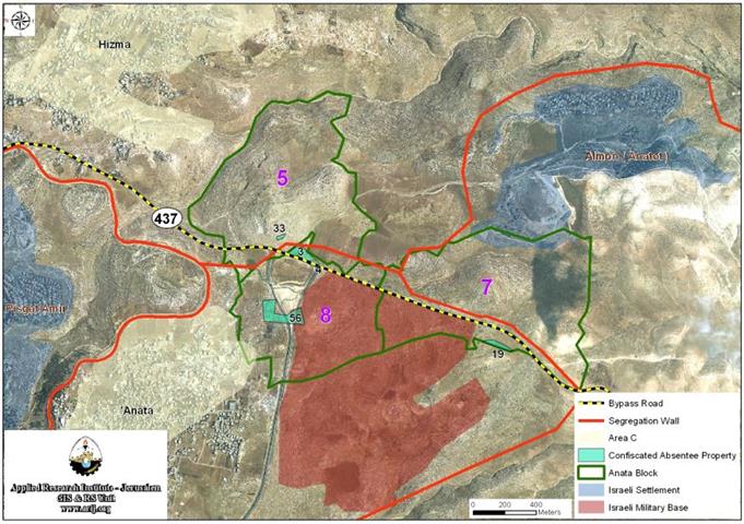
Map 1: the location of the threatened lands in ‘Anata Town northeast of Jerusalem
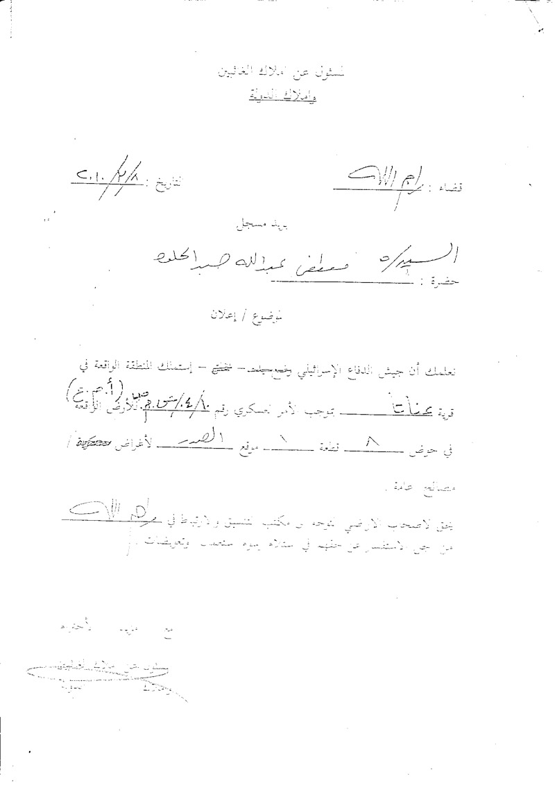
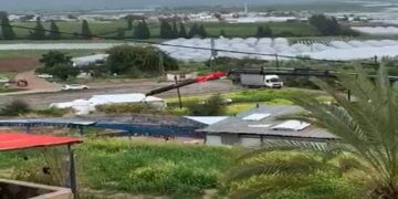
Photo 1 & Photo 2: Copies of the military orders that were delivereed to residents of ‘Anata Town
Anata village boundary include some 30,592 Dunums, however, acroos the past 43 years of the continued Israeli occupation, the town lost much of its lands to the various Israeli land grab tools; the settlements enterprise, military basses and lastly the illegal Israeli segregation wall all in total have caused a massive lost of the town’s lands, leaving less than quarter of the original land space for the Palestinian population of the town, with much restrictions on the usage of such spaces.
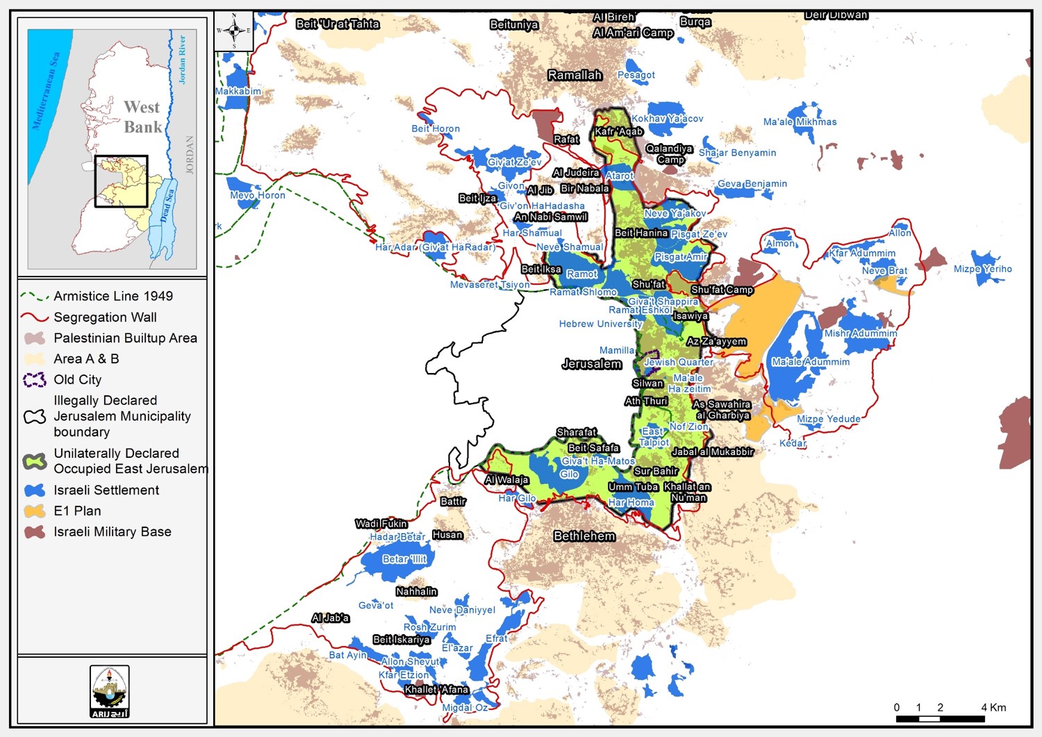
The settlement enterprise started on the lands of Anata, with an actual building space of 2,704 dunums. However, approved master plans of the settlements area allocate much more land space than the actual built up area, which is already segregated from the village boundary. An analyze of the master plans areas that set the previously mentioned allocated lands for future Israeli expansions indicate a space up to 23,426 Dunums (76.5%) of the Palestinian natives lands (see Table 2, see Map 1). Furthermore, some 15, 8 Km of roads was allocated as part of the roads network to facilitate the movement of the settlers inhabiting the settlements located within the town’s boundary and toward the rest of the settlement enterprise located in the occupied Palestinian territory.
|
Settlements located within the town village boundaries of Anata Town
|
|
Num
|
Settlement Name
|
Built up area in Dunums
|
Date Of establishment
|
|
1
|
Mishr Adummim
|
77
|
1974
|
|
2
|
Neve Brat
|
871
|
1992
|
|
3
|
Kfar Adummim
|
750
|
1979
|
|
4
|
Almon
|
695
|
1983
|
|
5
|
Allon
|
311
|
1990
|
|
Total
|
2704
|
|
Source: The geographical Information System , ARIJ 2010
Israeli illegal exploitation of the lands of Anata was accompanied by more than just colonizing settlements projects, an additional sum of 1,525 Dunums of lands were designated for military usage under the pretext of security and the need for military bases.
Map 2: The Israeli settlements established on lands of ‘Anata Town
Nevertheless, the segregation of Anata lands by the consecutive Israeli governments policy had yet passed a booming upgrade by the year 2002, when the Israeli occupying government led at that time by Ariel Sharon declared it’s plan to build the ‘Security Barrier’. Apparently the conclusion of this plan led to the building of the segregation wall, that disengaged Palestinians from their communities and lands, a policy of segregation and land grab tool and a grave violation of IHL as it has been documented by various Human Right’s reports
and as highlighted in the ICJ advisory ruling on the matter of the illegality of the segregation wall.
overall, Anata town lost a sum of 19,652 Dunums of it’s lands segregated by the building of the wall, hence, the local native population lost access and the right to exploit their private property due to the facts on the ground tool [the segregation wall] that was forced on the Palestinians endangering the livelihood of the native population and greatly setting back all hopes for prosperity and development in the area.
The legal argument that clearly classifies the Palestinian territory as occupied are highly documented in international law and declarations, the following affirms the legal definition of the Palestinian territory as occupied:
United Nations General Assembly adopted resolution A/RES/64/19 clearly noted and re-affirmed the illegality of all Israeli occupation practices of exploitation and control over the occupied Palestinian territory, including the illegality of Israeli settlements built within the 1967 occupied Palestinian territory including East Jerusalem, and re-affirmed the international legal stance towards the ‘Palestinian territory’ as occupied territory.
The previously mentioned General Assembly resolution also re-affirmed relevant resolutions previously set by the UN General Assembly, and UN Security council; ‘Recalling further relevant Security Council resolutions, including resolutions 242 (1967) of 22 November 1967, 338 (1973) of 22 October 1973, 1397 (2002) of 12 March 2002, 1515 (2003) of 19 November 2003, 1544 (2004) of 19 May 2004 and 1850 (2008) of 16 December 2008’.
Further more highlighted by The International Court of Justice in its decision of July 9, 2004 encapsulated this general view by noting the applicability of the Fourth Geneva Convention to the OPT.
Para 101: … The Court considers that the Fourth Geneva Convention is applicable in any occupied territory in the event of an armed conflict arising between two or more High Contracting Parties. Israel and Jordan were parties to that Convention when the 1967 armed conflict broke out. The Court accordingly finds that that Convention is applicable in the Palestinian territory which before the conflict lay to the east of the Green Line and which, during that conflict, were occupied by Israel, there being no need for any enquiry into the precise prior status of those territory
The argument of land property and the consequences of the occupying power abuse of its ‘temporary administrative’ in the occupied territory have been highlighted clearly in the
Forth Geneva Convention and
The Hague regulations.
The Forth Geneva Convention and under articles 49 and 147 prohibited the confiscation and the appropriation of native population property. Such unlawful behavior consists a ‘Grave Breach’ of international laws, as it deprives the native civil population their rights of property, and the utilization of private property for self sustainably (i.e. housing, utilization of resources and immovable property).
The Hague Regulations also require that the Occupying Power administer public lands, but only under the rules of usufruct; therefore the title of the public land is not transferred to the Occupying Power. The Occupying Power only acquires control over the “fruits” of the land, and may engage in profitable use of public lands only for the benefit of the local population, as well as to cover the cost of the occupation itself (Article 55 of The Hague Regulations, see also Article 48 and Article 49 of The Hague Regulations).
Furthermore, an Occupying Power cannot requisite nor seize private property on grounds other than security, unless such action is undertaken in accordance with local legislation in the occupied territory, i.e. legislation that predates the occupying force assuming control (Article 43 and Article 46 of The Hague Regulations).
To conclude
The Israeli continuous moves toward setting more facts on the ground; by building of settlements, bypass roads, military bases and the segregation wall, all the mentioned are continuous efforts to set a De-Facto irreversible status quo that would terminate the viability of the two state solution, a solution that the international community pursue as an answer for the Israeli-Palestinian conflict.
The variety of ‘security’ pretext and the manipulation of ‘legal’ land exploitation allegations set by the occupying power in occupied Palestinian territory are obviously tools that are being abused for the one and only interest of Israeli polices toward fortifying land grab and expansion on the ground.
:::::::::::::::::::____
Prepared by


