Violation: confirming the confiscation of 540 dunums intended to the construction of the Segregation Wall.
Date: April 4, 2011.
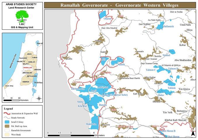
Damage inflicted on: Ni’lin, ‘Abud, Beit ‘Ur al Fauqa, Beit ‘Ur at Tahta, Safa, Bil’in, Al Midya, Deir Qiddis.
Details:
On April 4, 2011, the Israeli Occupation served 7 military orders stating the continuity of the confiscation of lands in the western villages of Ramallah through the so-called ‘District Coordination Offices’. The lands were confiscated in 2004 for the sake of the construction of the segregation wall.
The orders, signed by the Israeli Occupation Army High Commander in the West Bank, Avi Mizrahi, and issued on March 27, 2011, gave the victims a 15 days respite period to object to the orders. However, the Israelis handed the orders two months after the dates of the orders, giving them no chance to object whatsoever. This shows the Israeli intention to take over the land showing that the orders are nothing but ‘paper work’.
Picture 1-4: photocopies of some of theorders
Picture A-D: maps enclosed with the orders
Table 1: information on the confiscated lands:
|
Order Number
|
Location
|
Parcel
|
Number of fields
|
Confiscated area (dunum) (as mentioned in the order)
|
|
|
Safa
|
6
|
‘Irq al Theeb, Ben Hrez, and Ad Deir
|
105
|
|
5
|
Ad Daliya
|
|
4
|
Huriyya, Khallit Loot, Al Hiz’a
|
|
3
|
F’eish
|
|
|
Deir Qiddis
|
2
|
Ar Ras, Khallit ‘Abed Rabbu, Janye al Kufur
|
53
|
|
|
Al Midya
|
2
|
Najmit ‘Imeira, Misht al ‘Irq
|
65
|
|
Ni’lin
|
5
|
Wadi al Zbeid, Al Habala
|
|
|
‘Abud
|
2
|
Al Wajh al Gharbi, Al Wajh al Qabli
|
113
|
|
4
|
Al Wajh al Shami
|
|
|
N’ilin
|
2
|
Al Tarfana
|
72
|
|
9
|
Al Hariq, Bir Ren, Batn al Jahour
|
|
|
Beit ‘Ur al Fauqa
|
2
|
Al Mal’ab
|
4
|
|
Beit ‘Ur at Tahta
|
5
|
Piece 5
|
|
|
Safa
|
‘Irq al Theeb
|
6
|
128
|
|
Bil’in
|
Jabayel Snan. Al forkan, Al Wahs, Ad Daher, Khallit al Miqsar, Al Maghar, Al Mazar, Abu Shawa, Al Mesteh, Al Hamish, Harayiq Zayed
|
2
|
|
Total
|
540
|
The Segregation Wall around Ramallah:
The slice of the segregation wall surrounding Ramallah has, according to the Palestinian Ministry of Colonization Affairs, isolated and destroyed more than 37230 dunums. The areas to the west of the wall have been witnessing intense colonial activities for years.
The segregation wall surrounding Ramallah from:
First: the north western part, the wall on this side is connected to the part stretching from the south western part of Salfit. It extends from Northern ‘Abud to the south west of the village; extending further towards Al Lubban al Gharbi then surrounding Rantis. The wall on this side isolates huge areas of these villages and amends ‘Ufarim and Beit Areh the ‘state of Israel’.
Second: the Western Part, the wall extends from southern Rantis, further south to pass through numerous Palestinian villages including Shaqba, N’ilin, Al Midya, Deir Qiddis, Bil’in, Safa, Beit Sira, and Beit Liqya meeting the part surrounding the villages of north west Jerusalem. This part of the wall penetrates the West Bank amending colonies alike Modin Illit, Mattityahu, Shilat Labid, Avar Rot, and Makkabim. The Israelis started the expansion of Modin Illit over Bil’in lands showing the true purpose of the wall.
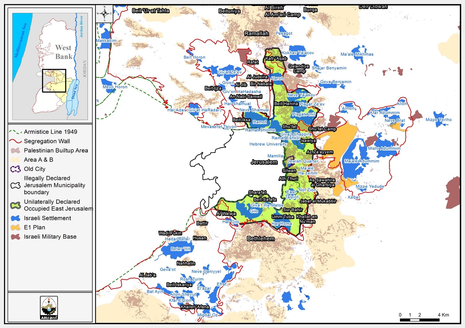
Third: the South Western Part, this part of the wall meets the part extending from Qalandiya; starting from Rafat village (southern Ramallah), it extends to Beituniya while isolating more than 12,000 dunums of the village lands in addition to 70 more needed for the construction of Beituniya commercial pathway, proposed by the Israelis. From Beituniya, the wall stretches towards Beit ‘Ur al Fauqa and Beit ‘Ur al Tahta meeting the part surrounding the villages of North West Jerusalem. The wall on this side accommodates Givat Zeev and Beit Horon colonies.


