Location and population
Deir Istiya village is located 8 km to the northwest of Salfit city and 15 km from the Artimistice Line (Green Line). The village has the population of 4000 inhabitants, 65 of whom are currently jobless. According to World Food Program, about 150 families are dependent on humanitarian assistance. This has been due to military closure and denial of work, especially after the construction of the Segregation Wall.
The village area
The village has the total area of 34000 dunums which makes it one of the largest areas in Salfit district. Out of this number, 900 dunums are designated for built-up area. The village is abundant of surface water springs which all located in the adjacent Wadi Qana.

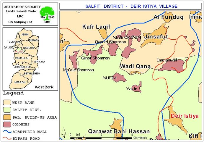
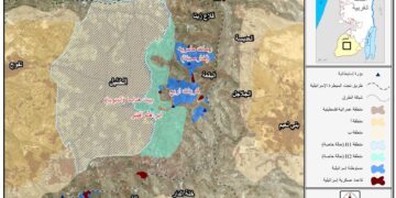
(Location map of Deir Istiya- Salfit, and settlements)
The Israeli colonization in Deir Istiya
Ever since the Israeli military occupation of the West Bank in 1967, the village witnessed continuous violations and land confiscation campaigns, the result of which was the establishment of 8 Israeli settlements and outposts built over almost 13000 dunums of Palestinian owned lands, as followed:
1. Karne Shomron (The oldest settlement), established in 1978 in the north western side of Deir Istiya and expanded over 2000 dunums of Palestinian agricultural lands. In the year 2000, it had the population of 5890 settlers ( Source- Peace Now movement);
2. Yakir, established in 1981 in the northern side of the village, close to a military camp. Now it has an area of about 3000 dunums. In the year 2000, it had the population of 822 settlers ( Source- Peace Now movement);
3. Emmanuel, established in 1982 in the northern side of the village. It has the area of 5000 dunums which makes it one of the largest settlements in the West Bank. In the year 2001, it had the population of 2700 settlers ( Source- Peace Now movement);
4. Nofim, established in 1988 in the south western side of the village with a total area of 500 dunums. In the year 2000, it had the population of 385 settlers ( Source- Peace Now movement);
5. Revava, established in 1991 in the western side of the village, on lands of Haris village, but expanded onto Deir Istya village land. Now, it occupies an area of 1500 dunums. It had the population of 504 in the year 2000 ( Source- Peace Now movement);
6. Ginat Shomron, established in 2000 in the north western side of the village with a total area of 500 dunum;
7. An outpost was built in year 2000 between Ginat Shomron and Karne Shomron settlements, to the north of the village. Now, it has an area of 450 dunums;
8. Another outpost was built near Revava settlement in the year 2000 with an area of 500 dunums.
Recent Israeli activities in the area:-
-
The additional confiscation of 150 dunums located to the southeastern side of Emmanuel settlement for the purpose of enlarging the settlement. Another 70 dunums were, also, confiscated for the expansion of Revava settlement in the west;
-
The pollution of water springs in Wadi Qana by pumping deliberately the wastewater coming out of the settlements of Ykir and Nufim into the land and water resources in the Valley, inflicting damage to agricultural biodiversity, polluting sweet water and causing health hazards to local inhabitants and farmers.
-
The prevention of Palestinian shepherds from grazing their cattle in the vicinity of settlements, which, in turn, reduced the available area of range land to 30 %;
-
The IOF closed all agricultural roads in the area to prevent framers from reaching their fields as a preliminary step towards confiscating these lands and annexing them to existing nearby settlements;
-
Continuous harassment and attacks on the part of settlers against Palestinian farmers and inhabitants of Deir Itstiya, including the shooting of live bullets, sound bombs and beatings.
Deir Istiya Village Council has submitted a series of complains against the practices of the Israeli army and settlers, some of which were presented to the Israeli High Court and human rights organization, but to no avail.
Prepared by
The Land Research Center
LRC


