The village of Al Jalboun is considered to be a prime example of the suffering of Palestinian villages since 1948. It serves also as an honorable example of the steadfastness of the Palestinian Man and his attachment to his land despite of all the daily challenges and threats presented to him be it by the occupation forces or by the colonists.
The village of Al Jalboun is located 12 kilometers east of the city of Jenin. It is bordered from the east and north by the Green Line. The area of the village before the 1948 War was almost 33,000 dunums stretching till the Jordanian borders in the east and the City of Bisan in the north. Thousands of those dunums were lost due to the War in addition to those taken over despite its classification as neutral de-militarilized zones. Currently, the area of the village is only 7850 dunums.
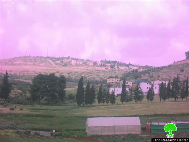
It is worth pointing out that the village is located in a low terrain between high mountains. Israeli occupation forces built three colonies on the mountains overlooking the village and the nearby village of Faqooa’. One of these colonies is called “Ma’ale Jalbou’a” which was established in the early 1950’s. It is an agricultural colony that has a large number of cows in addition to a military training camp.
Photo 1: The colony of Ma’ale Jalbou’a
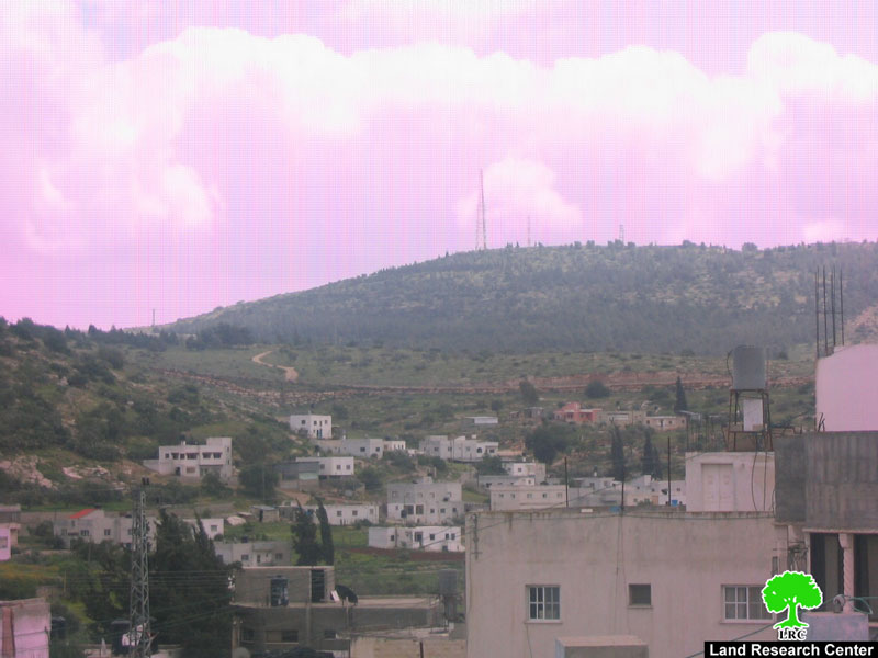
At the end of the 1970s Israeli occupation established the colony of “Malik Yasho’u” which is a residential colony located in the forest part of the village.
Photo 2: The colony of Malik Yasho’u
Finally, at the end of the last century occupation forces established the colony of “Mirav” east of the village. It is an agricultural colony that has both livestock and poultry stocks. As such, colonies are surrounding the village from three directions. Only the western direction is available to be used for future expansion of the village.
Photo 3: The colony of Mirav, built atop Al Jalboun lands.
It has to be mentioned here that at the time that the occupation devoured most of Al Jalboun’s lands, the Racist Isolation Wall deprived the residents from accessing their lands located in the southern parts of the village. More than 2,000 dunums lay beyond the Wall as it comes as close as 4 meters to some houses in the village.
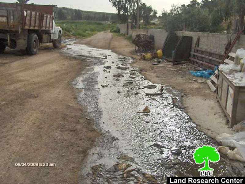
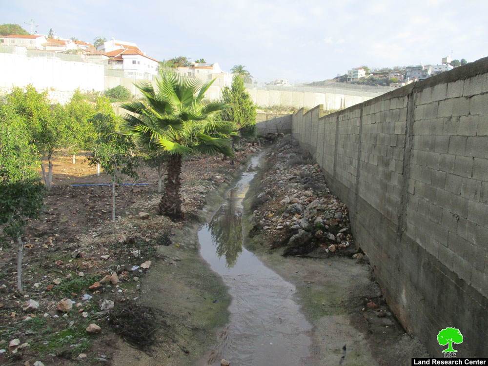
A new facet of the occupation is currently threatening the village and that is environmental pollution caused by the nearby colonies. These colonies pump their sewage and solid waste through the passages in the Racist Wall into the village from its northern and eastern directions. The location of the village in the valley makes it a natural destination for the solid waste and wastewater stemming from the colonies occupying the hilltops overlooking the village. Colonists pump their sewage and cow by-products into the valley as it finds its way into the village. Damage has been reported to the graves of the village as well as to the large planting fields in the area of Al Misrara located 4 kilometers east of the village due to the sewage. Tens of farmers have lost their crops and outsiders have become reluctant to buy any vegetables from the Al Jalboun Valley due to the pollution caused by the nearby colonies.
Photos 4 to 6: Some of the effects of pollution caused by Israeli colonies in Jalboun
The northern part of the village is not faring better than its eastern part; the colony of Ma’ale Jalbou’a is pumping its wastewater as well as the solid waste of its cow farms through the Barrier towards the village polluting the fields and damaging Palestinian houses. Around 30 houses have been damaged while skin disease cases have been widely spread. Moreover, insects and rodents have become a familiar sight especially during the summer months.
In addition to the effects of the wastewater and sewage on the agricultural and animal presence in the area, the dumped waste include the waste stemming from a pickles factory located in the colony. The concentrated chemical and its by-products have led to wiping out the crops of entire fields and turning it into the black color.
Mr. Hisham Abdullah Najji Abu Al Rub (49 years old) suffers from the flow of sewage from the colony of Ma’ale Jalbou’a as it runs in front of his house. He expressed the following to Land Research Center (LRC)’s field researcher: ' The situation is becoming intolerable. Our houses and neighborhoods have turned into a big prison due to the wastewater and sewage dumped upon us from the colony. The streets are becoming full of sewage and awful odor that we cannot even walk on it. Also, mosquitoes and other insects are becoming widely spread which makes us obliged to close our windows. The sons of my brother Hisham are currently suffering from skin disease and our plants and crops are destroyed. I have placed a number of bee hives in the area as a source of income, yet not enough honey was produced due to the pollutants.'
In turn, Mr. Fakhri Ibrahim Ali Abu Al Rub expressed the following: 'My situation is not better that my neighbors. Sewage from the colony of Mirav flows in the middle of my house’s front yard. It is dividing my house into two to the degree that I need a bridge to cross into my house. In addition, the mesquites that are spread around us have introduced diseases to my cattle. I need a special budget to cover the expenses of treating my 22 sheep.'
In addition to what was listed above, the awful odor coming from the cow farms in the nearby colonies fill the village, especially when the eastern winds blow in the valley.
It is worth noting here that the problem of pollution in Jalboun has started since the establishment of the surrounding colonies. Yet, it became much more magnified when the Israeli Racist Isolation Wall was built of the villages’ lands in 2002. The village Council has tried to find a solution for this problem through the legal channels and through national and international human rights organizations. However, the promises given to the Council stay as what they are; just promises with no real resolution to the pollution problem.
Al Jalboun Village: General Information
The village of Al Jalboun is located 12 kilometers northeast of the city of Jenin. It is located on a mountainous region at about 300 meters above sea level. The village of Faqooa’ is located north of the village while the village of Al Maghier is located south of it. On the western direction the lands of the village of Deir Abu Da’eif are located.
The village has only one clan; Abu Al Rub. Around 90% of its 250 residents are registered refugees. The number of houses is 380 in which 450 households live. The unemployment rate reached around 25%. The total area of the village is 7850 dunums (including the land confiscated for the construction of the Wall). Around 92% of the lands of the village are used for agricultural purposes.
Prepared by:
The Land Research Center
LRC


