- Violation: new colonial outpost.
- Location: West Salfit city.
- Date: September 30th 2021.
- Perpetrators: Illegal colonists of “’Etz Efraim”.
- Victims: Heirs of Late Rida ‘Odeh ‘Amer
Description:
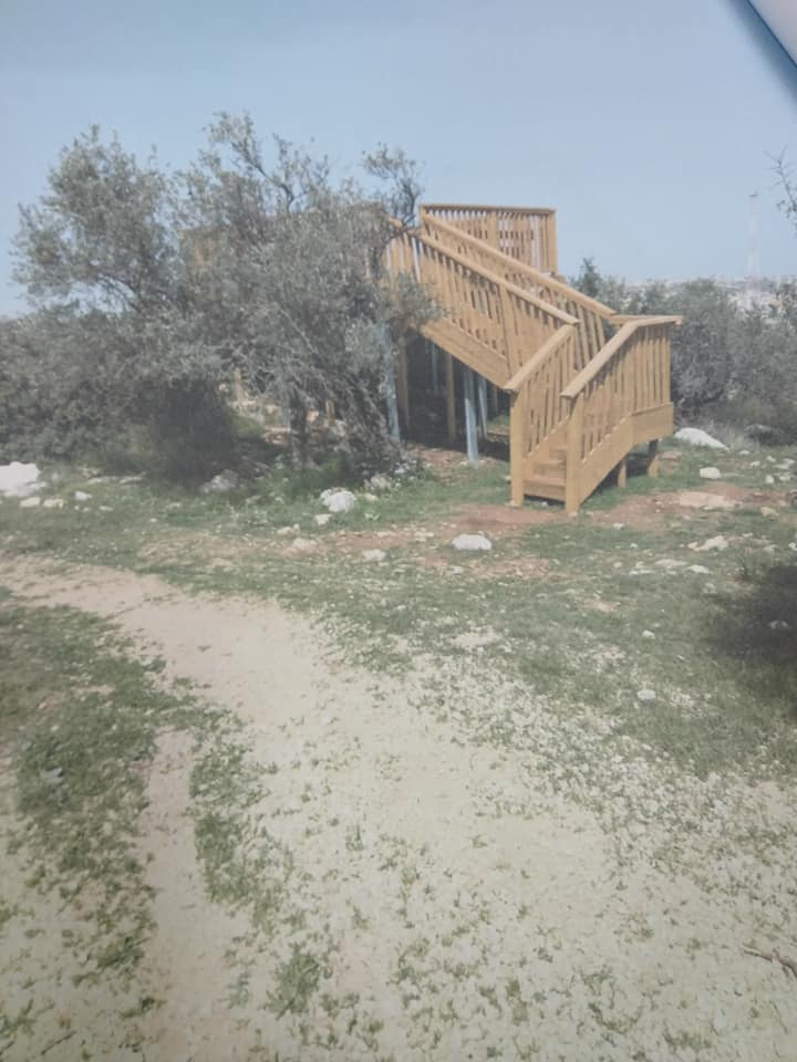
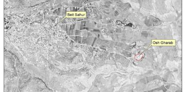
September 30th 2021 , Thursday, a group of radical colonists established a new outpost on Mas-ha village lands isolated behind the Annexation and Expansion wall in Hariqat Shehadeh area , which is an area of olive groves.
‘Etz Efraim colony is only few meters away from the targeted location. Recently, colonists are always present at the plot, harassing the owners, and imposing their illegal control.
Sadiq ‘Odeh (62) – one of the heirs told LRC:
“We inherited about 45 dunums in Hariqat Shahadeh area, most of them are planted with olive trees. Unfortunately, due to the location of the plot , we can only access it through a gate in the Annexation and Expansion wall on the village lands , and after coordination with the occupation forces in certain seasons. Luckily, a part of the plot can be accessed through a gate in the wall in ‘Azzun ‘Atma village that opens.”
‘Odeh pointed out:
“Thursday, as farmers were visiting their olive groves in Hariqat Shahadeh area, they noticed that a part of the plot was leveled, and a room and woodwork were built at the location, noting that the controlled part is a strategic location and overviews vast areas of agricultural lands at the location.”
 |
 |
 |
 |
 Colonial structures in Rida ‘Amer’s plot

Noteworthy, farmers filed a complaint to the Israeli Occupation, but no serious investigations were taken in this regard.
Mas-ha is under a Vicious Colonial Attack:
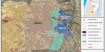
A small Palestinian Village surrounded by the Annexation and Expansion wall , People of Mas-ha wake up every morning to the voices of bulldozers ravaging lands and crumbling stones to build more colonial units and bringing in illegal Jewish colonists.
The Occupation built four colonies on Mas-ha land that occupy more than 3500 dunums, suffocated by the Annexation and Expansion wall that confiscated 890 dunums of its lands, and isolated 4235 dunums of fertile lands and olive groves, Israeli illegal colonies are still expanding on the village lands while people of the village are not allowed to build any new structures.
Noteworthy, during the past years – the so called Israeli civil Administration of Judea and Samaria – building and organization high council – Colonization subcommittee publishes expansion schemes for ‘Etz Fraim colony, the schemes were collected in a table for documentation purposes by LRC:
|
Location |
Date |
No. of colonial unit |
Plan area in dunums |
Plan no. |
notes |
Plan type |
|
Mas-ha |
Sept 18th 2016 |
34 |
– |
7/126 |
An objection was submitted of the notice |
Discussing objections |
|
Mas-ha |
Feb 14th 2017 |
38 |
48 |
Tender offer reopened with additional colonial units |
Deposition of an organizational plan |
|
|
Mas-ha |
March 13th 2017 |
– |
4 |
Land planning |
Deposition of an organizational plan |
|
|
Mas-ha |
May 21st 2017 |
– |
0.6 |
Expanding the area for residential construction |
Deposition of an organizational plan |
|
|
Mas-ha |
Jan 29th 2018 |
– |
19 |
4/126 |
Land planning |
Deposition of an organizational plan |
|
Mas-ha |
May 16th 2018 |
– |
5 |
Land planning was published first in August 29th 2017 |
Valid |
|
|
Mas-ha |
August 1st 2021 |
3 |
1 |
13/126 |
Adding new outposts |
Valid |
About Mas-ha:
17 km away from Salfit governorate, Mas-ha populates 2003 inhabitants on a total land area of 7870 dunums, of which 600 dunums are the village’s built-up area. The occupation confiscated massive area from the village for the favor of the apartheid wall and settlements.
The wall is reported to be of 8.9km in length and 100m in width. As per its construction, the wall confiscated 890 dunums of Mas-ha lands and isolated 4235 other dunums from the area. The following settlements are founded on the lands of the village:
|
settlement |
Year of establishment |
Population |
Area\dunum |
|
Elkana A |
1977 |
3,050 |
1,373.5 |
|
Elkana B |
1985 |
617 |
539 |
|
Shari Tikva |
1982 |
3,692 |
1,130.5 |
|
Benot Orot Israel |
1989 |
N.A |
168 |
|
Total |
7,359 |
3,211 |
|
(Source: Geographical Information System GIS – LRC)
UN Security Council resolutions in regard to Israeli colonies:
UN Security Council resolution 446, article 3 ” Calls once more upon Israel, as the occupying Power, to abide scrupulously by the 1949 Fourth Geneva Convention, to rescind its previous measures and to desist from taking any action which would result in changing the legal status and geographical nature and materially affecting the demographic composition of the Arab territories occupied since 1967, including Jerusalem, and, in particular, not to transfer parts of its own civilian population into the occupied Arab territories;”
- Un Security Council resolution 452, article 3″Calls upon the Government and people of Israel to cease, on an urgent basis, the establishment, construction and planning of settlements in the Arab territories occupied since 1967, including Jerusalem;”
- Un Security Council resolution 465, Strongly deplores the continuation and persistence of Israel in pursuing those policies and practices and calls upon the Government and people of Israel to rescind those measures, to dismantle the existing settlements and in particular to cease, on an urgent basis, the establishment, construction and planning of settlements in the Arab territories occupied since 1967, including Jerusalem;
Calls upon all States not to provide Israel with any assistance to be used specifically in connexion with settlements in the occupied territories;
- Un Security Council resolution 242, Affirms that the fulfilment of Charter principles requires the establishment of a just and lasting peace in the Middle East which should include the application of both the following principles:
(i) Withdrawal of Israel armed forces from territories occupied in the recent conflict;
(ii) Termination of all claims or states of belligerency and respect for and acknowledgment of the sovereignty, territorial integrity and political independence of every State in the area and their right to live in peace within secure and recognized boundaries free from threats or acts of force;
Prepared by
The Land Research Center
LRC


