• About The Project
  • Palestine in Century
  • Selected Maps
  • Glossary
  • About ARIJ
  • About LRC
  • By Year
    • Case Studies By Year
    • Daily Report By Year
Monday, May 25, 2026
POICA
No Result
View All Result
  • Home
  • Settlements
    • New Israeli Settlements
    • Settlement Expansion
  • Israeli Violations
    • Agriculture
    • Confiscation
    • Demolition
    • Environment
    • Eviction of Palestinians
    • Settlers Attacks
  • Bypass Roads
  • Israeli Plans
  • Segregation
    • Checkpoints
    • Closure
    • Separation Plans
  • Military Orders
  • Reports
    • Daily Report
    • Monthly Report
    • Quarterly Report
  • Home
  • Settlements
    • New Israeli Settlements
    • Settlement Expansion
  • Israeli Violations
    • Agriculture
    • Confiscation
    • Demolition
    • Environment
    • Eviction of Palestinians
    • Settlers Attacks
  • Bypass Roads
  • Israeli Plans
  • Segregation
    • Checkpoints
    • Closure
    • Separation Plans
  • Military Orders
  • Reports
    • Daily Report
    • Monthly Report
    • Quarterly Report
No Result
View All Result
POICA
No Result
View All Result

The Occupation Cancels Allocation of a Natural Reserve for Colonial Expansion in Qalqilya governorate

February 16, 2021
in Israeli Plans


  • Violation: Canceling Allocation of a Natural Reserve for Colonial Expansionist projects.
  • Location: ‘Azzun , Kafr Thulth and ‘Asla in Qalqilyab governorate.
  • Date: April – August 2020.
  • Perpetrators: The Occupation Forces Amy Commander.
  • Victims: The targeted towns and villages.

Description:

The Israeli Occupation Authorities perpetuate colonial expansionist projects in the Palestinian territories.

In April 21st 2020, West Bank Army Commander Nedav Badan issued a military order to change allocation of lands , previously announced as forests during the British Mandate in 1927 , in order to use them for colonial expansionist projects related to Alfei Menashe colony , which is illegally built on ‘Azzun and ‘Asala lands.


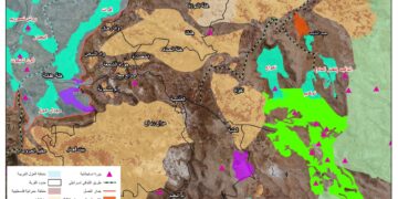
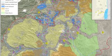
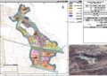
Photos 1-3: Military Order for ‘Alfei Menashe colony

August 18th 2020, the Occupation’s army commander issued a similar military order to cancel allocation of forests , for the sake of Ma’ale Shamron expansionist projects on Azzun and Kaft Thulth towns in Qalqilya.

Photos 4-6: Military order for Ma’ale Shamron colony

Land Research Center geographical information unit analyzed the military orders and found out the following:

  • The two military orders changed allocation 420 dunums of lands , and turned them from forests to Construction areas.
  • The area that surround Alfei Menashe colony is 407 dunums.
  • The area that surround Ma’ale Shamron colony is 13 dunums.
  • The targeted lands in the military orders are located to the south or southeast of the colonial outpost Tel Menashe , and to the south or southwest of Ma’ale Shamron colony.
  • The Occupation authorities and colonization organizations uprooted trees in the forests and replaced them with high buildings before declaring the military order or changing land allocation, the Occupation authorities later changed land allocation in order to authorize their construction.

During the last three years, the occupation changed allocation of land , and cancelled British laws in many colonies such as “Ma’ale Shamron” and “Alfei Menashe” in Qalqilya governorate.

Maale Shomron: A threat to the Palestinian land and environment

The colony of Maale Shomron was established in 1980 on lands classified as “State Property”. In years, the colony expanded to confiscate tens of agricultural dunums from the villages of Azzun, Kfar Thulth and Kfar Laqif from Qalqiliya and the town of Deir Istiya from Salfit governorate.

In 2001, the Israeli occupation set up many military points and a security fence in the periphery of the colony. As a result, tens of agricultural dunums got destroyed where some lands became isolated behind the fence. Noteworthy, those lands became subject for colonial activities such like establishing public parks, gardens and governmental buildings.

Photos 8-7: Ma’ale Shamron colony

About Alfei Menashe colony:

The colony started in the 1980s after the Israeli Occupation Forces confiscated some agricultural areas from Nabi Elyas and Ras Atyyeh villages to turn them into military base. The base later developed to accommodate more colonists and caravans. In 1986, colonial activity escalated to the level of opening new roads and developing the infrastructure, devouring more dunums from the area for the sake of the colony’s expansion .

After the establishment of the apartheid wall in 2002, colonists took advantage of it to confiscate more lands and expand their colonies on them.

The Apartheid wall that surrounds the colony is 18,565 m long, 9,397 m are built of cement , and the rest are a steal siege.

The settlement is close to bypass 55 which leads to the occupied territories of 1948.


Prepared by
The Land Research Center
LRC
 

Recommended For You

الآثار كأداة للضم الزاحف: مشروع القانون الإسرائيلي لإعادة هندسة الجغرافيا والهوية في الضفة الغربية

by arij
May 23, 2026
0
الآثار كأداة للضم الزاحف: مشروع القانون الإسرائيلي لإعادة هندسة الجغرافيا والهوية في الضفة الغربية

في خطوة تعكس تصاعد المساعي الإسرائيلية لإحكام السيطرة على الرواية التاريخية والجغرافيا الثقافية في الضفة الغربية، صادقت الهيئة العامة لـ الكنيست الإسرائيلي يوم 11 أيار 2026 على مشروع...

Read moreDetails

ذكرى الـ 50 ليوم الأرض: فلسطين بين ذاكرة الدم وصمود البقاء    

by arij
April 16, 2026
0

في الثلاثين من آذار، لا يستحضر يوم الأرض في الوعي الفلسطيني بوصفه مناسبة رمزية عابرة، بل كحدث تأسيسي متجدد يعكس استمرارية الصراع على الأرض والهوية. وبعد مرور خمسين...

Read moreDetails

Unprecedented Acceleration in Israeli Settlement Expansion in 2025

by arij
March 25, 2026
0
Unprecedented Acceleration in Israeli Settlement Expansion in 2025

Preface, The Israeli settlement policy in the occupied West Bank is one of the most significant obstacles to achieving a just and sustainable peace. Since the occupation of...

Read moreDetails

تسجيل الأراضي أم الضم عبر السجل؟ الرهانات القانونية والسياسية لتسوية الملكيات في الضفة الغربية

by arij
February 26, 2026
0
تسجيل الأراضي أم الضم عبر السجل؟ الرهانات القانونية والسياسية لتسوية الملكيات في الضفة الغربية

لم يعد مشروع "تسوية وتسجيل الأراضي" في الضفة الغربية مجرد إجراء تقني لتنظيم الملكيات، بل تحول إلى أداة سياسية وقانونية لإعادة تشكيل الواقع الجيوسياسي في الأرض الفلسطينية المحتلة....

Read moreDetails

الدورة الشتوية للكنيست الإسرائيلي 2025: الضم كسلاح سياسي وإقليمي

by arij
October 25, 2025
0

افتتحت الدورة الشتوية للكنيست الإسرائيلي وسط تصاعد التوترات، وتميزت بهجوم حاد من الحكومة على القضاء. في كلمته الافتتاحية، انتقد رئيس الوزراء بنيامين نتنياهو القضاء مباشرة ودافع عن العمليات...

Read moreDetails
Next Post

ARIJ Daily Report – Tue, 18th 08 2020

LATEST NEWS

سلطات الاحتلال الإسرائيلي بصدد الاستيلاء على موقع قبر النبي صموئيل شمال غرب مدينة القدس

سلطات الاحتلال الإسرائيلي بصدد الاستيلاء على موقع قبر النبي صموئيل شمال غرب مدينة القدس

by arij
May 23, 2026
0

........................................................

إقامة منطقة عسكرية عسكرية داخل أراضي (أ) في جنين

إقامة منطقة عسكرية عسكرية داخل أراضي (أ) في جنين

by arij
May 19, 2026
0

........................................................

الآثار كأداة للضم الزاحف: مشروع القانون الإسرائيلي لإعادة هندسة الجغرافيا والهوية في الضفة الغربية

الآثار كأداة للضم الزاحف: مشروع القانون الإسرائيلي لإعادة هندسة الجغرافيا والهوية في الضفة الغربية

by arij
May 23, 2026
0

........................................................

النكبة الفلسطينية في ذكراها الثامنة والسبعين: من التطهير العرقي إلى الإبادة وإعادة هندسة الجغرافيا الفلسطينية 

النكبة الفلسطينية في ذكراها الثامنة والسبعين: من التطهير العرقي إلى الإبادة وإعادة هندسة الجغرافيا الفلسطينية 

by arij
May 18, 2026
0

........................................................

flag_yellow_lowEU-PfP-Logo

This website and its content were initiated in 1993 by the Applied Research Institute – Jerusalem (ARIJ) and the Land Research Center (LRC) with the support from the European Union up until 2023. Since then, the Applied Research Institute – Jerusalem (ARIJ) has taken over the continued development and maintenance of the website. The views expressed remain solely those of ARIJ) and do not necessarily reflect those of the European Union.

© 2026 Copyright | ARIJ | All Rights reserved.

No Result
View All Result
  • Home
  • Settlements
    • New Israeli Settlements
    • Settlement Expansion
  • Israeli Violations
    • Agriculture
    • Confiscation
    • Demolition
    • Environment
    • Eviction of Palestinians
    • Settlers Attacks
  • Bypass Roads
  • Israeli Plans
  • Segregation
    • Checkpoints
    • Closure
    • Separation Plans
  • Military Orders
  • Reports
    • Daily Report
    • Monthly Report
    • Quarterly Report

© 2026 Copyright | ARIJ | All Rights reserved.