• About The Project
  • Palestine in Century
  • Selected Maps
  • Glossary
  • About ARIJ
  • About LRC
  • By Year
    • Case Studies By Year
    • Daily Report By Year
Monday, August 3, 2026
POICA
No Result
View All Result
  • Home
  • Settlements
    • New Israeli Settlements
    • Settlement Expansion
  • Israeli Violations
    • Agriculture
    • Confiscation
    • Demolition
    • Environment
    • Eviction of Palestinians
    • Settlers Attacks
  • Bypass Roads
  • Israeli Plans
  • Segregation
    • Checkpoints
    • Closure
    • Separation Plans
  • Military Orders
  • Reports
    • Daily Report
    • Monthly Report
    • Quarterly Report
  • Home
  • Settlements
    • New Israeli Settlements
    • Settlement Expansion
  • Israeli Violations
    • Agriculture
    • Confiscation
    • Demolition
    • Environment
    • Eviction of Palestinians
    • Settlers Attacks
  • Bypass Roads
  • Israeli Plans
  • Segregation
    • Checkpoints
    • Closure
    • Separation Plans
  • Military Orders
  • Reports
    • Daily Report
    • Monthly Report
    • Quarterly Report
No Result
View All Result
POICA
No Result
View All Result

Land Leveling In Beit Sahour City to fortify Ush Ghrab Military Base

December 29, 2015
in Israeli Plans
Land Leveling In Beit Sahour City to fortify Ush Ghrab Military Base


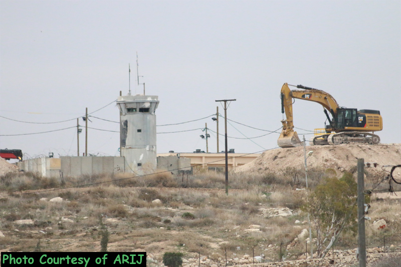
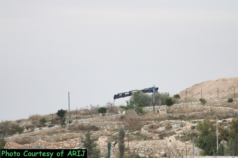
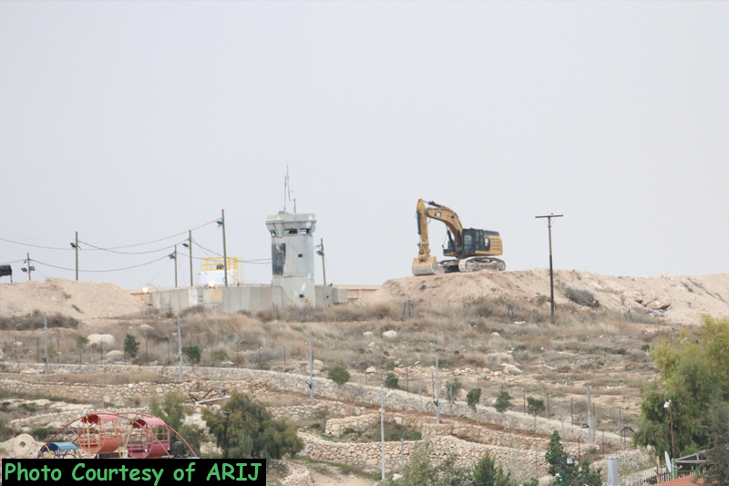
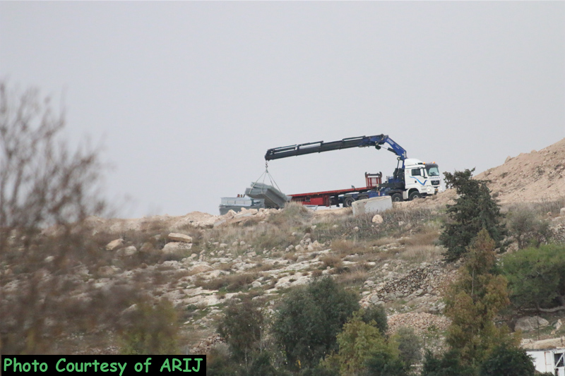
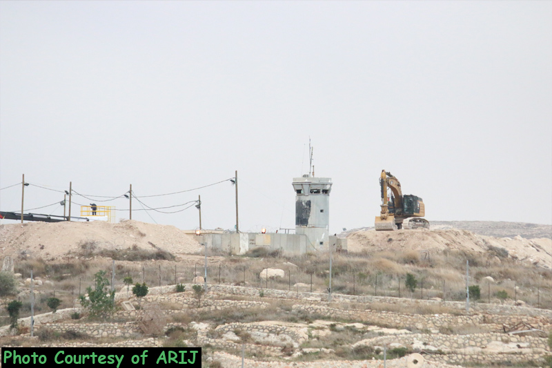
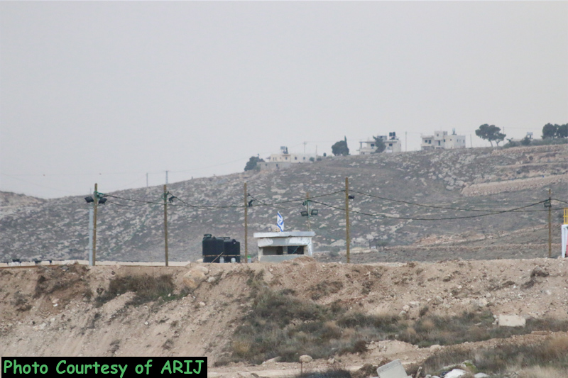
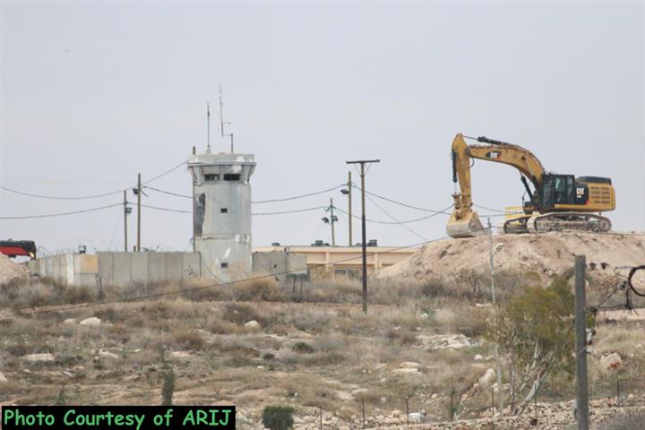
On December 29, 2015, the Israeli Army bulldozers stationed in “Ush Ghrab” Israeli military camp east of the city of Beit Sahour and start leveling the land and installing cement blocks to fortify the military base and its surroundings. See the pictures below:
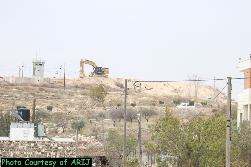
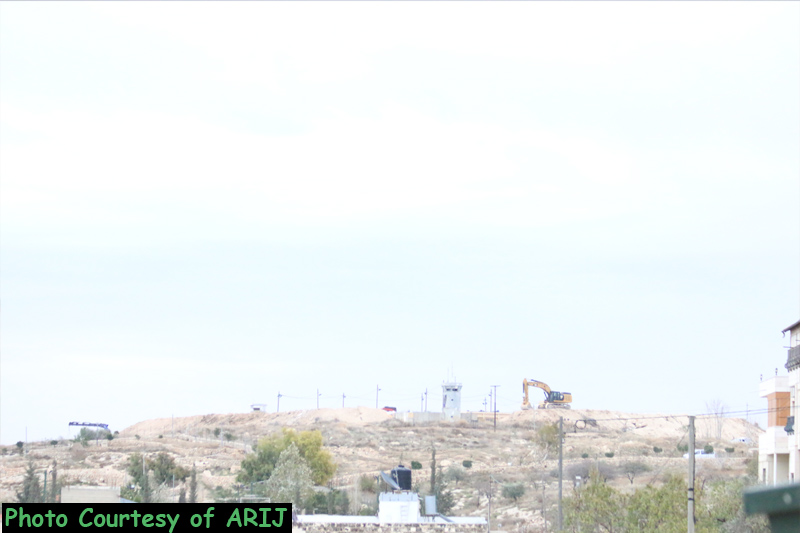
       

Pictures for the land leveling captured by ARIJ fieldworkers


It is worth to mention that on April 8, 2008, the Israeli Haaretz Daily newspaper published that a group of the Israeli right wing activists called 'Developing Har Shamuel Settlement' along with settlers of the Gush Etzion regional council are planning to establish a new Israeli outpost on remains of an evacuated Israeli military base east of Beit Sahour. The settlers and activists marched towards the site in an attempt to prevent the Israeli Army from demolishing the remaining barracks that are still standing there under the pretext that the Israeli Civil Administration any should authorize any demolition process.


Ush Ghrab Site in Beit Sahour

The area were the Israeli military base existed is locally known as Ush Ghrab (Shdemah as the Israeli Army called it). It lies to the east of Beit Sahour city, on a mountainous area stretching over tens of dunums of open spaces. The site is bordered from three directions (south, west and north) by Palestinian built-up area, while it is bordered by Za'tara bypass road from the east. The site was used by several administrations before it was occupied by the Israeli Army in 1967 as headquarter for the British Mandate troops and later on by the Jordanian Forces. However, the area that defines of the Israeli military base today is much larger than it used to be before 1967; as the Israeli forces confiscated more Palestinian lands throughout the years of occupation to increase the area of the military base. 

Following the eruption of second Intifada in September 2000, the camp was the launching point of repeated attacks against Palestinians and properties in the city of Beit Sahour. See the map below:
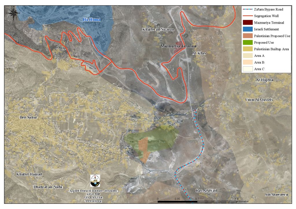
 

Map for Ush Ghrab Area east of the city of Beit Sahour


On the other hand and on  April 27, 2006, and in a surprising unilateral move, the Israeli Occupation Forces evacuated the base. Heavy equipment’s existed at the site were moved to another Israeli Military base located southeast of Beit Sahour City called 'Herodion Base', in Al Furdeis area. However, the evacuated site was not handed over to the Palestinian site at that same time. 

Developing  of Ush Ghrab Area was Foiled by the Occupation

Soon after the Israeli withdrawal from Ush Ghrab area in 2006, the Municipality of Beit Sahour presented a plan to the Israeli Civil Administration in Bethlehem Governorate to reclaim the land to develop it with constructive and productive projects after it was long used to subjugate the people in the governorate. The area where the camp existed is located within Zone 'C' which under Oslo II agreements requires the Municipality to acquire authorization from the Israeli Civil Administration. Months later, the ICA granted the license to Beit Sahour Municipality to proceed with the projects, which include a hospital, Youth center, Public Park, Environmental Center, recreational center, cultural center in addition to Parking lot. These projects are planned to establish to utilize specified area of the targeted land as for the remaining area, it is set to remain under the Israeli Army’s control where no Palestinian construction is allowed.

Plan presented by Beit Sahour Municipality

No

Type of Construction

Area in Dunums

1

Hospital

10.137

2

Nazereth Village

3.335

3

Youth Center

13.452

4

Public Park

3.388

5

Parking

3.869

6

Water Station

3.06

7

Environmental Center

2.056

8

Sport Center

8.6

9

Streets

6.968

Total

54.865

Source: Beit Sahour Municipality


Prepared by  
The Applied Research Institute – Jerusalem



Recommended For You

إقرار مخطط توسعي رئيسي في مستوطنة تقوع شرق بيت لحم

by arij
July 28, 2026
0
إقرار مخطط توسعي رئيسي في مستوطنة تقوع شرق بيت لحم

"تستهدف 6000 دونما من الأراضي الفلسطينية" صادقت الهيئة العامة لما يسمى "بالمجلس الإقليمي لمستوطنات غوش عتصيون" جنوب الضفة الغربية المحتلة في العشرين من شهر تموز من العام 2026...

Read moreDetails

تستهدف 6000 دونما من الأراضي الفلسطينية وشرعنة ستة مستوطنات جديدة
إقرار مخططات توسعة رئيسية في تجمع غوش عتصيون الاستيطاني جنوب الضفة الغربية المحتلة

by arij
July 22, 2026
0
تستهدف 6000 دونما من الأراضي الفلسطينية وشرعنة ستة مستوطنات جديدة  إقرار مخططات توسعة رئيسية في تجمع غوش عتصيون الاستيطاني جنوب الضفة الغربية المحتلة

صادقت الهيئة العامة لما يسمى "بالمجلس الإقليمي لمستوطنات غوش عتصيون" جنوب الضفة الغربية المحتلة في العشرين من شهر تموز من العام 2026 على مخطط هيكلي استيطاني واسع النطاق...

Read moreDetails

الآثار كأداة للضم الزاحف: مشروع القانون الإسرائيلي لإعادة هندسة الجغرافيا والهوية في الضفة الغربية

by arij
May 23, 2026
0
الآثار كأداة للضم الزاحف: مشروع القانون الإسرائيلي لإعادة هندسة الجغرافيا والهوية في الضفة الغربية

في خطوة تعكس تصاعد المساعي الإسرائيلية لإحكام السيطرة على الرواية التاريخية والجغرافيا الثقافية في الضفة الغربية، صادقت الهيئة العامة لـ الكنيست الإسرائيلي يوم 11 أيار 2026 على مشروع...

Read moreDetails

ذكرى الـ 50 ليوم الأرض: فلسطين بين ذاكرة الدم وصمود البقاء    

by arij
April 16, 2026
0

في الثلاثين من آذار، لا يستحضر يوم الأرض في الوعي الفلسطيني بوصفه مناسبة رمزية عابرة، بل كحدث تأسيسي متجدد يعكس استمرارية الصراع على الأرض والهوية. وبعد مرور خمسين...

Read moreDetails

Unprecedented Acceleration in Israeli Settlement Expansion in 2025

by arij
March 25, 2026
0
Unprecedented Acceleration in Israeli Settlement Expansion in 2025

Preface, The Israeli settlement policy in the occupied West Bank is one of the most significant obstacles to achieving a just and sustainable peace. Since the occupation of...

Read moreDetails
Next Post

الاحتلال يصدر أمراً عسكرياً بوضع اليد على أراضي في بلدة بيت أمر بمحافظة الخليل

LATEST NEWS

” 118 ألف دونم مهددة بالعزل في محافظة طوباس”  إسرائيل تستكمل مشروع “الخط القرمزي” وتوسع عزل الأراضي الفلسطينية شرق الضفة الغربية المحتلة

” 118 ألف دونم مهددة بالعزل في محافظة طوباس”
إسرائيل تستكمل مشروع “الخط القرمزي” وتوسع عزل الأراضي الفلسطينية شرق الضفة الغربية المحتلة

by arij
July 29, 2026
0

........................................................

إقرار مخطط توسعي رئيسي في مستوطنة تقوع شرق بيت لحم

إقرار مخطط توسعي رئيسي في مستوطنة تقوع شرق بيت لحم

by arij
July 28, 2026
0

........................................................

تستهدف 6000 دونما من الأراضي الفلسطينية وشرعنة ستة مستوطنات جديدة  إقرار مخططات توسعة رئيسية في تجمع غوش عتصيون الاستيطاني جنوب الضفة الغربية المحتلة

تستهدف 6000 دونما من الأراضي الفلسطينية وشرعنة ستة مستوطنات جديدة
إقرار مخططات توسعة رئيسية في تجمع غوش عتصيون الاستيطاني جنوب الضفة الغربية المحتلة

by arij
July 22, 2026
0

........................................................

“حتى النصف الأول من العام 2026 “, ” الاستيطان يلتهم الأرض الفلسطينية: ما يزيد عن 22 ألف دونم مستهدفة و 19 ألف وحدة استيطانية”

“حتى النصف الأول من العام 2026 “, ” الاستيطان يلتهم الأرض الفلسطينية: ما يزيد عن 22 ألف دونم مستهدفة و 19 ألف وحدة استيطانية”

by arij
July 22, 2026
0

........................................................

flag_yellow_lowEU-PfP-Logo

This website and its content were initiated in 1993 by the Applied Research Institute – Jerusalem (ARIJ) and the Land Research Center (LRC) with the support from the European Union up until 2023. Since then, the Applied Research Institute – Jerusalem (ARIJ) has taken over the continued development and maintenance of the website. The views expressed remain solely those of ARIJ) and do not necessarily reflect those of the European Union.
© 2026 Copyright | ARIJ | All Rights reserved.

No Result
View All Result
  • Home
  • Settlements
    • New Israeli Settlements
    • Settlement Expansion
  • Israeli Violations
    • Agriculture
    • Confiscation
    • Demolition
    • Environment
    • Eviction of Palestinians
    • Settlers Attacks
  • Bypass Roads
  • Israeli Plans
  • Segregation
    • Checkpoints
    • Closure
    • Separation Plans
  • Military Orders
  • Reports
    • Daily Report
    • Monthly Report
    • Quarterly Report

© 2026 Copyright | ARIJ | All Rights reserved.