On the 31st of October 2015, the Israeli Occupation Army handed out military orders to confiscate about 7 dunums of Palestinian land in six Palestinian villages in Nablus and Salfit Governorates.
According to the military orders, which signed by Roni Nomeh Alov, the commander of the Israeli Occupation Forces in the West Bank, the lands confiscated for security pretexts. The orders “Extension & borders Re-alignment”, will expand the control of the Israeli Army on the targeted lands for the end of the year 2017. Accordingly the Palestinian landowners can’t use their land for the next 3 years. Noted that it’s not the first time that the Israeli Occupation Authorities issued these orders, where some of them were issued for the first time three years ago.
Following the details of the military orders:
|
Name of the village |
No. of Order |
Targeted area |
|
Awarta |
T/12/10 (Extension) |
2.549 dunums |
|
Beit Furik |
T/22/12 (Extension & borders Re-alignment) |
0.223 dunums |
|
Yasuf & As-Sawya |
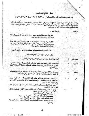
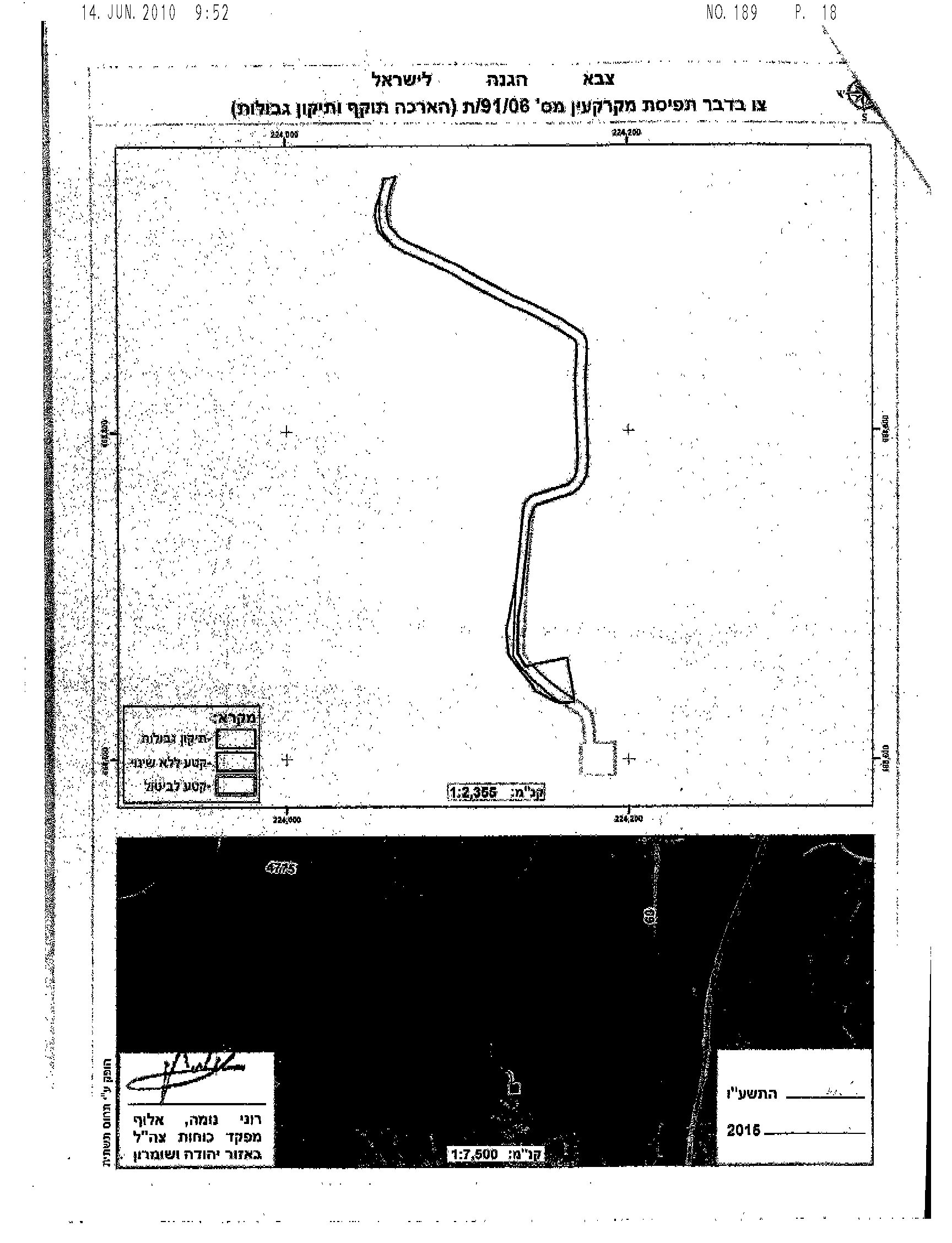
T/91/06 (Extension & borders Re-alignment) |
2.78 dunums |
|
Salim |
T/118/05 (Extension No. 2 & borders Re-alignment) |
1.094 dunums |
|
Azmut |
T/141/05 (Extension and borders Re-alignment) |
0.004 dunums |
|
Total |
——- |
6.65 dunums |
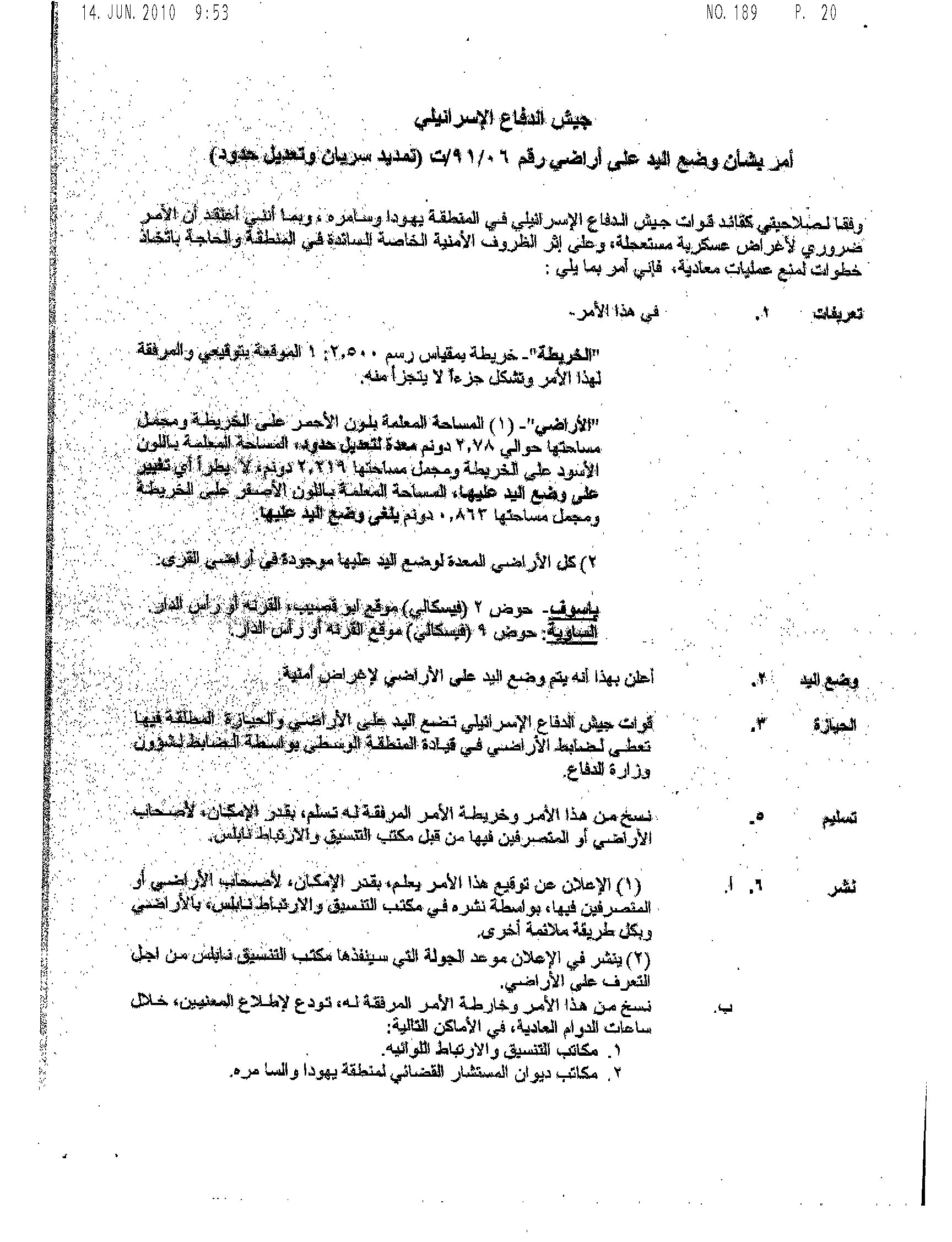
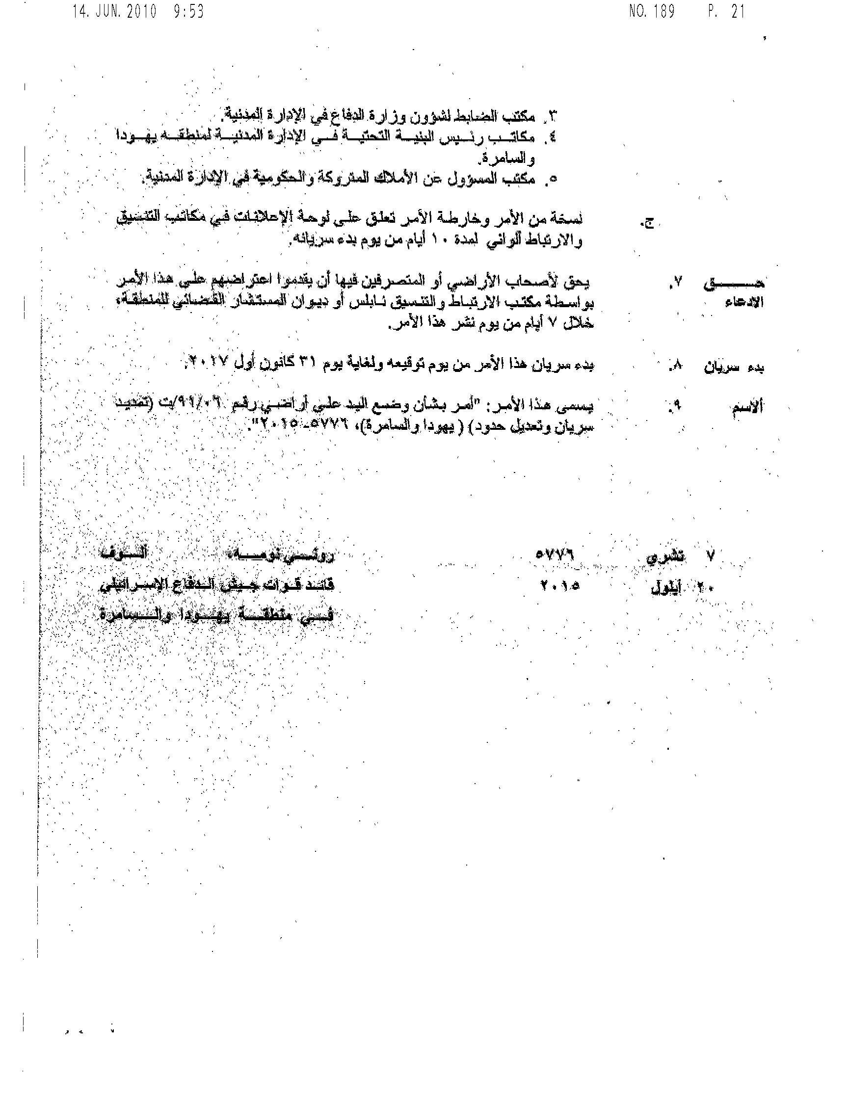
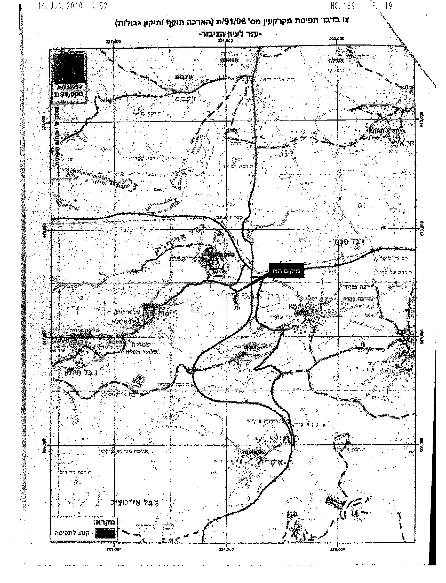
One of the Israeli Military order No. T/91/06
In a geopolitical analysis conducted by the GIS Department at ARIJ, the targeted lands (1.094 dunums) in Salim village, east of Nablus city, was used to erect a military tower and a road link between the Israeli bypass road No. 555 and the military tower. Noted that the targeted land is not “State land” nor within the Master Plan for the nearby Israeli settlement of “Elon Moreh”. On the other hand the targeted land located in an area classified as “Area C” (according to Oslo Agreement ,1995) which it is under the fully control of the Israeli Occupation Authorities. According to the military order No. T/118/05 (Extension No.2 & borders re-alignment) the Israeli military tower will benefit and protect the Israeli settlers who used the Israeli Bypass road No. 555. See the map No.1
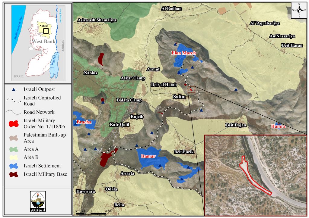
Map No.1: Israeli order No.T/118/05, targeted land in Salim village
Salim is a Palestinian village in Nablus Governorate, located east of Nablus City. It is bordered by Beit Dajan to the east, Deir al Hatab to the north and west, Beit Dajan and Beit Furik to the south. The total area of Salim village is approximately 10,466 dunums. For more information: http://vprofile.arij.org/nablus/pdfs/vprofile/Salim_vp_en.pdf
For the military order No. T/12/10 in Awarta village, south of Nablus city, the geopolitical analysis showed that the targeted land (2.549 dunums) is located inside the border of the Israeli settlement of “Itamar” and within the “Master Plan” of the aforementioned settlement. However, the Israeli Army used the targeted land to build a military tower, located adjacent to the Israeli illegal outpost “Hanekuda”. See map No.2.
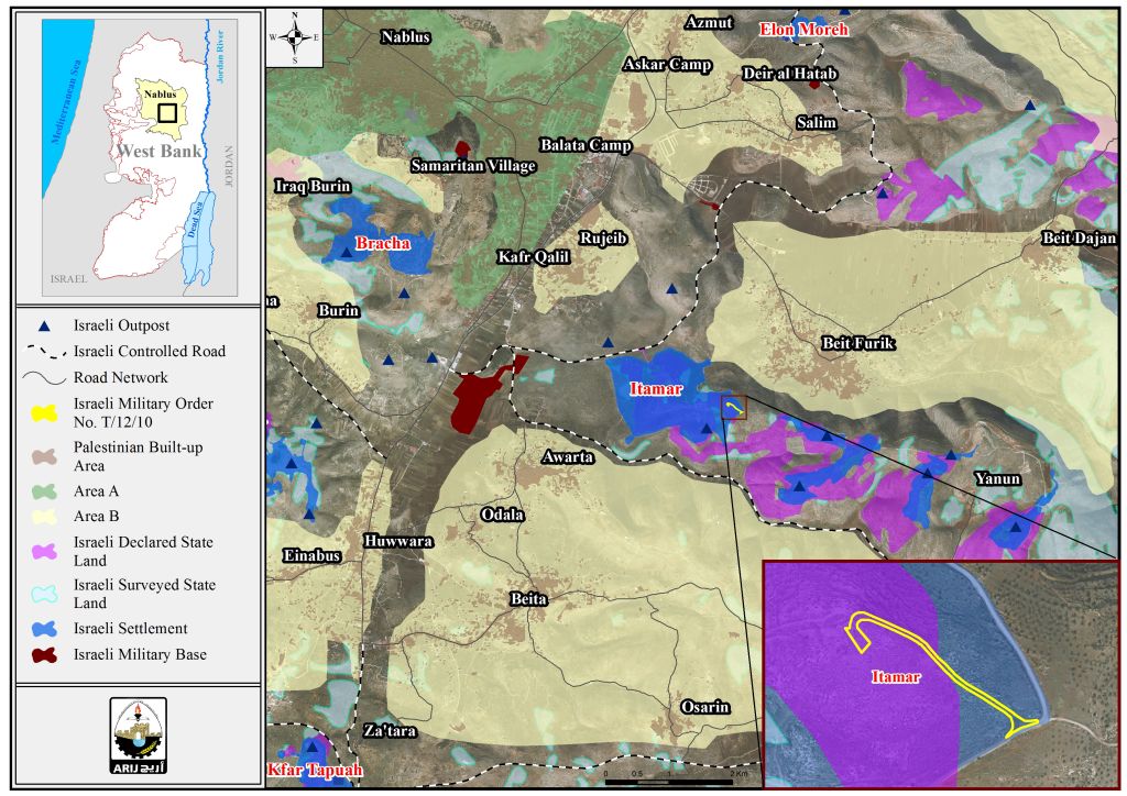
Map No.2: Israeli ordre No. T/12/10, targeted land in Awarta village
It’s worth pointed that , part of the targeted land classified by the Israeli Authorities as “State land”, and the rest of the land located within the area classified as “Area C” (according to Oslo Agreement ,1995) which it is under the fully control of the Israeli Occupation Authorities.
Furthermore and according to the military order No. T/12/10, the Israeli Authorities will use the land for “security issues. And this what the analysis showed, where the military tower, will serve and protect the Israeli settlers, especially those who lives in the Israeli illegal outpost “Hanekuda”.
Awarta is a Palestinian village in the Nablus Governorate, located south of the city of Nablus. It is bordered by Yanun and Beit Furik to the east, Rujeib to the north, Burin and Huwwara, to the west, and Beita and Odala to the south. The total area of ‘Awarta village is approximately 13,449 dunums. For more information:
http://vprofile.arij.org/nablus/pdfs/vprofile/Awarta_vp_en.pdf
For the Military order No. T/141/05, it is targeted a land in Azmut village, east of Nablus city, while the geopolitical analysis showed the targeted land (0.004 dunums) is a part of the Israeli illegal outpost of “North Elon Moreh”, also and the satellite images showed that the Israeli settlers and/or Israeli Army razed the targeted land, for the future expansion of the outpost. See map No.3.
On the ground, there is a road links between the North Elon Moreh” outpost and the Israeli settlement of “Elon Moreh”. The geopolitical analysis also showed that the targeted land is not a “State land” nor within the master plan or the border of the nearby Israeli illegal settlement of “Elon Moreh”, but it’s a land located in an area classified as “Area C”, and the Israeli settlers illegally used the land to build their illegal outpost.
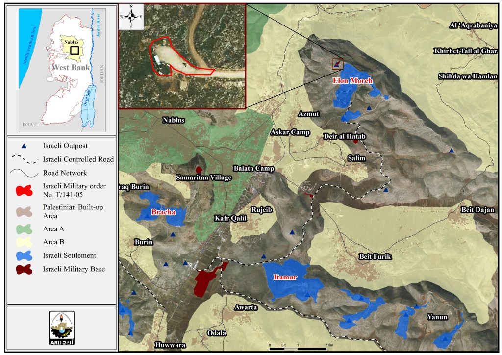
Map No.3: Israeli order No.T/141/05, targeted land in Azmut village
As a matter of fact, when the Israeli Authorities issued a military order targeted land used by Israeli settlers to build an illegal outpost, its mean that the Israeli Authorities accept the Israeli settlers defacto actions in the occupied Palestinian territory, and more than that helping and protecting them, andtrying to legalize there illegal status as a settlers living in illegal and illegitimate outpost .
Azmut is a Palestinian village in the Nablus Governorate, located east of Nablus City. It is bordered by Deir al Hatab and Al ‘Aqrabaniya to the east, Al Bahdan to the north, ‘Asira ash Shamaliya and Nablus City to the west, and Deir al Hatab to the south. The total area of Azmut village is approximately 9,836 dunums. For more information: http://vprofile.arij.org/nablus/pdfs/vprofile/Azmut_vp_en.pdf
In Yasuf and As-Sawiya villages, and according to the geopolitical analysis, the targeted land (2.78 dunums) part of the Israeli illegal outpost of “South Kfar Tapouah” and a road link between the outpost and the road No. 4777, which link to “Za’tara military checkpoint” and the main entrance of Kfar Tapouah settlement.See map No.4.
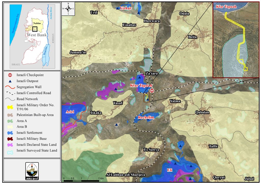
Map No.3: Israeli order No. T/91/06, targeted land in As-Sawiya and Yasuf villages
It is worth mentioning that there is part of the targeted land where most probably will used by the Israeli Occupation Army to establish a military tower that will grant the protection to the Israeli outpost of “South Kfar Taqouah”. However, part of the targeted land classified as “State land”, which means, that the Israeli Occupation Authorities issued the order No. T/91/06, to keep their control over the land that used to establish a road which benefit the Israeli settlers only.
As-Sawiya is a Palestinian village in Nablus Governorate, located south of Nablus city. It is bordered by Talfit and Qaryut to the east, Al Lubban ash Sharqiya to the south, Salfit city to the west, and Yatma and Yasuf to the north. The total area of As-Sawiya village is approximately 10,733 dunums. For more information:
http://vprofile.arij.org/nablus/pdfs/vprofile/As%20Sawiya_vp_en.pdf
Yasuf is a Palestinian village in the Salfit Governorate, located north-east of Salfit City. Yasuf is bordered by Yatma village in Nablus Governorate to the east, As Sawiya village in Nablus Governorate and Iskaka village to the south, Jamma’in village in Nablus Governorate and Iskaka village to the west, and Jamma’in and Huwwara villages in Nablus Governorate to the north. The total area of Yasuf village is approximately 6,037 dunums. For more information: http://vprofile.arij.org/salfit/pdfs/vprofile/Yasuf_vp_en.pdf
To Conclude
The Israeli Occupation Authorities systematically issuance of military orders to seize Palestinian land came for the interest of the Israeli settlement enterprise in the oPt.
The Israeli actions and procedures in the occupied Palestinian territory are illegal and contradicts with the international law rules, United Nations Security Council Resolutions:
Resolution 446 March 22, 1979 calls on Israel to rescind its previous measures and to desist from taking any action which would result in changing the legal status and geographical nature and materially affecting the demographic composition of the Arab territories occupied since 1967, including Jerusalem and, in particular, not to transfer parts of its own civilian population into the occupied Arab territories"
Also the resolution 452 of the 1979 “calls upon the Government and people of Israel to cease, on an urgent basis, the establishment, construction and planning of settlements in the Arab Territories since 1967 including east Jerusalem.
United Nation Security Council Resolution 452 of 1979: 'Calls upon the Government and people of Israel to cease, on an urgent basis, the establishment, construction and planning of settlements in the Arab occupied Territory since 1967, including Jerusalem.'
Article 49 of the Fourth Geneva Convention of 1949: 'the occupying power shall not deport or transfer parts of its own population into the Territory it occupies.'
The Fourth Geneva Convention in Article 174 also prohibits the 'extensive destruction and appropriation of property not justified by military necessity and carried out unlawfully and wantonly'.
The Roadmap of Peace signed on April 30, 2003 between Israel and the Palestinians (originally developed by the United States, in cooperation with Russia, the European Union, and the United Nations (the Quartet)) under which the Israeli Government agreed to freeze all settlement, indicated that: The -Government of Israel- immediately dismantles settlement outposts erected since March 2001, and, consistent with the Mitchell Report, [Government of Israel] freezes all settlement activity (including natural growth of settlements).The plan was adopted by the USCR 1515-2003.
Prepared by:
The Applied Research Institute – Jerusalem


