Violation: confiscating Palestinian lands for the favor of colonial expansion
Targeted villages: al-Sawyeih, eastern Lubban and Qaryut
Date: November 2014
Perpetrators: Eli colonists
Victims: residents of the aforementioned villages
Details:
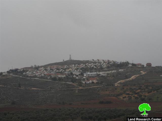
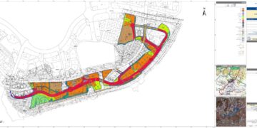
Israeli newspaper Haaretz mentioned on November 17, 2014 that Israel Civil Administration intended to build new colonial units (620 approximately) in Eli colony, which is located to the south of Nablus governorate. The units are to be annexed within the a master plan that is suggested by Israel Planning Committee.
Noteworthy, a total of 221 dunums from the confiscated lands are considered Palestinian private property, which are originally owned by farmers from the village of al-Sawyeih, eastern Lubban and Qaryut.
The Israeli occupation justified the lands takeover by claiming them "State lands", taking into consideration that no advertisements were featured in Palestinian newspapers so that people can object the project, Israeli side asserted.
As a result , 221 Palestinian dunums will be illegally looted without even giving their legitimate owners the chance to object the master plan of the new colonial units. This theft is led by colonial associations, which depend on certain pretexts to grab lands such as " lands being classified as state ones".
The villages councils are seeking help through Yish Din legal association to object the master plan which is being modified and awaiting to be ratified by Israel Supreme Court.
Exploiting the lands surrounding Eli colony :
It is notable, according to Land Research Center field observation on the place, that Eli colonists grabbed a vast area from the neighboring lands to the colony as a periphery zone "security zone" and opened roads to serve the colony's own good using the nearby Palestinian lands. Colonists took advantage of Palestinians being denied access to their lands to take them gradually over for the sake of colonial expansion.
Using forged documents and fraud to grab lands for the favor of colonies :
A top priority on the Israeli agenda since the occupation of West Bank in 1967 was to totally takeover lands for the favor of colonial expansion.
The apartheid wall had also a huge share in expropriating lands and separating others behind it in the course of its construction. Not only that, colonial associations and colonists gangs took advantage of the political circumstances to loot as much area of lands as possible to serve their own good in expansion. The benefited colonies are Itamar, Allon Moreh, and Elkana. From another side, colonists exploited the Jordanian and British camps to change them into Israeli colonies as in the case of Kedumim colony in Qalqiliya, Shave Shomron in Nablus and Maskiyyot in Tubas.
Since the aftermath of second Intifada and until today, the so-called Israeli army issued big numbers of administrative orders to confiscate lands under the pretext of security reason. Consequently, the confiscated lands were turned into colonial outposts and then grow into full colonies as in the case of Adi Ad and Ahya colonies in Nablus and Nahliel and Amona in Ramallah.
About Eli :
The story began in 1984 when colonists took over a mountain top to establish the first outpost in the area. Wadi Ali " Ali's valley" was the real name of the area and from which the name Eli was taken. Noteworthy, the valley draws borders between Nablus and Ramallah cities but Zionist resources claim that this valley in addition to the area of Shilo colony and the Canaanite area of Silo are the separating borders between the Sumerian kingdom in the north and the Yehuda kingdom in the middle and south.
With time passing by, Eli outpost expanded rapidly on lands from Tal al-Shuneh, Ali, Jabal al-San'a, al-Merhan, and Qal'at al-Hamra. Noteworthy, the colony now is only 30m away from Palestinian house of Qaryut village. It should be marked that Shilo colony includes a Jewish hotel and a synagogue to plant racist plans in their children minds against Arabs and Palestinians. Also, the place has cemetery for Jews which is to pin down their existence in the area.
Prepared by
The Land Research Center
LRC


