• About The Project
  • Palestine in Century
  • Selected Maps
  • Glossary
  • About ARIJ
  • About LRC
  • By Year
    • Case Studies By Year
    • Daily Report By Year
Thursday, October 2, 2025
POICA
No Result
View All Result
  • Home
  • Settlements
    • New Israeli Settlements
    • Settlement Expansion
  • Israeli Violations
    • Agriculture
    • Confiscation
    • Demolition
    • Environment
    • Eviction of Palestinians
    • Settlers Attacks
  • Bypass Roads
  • Israeli Plans
  • Segregation
    • Checkpoints
    • Closure
    • Separation Plans
  • Military Orders
  • Reports
    • Daily Report
    • Monthly Report
    • Quarterly Report
No Result
View All Result
POICA
No Result
View All Result

Itamar colonists ravage land in area classified B according to Oslo

January 31, 2014
in Settlements
Itamar colonists ravage land in area classified B according to Oslo

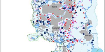
Violation: Ravaging land in area B in order to take it over

Date: 30/01/2014

Location: Yanoun- Nablus governorate

Perpetrators: Colonists of Itamar

Victims: People of Yanoun

Details:

Yanoun, 4 km to the south of Aqraba in Nablus, is an example of the hostility Palestinians suffer from all around the West Bank. Since 2000, the village has suffered from numerous attacks on Palestinians and their properties; most of these attacks were committed by colonists of Itamar. Itamar and nearby colonial outposts are expanding at the expense of Yanoun and nearby villages.

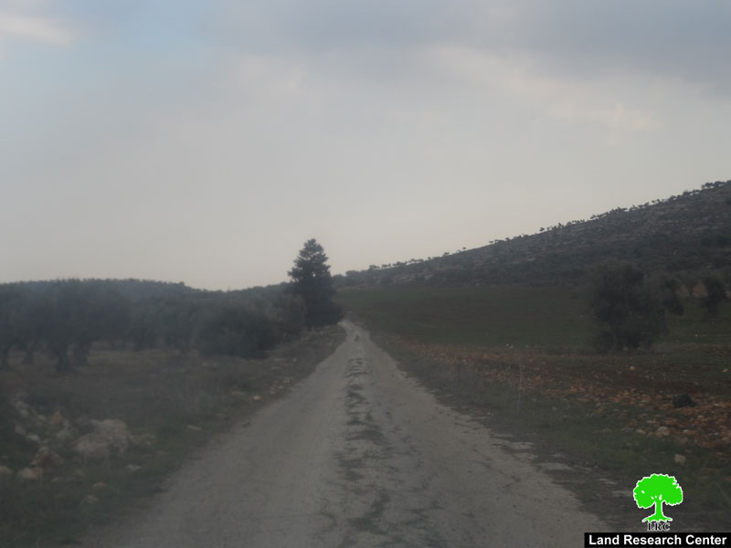
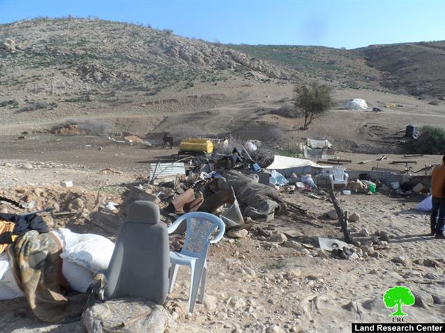
Picture 1: The road Palestinians are banned from using

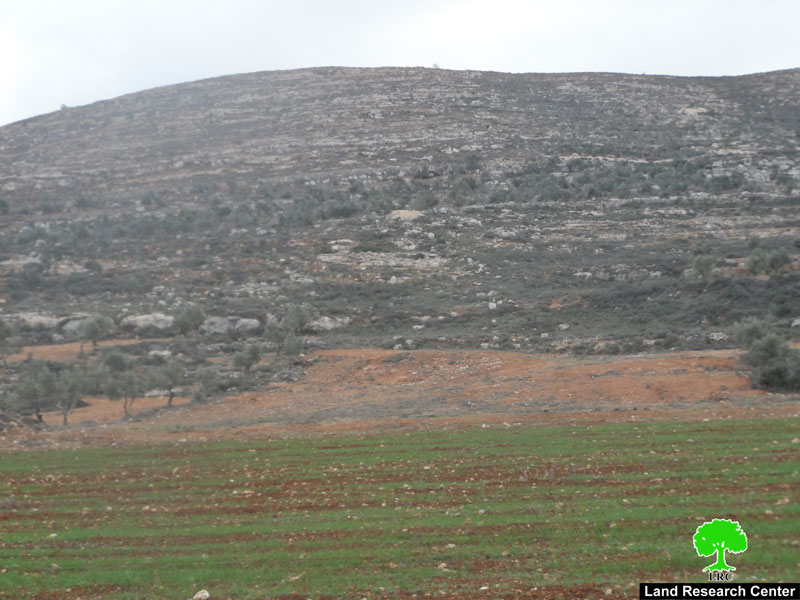
Picture 2: Lands in area B where Palestinians are prohibited from taking advantage of

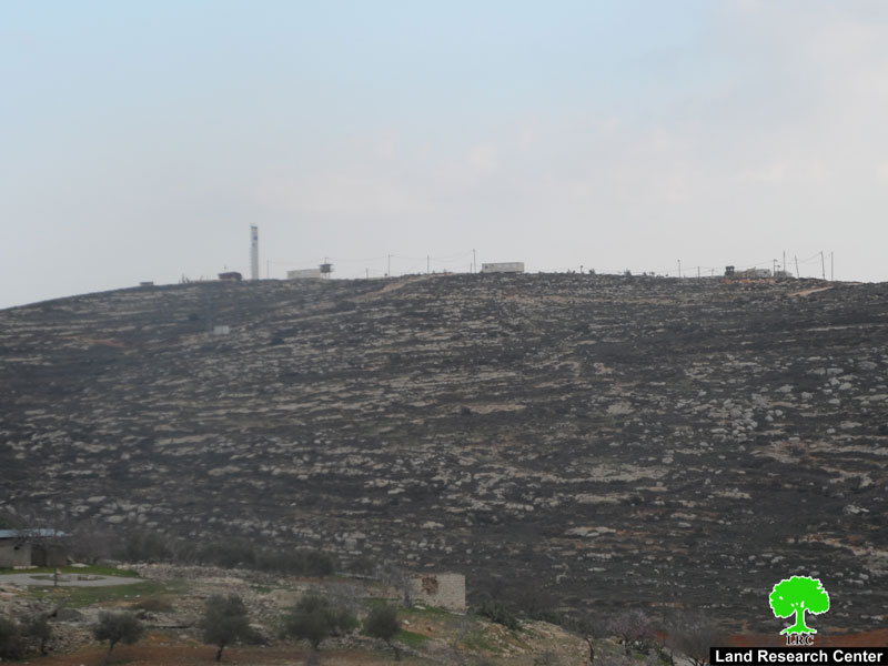
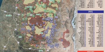
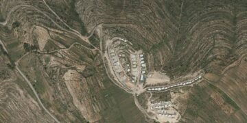
Picture 3: Itamar colony

The greed of Itamar colonists did not stop at stealing land and building random colonial outposts but got expanded to taking over vast areas, more than 3,000 dunums in area, and turning them into closed military zones. The lands are located along Awarta- Yanoun road which has been closed since Al Aqsa Intifada. The lands are in an area classified B (where PA is in charge of civil matters with Israel responsible for security) according to Oslo Accords and have been ravaged lately by the colonists in order to be taken advantage of.

According to Yousef Deiriya, a farmer form Yanoun: “Since 2000, i.e. Al Aqsa second Intifada, Yanoun and nearby villages witnessed a ferocious wave of attack by colonists in response to the Prime Minister back then, Ariel Sharon, who called for building random outposts wherever it is applicable and seizing mountains for constructing colonies.” Since then, farmers are denied access to their lands adjacent to Itamar. They also refrain from using the Awarta – Aqraba road though it is open for fear of being attacked by the nearby colony.”

Deiriya added, “Colonists were not content with stealing land but they also sought turning hundreds of agricultural dunums surrounding the colony into closed military zones to which Palestinians are denied access unless with prior coordination with District Coordination Office at specific times. And this is how 3,000 dunums in area B, south of Itamar colony and Awarta-Yanoun road, turned into closed military zones and as a result people are not allowed to take advantage of the road that could save 12 km of travelling.”

He also commented: “There is a systematic policy followed by the Israeli occupation army in coordination with colonists meant to prohibit farmers from reaching their lands. Though according to Oslo Accords, the Palestinian side enjoys civil authority but the Israeli occupation and colonists do not abide by Oslo as they refuse farmers passage to their lands except in olive harvesting season and only for two days. On top of that, colonists graze sheep and harvest olive in Palestinian lands under the protection of the army.” The farmers filed complaints to the District Coordination Office but they only received promises in return.

Yanun is 15 km to the east of Nablus city. There is not any road network that connects the village to the city except the old road which was renovated only lately. The street leads to 'Aqraba village. The village borders extend to reach 'Aqraba, Beit Furik, and 'Awarta villages. To the east there is Makhola colony and by-pass Road 90. The total area of the village is 16,000 dunums including 1,668 dunums built up area.

According to Palestinian official sources, there are 102 people living in the village, most of them belong to Bani Jaber and Marar clans.  Some of the residents are refugees originally from the occupied village of 'Ajur which was occupied and destroyed back in 1948. Itmar colony has been expanding on the village lands as it took over more than 503 dunums from the village till now.

Prepared by
 The Land Research Center
LRC
 

Recommended For You

Israeli Breach of the Hebron Agreement through the Establishment of a New Settlement in Area (H1)

by arij
August 26, 2025
0
Israeli Breach of the Hebron Agreement through the Establishment of a New Settlement in Area (H1)

Introduction In a new provocative move, the Israeli occupation authorities have established a new settlement outpost in the heart of Hebron, specifically in Area (H1), which is under...

Read moreDetails

خرق إسرائيلي لاتفاقية الخليل بإنشاء مستوطنة جديدة في منطقة (H1)

by arij
August 26, 2025
0
خرق إسرائيلي لاتفاقية الخليل بإنشاء مستوطنة جديدة في منطقة (H1)

المقدمة في خطوة استفزازية جديدة، أقدمت سلطات الاحتلال الإسرائيلي على وضع بؤرة استيطانية جديدة في قلب مدينة الخليل، وتحديدا في منطقة (H1) الخاضعة للسيطرة الفلسطينية الكاملة وفق اتفاقية...

Read moreDetails

Escalation and forced displacement in Kisan

by arij
August 6, 2025
0

The village of Kisan, located southeast of the Bethlehem Governorate, has faced continuous attacks for many years by settlers and Israeli occupation forces as part of a systematic...

Read moreDetails

بؤرة استيطانية جديدة وتهجير قسري في كيسان

by arij
August 6, 2025
0

موقع الاستهداف، تقع قرية كيسان جنوب شرق محافظة بيت لحم، وتواجه منذ سنوات طويلة هجمات متواصلة من قبل المستوطنين وقوات الاحتلال الإسرائيلي ضمن سياسة ممنهجة تهدف إلى السيطرة...

Read moreDetails

Expansion of Gilo Settlement: A Strategic Plan to Isolate Bethlehem and Undermine Palestinian Rights

by arij
May 12, 2025
0
Expansion of Gilo Settlement: A Strategic Plan to Isolate Bethlehem and Undermine Palestinian Rights

The Israeli Civil Administration has announced a new settlement expansion plan—No. 101-1284223—which outlines the construction of 1,990 new settlement units on approximately 175.9 dunums of land extending towards...

Read moreDetails
Next Post
The Israeli occupation totally razes Umm Jamal dwelling

The Israeli occupation totally razes Umm Jamal dwelling

LATEST NEWS

Annexation of the Jordan Valley: Implications for the Two-State Solution and Regional Stability

Annexation of the Jordan Valley: Implications for the Two-State Solution and Regional Stability

by arij
September 29, 2025
0

........................................................

Isolation of Three Villages Northwest of Jerusalem: Silent Annexation Creeps toward the Capital

عزل ثلاث قرى فلسطينية شمال غرب مدينة القدس: الضم الاسرائيلي الصامت يزحف نحو محيط العاصمة

by arij
September 24, 2025
0

........................................................

Isolation of Three Villages Northwest of Jerusalem: Silent Annexation Creeps toward the Capital

Isolation of Three Villages Northwest of Jerusalem: Silent Annexation Creeps toward the Capital

by arij
September 24, 2025
0

........................................................

سياسات التهويد في القدس: من السيطرة المكانية إلى طمس الهوية عبر التسمية

سياسات التهويد في القدس: من السيطرة المكانية إلى طمس الهوية عبر التسمية

by arij
September 23, 2025
0

........................................................

flag_yellow_lowEU-PfP-Logo

This website and its content were initiated in 1993 by the Applied Research Institute – Jerusalem (ARIJ) and the Land Research Center (LRC) with the support from the European Union up until 2023. Since then, the Applied Research Institute – Jerusalem (ARIJ) has taken over the continued development and maintenance of the website. The views expressed remain solely those of ARIJ) and do not necessarily reflect those of the European Union.

© 2025 Copyright ARIJ . All Rights reserved. .

No Result
View All Result
  • Home
  • Settlements
    • New Israeli Settlements
    • Settlement Expansion
  • Israeli Violations
    • Agriculture
    • Confiscation
    • Demolition
    • Environment
    • Eviction of Palestinians
    • Settlers Attacks
  • Bypass Roads
  • Israeli Plans
  • Segregation
    • Checkpoints
    • Closure
    • Separation Plans
  • Military Orders
  • Reports
    • Daily Report
    • Monthly Report
    • Quarterly Report

© 2025 Copyright ARIJ . All Rights reserved. .