The Famous quote of the former Israeli Prime Minister Ariel Sharon (2001-2006) is still being implemented in the Israeli government schema towards Palestinian lands: “Everybody has to move; run and grab as many hilltops as they can to enlarge the settlements, because everything we take now will stay ours. Everything we don’t grab will go to them.”[1]
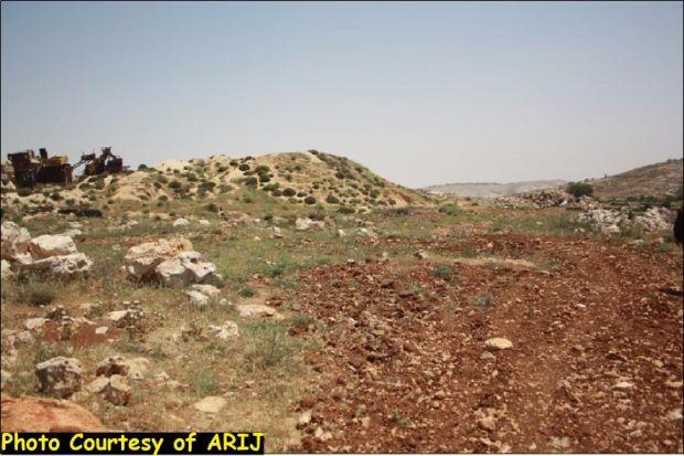
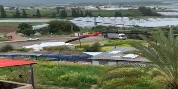
On the early morning of 29th of April, 2013, the Israeli Occupation Army (IOA) bulldozers stormed, without any prior notification, Khallet Al Louza (Al Louza Hamlet), south-west of Bethlehem city, and razed a 3-dunum agricultural land and uprooted more than 60 olive trees owned by Citizen Yousef Khalaf Al-Rayan. Moreover, the Israeli bulldozers closed a 1-kilometer long road with earth-mounts in order to prevent land owners from reaching their lands in the targeted area. See photos
Photos 1-2: the Israeli bulldozers closed a 1 kilometer long road
Photos 3-8: the targeted lands in Khallet Al Louza area
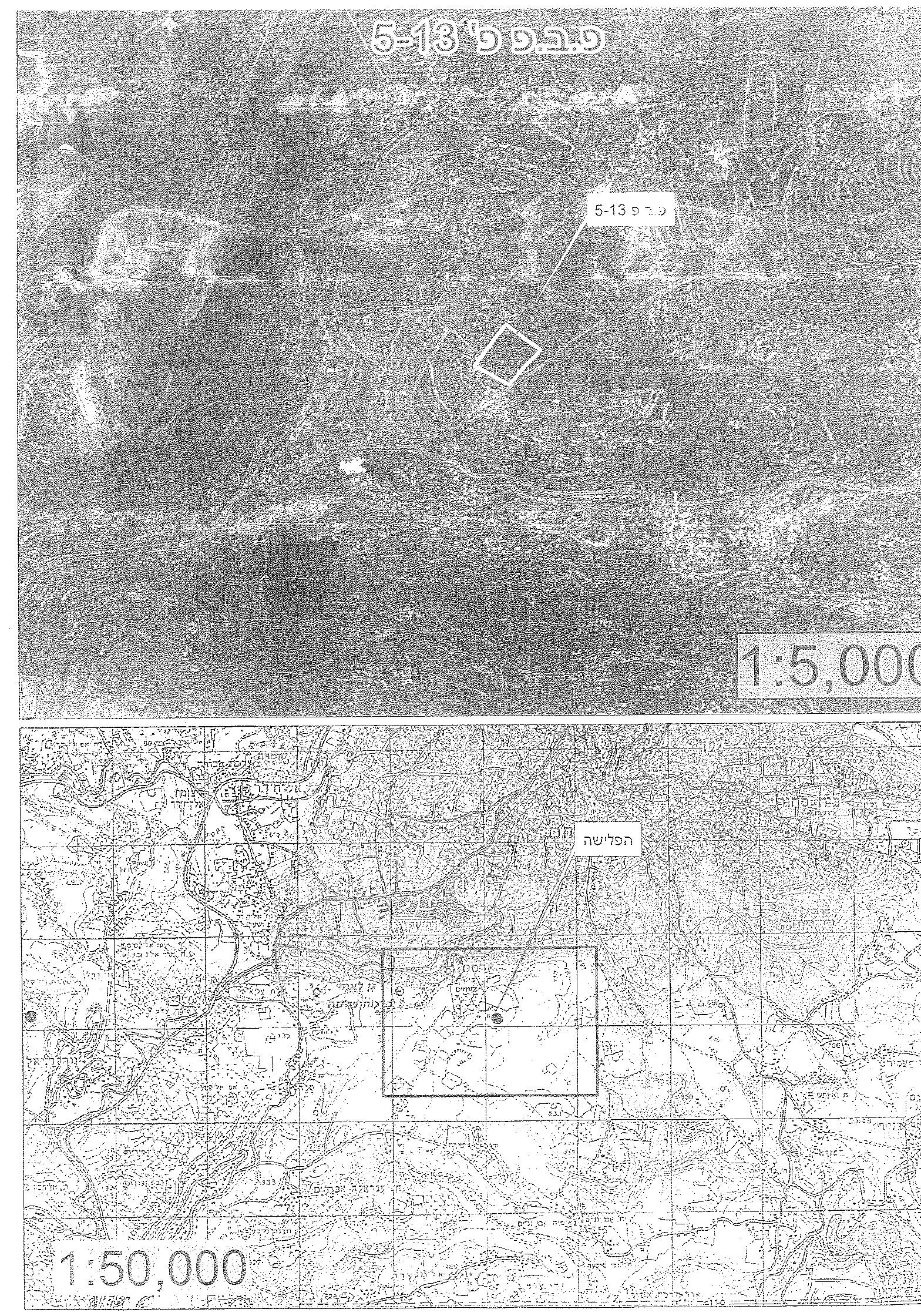
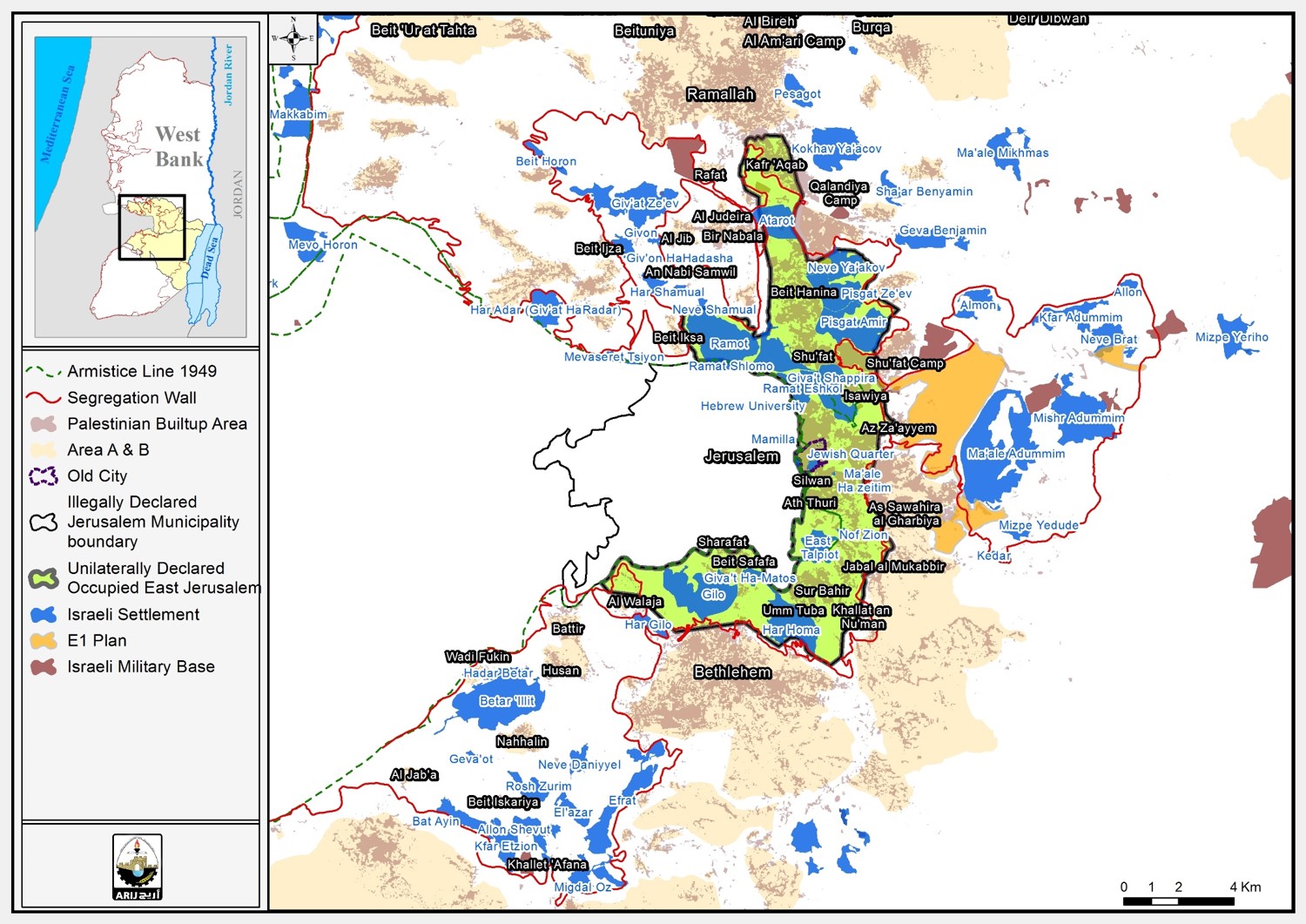
In the same context, the (IOA) bulldozers razed a 2,5 dunums of agricultural lands, and uprooted more than 60 olive trees owned by the citizen Yousef Abu Laban in Khallet Al Qoton )Al Qoton Hamlet) which is located within the boundary of Khallet Al Louza. See Map 1 of targeted location
Note worthy that these Israeli attacks correspond with the declaration of the Israeli Prime Minister Netanyahu to freeze settlement building until mid July 2013. However, Israel escalates its attacks and violations against the Palestinians in the occupied West Bank without any respite in order to impose facts on the ground which would become hard to change in the future. These bitter facts increase the suffering of the Palestinians from one hand and undermine the political situation which in turn will allow Israel to maintain the current status quo, on the other hand.
Khallet Al Louza, general glance
Khallet Al Louza is located 4 kilometers to the southeast of Bethlehem City. It’s bounded by Hindaza and Artas villages from the north, Abu Njeim village from the south, Rakhma and Beit Falouh villages from the west and the Israeli segregation wall (which annexes the Gush Etzion settlement bloc.) from the west. Khallet Al Louza is a home to 654 people (according to the Palestinian Central Bureau of Statistics – 2012).
The geopolitical status in Khallet Al Louza village
According to the Oslo II Interim agreement of 1995, singed between the Palestinian National Authority (PNA) and Israel, the lands of Khallet Al Louza village classified as area “C”, which means its under the full control of the Israeli government (security and administrative).
According to the Oslo II Interim Agreement signed in 28th September 1995 between the Palestinian Liberation Organization (PLO) and Israel, Khallet Al Louza was divided into areas ‘A’, “B” and “C”. Approximately 1161 dunums (29.9% of the hamlet’s total area which is 3880 dunums) were assigned as area ‘A’ where Palestinians have overriding responsibility over security and administrative issues. While 631 dunums (16.3% of the hamlet’s total area) were assigned as area B, where the Palestinian National Authority (PNA) has a complete control over civil matters but Israel continues to have overriding responsibility for security. The rest of the village’s area, constituting 2088 dunums (53.8% of the total area), is classified as area C, where Israel retains full control over security and administration related to the territory. In area C Palestinian building and land management is prohibited unless through consent or authorization by the Israeli Civil Administration. Therefore, the Palestinians find insurmountable obstacles to obtain building permits in areas classified as ‘C’ from the Israeli Civil Administration to meet their needs of “Natural growth”. This is because of the various pretexts alleged by the Israeli Civil Administration such as: incomplete application requests, the high expanses imposed on Palestinians applying for building permits, or that the structure intended for building (no matter what the type is) is located on lands were confiscated by the Israel some time ago or that the land targeted for building and construction is classified by Israel as ‘State Land’ and many other pretexts.
The deliberate policy of the Israeli occupation authorities in targeting Palestinian buildings and structures located in area “C” aims to consolidate the Israeli dominance over Palestinian lands. Nevertheless, the arbitrary practices of the Israeli occupation authorities that are imposed on Palestinians living in area “C” and applying for permits in such area, may take months or years in trying to fulfill the requirements of Israeli Civil Administration and at most cases, these applications are rejected. Therefore, the Palestinians are forced to build “illegally” (according to the Israeli concept) in the area classified as “C”, which makes them vulnerable to demolition at any moment.
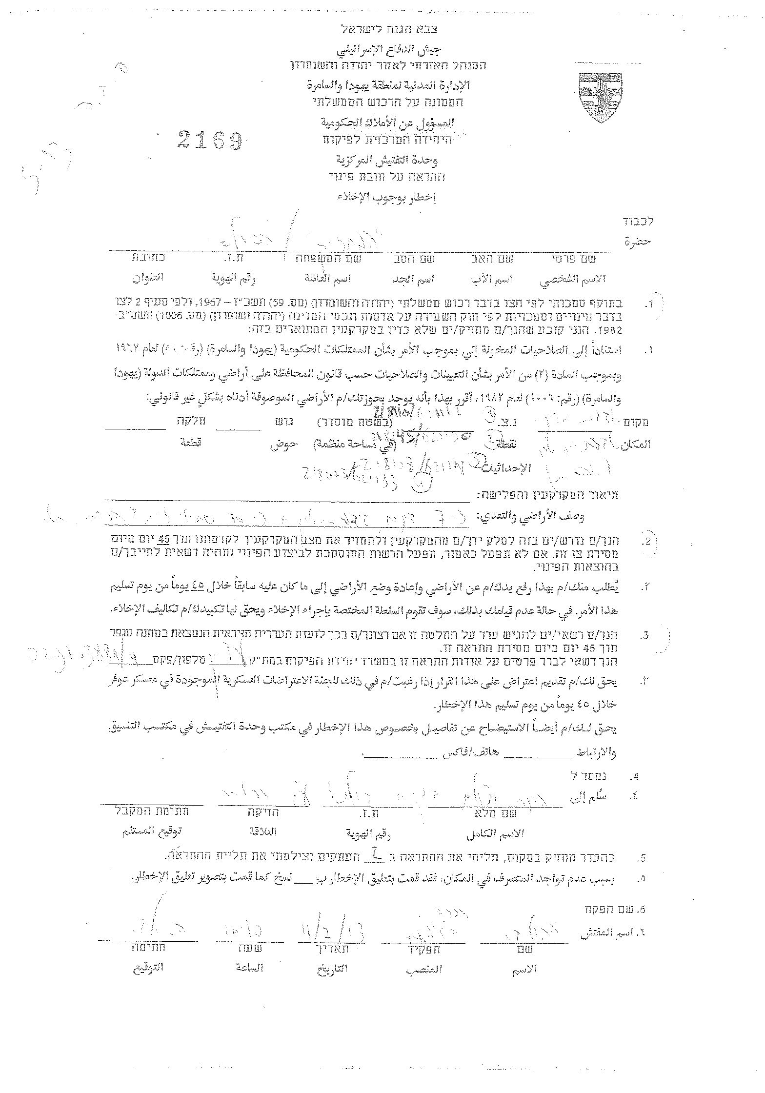
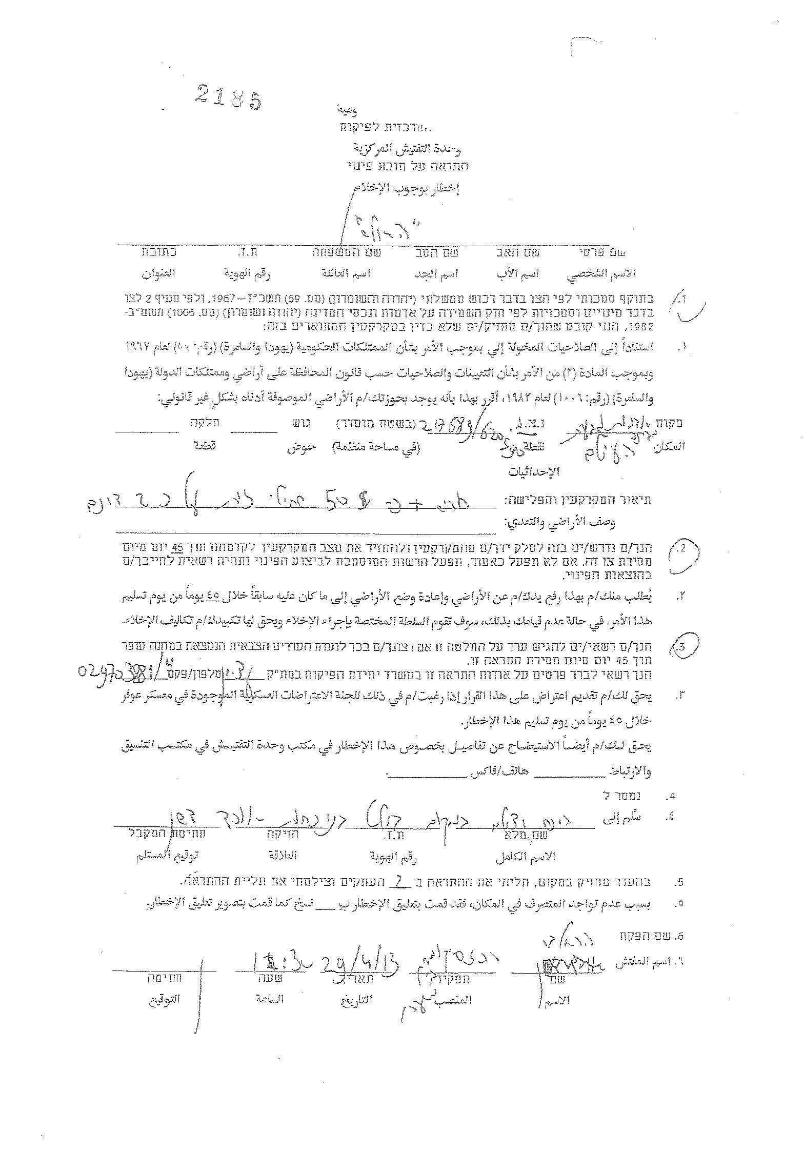
In the context of targeting Khallet Al Lauza village, The Israeli Authority, also, handed over a number of Palestinian families living in Khallet An Nahleh (An Nahleh Hamlet) eviction and demolition notices conducted under the pretext of being classified as “State Land”. The targeted lands and structures belong to:
Muhammad Yahya Ayyash/owner of an agricultural land – Khallet Al Nahleh.
Ibrahim Muhammad Abdeh/owner of a quarry and agricultural land – Khallet Al Nahleh.
Al Hajj Abed Al-Shweiky/owner of a cement factory and agricultural land – Khallet Al Nahleh.
Suliman Abu Ghosh /owner of an agricultural land – Khallet Al Qutun (Al-Qutun Hamlet). See Map 1 and copies of the militray orders
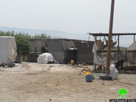
Photos 9- 14: a copy oif the militray orders and the targeted lands
Khallet Al Nahleh, general glance
Khallet An Nahleh (An Nahleh Hamlet) is located to the southwest of Bethlehem city and within the village boundary of Wad Rahhal village. It’s bounded by Artas village from the north, Ath Thabra and Wadi Rahhal villages from the south, Khallet Al louza from the east, and the Israeli segregation wall and the settlement of Efrat from the west.
The geopolitical status of the threatened areas in Khallet Al Nahleh
An analysis conducted by the Geo-informatics department at the Applied Research Institute – Jerusalem (ARIJ) indicates that the threatened lands in Khallet Al Nahleh are located in what Israel calls “State Land”, and that’s according to the Israeli military order No. 56/967 issued by the Israeli Civil Administration on the 3rd of August, 2004 and states the seizure of 1,700 dunums of Palestinian lands in Al Khader and Artas villages and allegedly declared as ‘State Land’. The Israeli practices in the area aim at reviving an old Israeli plan at the same location to build an additional neighborhood for Efrat settlement, at the targeted land, which the settlement council of Efrat calls the “eighth hill” and the planned neighborhood name is ‘Giv’at Hayetim.’ The initial plans for the neighborhood is to construct 2500 housing.
The Israeli policy of seizing private Palestinian lands and declaring them as “Israeli State Lands”, is just another tool by which Israel loots more Palestinian lands in the occupied West Bank. Therefore, these practices give Israel the green light to go on with its “Colonial enterprise”.
Ever since 1967, when Israel occupied the West Bank including East Jerusalem and the Gaza Strip, it intensely started to establish illegal settlements, outposts and military bases to assure its settlers superiority in the area. These actions impose bitter facts on Palestinians on a daily basis and undermine every Palestinian effort to establish a viable Palestinian state in the future.
To conclude
Israel continues to implement its Colonial enterprise in the occupied State of Palestine without taking into consideration the International charters and human rights conventions, where it confiscates Palestinian lands, expels owners from their houses under various guises. Some of which are listed below:
The Universal Declaration of Human Rights adopted and proclaimed by General Assembly resolution 217 A (III) of, December 10, 1948, Article 17 reads: ‘No one shall be arbitrarily deprived of his property.’ Which means it bans Israel from destroying or confiscating the property of the Palestinians at any case.
Article 53 & 147 of the Fourth Geneva Convention of 1949 indicated that: Extensive destruction and appropriation of property not justified by military necessity and carried out unlawfully and wantonly, is a grave breach of the Convention.
In the year 2004 the United Nations Security Council called on Israel to stop demolition of Palestinian homes under Resolution No. 1544-(2004), the resolution states: ‘The Security Council called on Israel to respect its obligations under international humanitarian law, particularly the obligation not to undertake home demolitions contrary to that law’.
[1] Ariel Sharon, Israeli Foreign Minister, addressing a meeting of the Tsomet Party, Agence France Presse, Nov. 15, 1998.

