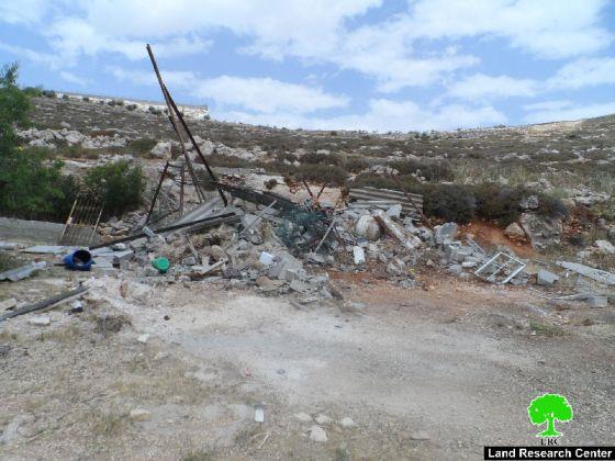
On the 17th of April, 2013, dozens of Israeli settlers escorted by the Israeli Occupation Army (IOA) stormed Solomon’s pools area, southwest of Bethlehem city, and performed Talmudic rituals in the Area.
According to the Oslo II Interim agreement of 1995, Solomon’s Pools are located within the area classified as area “A”, which means it’s under the full control of the Palestinian National Authority (security and administrative) and so, neither Israeli settlers nor the IOA have the authorization to be present or operate in this area and only Palestinians themselves are authorized to exist in such areas. Note that the continued Israeli settlers’ attempts to storm Solomon’s Pools area in Bethlehem shows the Israeli settlers’ intention to seize the area in order to annex it to Gush Etzion settlement bloc area.
Solomon’s Pools, general glance
The Solomon’s Pools area is located to the southwest of Bethlehem city. It is surrounded by Al Khader village from the north, Artas village from the east, the Israeli segregation wall and the Gush Etzion settlement bloc from the south. See Map 1
 |
Over the centuries, this area has provided a pleasant atmosphere for picnics and relaxation for the people of the surrounding villages and towns of Bethlehem Governorate. Additionally, the Solomon’s Pools until 1967, used to be an aqueduct system supplying the villages and towns of Bethlehem and Jerusalem with water.
Today, after the establishment of a number of illegal Israeli settlements in the area (the settlements of the Gush Etzion bloc) and the construction of the segregation wall, this water source no longer provides the cities of Jerusalem and Bethlehem with enough water supplies as it used to be.
Previous Israeli settlers’ attacks at Solomon’s pools area
Storming Solomon’s Pools area by the Israeli settlers and under the protection of the Israeli occupation Army (IOA) is not the first of its kind. Several Israeli violations occurred in the previous years, the last of which occurred on the 31st of March, 2013, when dozens of Israeli settlers living in the settlement of Efrat stormed Solomon’s Pools area and Al Khader Village under the protection of the IOA to perform their religious rituals.
The practices carried out by the Israeli settlers of Efrat settlement against Solomon’s Pools area aren’t at random; settlers are working, obviously, under a systematic approach in which they could impose a massive pressure on the Israeli government to annex that area to become part of ‘Gush Etzion’ settlement bloc, which Israel plans to annex to Israel through the construction of the Israeli segregation wall.
The planned Israeli segregation wall west of Solomon’s Pools area is not a permanent one. The Israeli government has always the ability to change its route, certainly, as long as it serves the demands of Israeli settlers and settlements and enhances their presence in the territory.
However, the previous assumption (the continuous attack of Solomon’s pools area) is based on previous incidents took place in years before and show how the Israeli government dealt with such situations. In 2009, The Israeli military court in Gush Etzion affiliated to the Israeli Civil Administration in Bethlehem Governorate rejected eight of nine petitions filed by Palestinians of Al Khader and Artas villages southwest of Bethlehem city against an Israeli military order issued back in 2004 which stated the seizure of 1700 dunums of Palestinian lands, and allegedly declared as ‘State Land’.
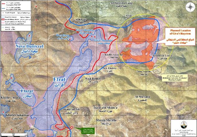
According to the revised wall route of 2004, the targeted lands (the 1700 dunums) are located within the ‘master plan’[1] of Efrat settlement southwest of Bethlehem city and within the land area that was set to be isolated by the Segregation Wall and annexed to Israel.
In the Year 2005, the Israeli Ministry of Defense made changes in several sections of the segregation wall in the West Bank territory, one of which was the section where the area declared by Israel as ‘State Land’ north of Efrat settlement. According to the Israeli version, the targeted land was set outside the route of the Segregation Wall, on the eastern side of the fence. See Map 2
|
Even until today, Israeli settlers keep targeting the previously mentioned area to impose pressure on the Israeli Government to re-route the wall to include the 1700 dunums once again within the area to be annexed to Israel through the construction of the wall. This is exactly what is happening in Solomon’s pools area, as settlers keep attacking the area of Solomon’s pools in attempt to put pressure on the Israeli Government to annex this area and to become part of the Gush Etzion settlement bloc. Click here for more information: Wind of Change Storm as the Likud is back to Power in Israel, ‘The Israeli Military Court confirms the confiscation of 1700 Dunums south of Bethlehem Governorate’
To conclude
The Israeli government is working hard to accomplish its “Colonial Plans” in the occupied West Bank. The expropriation and annexation of Palestinian lands such as Solomon’s Pools area is just an integral part of this plan. Israel by doing so undermines the right of Palestinians to establish their viable Palestinian state in the future.
These practices are condemned by international law and all Human rights conventions. Some of which are listed below:
Article XXXI of the 1995 Oslo agreement, Israel is forbidden from building or planning to any project or settlements or any colonial expansion or any plan that lead to change the status of the West Bank and Gaza Strip. The article provides ‘Neither side shall initiate or take any step that will change the status of the West Bank and the Gaza Strip pending the outcome of the permanent status negotiations’.
United Nations Security Council, Resolution 446 March 22, 1979 calls on Israel to rescind its previous measures and to desist from taking any action which would result in changing the legal status and geographical nature and materially affecting the demographic composition of the Arab territories occupied since 1967, including Jerusalem and, in particular, not to transfer parts of its own civilian population into the occupied Arab territories’.
Article 49 paragraph 6 in the Fourth Geneva Convention that” The occupying power shall not deport or transfer parts of its own population into the territories it occupies.”
[1] In 1991, the Israeli civil administration issued master plans for Israeli settlements in the occupied Palestinian territory. These master plans showed an increase in the settlements built-up area in the future and all was planned to be implemented on the expense of surrounding Palestinian lands.