Violation: eviction orders for 70 dunums in Beit Ulla.
date: October 14, 2012.
location: Deir Ibn Ibead, Wadi al Raqati, and Khallit Alqam in Beit Ulla – Hebron.
perpetrators: the Inspection Subcommittee, the Israeli Occupation Civil Administration, the Israeli Occupation Army.
details:
On October 14, 2012, the Israeli Occupation Authorities served a number of residents of Beit Ulla eviction orders for their lands. The locals said that they found the orders entitled ‘eviction orders’ thrown in their fields. The orders were designated for 3 plots that have been recently rehabilitated, these are:
order 1057, designated for a field owned by Issa Sharif; the plot’s area is 11.5 dunums planted with olives (120 trees) and prunes (350 trees). The plot is fenced and holds a 100-m3-cistern within. According to LRC’s GIS unit which examined the enclosed maps, the targeted area is 7 dunums.
picture 1-2: order 1075
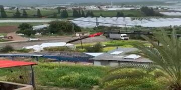
picture 3: targeted area
2. order 1052, designated for a field owned by Mohammad Ibrahim; the plot’s area is 5 dunums planted with olives (120 trees). The plot is fenced and holds an 80-m3-cistern within. According to LRC’s GIS unit which examined the enclosed maps, the targeted area is 9 dunums.
Picture 6: an aerial photograph showing the targeted area
3. order 1054, designated for a field owned by heirs of Abdul Kader al Saraheen; the plot’s area is 8.4 dunums planted with olives (40 trees) and grapes (6 trees). The plot is fenced and was rehabilitated 5 years earlier
picture 9-11: targeted area
picture 12: an aerial photograph showing the targeted area
4. order 1061, designated for a field owned by Jamal Farrash; in addition to an 11-dunum-plot, property of Ibrahim al Adam. According to LRC’s GIS unit which examined the enclosed maps, the targeted area is 41 dunums.
picture 13-14: order 1061
5. order 1056, designated for a field owned by Mohammad Al Adam; the plot’s area is 5 dunums planted with olives (55 trees), grapes (20 trees), and pine (7 trees). The plot is fenced and holds a 35-m3-cistern within. According to LRC’s GIS unit which examined the enclosed maps, the targeted area is 5 dunums.
picture 15-16: order 1056


