• About The Project
  • Palestine in Century
  • Selected Maps
  • Glossary
  • About ARIJ
  • About LRC
  • By Year
    • Case Studies By Year
    • Daily Report By Year
Saturday, May 10, 2025
POICA
No Result
View All Result
  • Home
  • Settlements
    • New Israeli Settlements
    • Settlement Expansion
  • Israeli Violations
    • Agriculture
    • Confiscation
    • Demolition
    • Environment
    • Eviction of Palestinians
    • Settlers Attacks
  • Bypass Roads
  • Israeli Plans
  • Segregation
    • Checkpoints
    • Closure
    • Separation Plans
  • Military Orders
  • Reports
    • Daily Report
    • Monthly Report
    • Quarterly Report
No Result
View All Result
POICA
No Result
View All Result

Israel issues an amendment to a previously issued confiscation order for the Israeli Segregation Wall in Rachel’s Tomb area

April 4, 2010
in Military Orders
Israel issues an amendment to a previously issued confiscation order for the Israeli Segregation Wall in Rachel’s Tomb area
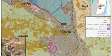
On March 14, 2010, the Israeli Occupation Forces handed the Palestinian residents of Rachel’s Tomb area north of Bethlehem city issued an amendment to a previously issued military order  number 14/03/T which was issued on February 9, 2003 and states the confiscation of 26.2 dunums of Palestinian lands to build the illegal Israeli Segregation Wall in Rachel’s Tomb area. which was issued on February 9, 2003 and states the confiscation of 26.2 dunums of Palestinian lands to build the illegal Israeli Segregation Wall in Rachel’s Tomb area.
 

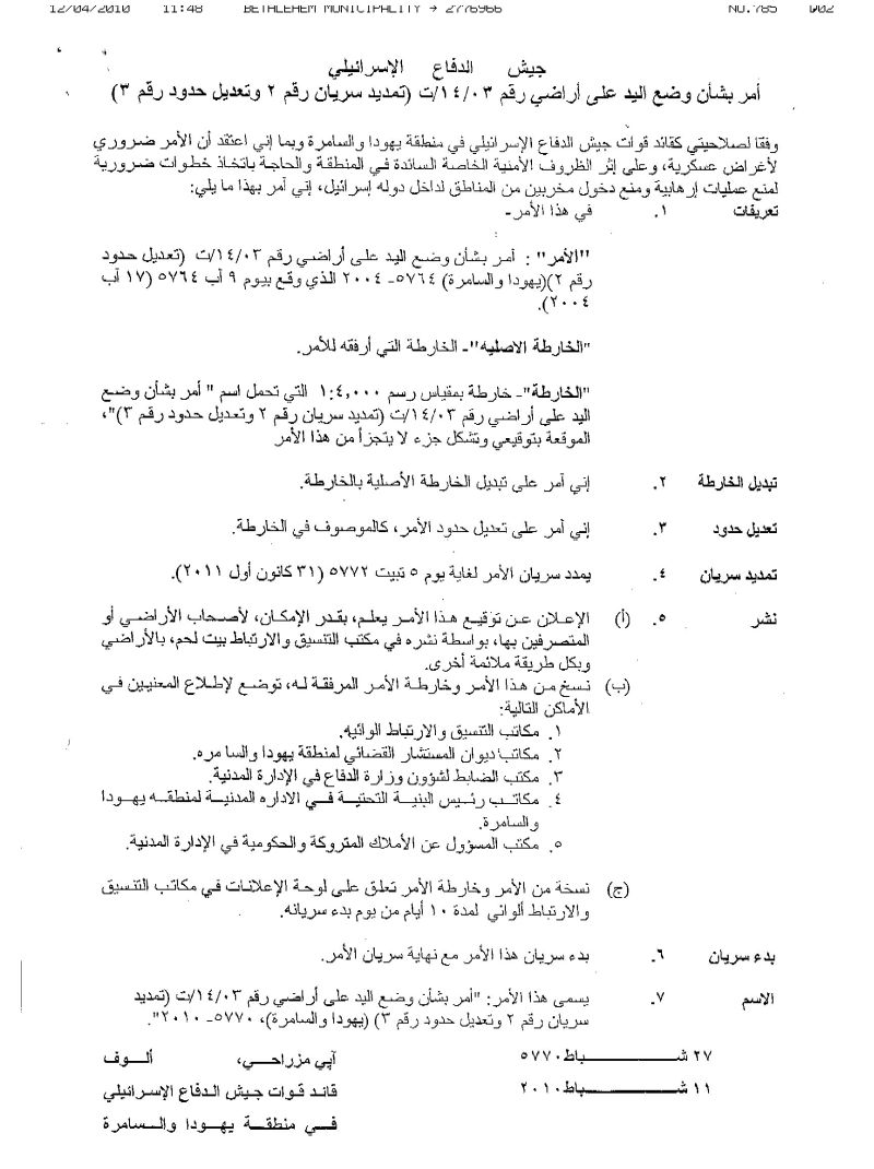
Photo 1 & Photo 2: The amendment of the MIlitary Order Number 14/03/T
 
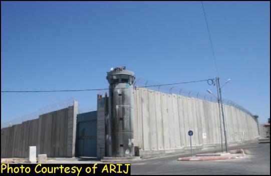
The Segregation Wall around Rachel’s Tomb Area
 In December 2003, the Israeli Occupation Forces started to build the Segregation Wall in Rachel’s Tomb area (the northern section of the Segregation Wall in Bethlehem Governorate) which stretches through 1.7 km long. The lands surrounding the Tomb were confiscated under “security pretexts” to establish a parameter of a 12 meters concrete partition blocks around the Tomb.
 
On February 3, 2005, the Israeli Supreme Court rejected petitions submitted by 18 Palestinian families from Bethlehem and Beit Jala cities against the construction of a bypass parallel to the path of the Segregation Wall at Bethlehem’s northern entrance stretching through the way from Gilo 300 Terminal to Rachel’s Tomb.
 
By August 2006, Israel had finally sealed off the Rachel’s Tomb area from Bethlehem Governorate with a large iron gate. See map 1 & Photos
 
 
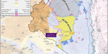
Map 1: the Segregation Wall in Rachel’s Tomb Area
 

The Rachel’s Tomb area before and after the construction of the Segregation Wall
 
 
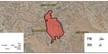
The Rachel Tomb Area today
 The Segregation Wall which totally isolates the Rachel’s Tomb area did not fully satisfy the Jewish colonial desires towards the annexation of all of the Palestinian lands to its territories; rather on February 21, 2010, the Israeli Prime Minister Benjamin Netanyahu announced that two holy sites located in the West Bank, the Rachel’s Tomb north of Bethlehem and the Ibrahimi Mosque in Hebron Governortae (also known to the Israelis as the Tomb of the Patriarchs)  will be included on a list of Israeli national heritage sites to be restored.
 
As a result of building the Segregation Wall around the Rachel’s Tomb area, 60 people were enclosed inside this wall and completely segregated from center of Life in Bethlehem city.
 
Bethlehem Governorate has been severely affected by building the Segregation Wall where 159,793 dunums (23.5%) from the total area of Bethlehem Governorate will be totally isolated by the Wall; most of which are fertile agriculture lands and their owners have to issue a special permit form the “Israeli Civil Administration” in order to be able to access their isolated lands; most often their requests are rejected. See Table 1:
 
Table 1: Status of the Israeli Segregation Wall in Bethlehem Governorate
Wall Status
Length-km
Existing Sections
25.4
Planned Sections
43.6
Under Construction Sections
5.8
Total Wall Length
74.8
Source: ARIJ-GIS Database 2010
 
 
To Conclude
Israel is steadily moving towards imposing facts on the ground and unilaterally shaping the borders of their colonial state by building the illegal Segregation Wall in the Occupied Palestinian Territory, expanding  Illegal Israeli settlements, confiscating Palestinian land and demolishing Palestinian houses and targeting east Jerusalem, aiming to create an atmosphere of voluntary displacement of Palestinians from their own lands.
 
The construction of the Wall in the OPT clearly violates international law, rules and conventions such as:
  • Article 147&53 of the Fourth Geneva Convention of 1949 indicates that: ‘Extensive destruction and appropriation of property not justified by military necessity and carried out unlawfully and wantonly is a grave breach of the Convention.‘
  • Article 23 of the Hague Convention of 1907 also provides: ‘In addition to the prohibitions provided by special Conventions, it is especially forbidden to destroy or seize the enemy’s property, unless such destruction or seizure be imperatively demanded by the necessities of war;’
  • Article XXXI of the 1995 Oslo agreement provides ‘Neither side shall initiate or take any step that will change the status of the West Bank and the Gaza Strip pending the outcome of the permanent status negotiations.’
  • Under the Universal Declaration of Human Rights adopted and proclaimed by General Assembly resolution 217 A (III) of, December 10, 1948, Article 17 reads: ‘No one shall be arbitrarily deprived of his property.’ In otherwords, it bans Israel from destroying or confiscating the property of the Palestinians at any case.


Prepared by  
The Applied Research Institute – Jerusalem
 

Recommended For You

الأراضي الفلسطينية بين الذرائع الأمنية والأطماع الاستيطانية – “الأمن، الآثار، والطبيعة كحجج لاقتلاع الفلسطينيين من أراضيهم”

by arij
April 15, 2025
0

مقدمة شهدت الأراضي الفلسطينية في الضفة الغربية المحتلة على مدار عقود طويلة سياسة ممنهجة من المصادرة الإسرائيلية للأراضي، حيث تبرر سلطات الاحتلال الإسرائيلي هذه السياسة بمجموعة من الذرائع...

Read moreDetails

سلطات الاحتلال الإسرائيلي تخصص ما يزيد عن 16,000 دونما من الأراضي الفلسطينية التي تحيط بالمستوطنات الإسرائيلية لأغراض الرعي

by arij
February 12, 2025
0
سلطات الاحتلال الإسرائيلي تخصص ما يزيد عن 16,000 دونما من الأراضي الفلسطينية التي تحيط بالمستوطنات الإسرائيلية لأغراض الرعي

  أصدرت سلطات الاحتلال الإسرائيلي في العاشر من شهر شباط من العام 2025 ستة أوامر عسكرية جديدة تقضي"بإعلان عن نية المسؤول عن الأملاك الحكومية وأملاك الغائبين على المصادقة...

Read moreDetails

Sheep Pens in Bardala Village Falls to a systematic Attack of the Israeli Army, Aiming to Displace the Community

by arij
January 30, 2025
0
اخطارات اسرائيلية بوقف العمل في قرية بردلة

The Israeli Settlement Council Organization stormed the village of Bardala, northeast of Tubas, targeting a sheep pen owned by Mr. Louay Abu Rushdi. The escorting occupation Army issued...

Read moreDetails

اخطارات اسرائيلية بوقف العمل في قرية بردلة

by arij
January 30, 2025
0
اخطارات اسرائيلية بوقف العمل في قرية بردلة

  الموقع: بردلة -الأغوار الشمالية / محافظة طوباس الجهة المعتدية: المجلس الأعلى للتخطيط /تنظيم مجلس المستوطنات الجهة المتضررة: السيد لؤي ابو رشدي الانتهاك: وقف عمل لحظيرة أغنام تفاصيل...

Read moreDetails

إخطارات بهدم بركسات سكنية وزراعية في تجمع عاطوف

by arij
January 23, 2025
0
Demolition Notices for Residential and Agricultural Structures in the Atouf Community

  الانتهاك: إخطارات بهدم مسكن وحظائر اغنام الموقع: الرأس الاحمر- عاطوف / محافظة طوباس الجهة المعتدية: تنظيم مجلس المستوطنات الجهة المتضررة: السيد ثائر حسين تفاصيل الانتهاك أقدمت قوات...

Read moreDetails
Next Post
Land grab for military purposes in ‘Awarta village

Land grab for military purposes in 'Awarta village

LATEST NEWS

الأراضي الفلسطينية بين الذرائع الأمنية والأطماع الاستيطانية – “الأمن، الآثار، والطبيعة كحجج لاقتلاع الفلسطينيين من أراضيهم”

by arij
April 15, 2025
0

........................................................

الطرق الالتفافية الاسرائيلية وأثرها على البيئة الفلسطينية

انتهاك للطبيعة والهوية في الأراضي الفلسطينية المحتلة

by arij
March 17, 2025
0

........................................................

Israel Advances Settlement Plan on Ancient Olive Groves on lands of Beit Jala city, Violating International Law and depriving Palestinians their lands

إسرائيل تمضي قدمًا في مخطط استيطاني جديد على أراضي مدينة بيت جالا، في انتهاك للقانون الدولي وحرمان الفلسطينيين من أراضيهم

by arij
April 29, 2025
0

........................................................

Israel Advances Settlement Plan on Ancient Olive Groves on lands of Beit Jala city, Violating International Law and depriving Palestinians their lands

Israel Advances Settlement Plan on Ancient Olive Groves on lands of Beit Jala city, Violating International Law and depriving Palestinians their lands

by arij
April 29, 2025
0

........................................................

flag_yellow_lowEU-PfP-Logo

This website has been produced with the assistance of the European Union. The contents of this publication are the sole responsibility of ARIJ & LRC and can in no way be taken to reflect the views of the European Union.

© 2025 Copyright ARIJ . All Rights reserved. .

No Result
View All Result
  • Home
  • Settlements
    • New Israeli Settlements
    • Settlement Expansion
  • Israeli Violations
    • Agriculture
    • Confiscation
    • Demolition
    • Environment
    • Eviction of Palestinians
    • Settlers Attacks
  • Bypass Roads
  • Israeli Plans
  • Segregation
    • Checkpoints
    • Closure
    • Separation Plans
  • Military Orders
  • Reports
    • Daily Report
    • Monthly Report
    • Quarterly Report

© 2025 Copyright ARIJ . All Rights reserved. .