• About The Project
  • Palestine in Century
  • Selected Maps
  • Glossary
  • About ARIJ
  • About LRC
  • By Year
    • Case Studies By Year
    • Daily Report By Year
Friday, August 15, 2025
POICA
No Result
View All Result
  • Home
  • Settlements
    • New Israeli Settlements
    • Settlement Expansion
  • Israeli Violations
    • Agriculture
    • Confiscation
    • Demolition
    • Environment
    • Eviction of Palestinians
    • Settlers Attacks
  • Bypass Roads
  • Israeli Plans
  • Segregation
    • Checkpoints
    • Closure
    • Separation Plans
  • Military Orders
  • Reports
    • Daily Report
    • Monthly Report
    • Quarterly Report
No Result
View All Result
POICA
No Result
View All Result

The construction of a New Colonial Road South of the Town of Adh Dhahiriya

July 3, 2008
in Bypass Roads
The construction of a New Colonial Road South of the Town of Adh Dhahiriya

Israeli occupation forces bulldozed a new colonial road connecting between Wadi Al Khalil Crossing, located south of the town of Adh Dhahiriya, and the colony of Shima. The new colonial road stretches over a distance of 7 kilometers with an average width of 40 meters. It is worth pointing out that the Wadi Al Khalil Crossing used to be a permanent checkpoint separating between the southern parts of the West Bank and the area of Beer Sheva. It was transferred to an official crossing at the end of 2007.


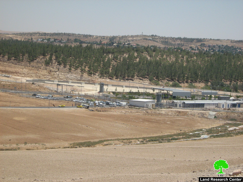
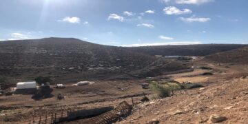
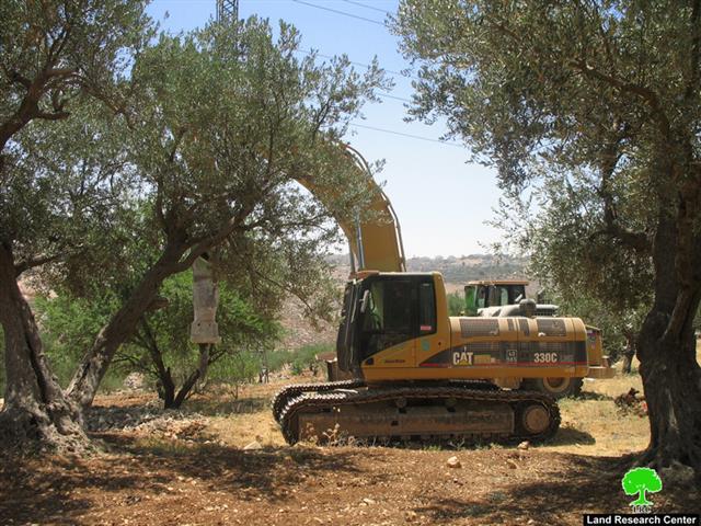
Photo 1: Wadi Al Khalil Crossing


The work on the new colonial road has started after the designation of the old route of Road 60 as part of the route of the Racist Israeli Isolation Wall. The establishment of the new Road led to the confiscation of 280 dunums belonging to the residents of the town of Adh Dhahiriya. That is in addition to thousands of dunums isolated between the new colonial Road and the Wall which are also owned by residents of Adh Dhahiriya.


Due to the establishment of the new Road in addition to the presence of the colony of Shima, the Metariam Industrial Zone and the Wall, the khirbat of Zanuta has become totally surrounded from all direction which led to massive movement and access difficulties of its resident to Adh Dhahiriya. 


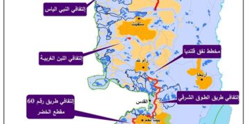
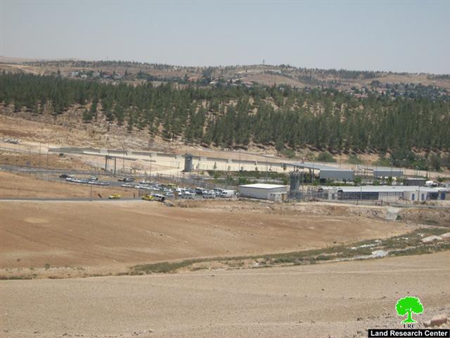
Photo 2: A section of Road 60

The population of the khirbet is estimated to be 180 people living in 11 housing structures including tents and caves. They are totally dependent on herding and agriculture as the main source of income. The population belongs to the clans of Al Til, Al Battat and Al Samamreh. The khirbet has no basic infrastructure whatsoever. The water is usually purchased from Adh Dhahiriya and then tankered to the khirbet at high cost.


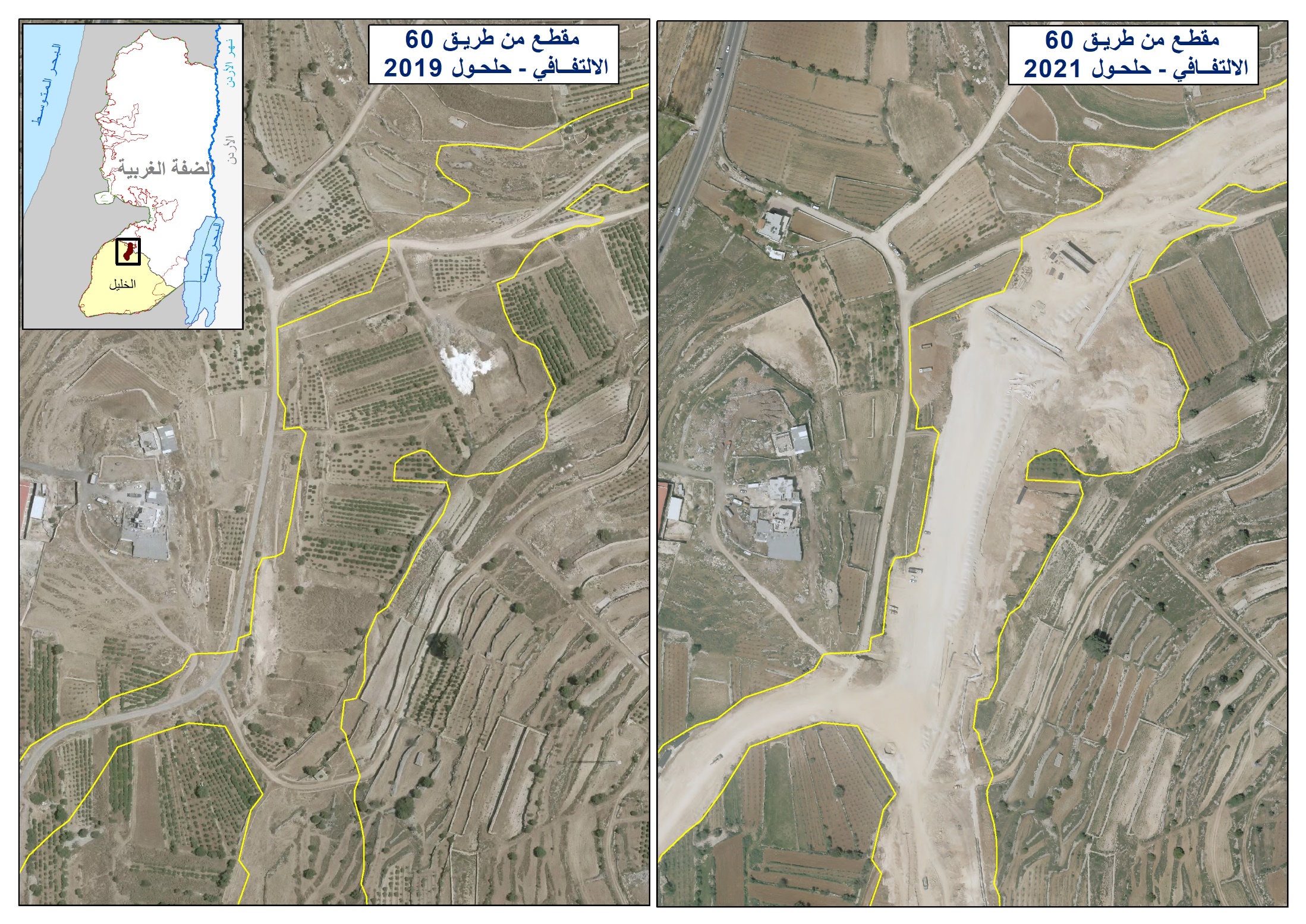
Israeli occupation authorities started work on the new colonial road in 2000. Work stopped on it for a period of 7 years only to be re-started again in the spring of 2007. The new section of the road connects between the colony of Shima in the north and the Wadi Al Khalil crossing in the south. Israeli colonist cars have been observed using the new road as a sign of its near completion.


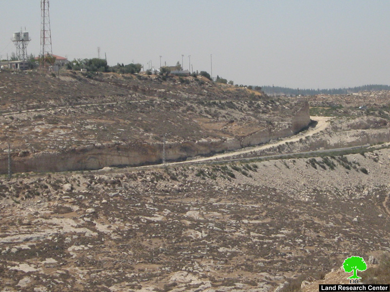
Photo 3: Road 60 close to the colony of Shima.


The new colonial road has devoured Palestinian lands owned by Palestinians from the clans of Abu Allan, Al Til, Al Samamra, Al Awaysa in addition to Al Makharza in the following manner:

1.     Abu Allan clan: The colonial road runs 1 kilometer along their lands. It isolated hundreds of dunums between it and the Wall in an area known as Wadi Al Khalil. The lands are owned:

  • Ismaeel Ahmad Ismaeel Abu Allan.

  • Wajeeh Abu Allan.

  • Ibraheem Mohammad Saleh Abu Allan.

  • Ali Abdel Qader Abu Allan.

  • Musa Mohammad Khalil Abu Allan.

2.     Al Til clan: The colonial road runs 3 kilometers along their lands in an area called Wadi Abu Musa and Khillat Umm Sira. The lands are owned by:

  • Shafeeq Suleiman Abed Al Til.

  • Mohammad Amero Al Til

  • Sami Ibrahim Al Til

  • Younis Abu Khshoum

  • Mohammad Talib Al Til

  • The heirs of Mr. Othman Al Til.

3.     Al Awaysa clan: The colonial road runs 1 kilometer along their lands in an area called Al Tala’a. The lands are owned by:

  • Abbas Al Shaba’an

  • Abdel Samee’s Al Shaba’an

  • Mohammad Ali Al Shaba’an

  • Khalil Al Shaba’an

  • Abdel Halim Atta Al Awaysa

  • Ali Ibrahim Al Awaysa.

4.     Al Samamra clan:

The colonial road runs 750 meters along their lands in an area called Wadi Masoud. The land is owned by:

  • Mohammad Amero Al Samamra

  • Mohammad Hasan Al Hannoni

  • Jamal Al Hannoni

  • Ali Saleh Al Samamra

  • Rasmi Al Shalami

5.     Al Makharza clan: The colonial road runs about 750 meters along their lands in an area called Al Qurna. The lands belong to the following:

  • Ahmad Al Sheikh

  • Othman Al Sheikh

  • Ayed Abu Sharkh

  • Ouda Abu Sharkh

  • Yousef Jaber Abu Sharkh

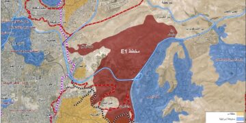
In terms of the nature of the confiscated lands for the benefit of the new colonial road and the isolated land between it and the Wall, they are agricultural lands that used to form the main source of income for its owners. The affected lands contain a number of water cisterns, a group of which are known as the Shama cisterns that were demolished in the year 2000. They used to be owned by Mr. Ahmad Talib Al Til and the family of Abu Ali Al Til. According to Mr. Ahmad, the cisterns used to be big pools that satisfied their drinking needs. Nowadays, there is a great need for additional cisterns and water in the isolated khirebt and lands. See Map 1

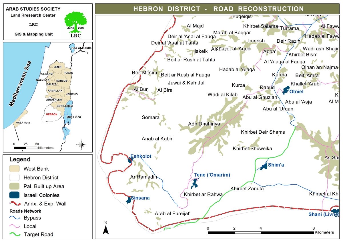
Map 1: Map illustrating the route of the new colonial road connecting
the colony of Shima and Wadi Al Khalil crossing.  

Prepared by:
The Land Research Center
LRC

Recommended For You

​الطرق الالتفافية الإسرائيلية: “مشنقة مشروع حل الدولتين”

by arij
July 21, 2025
0
​الطرق الالتفافية الإسرائيلية: “مشنقة مشروع حل الدولتين”

مقدمة: اختلف الشكل العام لشبكة الطرق في الضفة الغربية تبعا للظروف السياسية والعسكرية التي مرت بها المنطقة، فحتى العام 1967 كانت شبكة الطرق في الضفة الغربية عبارة عن...

Read moreDetails

شق طريق استيطاني جديد يهدد سبل العيش في قرية بردلة

by arij
January 13, 2025
0
New Israeli Settlement Road Construction and Its Impact on the Village of Bardala in the Jordan Valley

المكان: تجمع بردلة- محافظة طوباس/الأغوار الزمان: سبتمبر 2024 الجهة المتضررة: أهالي قرية بردلة والقرى المجاورة الجهة المعتدية: ما تسمى بالإدارة المدنية الاسرائيلية الانتهاك: شق طريق استيطاني تفاصيل الانتهاك:...

Read moreDetails

New Israeli Settlement Road Construction and Its Impact on the Village of Bardala in the Jordan Valley

by arij
December 31, 2024
0
New Israeli Settlement Road Construction and Its Impact on the Village of Bardala in the Jordan Valley

  The construction of new settlement infrastructure in the occupied Palestinian territories has profound implications for local communities, threatening livelihoods, increasing isolation, and impairing socio-economic vulnerabilities. This case...

Read moreDetails

الطرق الالتفافية الاسرائيلية وأثرها على البيئة الفلسطينية

by arij
January 16, 2024
0
الطرق الالتفافية الاسرائيلية وأثرها على البيئة الفلسطينية

  الاعتداءات الإسرائيلية على الفلسطينيين لا تقتصر على التنكيل بالافراد، أو وضع القيود على الحركة والتنقل، أو استهداف المنازل والمنشات، أو مصادرة الأراضي، أو نهب الموارد والمصادر الطبيعية،...

Read moreDetails

Israeli Colonists Take Over an Agricultural Road in Ya’bad town / Jenin Governorate

by arij
January 12, 2022
0
Israeli Colonists Take Over an Agricultural Road in Ya’bad town / Jenin Governorate

  Violation: Taking over an agricultural road for the favor of colonization. Location: Ya’bad town / Jenin Governorate. Date: October 17th 2021. Perpetrators: Mevo Dotan Colony. Victims: Farmers...

Read moreDetails
Next Post
Devastation of land and uprooting of long- lived olive trees in Beit Hanina

Devastation of land and uprooting of long- lived olive trees in Beit Hanina

LATEST NEWS

بواقع 86 أمرا عسكريا – الأوامر العسكرية الإسرائيلية, الأداة الرئيسية للاحتلال الاسرائيلي للسيطرة على المياه الفلسطينية في الضفة الغربية المحتلة

“سيطرة من تحت الأرض”, بواقع 108 أمرا عسكريا, سيطرة اسرائيلية على مياه الفلسطينيين في الضفة الغربية المحتلة

by arij
August 12, 2025
0

........................................................

تصعيد إسرائيلي جديد: الاحتلال يهدم مبنى في بيت لحم ويواصل سياسة التطهير المكاني

تصعيد إسرائيلي جديد: الاحتلال يهدم مبنى في بيت لحم ويواصل سياسة التطهير المكاني

by arij
August 12, 2025
0

........................................................

Escalation and forced displacement in Kisan

by arij
August 6, 2025
0

........................................................

بؤرة استيطانية جديدة وتهجير قسري في كيسان

by arij
August 6, 2025
0

........................................................

flag_yellow_lowEU-PfP-Logo

This website has been produced with the assistance of the European Union. The contents of this publication are the sole responsibility of ARIJ & LRC and can in no way be taken to reflect the views of the European Union.

© 2025 Copyright ARIJ . All Rights reserved. .

No Result
View All Result
  • Home
  • Settlements
    • New Israeli Settlements
    • Settlement Expansion
  • Israeli Violations
    • Agriculture
    • Confiscation
    • Demolition
    • Environment
    • Eviction of Palestinians
    • Settlers Attacks
  • Bypass Roads
  • Israeli Plans
  • Segregation
    • Checkpoints
    • Closure
    • Separation Plans
  • Military Orders
  • Reports
    • Daily Report
    • Monthly Report
    • Quarterly Report

© 2025 Copyright ARIJ . All Rights reserved. .