• About The Project
  • Palestine in Century
  • Selected Maps
  • Glossary
  • About ARIJ
  • About LRC
  • By Year
    • Case Studies By Year
    • Daily Report By Year
Wednesday, May 21, 2025
POICA
No Result
View All Result
  • Home
  • Settlements
    • New Israeli Settlements
    • Settlement Expansion
  • Israeli Violations
    • Agriculture
    • Confiscation
    • Demolition
    • Environment
    • Eviction of Palestinians
    • Settlers Attacks
  • Bypass Roads
  • Israeli Plans
  • Segregation
    • Checkpoints
    • Closure
    • Separation Plans
  • Military Orders
  • Reports
    • Daily Report
    • Monthly Report
    • Quarterly Report
No Result
View All Result
POICA
No Result
View All Result

ARIJ Fact Sheet: The Israeli Segregation Plan in the Occupied Palestinian Territory

December 9, 2007
in Separation Plans
ARIJ Fact Sheet: The Israeli Segregation Plan in the Occupied Palestinian Territory

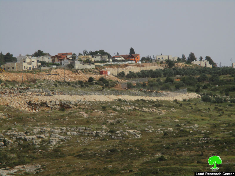
On September 12, 2007 the Israeli government published another revised route of the Segregation Wall in the West Bank. The new revised plan makes some significant changes in areas northwest of Ramallah city and in the southern part of Hebron Governorate. The updated map that was published in September 2007 was actually endorsed back to April 2007, but was only published on the website until that date.


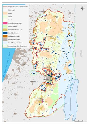
According to the revised plan, the Segregation Wall will run along 770 km in the West Bank and only 80 km of it will run on the 1949 Armistice Line (Green Line). When complete, the wall will isolate 713 km² of Palestinian land in the West Bank (12.6 % of the total area 5661 km²) in what became to known as the Western Segregation Zone; the area which falls between the wall and the 1949 Armistice Line (Green Line). It will enclose 107 Israeli settlements (including those in East Jerusalem) accommodating 425,000 (80.2%) of the Israeli settlers' total population in the West Bank (530,000). See Map


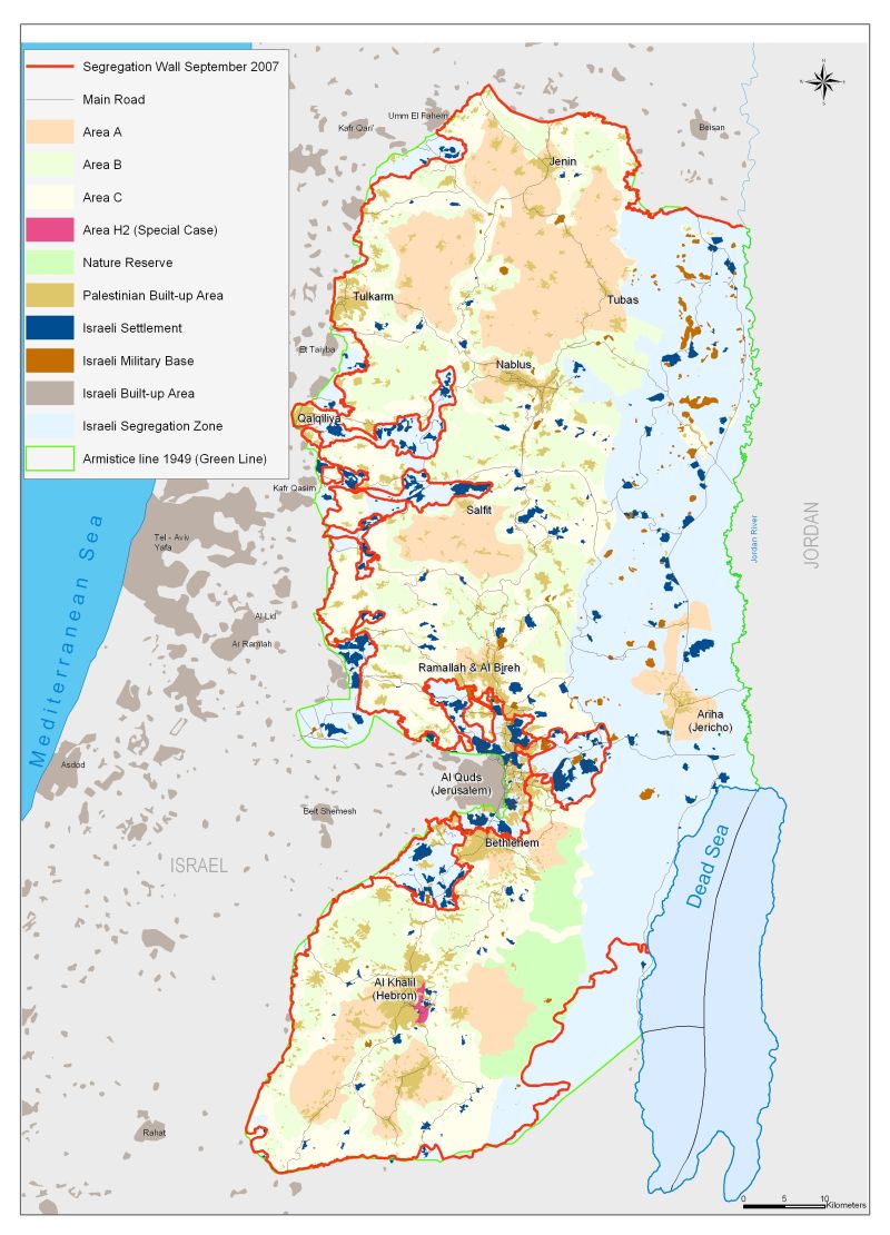
Moreover, the Israeli Army consolidated its control over the eastern terrains (including the Jordan Valley area) of the West Bank territory with 28 military controlled checkpoints. The targeted area as area that came to known as the Eastern Segregation Zone is 1555 km² (27.5% of the West Bank area) stretches along 200 Km from north to south. After the 1967 war, Israel classified some 925 km² of what the Eastern Segregation Zone as 'closed military area'. Furthermore, Israel has illegally classified an additional 630 km² of the Eastern Segregation Zone as 'State Land' which include the area of the settlements, the military bases, and some parts of the closed military areas.


In total, the Israeli Segregation Plan expropriates at least 40.1% of the total West Bank area, which according to Israel will be excluded from any future negotiations with the Palestinians, and consequently out of any peace settlement agreement.


The Status of the Israeli Western Segregation Wall in the West Bank:

  • 397 km (51.6% of the total length) is completed in the West Bank.

  • 303 km (39.3% of the total length) is planned to be constructed in the West Bank.

  • 70 km (9.1% of the total length) is under construction in the West Bank.

  • 80 km (10.4 % of the total length) runs on the 1949 Armistice Line (Green Line).

Palestinian Communities Affected by the Segregation Wall:

  • 29 Palestinian villages' boundaries with a total area of 216.7 km² will become trapped in enclaves; in addition to that, 138 Palestinian villages' boundaries are largely affected, some 554.4 km² will be lost behind the Segregation Wall.

  • 40 Palestinian communities, including more than 37,000 people, will be isolated in the Eastern Segregation Zone.

Environmental Resources Appropriated by the Segregation Wall:

  • 29 wells and 29 springs will be isolated in the Western Segregation Zone. 

  • 204 wells and 43 springs will be isolated in the Eastern Segregation Zone

  • Up to 192 km² of agricultural land area isolated within the Western Segregation Zone (6.8% of the total Agricultural lands in the West Bank) in addition to 844 km² within the Eastern Segregation Zone (29.9% of the total agricultural lands in the West Bank), both of which constitute 18.3 % of the total West Bank Area.

  • Up to 246.8 km² of forest land and areas with shrubs are included in the Western Segregation Zone (10.8% of the total forests and open spaces area in the West Bank) and 707.8 km² in the Eastern Segregation Zone (31.1% of the total Forests and open spaces area in the West Bank), both of which constitute 16.9 % of the total area of the West Bank.

The Segregation Wall and Illegal Israeli Settlements

  • 107 Israeli settlements (out of 199 settlements in the West Bank), with a combined population exceeding 425000 (80.2 % of the total Israeli settlers' population are in the West Bank, 530,000) are in the Western Segregation Zone.

  • Settlements in the Western Segregation Zone cover an area of 106.7 km² (15% of the total western segregation Zone Area).

  • 38 Israeli settlements, with a combined population of 12530 settlers, (2.4% of the settlers' population), are in the Eastern Segregation Zone.

  • Settlements in the Eastern Segregation Zone cover an area of 37.8 km² (2.4% of the area of the Zone).

Changes made on the Israeli Segregation Wall Route during the period between 2002 & 2007

This is not the first time that the Israeli ministry of defense makes changes with regard to the Segregation Wall's route in the West Bank; in fact, this is the fourth alteration to the Segregation Wall route since the Israeli Government sanctioned its construction in the West Bank back in June 2002. Each change in Wall route showed an increase in wall's length and the segregated area.


Table 2: Changes on the Segregation Wall Route between June 2004 and April 2007

Date of Change

Wall Length

Area Isolated

% of the West Bank Area

June 2004

645 km

633 km²

11.2

February 2005

683 km

565 km²

10

April 2006

703 km

555 km²

9.8

April 2007

770 km

713 km²

12.6

Source: ARIJ GIS Database 2007


Download Printable Version

Prepared by
The Applied Reserach Institute – Jerusalem


Recommended For You

إغلاق مداخل قرية دير نظام بالتزامن مع إقامة مقطع جديد من السياج الفاصل / محافظة رام الله

by arij
June 25, 2019
0
The Israeli occupation violates human rights in Deir Nitham / Ramallah governorate

  الانتهاك: إقامة مقطع جديد من السياج الفاصل وإغلاق مداخل القرية. الموقع: قرية دير نظام شمال مدينة رام الله. تاريخ الانتهاك: 13/02/2019. الجهة المعتدية: جيش الاحتلال الإسرائيلي. الجهة...

Read moreDetails

The Israeli occupation violates human rights in Deir Nitham / Ramallah governorate

by arij
June 25, 2019
0
The Israeli occupation violates human rights in Deir Nitham / Ramallah governorate

  Violation: closing the town’s entrance and establishing a new segment of the apartheid wall. Location: Deir Nitham village north Ramallah city. Date: 13/02/2019. Perpetrator:  The Israeli occupation...

Read moreDetails

Info-graph: Manipulating the Demography of Occupied East Jerusalem
“The Construction of the Israeli Segregation Wall in and around Jerusalem

by arij
January 16, 2019
0
Info-graph: Manipulating the Demography of Occupied East Jerusalem “The Construction of the Israeli Segregation Wall in and around Jerusalem

  When Israeli captured East Jerusalem along with other Arab-Palestinian territories during the 1967 war, it became an obsession of the successive Israeli governments to win the demographic...

Read moreDetails

جيش الاحتلال الاسرائيلي ينصب بوابة حديدية جديدة شمال مدينة سلفيت

by arij
July 3, 2018
0
جيش الاحتلال الاسرائيلي ينصب بوابة حديدية جديدة شمال مدينة سلفيت

  الانتهاك: نصب بوابة حديدية على مدخل طريق زراعي شمال سلفيت. الموقع: مدينة سلفيت.. تاريخ الانتهاك: 21 حزيران 2018م. الجهة المعتديه: جيش الاحتلال الإسرائيلي. الجهة المتضرره: المزارعون في...

Read moreDetails

Israel to build new segment of the apartheid wall around “Ma’ale Isreal”

by arij
December 10, 2018
0
Israel to build new segment of the apartheid wall around “Ma’ale Isreal”

violation: completing the construction of the apartheid wall Location: Sarta Ash-Sharqiya village/ Salfit Governorate. Date:  May 01 - 2018 Perpetrators: Israeli Occupation Forces Victims:  residents of Sarta Description:...

Read moreDetails
Next Post

Israel put into effect the internationally outlawed "Collective Punishment" Policy against Palestinians in the Gaza Strip

LATEST NEWS

Expansion of Gilo Settlement: A Strategic Plan to Isolate Bethlehem and Undermine Palestinian Rights

Expansion of Gilo Settlement: A Strategic Plan to Isolate Bethlehem and Undermine Palestinian Rights

by arij
May 12, 2025
0

........................................................

الأراضي الفلسطينية بين الذرائع الأمنية والأطماع الاستيطانية – “الأمن، الآثار، والطبيعة كحجج لاقتلاع الفلسطينيين من أراضيهم”

by arij
April 15, 2025
0

........................................................

الطرق الالتفافية الاسرائيلية وأثرها على البيئة الفلسطينية

انتهاك للطبيعة والهوية في الأراضي الفلسطينية المحتلة

by arij
March 17, 2025
0

........................................................

Israel Advances Settlement Plan on Ancient Olive Groves on lands of Beit Jala city, Violating International Law and depriving Palestinians their lands

إسرائيل تمضي قدمًا في مخطط استيطاني جديد على أراضي مدينة بيت جالا، في انتهاك للقانون الدولي وحرمان الفلسطينيين من أراضيهم

by arij
April 29, 2025
0

........................................................

flag_yellow_lowEU-PfP-Logo

This website has been produced with the assistance of the European Union. The contents of this publication are the sole responsibility of ARIJ & LRC and can in no way be taken to reflect the views of the European Union.

© 2025 Copyright ARIJ . All Rights reserved. .

No Result
View All Result
  • Home
  • Settlements
    • New Israeli Settlements
    • Settlement Expansion
  • Israeli Violations
    • Agriculture
    • Confiscation
    • Demolition
    • Environment
    • Eviction of Palestinians
    • Settlers Attacks
  • Bypass Roads
  • Israeli Plans
  • Segregation
    • Checkpoints
    • Closure
    • Separation Plans
  • Military Orders
  • Reports
    • Daily Report
    • Monthly Report
    • Quarterly Report

© 2025 Copyright ARIJ . All Rights reserved. .