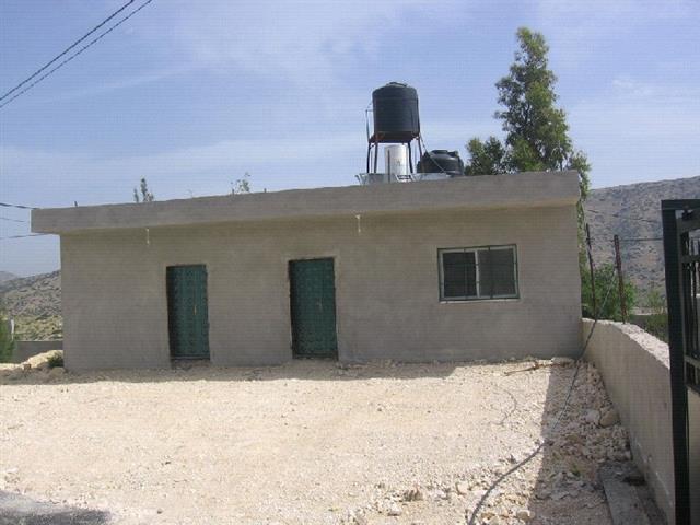
On April, 10th, 2006, the Israeli occupation authorities distributed 16 demolition notices against a mosque, kindergarten, room for electric generator, number of residential barracks, two cement built rooms and 500m long by 4m wide newly asphalted road that leads to the village which all located in the village of Al 'Aqaba in Tubas governorate.
(Photo 1 & Photo 2: copies of the Israeli notices to demolish two cement built
rooms and the asphalted road in Al 'Aqaba village, Tubas)
Location, population and area
The village of Al 'Aqaba is located in the northern parts of the Jordan valley in Tubas governorate and about 7 km to the east of Tubas town. It is bordered from the west by Tubas and Tayasir, from east by Jordan borders, from south by the land of Tamun village and from north by Bardala and Ein Al Baiyda villages.
The village's population has been exposed to continuous eviction campaigns at the hands of the Israeli occupation authorities after the war of 1967 under the pretext that the village and its land are located within post 1967 declared military zone. As a result, more than 700 people of the village's indigenous people have been dismissed out of the village and became refugees in different locations such as Jordan,Tubas, Tayasir and Nablus.

Map1: location of Al 'Aqaba village
In 1983, a third Israeli military camp (under the name of Tsivi) was set up at the main entrance to the village; in addition the two other camps of Cobra 1 in the east of the village and Cobra 2 in the south of the village. The remaining population has been decreased to only 300. The inhabitants of Al 'Aqaba are mainly dependent on agriculture and animal breeding as main income.
The village's total land area is about 3500 dunums which lies within zone C according to Oslo agreement's classification, although, the whole village's land area is registered in the taboo. Out of the above mentioned total land area, there are 500 dunums situated in Wadi Al Maleh to the south east of the village which have been totally inaccessible by its legal owners since the occupation of 1967 because it lies within the actual military training zone.
Photo 3: A section from the threatened road in Al 'Aqaba, Tubas
Denial of master plan and infrastructure
During the years from 1967 until 1997 the Israeli occupation authorities deprived the village from any services or infrastructure due to the fact that they had refused to organize any master plan for the village.
In 1997, and after the coming of the Palestinian national Authority, a basic school (in which 64 pupils are enrolled now) was established, followed by a health clinic in 2001 (financed by the British consulate), a kindergarten in 2002 (financed by the Belgian representative to the PNA, the American institution for the reconstruction of demolished houses and the British Consulate).
The village local council was also formed in 1997.
Three years ago, and in an attempt to avoid the Israeli repressive measures against the land and people of Al 'Aqaba, the village's council presented a legal case to the Israeli high court demanding the recognition of the village on part of the Israeli authorities and creation of a detailed master plan for it, but, to no avail.

Photo 4: Another section from the threatened road in Al 'Aqaba,
Tubas. The village school is visible in this picture)
Previous acts of demolitionThe latest demolition campaign was carried out in the year 2003 in which the following structures were destroyed: The latest demolition campaign was carried out in the year 2003 in which the following structures were destroyed:
|
Owner' name |
Demolition date |
Type of structure |
No. of family members |
Area In M2 |
Use |
Pretext for demolition |
|
Nayef Abdul Karim Saleh |
23.10.2003 |
Barrack |
8 |
70 |
Housing |
Closed military zone |
|
Akram Mohammed Saleh Taleb |
23.10.2003 |
Barrack |
8 |
300 |
Housing and animal rearing |
Closed military zone |
|
NA |
23.10.2003 |
Pool |
NA |
200 |
Agricultural Irrigation |
Closed military zone |
Prepared by
The Land Research Center
LRC


