Location
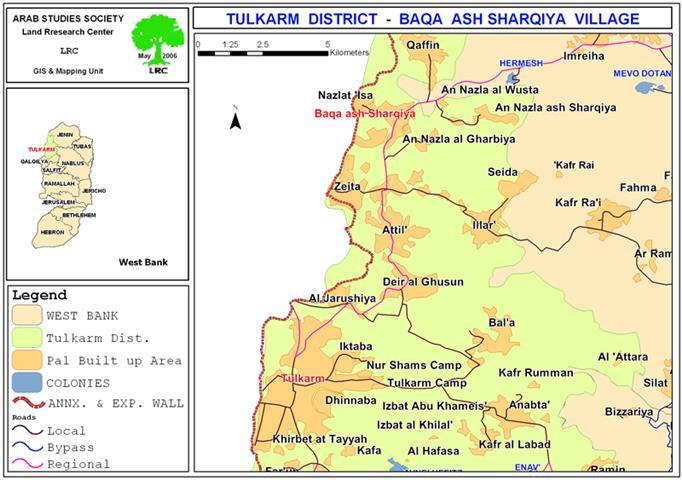
The village of Baqa Al Sharqiya is located 12 kilometers northwest of the city of Tulkarem. It is located right on the Green Line and most of its residents came originally from the town of Baqa Al Gharbiya which was occupied in 1948. See Map 1

Map 1: Location of Baqa Ash Sharqiya
There are four main families in the village; Al Majadila, Abu Mukh, Tou'ama and Kana'an. The population of the village according to the 2005 projection is about 4,200. About 89% of the workforce in the village used to work inside of the Israeli proper in the agricultural field before the year 2000. The area of the village is about 3300 dunums 50% of which is filled with greenhouses and citrus trees. The remaining 1200 dunums is planted with olive trees.
The Closure of the Villages Main Municipal and Agricultural Roads
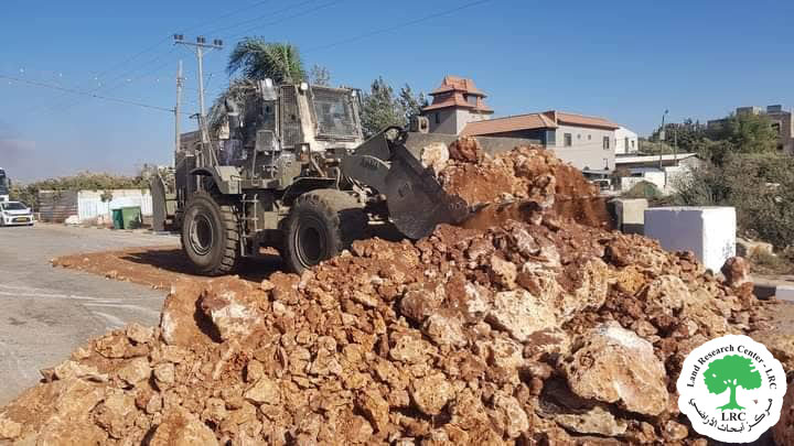
The Israeli occupation forces have closed up in the past couple of weeks the village's agricultural roads that lead to the agricultural lands located in the northern and western sides of the village. Such actions have led to the complications of land accessibility in those regions and to economical losses for the farmers working in the lands. See Photo 1
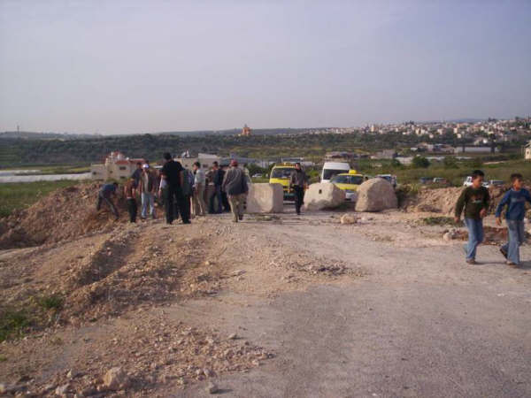
Moreover, Israeli occupation forces used cement blocks as well as a series of earth mounds and ditches (as to prevent car access) to close down the main roads connecting the village to the cities of Tulkarem and Jenin. The continuous presence of Israeli occupation patrols in that area was also noticed. These group punishment tactics have led to placing the village under siege and the prevention of any movement into or out of the village except for those who hold an ID in which Baqa Ash Sharqiya was mentioned as the place of residence. In case such policies were to continue for an extended period of time, a huge human and economical crisis is sure to develop in the upcoming few days.

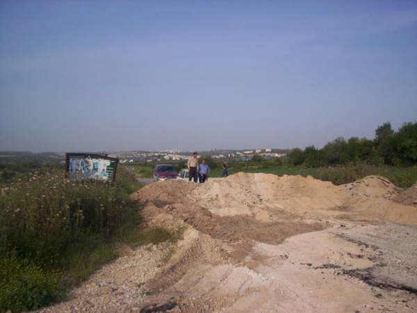
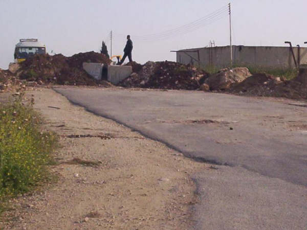
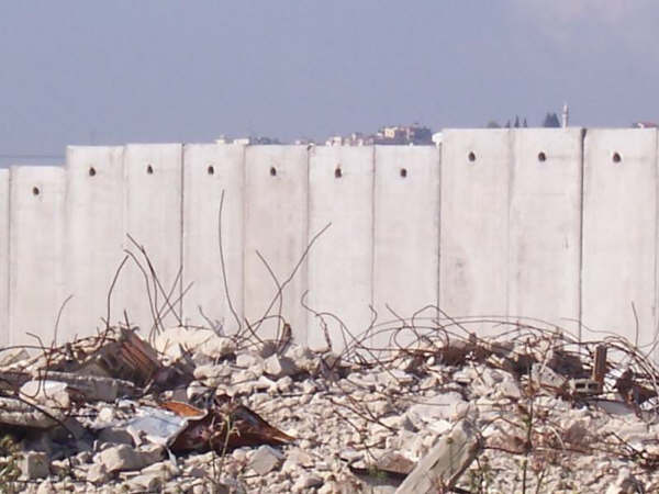
(Photos 2, 3 & 4: All the entrances to Baqa Ash Sharqiya are blocked
with rocks and earth mounds or bulldozed), Photos courtesy of LRC
Series of Israeli violations against the village and its residents
The village is considered to be a prey to the Israeli policy of aggression since the year 1948 when the village lost a great part of its lands and its residents dismissed to the east of the Green Line to a land that is currently known as Baqa Ash Sharqiya.
After the occupation of 1967 the village was subjected to a series of Israeli violations that came in the form of continuous arrest campaigns and the prevention of the residents of the village from building in the western and northern sides of the village as necessitated by the rules of natural demographic expansion of the residents of the village.
Since the year 2003 Israeli authorities continued its efforts to grab more lands and evict the residents of the village through the establishment of the Israeli Annexation and Expansion Wall on the lands of the village. In so doing, Israeli occupation authorities confiscated more than 500 dunums of the villages' fertile lands after which bulldozing took place within the boundaries of the village in an effort to annex more lands inside the Wall. In turn, this aggression has caused a great deal of damage to roads, water and electricity networks in the village. Yet, due to mounting criticism and outside pressures Israel was forced to retreat and to establish the Wall on the Green Line. It is worth noting here that residents are currently prohibited from rehabilitating the destroyed lands in the eastern side of the village as Israeli occupation forces declared it to be "closed military areas" that one needs to obtain a permit to access it.
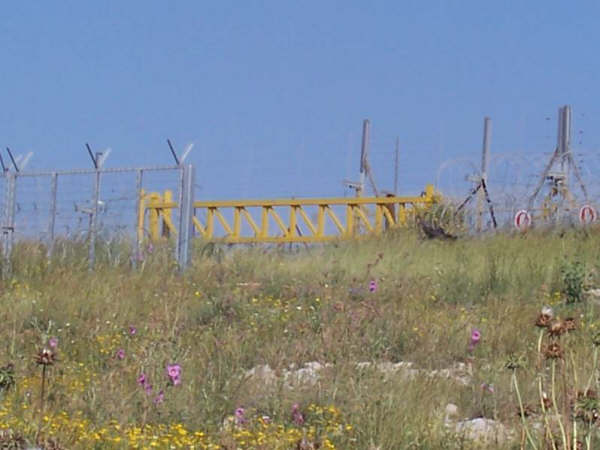
(Photos 5 & 6: Parts of the Wall besieging the village of
Baqa Ash Sharqiya), Photos courtesy of LRC
The length of the Wall in the village (including the part in Nazlat Issa) is about 5 kilometer 1 kilometer of which consists of a series of 8-meter high cement blocks located especially in the areas between houses. The remaining 4 kilometers consists of electronic fences that have surveillance cameras and early warning systems in addition to streets used by Israeli military patrols with a width of 60 meters. All these items were established on Palestinian agricultural lands despite the fact that such lands are considered to be state lands.
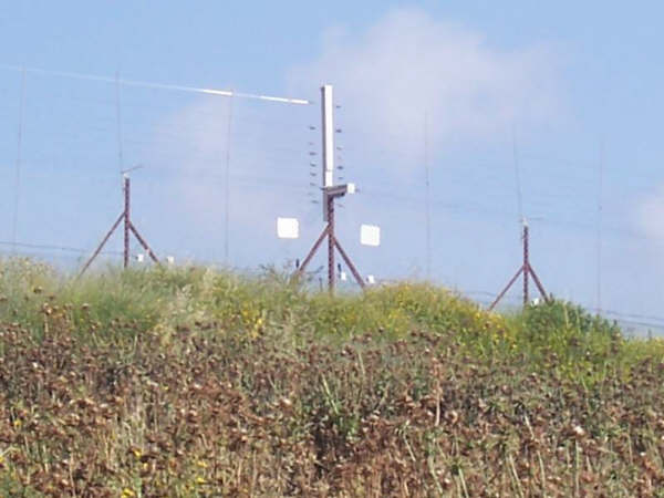
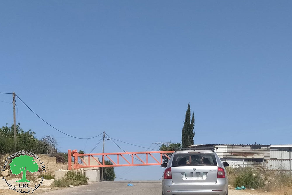
(Photos 7 & 8: Iron gates, surveillance camera and early warning systems
are integral parts of the Wall around Baqa Ash Sharqiya and else where in the West Bank)
Photos courtesy of LRC
Ever since the establishment of the Wall in mid 2003, Israeli occupation authorities have made it its policy to make the lives of the residents of the village and nearby communities an unbearable hell. They even placed the Wall in the backyards of some of the residents of the village such as the house of Mr. Iyad Abu Mukho. It is worth noting here that recently Israeli occupation forces have tightened its grip towards residents and land owners of the areas located near the Wall to the degree that owners were not permitted to reach their lands during the evening hours. Israeli soldiers manning the towers in the vicinity of such lands would open fire on anyone that would get close to the Wall in addition to shooting light flares into the sky as well as using teargas against Palestinians. That is in addition to a continuous arrest campaigns under the pretext of preventing illegal workers to get into Israel. Such a policy forced a large number of landowners to abandon their agricultural lands located in the vicinity of the Wall.
Prepared by
The Land Research Center
LRC