• About The Project
  • Palestine in Century
  • Selected Maps
  • Glossary
  • About ARIJ
  • About LRC
  • By Year
    • Case Studies By Year
    • Daily Report By Year
Tuesday, June 3, 2025
POICA
No Result
View All Result
  • Home
  • Settlements
    • New Israeli Settlements
    • Settlement Expansion
  • Israeli Violations
    • Agriculture
    • Confiscation
    • Demolition
    • Environment
    • Eviction of Palestinians
    • Settlers Attacks
  • Bypass Roads
  • Israeli Plans
  • Segregation
    • Checkpoints
    • Closure
    • Separation Plans
  • Military Orders
  • Reports
    • Daily Report
    • Monthly Report
    • Quarterly Report
No Result
View All Result
POICA
No Result
View All Result

Separated Olive tree fields razed for expanding Kibbutz cultivable land Hebron Governorate.

January 4, 2005
in Settlement Expansion
Separated Olive tree fields razed for expanding Kibbutz cultivable land Hebron Governorate.

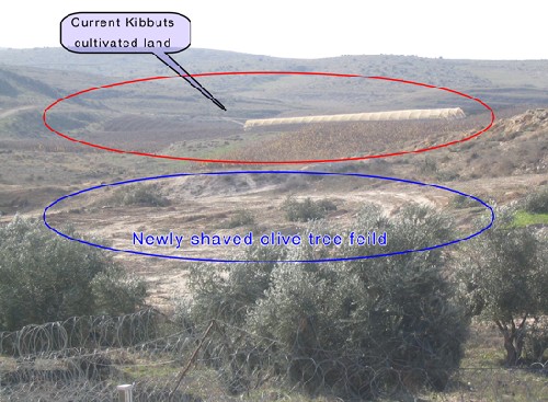
Under the pretext of shaving lands for security, the Israeli occupation forces cut on January 2nd, 2006 not less than 400 olive trees planted in the lands separated behind the route of the Segregation wall to the west of As Sikka village in Hebron district.

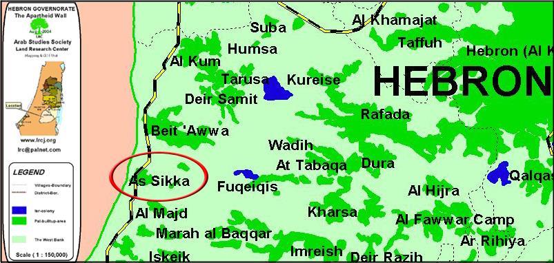
The village of As Sikka is located about 20 km to the southwest of Hebron city on the Armistice Line (Green Line). It has the population of 750 people, mostly working in agriculture. See Map 1

Location of As Sikka


The Israeli army personnel who started to cut the trees using sawing machines at 8 am on January 2nd, 2006 targeted all the trees over the age of 15 years in Khallet As Sikka and Joron Al Araneb. The trees belong to the families of Ihsheish, Abu Samra, Abu Eid, Iqteit and Ihribat. See photo 2

As Sika- Hebron: olive trees cut behind the route of the Wall – Photo courtesy of LRC. 


In an interview with LRC field worker, the head of As Sikka village council, Mr. Najib Jawa'da said that the killing of the trees aims at confiscating and annexing agricultural lands into Kibbuts Sheqev which was built over the Arab destroyed village of Um Ash Shaqaf. He stressed that during the last olive picking season in October, 2005, the Israeli army issued farmers passing permits to access their lands located behind the Wall. See photos


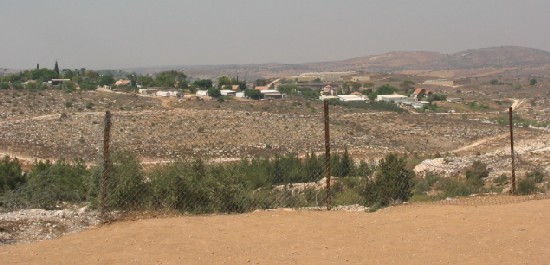
Kibbuts Sheqev to the west of As Sika village- Photo courtesy of LRC


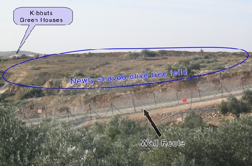
He added that the local people are concerned that the on going land razing and trees uprooting process might hit other areas planted with thousands of olive trees and planted in about 300 dunums of land separated behind the Wall or in a strip of land at the depth of 100 meters from the eastern edge of the Wall. These concerns are highly felt because of continuous threats by the Israeli army officers to commit a big massacre against trees if security situations are necessary.

Last week, the Israeli army broke into a number of houses in the village of Deir Al Asal Al Foqa located about two kilometers to the south of As Sikka under the pretext of searching for stolen Wall fences. Local sources indicated that this break in operations which were carried out under the aforementioned pretext might be used as a cover for destroying an additional number of trees in the western and eastern banks of the Wall in that area.

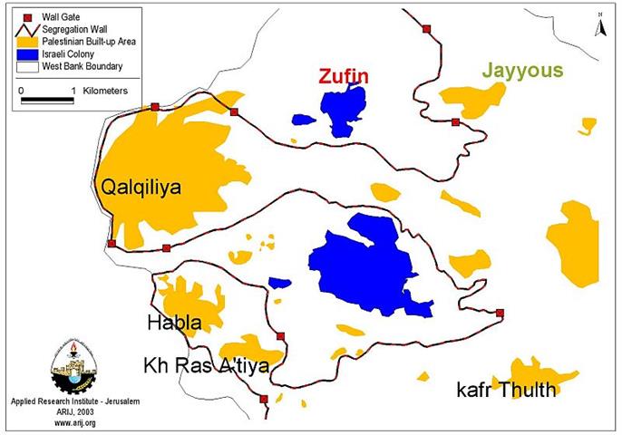
As Sikka and the Wall

On the 2nd of September, 2004, the Israeli government decided to start work on the Segregation Wall in the areas to the west of Hebron, including the village of As Sikka. In this area, the wall has been built of barbed wires and fences at a depth of 100 meters from the Armistice Line (Green Line) inside the Palestinian territory.

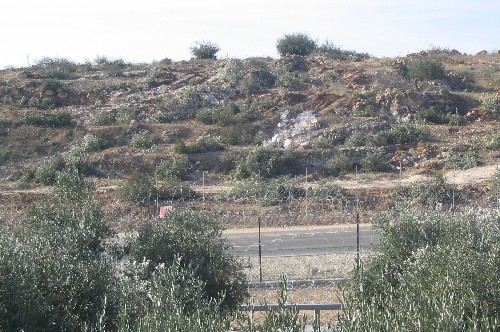
More than 600 dunums of fertile agricultural lands were segregated behind the Wall in the section between Beit Awa village and Beit Mirsim village in the western part of the district of Hebron.  The segregated lands are considered the main source of living for Palestinian families, especially at the time of military closure, economic punishment and movement restrictions.  See photos 5&6

 c

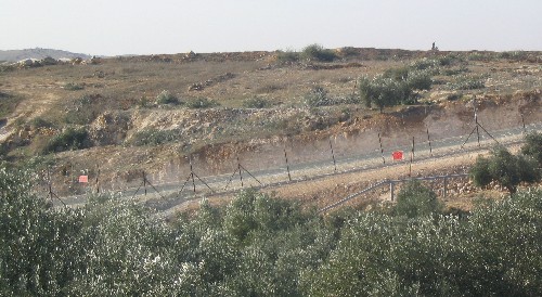
As Sika- Hebron:  Threatened olive orchards to the east of the Wall route – Photos courtesy of LRC

Before 1948, As Sika land area was 1200 dunums, about 80% of which were forcibly annexed to Israel. From the remaining area, the total of 80 dunums have been separated behind the Wall or destroyed under its path.  

It is worth mentioning that according to the Israeli army's 'revised' Wall map of February 20th, 2005, the total length of the Wall west of Hebron governorate is 80 km. The total land area separated behind the Wall is 41.6 km, while the total land area destroyed under the route of the Wall is 8 km. Both land areas are equal to 5 % of the total land area of the district.


Prepared by
The Land Research Center
LRC


Recommended For You

Expansion of Gilo Settlement: A Strategic Plan to Isolate Bethlehem and Undermine Palestinian Rights

by arij
May 12, 2025
0
Expansion of Gilo Settlement: A Strategic Plan to Isolate Bethlehem and Undermine Palestinian Rights

The Israeli Civil Administration has announced a new settlement expansion plan—No. 101-1284223—which outlines the construction of 1,990 new settlement units on approximately 175.9 dunums of land extending towards...

Read moreDetails

إسرائيل تمضي قدمًا في مخطط استيطاني جديد على أراضي مدينة بيت جالا، في انتهاك للقانون الدولي وحرمان الفلسطينيين من أراضيهم

by arij
April 29, 2025
0
Israel Advances Settlement Plan on Ancient Olive Groves on lands of Beit Jala city, Violating International Law and depriving Palestinians their lands

  في أواخر شهر شباط من العام 2025، صادقت دولة الاحتلال الإسرائيلي على مخطط استيطاني جديدة لبناء حي سكني للمستوطنين على مساحة 22.2 دونما من الأراضي الفلسطينية لتابعة...

Read moreDetails

سلطات الاحتلال الإسرائيلي تصادر 64 دونما شمال مدينة بيت لحم لإقامة موقفا للحافلات

by arij
October 19, 2023
0
سلطات الاحتلال الإسرائيلي تصادر 64 دونما شمال مدينة بيت لحم لإقامة موقفا للحافلات

  في السابع من شهر أيلول من العام 2023, صادقت بلدية الاحتلال الإسرائيلي في القدس المحتلة على مخطط استيطاني جديد من شأنه أن يصادر مساحات شاسعة من أراضي...

Read moreDetails

Israeli Settlements in the Occupied West Bank: from “outposts” to urban blocks

by arij
May 20, 2023
0
Israeli Settlements in the Occupied West Bank: from “outposts” to urban blocks

  The Applied Research Institute – Jerusalem (ARIJ) In cooperation with Palestine Economic Policy Research Institute (MAS)   Preface Legalizing nine Israeli settlement outposts in the occupied West...

Read moreDetails

استكمال انشاء حي استعماري تابع لمستعمرة ” الكانا” على أراضي قرية مسحة / محافظة سلفيت

by arij
November 1, 2022
0
استكمال انشاء حي استعماري تابع لمستعمرة ” الكانا” على أراضي قرية مسحة / محافظة سلفيت

  الانتهاك: توسع استيطاني. الموقع: قرية مسحة / محافظة سلفيت. تاريخ الانتهاك: تشرين أول 2022. الجهة المعتدية: مستعمرة " الكانا". الجهة المتضررة: أهالي قرية مسحة.  تفاضيل الانتهاك:   استكمل...

Read moreDetails
Next Post
Israel Begins New Settlement on Stolen Land in the West Bank Village of Jayyus

Israel Begins New Settlement on Stolen Land in the West Bank Village of Jayyus

LATEST NEWS

77 عام  على النكبة الفلسطينية: حاضر مستمر لا تاريخ منتهي

77 عام  على النكبة الفلسطينية: حاضر مستمر لا تاريخ منتهي

by arij
June 2, 2025
0

........................................................

Expansion of Gilo Settlement: A Strategic Plan to Isolate Bethlehem and Undermine Palestinian Rights

Expansion of Gilo Settlement: A Strategic Plan to Isolate Bethlehem and Undermine Palestinian Rights

by arij
May 12, 2025
0

........................................................

الأراضي الفلسطينية بين الذرائع الأمنية والأطماع الاستيطانية – “الأمن، الآثار، والطبيعة كحجج لاقتلاع الفلسطينيين من أراضيهم”

by arij
April 15, 2025
0

........................................................

الطرق الالتفافية الاسرائيلية وأثرها على البيئة الفلسطينية

انتهاك للطبيعة والهوية في الأراضي الفلسطينية المحتلة

by arij
March 17, 2025
0

........................................................

flag_yellow_lowEU-PfP-Logo

This website has been produced with the assistance of the European Union. The contents of this publication are the sole responsibility of ARIJ & LRC and can in no way be taken to reflect the views of the European Union.

© 2025 Copyright ARIJ . All Rights reserved. .

No Result
View All Result
  • Home
  • Settlements
    • New Israeli Settlements
    • Settlement Expansion
  • Israeli Violations
    • Agriculture
    • Confiscation
    • Demolition
    • Environment
    • Eviction of Palestinians
    • Settlers Attacks
  • Bypass Roads
  • Israeli Plans
  • Segregation
    • Checkpoints
    • Closure
    • Separation Plans
  • Military Orders
  • Reports
    • Daily Report
    • Monthly Report
    • Quarterly Report

© 2025 Copyright ARIJ . All Rights reserved. .