• About The Project
  • Palestine in Century
  • Selected Maps
  • Glossary
  • About ARIJ
  • About LRC
  • By Year
    • Case Studies By Year
    • Daily Report By Year
Thursday, May 21, 2026
POICA
No Result
View All Result
  • Home
  • Settlements
    • New Israeli Settlements
    • Settlement Expansion
  • Israeli Violations
    • Agriculture
    • Confiscation
    • Demolition
    • Environment
    • Eviction of Palestinians
    • Settlers Attacks
  • Bypass Roads
  • Israeli Plans
  • Segregation
    • Checkpoints
    • Closure
    • Separation Plans
  • Military Orders
  • Reports
    • Daily Report
    • Monthly Report
    • Quarterly Report
No Result
View All Result
POICA
No Result
View All Result

Alarming demolition orders in Nazlat ‘Isa Village

January 21, 2003
in Military Orders
Alarming demolition orders in Nazlat ‘Isa Village


As part of the Israeli harsh tactics implemented on Palestinians as a form of collective punishment and humiliation. The Israeli bulldozers backed with forces staged this morning into the village of Nazlat 'Isa located to the north of Tulkarem district and started demolishing houses in the village. The Israeli Government announced late yesterday the demolition of commercial area along with a number of houses, thus, implementing its vicious policy of house demolition in the Palestinian territories. See Map


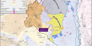
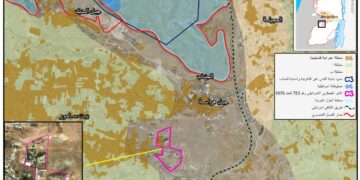
Nazlat 'Isa is one of Tulkarem villages and has a population of 2500 and an area of 622 m². The village has been a target of repeated declarations of demolitions for over four months as Israel is widening its borders by building the Separation Wall inside the West Bank, segregating between Palestinian Built-up and agricultural areas to contain its Jewish Settlements and at the same time disposition Palestinians from their lands.

The location of Nazlat 'Isa along side the green line and between the Israeli's self-proclaimed military zone and the Separation Wall has made it of great importance to the Israelis. It is also known for its strong commercial relationships with a number of nearby villages, which are also threatened to be confiscated at favor of the Separation Wall.

The Israeli forces handed demolition orders to 28 houses and 170 commercial stores in Nazlat 'Isa village claiming that some of those houses and commercial stores were illegally build in the village and therefore must be evacuated for demolition purposes.

Among the owners, ARIJ Fieldworkers were able to list the following: Mu'en Ibrahim Mahmmoud, Asa'd Ibrahim Mahmmoud, Ziad Abdel Latif Asa'd, Amjad Abdel Latif, Abdel Rahim Abu Ash Shawareb, Abdullah Abu Ash Shawareb, Awni Muhammad Abdullah Asa'd, Tayseer Ibrahim Tawfiq, Abdel Halim Hasan, Abdel Rahman Yousef Khalil, Ibrahim Ahmad Muhammad Sa'ed, Lutfi Muhammad Sa'ed and Mahmmoud Mahmmoud Asa'd.

The Israeli plan is far from the above justification and is an excuse to justify their acts in the Palestinian Territories, from building the Apartheid Wall that led to the confiscation of thousands of dunums of agricultural lands to the uprooting of Olive Trees and the demolition of houses and commercial areas, destroying the hopes of Palestinians and devastating their abilities.

The Israeli policy behind such actions is to reduce as much as possible the number of Palestinian citizens living in the area located between the Green Line and the Separation Wall. The above-mentioned area shall be illegally annexed to Israel from the Occupied Palestinian Territories, a unilateral step of Separation; therefore, a sharp reduction in the number of Palestinians living on that area is becoming a target and a key step for Palestinian Ethnic Cleansing.


Prepared by:
The Applied Research Institute – Jerusalem


Recommended For You

إقامة منطقة عسكرية عسكرية داخل أراضي (أ) في جنين

by arij
May 19, 2026
0
إقامة منطقة عسكرية عسكرية داخل أراضي (أ) في جنين

   في السابع من شهر أيار من العام 2026، وزعت سلطات الاحتلال الإسرائيلي أمرا عسكريا جديدة على أهالي مدينة جنين يقضي بمصادرة 7.2 دونما من الأراضي الفلسطينية في...

Read moreDetails

“بمساحة اجمالية 177 دونما من أرضي البيرة وبيتين”, طريق استيطاني لخدمة البؤر الاستيطانية في محافظة رام الله

by arij
May 18, 2026
0
“بمساحة اجمالية 177 دونما من أرضي البيرة وبيتين”, طريق استيطاني لخدمة البؤر الاستيطانية في محافظة رام الله

في الحادي عشر من شهر أيار من العام 2026, نشرت دائرة أراضي إسرائيل اعلانا جديدا يقضي بمصادرة المزيد من الأراضي الفلسطينية في محافظة رام الله لأغراض استيطانية في...

Read moreDetails

“في خدمة مستوطنة ناحال حيلتس”, طريق استيطاني إسرائيلي جديد على أراضي بتير وبيت جالا في محافظة بيت لحم

by arij
May 18, 2026
0
“في خدمة مستوطنة ناحال حيلتس”, طريق استيطاني إسرائيلي جديد على أراضي بتير وبيت جالا في محافظة بيت لحم

تواصل سلطات الاحتلال الإسرائيلي إحكام سيطرتها على المزيد من الأراضي الفلسطينية في الضفة الغربية المحتلة، وهذه المرة من خلال استهداف أراضي محافظة بيت لحم. ففي السادس والعشرين من...

Read moreDetails

مناطق نفوذ المستوطنات ودورها في إعادة تشكيل الجغرافيا الفلسطينية

by arij
April 23, 2026
0
مناطق نفوذ المستوطنات ودورها في إعادة تشكيل الجغرافيا الفلسطينية

أصدرت سلطات الاحتلال الإسرائيلي في العاشر من شهر نيسان 2026 الكراسة رقم (273)، وهي وثيقة تضم مجموعة من المناشير والأوامر والتعيينات الإسرائيلية المتعلقة بالجوانب الأمنية والعسكرية والإدارية، إضافة...

Read moreDetails

INFOGRAPHIC: Mapping Control – Israeli Militray Orders across the occupied West Bank – 2025

by arij
April 16, 2026
0

    Prepared by:   The Applied Research Institute – Jerusalem

Read moreDetails
Next Post
Israel Eradication Campaigns to Palestinian villages of Bethlehem District

Israel Eradication Campaigns to Palestinian villages of Bethlehem District

LATEST NEWS

إقامة منطقة عسكرية عسكرية داخل أراضي (أ) في جنين

إقامة منطقة عسكرية عسكرية داخل أراضي (أ) في جنين

by arij
May 19, 2026
0

........................................................

النكبة الفلسطينية في ذكراها الثامنة والسبعين: من التطهير العرقي إلى الإبادة وإعادة هندسة الجغرافيا الفلسطينية 

النكبة الفلسطينية في ذكراها الثامنة والسبعين: من التطهير العرقي إلى الإبادة وإعادة هندسة الجغرافيا الفلسطينية 

by arij
May 18, 2026
0

........................................................

“بمساحة اجمالية 177 دونما من أرضي البيرة وبيتين”, طريق استيطاني لخدمة البؤر الاستيطانية في محافظة رام الله

“بمساحة اجمالية 177 دونما من أرضي البيرة وبيتين”, طريق استيطاني لخدمة البؤر الاستيطانية في محافظة رام الله

by arij
May 18, 2026
0

........................................................

“في خدمة مستوطنة ناحال حيلتس”, طريق استيطاني إسرائيلي جديد على أراضي بتير وبيت جالا في محافظة بيت لحم

“في خدمة مستوطنة ناحال حيلتس”, طريق استيطاني إسرائيلي جديد على أراضي بتير وبيت جالا في محافظة بيت لحم

by arij
May 18, 2026
0

........................................................

flag_yellow_lowEU-PfP-Logo

This website and its content were initiated in 1993 by the Applied Research Institute – Jerusalem (ARIJ) and the Land Research Center (LRC) with the support from the European Union up until 2023. Since then, the Applied Research Institute – Jerusalem (ARIJ) has taken over the continued development and maintenance of the website. The views expressed remain solely those of ARIJ) and do not necessarily reflect those of the European Union.

© 2026 Copyright | ARIJ | All Rights reserved.

No Result
View All Result
  • Home
  • Settlements
    • New Israeli Settlements
    • Settlement Expansion
  • Israeli Violations
    • Agriculture
    • Confiscation
    • Demolition
    • Environment
    • Eviction of Palestinians
    • Settlers Attacks
  • Bypass Roads
  • Israeli Plans
  • Segregation
    • Checkpoints
    • Closure
    • Separation Plans
  • Military Orders
  • Reports
    • Daily Report
    • Monthly Report
    • Quarterly Report

© 2026 Copyright | ARIJ | All Rights reserved.