Dier Qiddis land confiscated by Israel for the expansion of
Kiryat Sefer
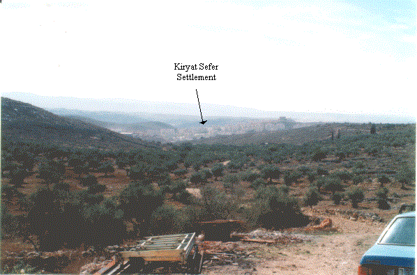
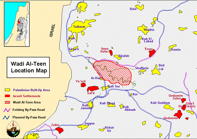
The Israeli settlement of Kiryat Sefer is located northwest of Ramallah city, adjacent to the border area which separates the central parts of the West Bank from Israel (Map 1). The settlement, although barely five years old, is already one of the largest on the West Bank, occupying a built-up land area of approximately 702 dunums and housing approximately 10,000 religious Jewish settlers. Kiryat Sefer is, however, only one of several Israeli settlements in the area. Neighboring settlements include Mitatyahu, Nilit, Na'ale, Minora, Shilat, Kefar Ruth, Hashmona'im, and the nascent Or Tsomech, built in that area (Map 2). Collectively, these settlements create an expanding bloc in the area which is threatening the existence of the neighboring Palestinian villages, especially Dier Qiddis.
Kiryat Sefer was one of the many settlements which were greatly expanded under the Rabin and Peres administration, in spite of the 'settlement freeze' which the Labor government frequently proclaimed. The settlement was originally part of Ariel Sharon's 'Seven Stars' plan for colonization and absorption of the West Bank, which Israel would achieve through a program of intensive housing construction in those areas of the Occupied Territories closest to Israel. Initiated by Sharon in 1990, the plan has been implemented with little interruption ever since, with the Labor administration playing a full part in ensuring that Sharon's dream became a reality.
On 8 October 1996, the new Israeli government under the leadership of Prime Minister Netanyahu announced its intention to enlarge the settlements around Dier Qiddis. The settlements marked for growth are Kiryat Sefer, Menora, Mitatyahu, Hashmona'im, Nili and Or Tsomech. The expansion plan of Kiryat Sefer includes 1,800 new housing units, while the overall plan calls for an additional 12,000 housing units (Al-Quds Newspaper, 15 November, 1997). The land confiscated from Dier Qiddis village for the expansion of Kiryat Sefer and Nili settlments alone reaches 1,761 dunum (Map 3). The growth of these settlements inside the Green Line has been planned with the intention to connect them with the massive growing Modi'in Settlement Block, which straddles the border between Israel and the Palestinian territory occupied since 1967. According to the new plan announced by Netanyahu, the 'legitimate' town of Modi'in, in Israel, will be joined with the settlements on the West Bank in a new urban area named Modi'in Ilit (Map 4). Precisely in accordance with Sharon's plan, huge areas of occupied Palestinian territory may then become part of Israel by means of the settlements' contiguity with a neighboring town within the 1948 boundaries.
In addition to the expansion of Kiryat Sefer and its sister settlements towards Modi'in, the Israeli government has been building road links with another cluster of settlements near Ramallah. Roads, such as highway 6, connecting the settlements of Talmon and Ein Ayyub with the Modi'in cluster have consumed more than $8 million and confiscated approximately 670 dunums of Palestinian land. These highways have become the main artery of transport for Israeli settlers across the Green Line. Due to these expansions, the Palestinian villagers of Deir Qiddis face not only the loss of their land (and therefore their livelihood) but the prospect of permanent occupation by Israel.
A protest against Israel's confiscation and colonization, held outside Deir Qiddis on 11 November 1996, ended in the death of a local Palestinian and injury to twelve others. The Israeli army opened fire on the peaceful protest, killing local farmer Atallah Amira, 36, who left behind seven children and a pregnant wife. Israel is about to confiscate the family's remaining 45 dunums of agricultural land, after which they will be left with nothing.
Prepared by:
The Applied Research Institute – Jerusalem


