Palestinian communities in area “C” under the administrative and security control of the Israeli occupation have been having hard time within the past few months, more than usual. In Bethlehem, the Israeli Army has escalated its procedures against the Palestinian communities aiming to execute their will as an occupation is still in charge of such areas. In June 2011, the Israeli Civil administration delivered several notification for Palestinian residents and community councils’ to halt construction, or demolishing order for existing structure in several of these communities; they are Al-Ma’sara Village, Al-Jab’a Village, and Nahalin Village, located south and southwest of Bethlehem governorate.
On the 15th of June 2011, the Israeli Occupation Authorities, Israeli Occupation Army accompanied with the Israeli Civil Administration raided the village of Al-Ma’sara, handing out a demolition order for the under construction Mosque in the village. ARIJ field workers met with the head of Al-Ma’sara Village Council, Mahmoud Musa Ala’adin, who said that the targeted Mosque existed since 1994, and two months ago, the Israelis’ delivered a notification to halt construction, and just two weeks ago a demolition order was delivered. See interview between ARIJ’s field workers with the Head of Al-Ma’sara Village Council summarizing the situation of the mosque.
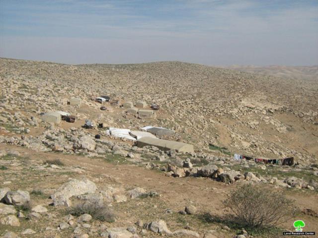
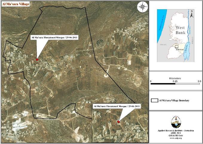
In Map 01 it shows the area of the threatened mosque in Al-Ma’sara Village. In Image 01, and Image 02 it shows the mosque that is going to be demolished.
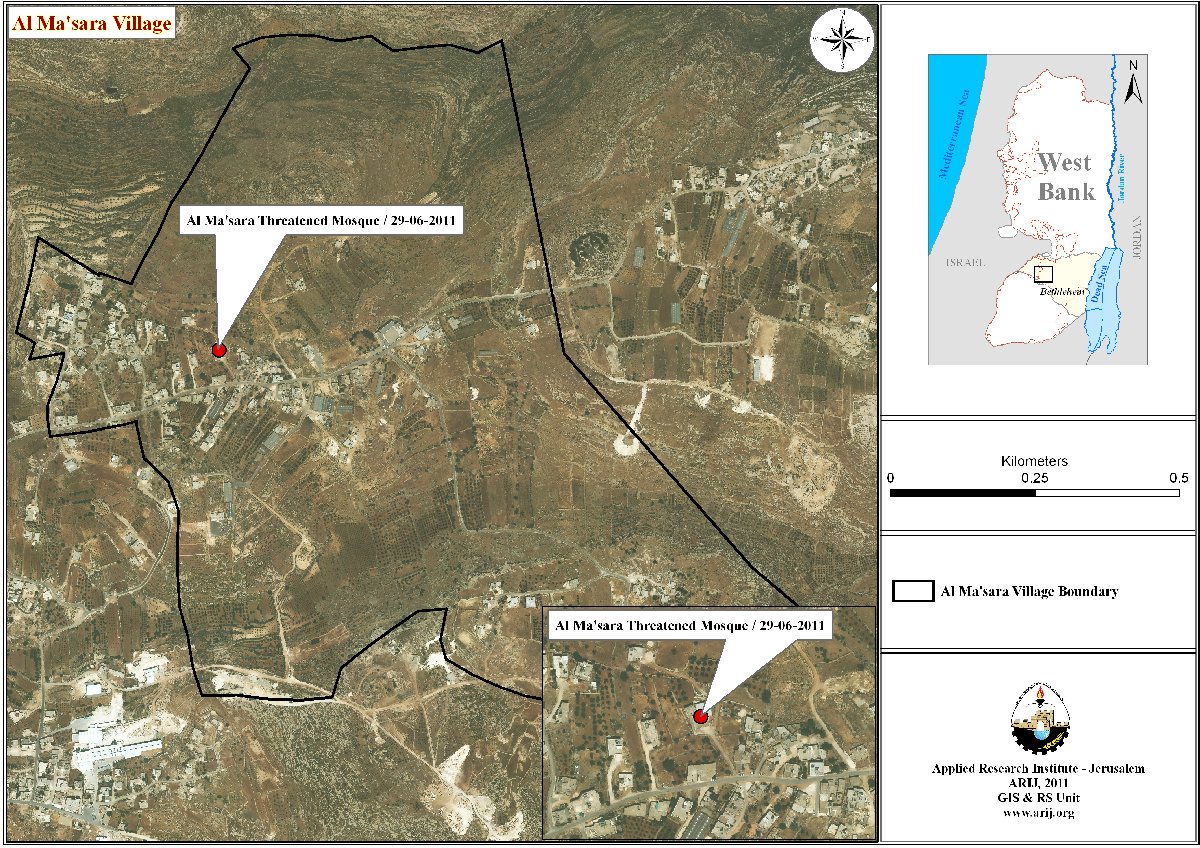
Map 01: Area of the threatened mosque in Al-Ma’sara Village
Source: GIS Unit / ARIJ 2011


Image 01 Image 02
Al Ma’sara is a Palestinian village in Bethlehem Governorate, located south-west of Bethlehem City. The Village is bordered from the east by Khallet Al Haddad, as for the north it is bordered with Wadi Rahhal village, and from the west it is bordered by Jurat ash Sham’a village, and from the south it is bordered by Marah Ma’alla village. Al Ma’sara has a total land area of 973 dunums, where 877 dunums are considered arable land, and 42 dunums are residential land. Area B counts 363 dunums of the village and this is where Palestinians have only administrative control on the land, while security wise it still remains under the control of the Israelis. The rest of the village is classified as, 610 dunums is classified as area C where Israelis still enjoy absolute control over and security.
Map 02 it shows the borders and village boundaries of Al-Ma’sara village.
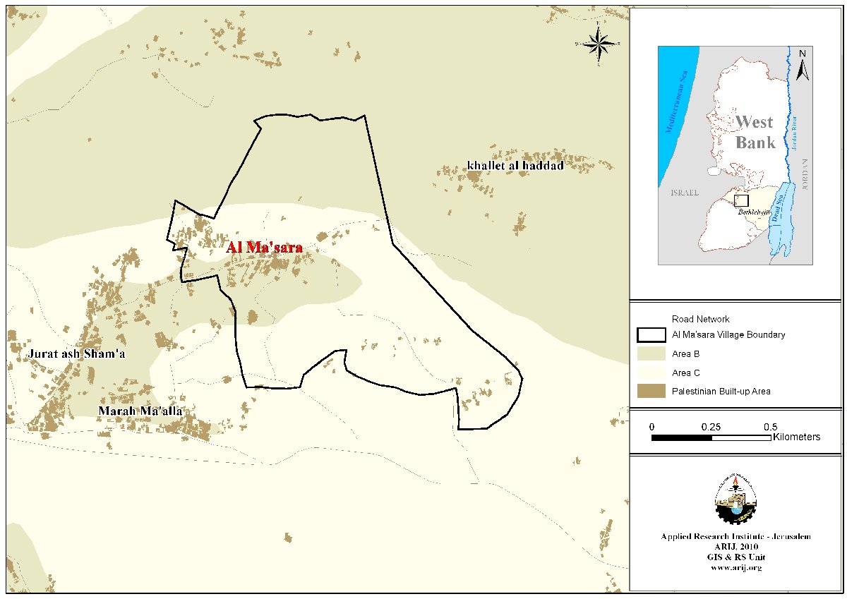
Map 02: borders and village boundaries of Al-Ma’sara village
Source: GIS Unit / ARIJ 2011
Al-Jab’a Village
On the 28th of June 2011, the Israeli Civil Administration, accompanied with the Israeli Occupation Army raided the village of Al-Jab’a to deliver orders to halt constructions, and Demolition orders, and document with photos status of certain residential buildings, in order to issue future demolition orders for them. The first house which received order is for Nabiel Ibrahim Hamdan, a head of family of 10 members. The house total area is 80 square meter, with a total cost of 50,000 NIS.
In Image 03, and Image 04, it shows the threatened house with the demolition order.
As For Village
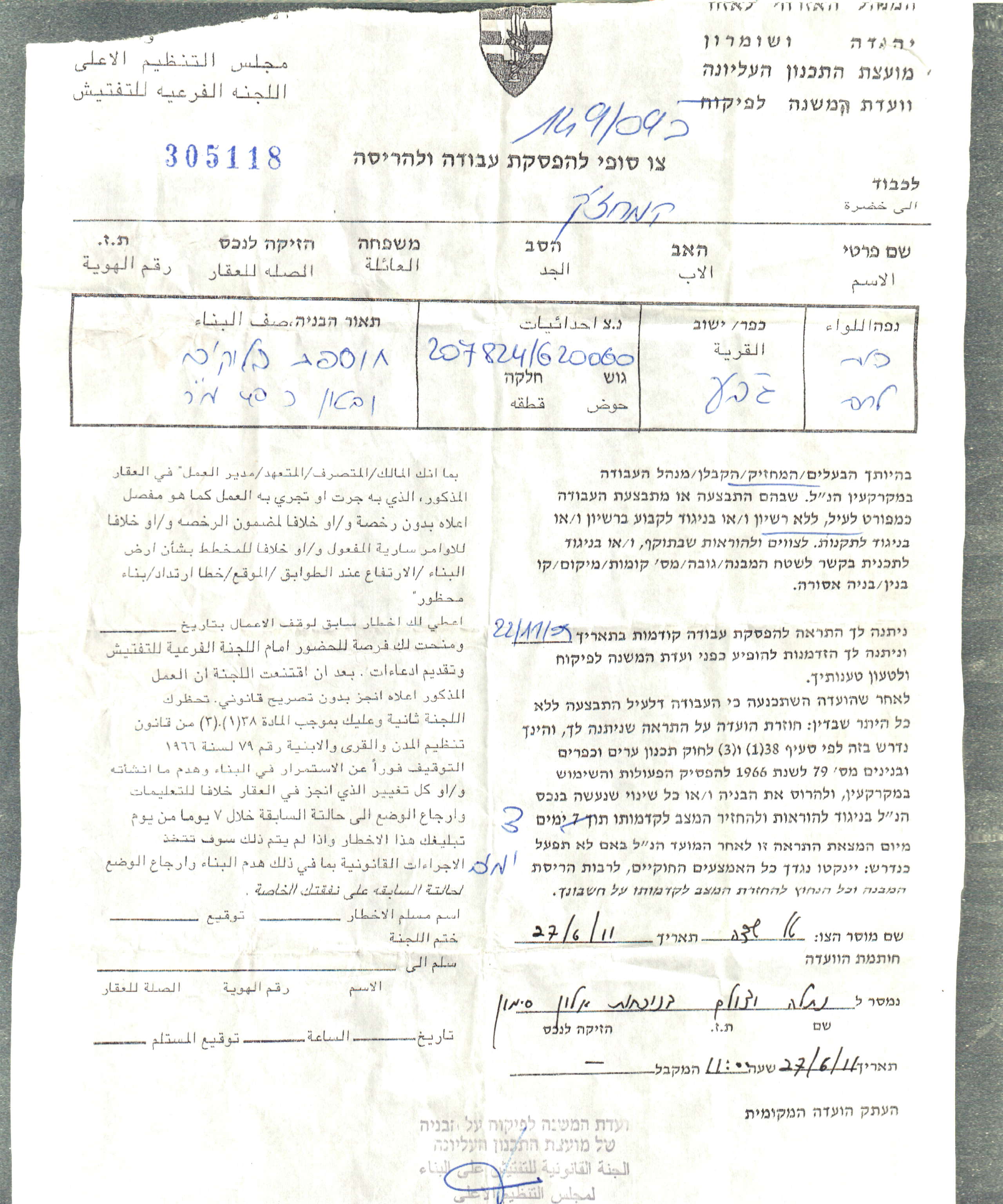
Image 03
Image 04
Another order to halt of construction was delivered to Nasr Al-Din Hasan Al-Tos, who is the head of a family of 13 members, 3 of them are handicapped. The house is still under construction with a total area of 100 square meters, and a total cost of 50,000 NIS.
Image 05 and Image 06 show the targeted house under construction and the Israeli order to halt construction.

Image 05

Image 06
Al-Jab’a is a Palestinian village in Bethlehem Governorate, located in the south-west of Bethlehem City. The village is bordered from the east by Etzion Settlement, and from the north it is bordered by Nahhalin village. As from the west it is bordered by the 1949 Armistice Line (the Green Line). Surif borders the village from the south (Hebron Governorate). Al Jab’a is bordered from its four sides by the Israeli segregation wall and the illegal Israeli settlements; Betar ‘Illit, from the north, Geva’ot and Rosh Zurim settlements from the east.
Al Jab’a lies on a total area of about 7,969 dunums of which 7,318 dunums are arable lands, and 152 dunums residential land. Area “C” constitutes 96.5% of the total area of the village, while the remaining 3.5% in area “B” where the village’s urban area exists.
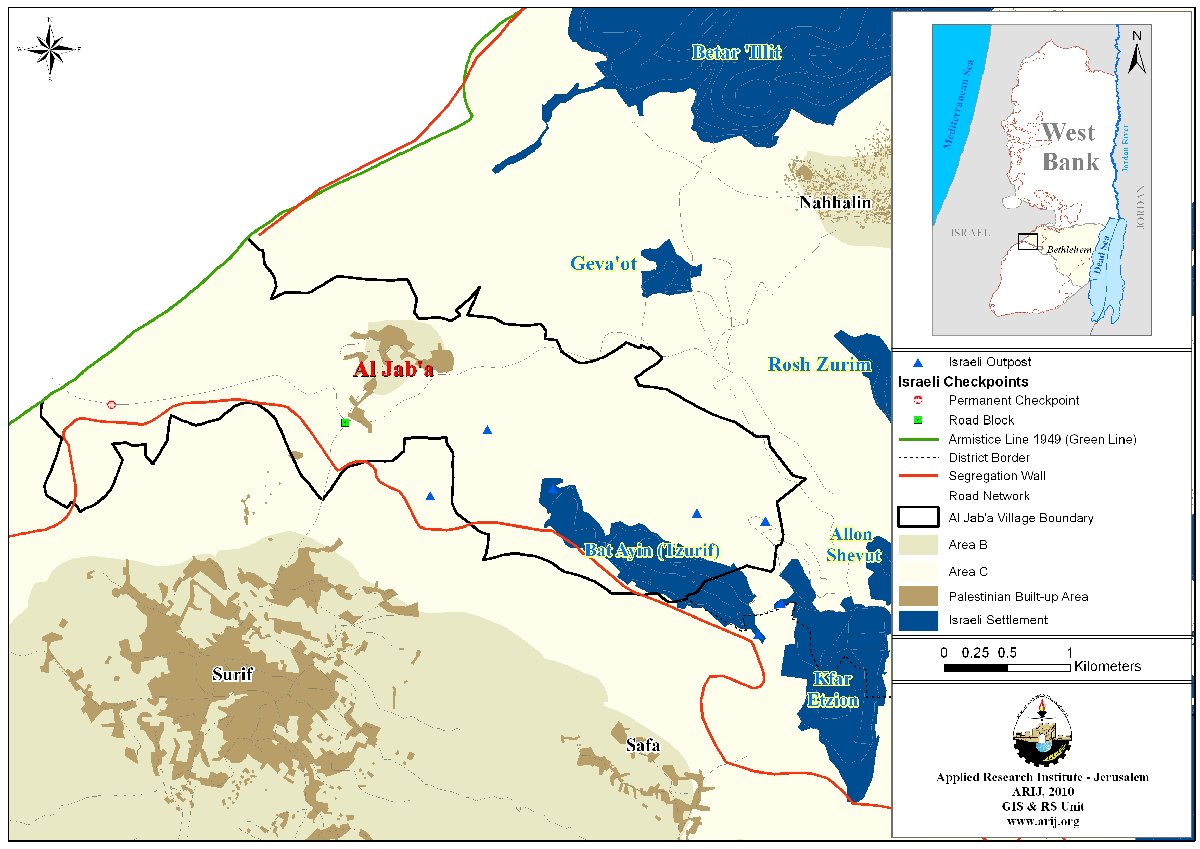
Map 03: borders and village boundaries of Al-Jab’a village
Source: GIS Unit / ARIJ 2011
Nahalin Village
On the 27th of June 2011, the Israeli Civil Administration, accompanied with the Israeli Occupation Army raided Nahalin Village, to deliver order to halt construction, and Demolition orders. There were two demolition orders to a Cattle farm owned by Mahmoud Hasan Shakarneh, built in the year 2001. As for the second demolishing order it was delivered to Muhammad Ismail Hussien Najajrah.
Image 07 shows the demolition order of Najajrah House. Image 08, and Image 09 show the under construction house that is threatened with the Halt of Construction orders.

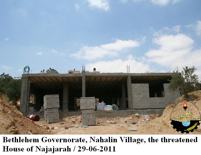
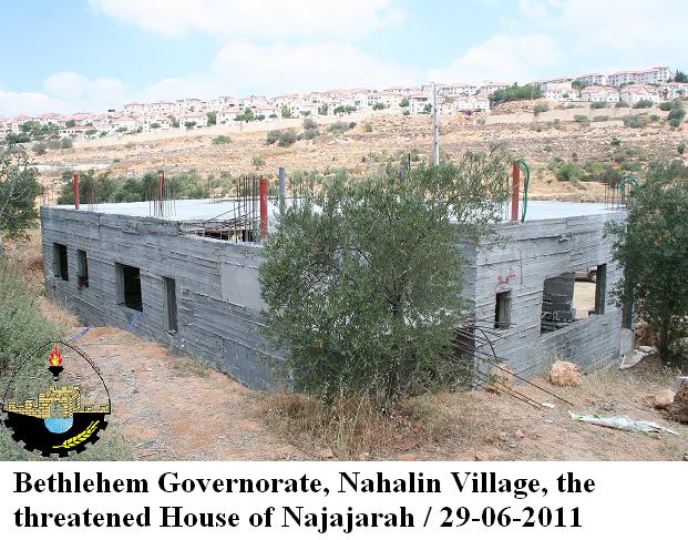
Image 07 Image 08 Image 09
Nahalin village lies on a total area of about 12126 dunums of which 1096 is classified as area B representing about 9% of the total area of Nahalin village and. Area “C” is the remaining 91% of the total area of the village.
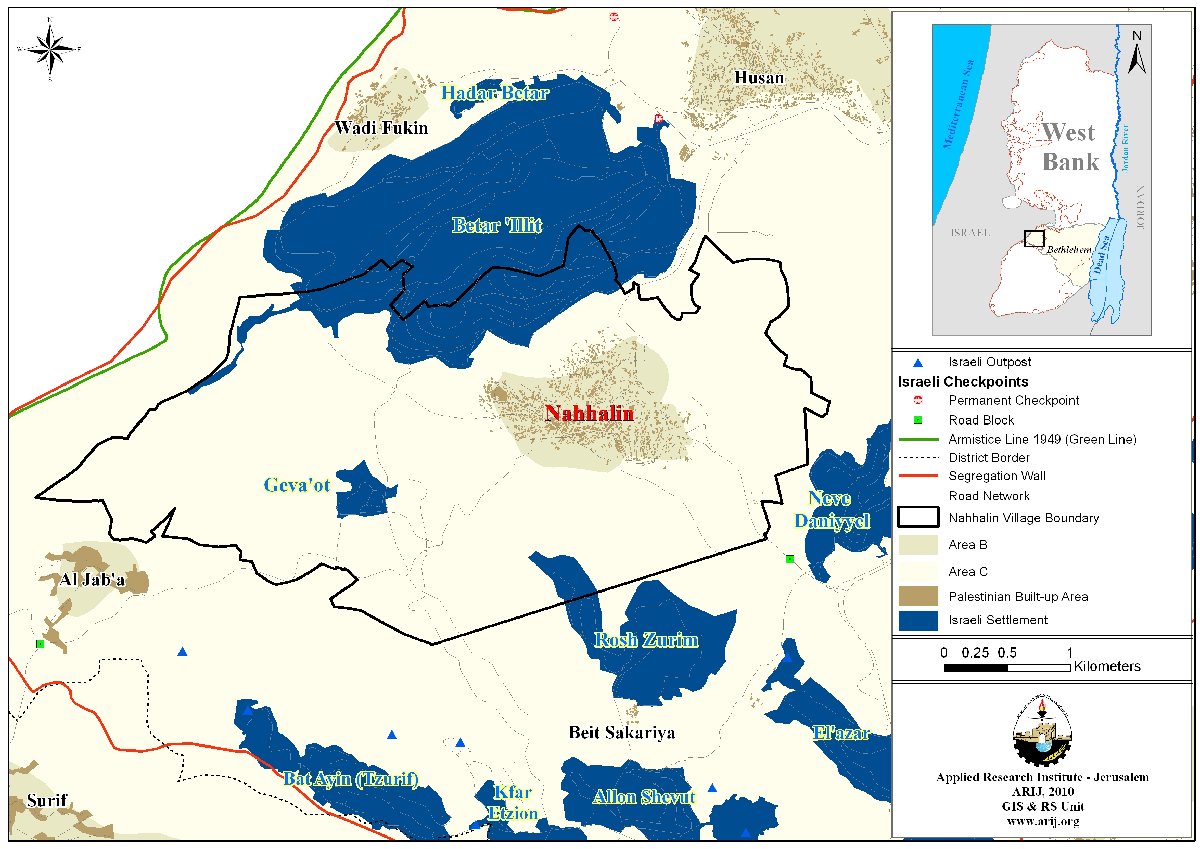
Map 04: borders and village boundaries of Nahalin village
Source: GIS Unit / ARIJ 2011
Conclusion:
- The Israeli Occupation Authorities, Army, and Civil Administration are escalating their attacks toward the Palestinian people in a tremendous well schemed plan. The Israeli Occupation Authorities are aiming to limit the Palestinian Natural growth and development by not allowing construction to exist beyond the defined parameters of these communities which were drawn back during the British mandate time during the 1940,s but no longer sufficient to cope with the population growth. The Israeli occupation is violating the international law by not allowing such communities to expand and develop according to their needs.
Prepared by:
The Applied Research Institute – Jerusalem
ARIJ