- Violation: attacking olive seedlings.
- Location: the lands of the town of Kafr ad-Dik, west of Salfit Governorate.
- Date of violation: 19/07/2022.
- Perpetrators: the settlement of “Eli Zahav”.
- Affected party: farmer Hussein Sayel Al-Mashni.
- Details of the violation:
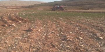
By the evening hours of Tuesday, 19/7/2022, when the farmers leave their lands after a hard day’s work in cultivating the land, a malevolent group of settlers infiltrated from the “Eli Zahav” settlement towards the “Khilat al-Qamh” located to the north of the town of Kafr ad-Dik, where a plot of 2 dunums of land located in the “Al-Manjara” which is owned by farmer Hussein Sayel al-Mashni, a resident of the neighboring village of Rafat. The settlers there deliberately cut and destroyed 60 three-year-old olive plantations with sharp tools, which led to their complete destruction, before they withdrew from the site.
It is worth mentioning that the field researcher observed the targeted land from a few meters away and that the settlers more than once cut and destroyed dozens of olive plantations and destroyed them, in addition to assaulting a number of other farmers while they were on their agricultural lands there, causing great damage. Bearing in mind that the settlement is only 300 meters away from the targeted site.
The affected farmer told the field researcher of the Land Research Center the following:
“I support a family of six, including three females. I work in agriculture after my retirement from the government job, and I am always keen to cultivate the land and take care of it. Late last year, I planted a plot of land I owned in the Al-Manjara area with about 60 olive plants, that is because of my love for the land. I communicate with my land continuously, and on the morning of last Wednesday, while I was heading to my land to work on it as usual, I was shocked by the settlers cutting the entire plantings that I planted leaving them in complete destruction, but I insist on re-cultivating the land again and take care of it”.
 |
 |
 |
 |
 |
 |
Over the past years, the field researcher monitored a large number of violations in the town of Kafr adDik, most of which were concentrated in the northern side of the town, as targeting a number of agricultural rooms and some developmental agricultural projects, and cutting down trees is one of the most prominent attacks that were monitored in this particular area.
In general, the northern and western areas of the town of Kafr ad-Dik are considered one of the most prominent sites targeted by the occupation forces and settlers, where more than 45 notices to stop construction were distributed in the two sites, and a network of agricultural roads was also destroyed, and a large number of olive trees and plants were cut and destroyed there. As the main goal is to empty the area and change its features, in order to serve the occupation racist expansion activities there.
About the town of Kafr ad-Dik[1]:
The town of Kafr ad-Dik is located 15 km to the west of the city of Salfit. It is bordered to the north by Bidya, to the west by the villages of Rafat, Deir Ballut, to the east by the villages of Burqin and Sarta, and to the south by the villages of Bani Zaid. Its population reached 5551 people until 2017, and its total area is 15529 dunums, of which 791 dunums are the building up area of the village.
The occupation confiscated an area of 2477 dunums of its lands, as follows:
- The settlements plundered 1225 dunums of village lands, which are:
|
Name of the settlement |
Year of establishment/ dunum |
Size of the confiscated land |
Number of settlers |
|
Har Alei Zahav |
1983 |
134 |
NA |
|
Alei Zahav- Yo’ezer |
1982 |
290 |
424 |
|
Pedu’el |
1984 |
800 |
1088 |
|
Bruchin |
1999 |
1 |
NA |
|
Total |
|
1225 |
1512 |
- Bypass roads plundered 362 dunums.
- The separation wall was plundered under its track of 890 dunums, and about 8842 dunums will be isolated behind it. Its length on the village lands is 8905 meters.
According to the Oslo agreement, the lands of Kafr ad-Dik are classified as B, which constitutes 15% of the area of the village, while areas C, i.e. is under the full control of the Israeli occupation, constitute 85%.
- Areas classified as “B” 2252 dunums.
- Areas classified as “C” are 13,277 dunums.
[1] GIS – LRC


