- Violation: Closing off an agricultural road.
- Location: Deir Istiya town, northwest of Salfit.
- Date: 05/05/2022.
- perpetrator: the Israeli occupation Forces.
- Victims: people of the town and neighboring villages.
Description:
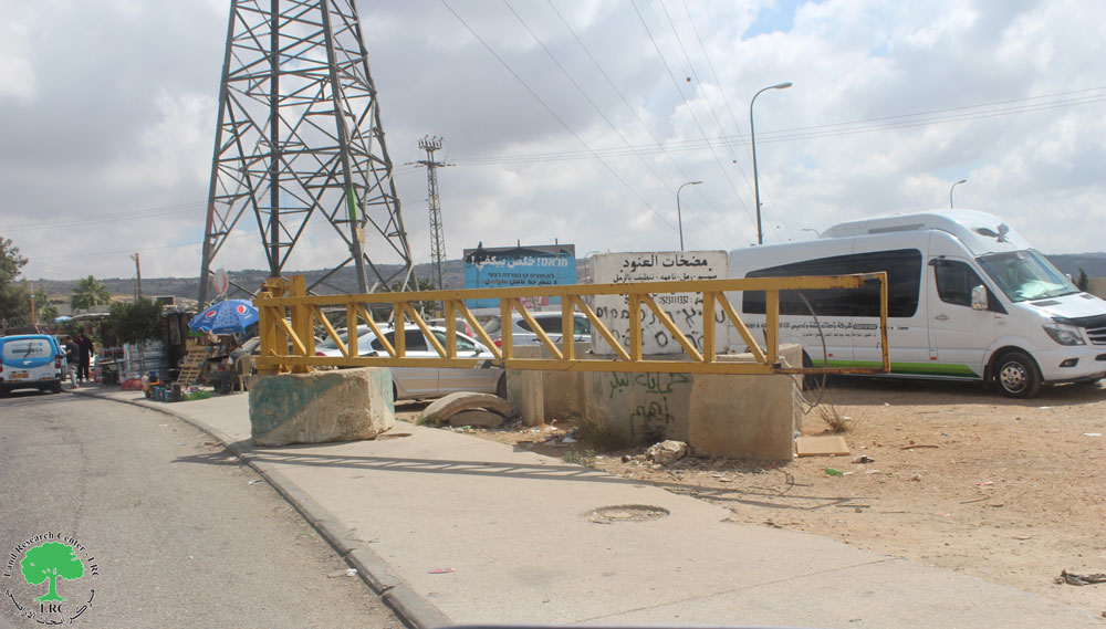
As part of the Israeli occupation’s policy to restrict Palestinians’ movement and imposing collective punishment against them. On Thursday evening, the fifth of May 2022, The occupation forces closed off a secondary agricultural road west the town of Deir Istiya, in Salfit Governorate, by placing large amounts of earth mounds and closing the entrance completely.


The target road is a main road linking the western neighborhood of the town with the bypass road that penetrates the Wadi Qana area, apart from its importance in serving no less than 150 dunums of land planted with olive trees. This arbitrary measure prevents farmers from accessing their lands and taking care of them, especially at this stage when the land needs great care before the start of the olive harvest season next October.
Speaking to LRC’s field researcher, Mr. Nazmi al-Salman, a citizen of Deir Istiya, said the following:
“This entrance is considered one of the main passages used by a large number of families while going to their work, and it has been in existence for more than 35 years. But, it was closed at the beginning of the Al-Aqsa Intifada between 2000 and 2012”.
In recent years, the LRC’s field research team documented the closure of five agricultural roads west the town of Deir istiya by the Israeli occupation, which negatively affected the agricultural sector and rural development in the region as a whole.

Deir Istiya village:
10 km north Salfit , Deir Istiya is surrounded by Ematin , Jinsafut and Kafr Laqif (north), Azzun and Kafar Thulth (west), Zita, Jama’en and Kafl Haris (east), Haris and Qaraqwat Bani Hyssan (south)
Deir Istiya has a population of (3,696) people in 2017 census.
The town has a total area of 34,125, of which 640 dunums are a built-up area.
The Israeli occupation confiscated (4,257) dunums for the following purposes:
|
Settlement name |
Establishment year |
Area in dunums |
Number of settlers 2018 |
|
Revava |
1991 |
167 |
2,664 |
|
Yakir |
1981 |
757 |
2,341 |
|
Ginat Shomron |
1985 |
944 |
NA |
|
Karnei Shomron |
1978 |
540 |
8,388 |
|
Novim |
1986 |
663 |
867 |
|
Immanuel |
1981 |
879 |
4,220 |
|
Ma’ale Shomron |
1980 |
52 |
1,002 |
|
Al-Matan |
1981 |
22 |
NA |
Bypass roads 55 and 5066 devoured 118 dunums.
The segregation wall (1,148 m ate up115 dunums , in case its construction plan was completed it will isolate 8,408 dunums and eat up 160 dunums.
Oslo accords classified Deir Istiya as the following :
- B area : 6,132 dunums.
- C area 27,993 dunums.
The Land Research Center
LRC