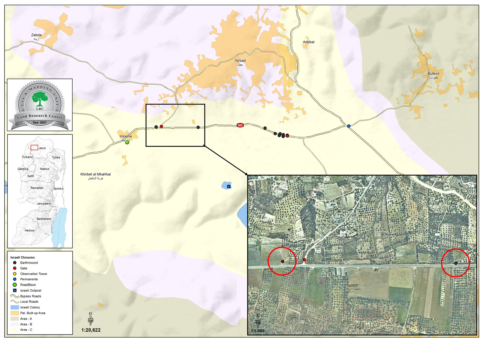
- Violation: Closure of a road.
- Location: Ya’abad town / southwest Jenin city.
- Date: September 23rd 2021.
- Perpetrators: The Occupation Forces.
- Victims: People of Ya’bad town.
Description:
Ya’bad town is heavily targeted by the Israeli Occupation, Its people suffer from land confiscations and restrictions on movement and work. Reportedly, in Thursday, September 23rd 2021, the Israeli Occupation forces closed off the main road that connects Ya’bad town and Imreiha village via earth mounds.
Yousif ‘Atatra , Mayor of Ya’bad told LRC:
“This road is 1 km long and provides access to 2600 dunums of olive groves nearby Mevo Dotan colony, and serves more than 1200 citizens in Imreha village south the town. The road is also taken by a large number of Palestinian workers who pass the check point everyway to work behind the green line (the so-called Israel).”
The road was rehabilitated in June 2021, and was a glimpse of hope for people of the town, and provided an alternative after the occupation forces closed 8 agricultural roads and a main road that were facilitating movement for people of the town; now however the only alternative road is closed, and they have to pass through the Israeli checkpoint Mevo Dotan towards Y’abad town to get to the same destination (about 7 km longer).
 Photo 1: The closed off road
Closure of An Agricultural Road:
In the Same Context, The Occupation closed off another road that was opened by farmers to reach their lands south Ya’bad town, the road was providing access to 200 dunums of olive groves.
Noteworthy, Palestinian farmers are waiting patiently for the olive harvesting season to reap the fruit of hard work all the yearlong.
 Photo 2: The closed off agricultural road
The town of Ya’bad: [1]
Ya’bad is located 18 km to the southwest of Jenin. Its population is 16,012, according to the 2017 census. Its total area is 29,572 dunums, of which 1,814 dunums are a built-up area. The occupation has confiscated an area of 1,840 dunums of its lands, as detailed below:
- 483 dunums for the construction of the settlements of Mevo Dotan and Hermesh.
- 1357 dunums in favor of building bypass roads No. 596 and No. 585.
The lands of the town are classified according to the Oslo Accords as follows:
- Areas classified (A) 1674 dunums.
- Areas classified (B) 8124 dunums.
- Areas classified (C) 19774 dunums.
Legal Feedback:
The Occupation Authorities closures in West Bank governorates is a violation of Movement Rights imposed by international treaties:
Article 13 of Universal Declaration of Human Rights:
- Everyone has the right to freedom of movement and residence within the borders of each state.
- Everyone has the right to leave any country, including his own, and to return to his country.
Article 5 International Convention of Elimination of all forms of Racial Discrimination:
(d) Other civil rights, in particular:
(i) The right to freedom of movement and residence within the border of the State;
(ii) The right to leave any country, including one’s own, and to return to one’s country;
[1] GIS-LRC
Prepared by
The Land Research Center
LRC


