- Violation: Cutting 142 olive trees.
- Location: Yasouf village / east Salfit.
- Date: July 8th 2020.
- Perpetrators: The Israeli Occupation Forces.
- Victims: 11 agricultural facilities at the village.
Description:
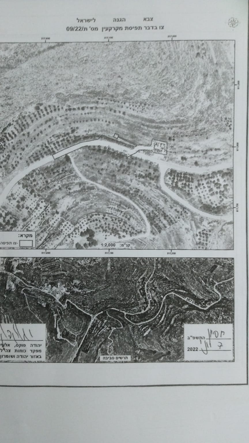
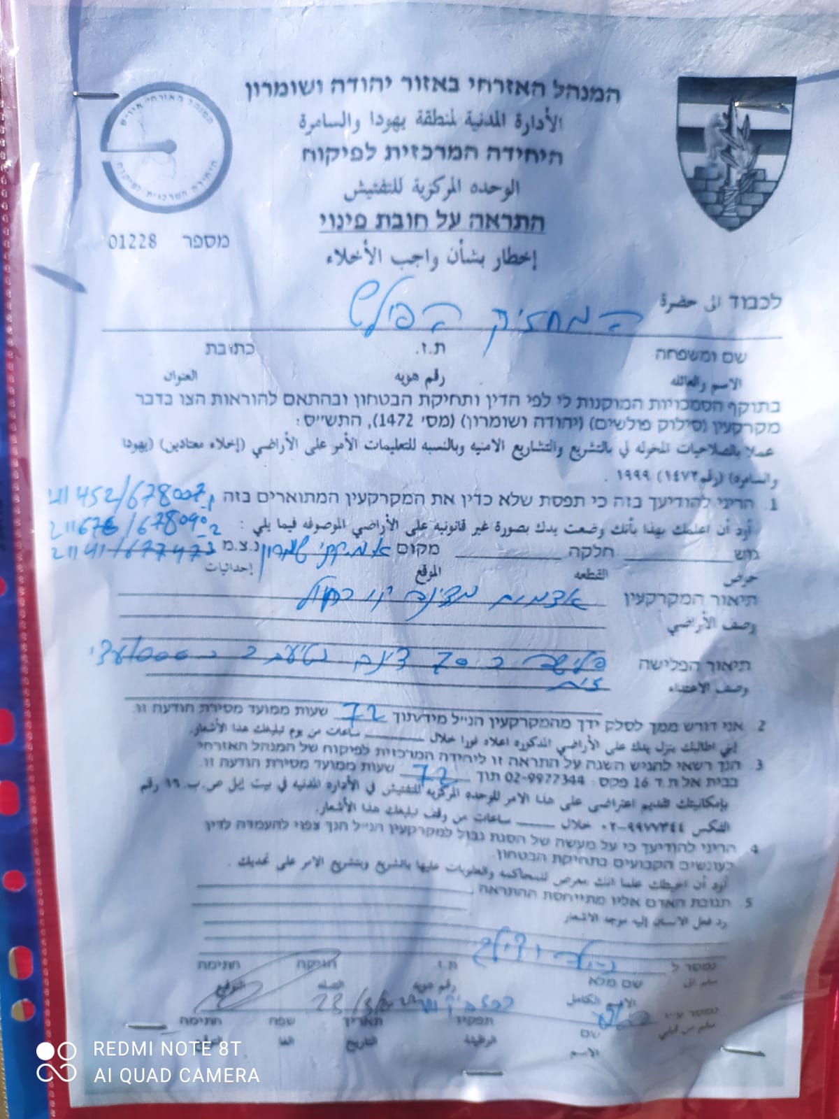
The Israeli Occupation cut down olive trees from Yasuf village northeast Salfit , in order to open a new bypass road known as bypass Huwara , which was ratified by the occupation’s government in 2019 , but working on the ground only started recently.
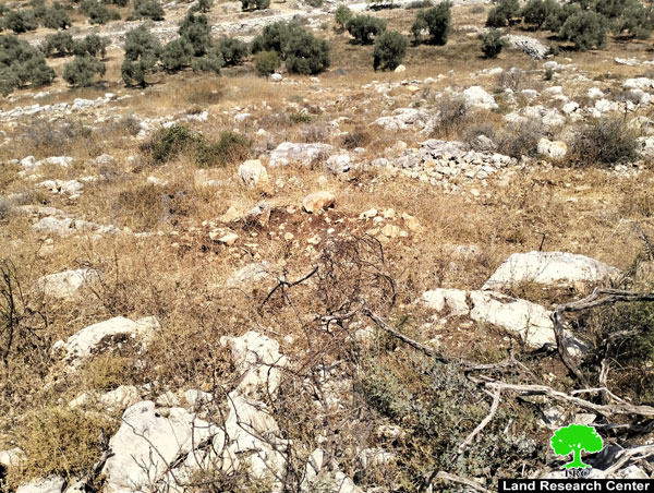
Wednesday morning, July 8th 2020, the Israeli Occupation forces cut and sabotaged 142 aging olive trees , at As-Shajara location nearby bypass (60) , and towards Za’atara military checkpoint northeast Yasuf village.


Photos 1-4: cutting trees at citizen’s lands
This step followed the Israeli Occupation’s resolution decision to open the road.
The following table shows more information ab9out the attack:
|
Affected citizen |
Number of damaged trees |
|
Samer Misleh |
7 |
|
Ahmed Misleh |
18 |
|
Kinan Misleh |
20 |
|
Mohammed Misleh |
15 |
|
Ghassan Misleh |
19 |
|
Mufeed Misleh |
12 |
|
Mohammed Misleh |
14 |
|
Sabri Misleh |
14 |
|
Abdul Rahman Misleh |
8 |
|
Sayel Misleh |
5 |
|
Mohammed Misleh |
10 |
|
total |
142 |
Source: Firsthand field observation – Israeli Violations Monitoring Section – Land Research Center – July 2019.
The Occupation forces confiscated 406 dunums in 2019 to open the road in the lands of (Huwara , Bita , ‘Awarta , Yatma, As-Sawiya, Yasouf) which will result in uprooting 3 thousand fruitful trees.
This road is one of the most dangerous colonialist projects , it aims to turn Israeli colonies illegally built in Nablus governorate into large cities.
The targeted location in opening the bypass road according to the military notice (Resolution of confiscating a property – Huwara bypass road number h/2/19):
|
village |
Location |
Natural block |
|
Burin |
Wad Al-‘Arees , At-Tirah , Wad Burin , Fejaj – Burin |
Block Feskali 6 |
|
Huwara |
– Wad Burin , Al-‘Amed Hersat Sa’id , Marj Oud Allah. -Wad Suliman , Bab Beit Al-Khirbeh , At-Tul. -An-Nuqa’a , Ad-Dera’a , Ras Aj-Junh , Ad-Der’a. -An-Najma Al-Qibliya. -Al-Omari , Beir Qozeh land. – As-Sabt. -Luhuf Jabal Zaid , Jabal Zaid |
-Block Feskali 13
-Block Feskali 6
-Block Feskali 12
-Block Feskali 5
-Block Feskali 4
-Block Feskali 1 -Block Feskali 2
|
|
Bita |
-Land – Bir Qozeh – As-Sabt , Khallet Bir Abu Shusha
|
-Block Feskali 8 -Block Feskali 10
|
|
‘Awarta |
The Khirbet’s land |
-Block Feskali 5
|
|
Yasuf |
-She’ab Al-Wareet , She’ab As-Sadi . Za’atar. -Al-Kajam, Aj-Jefri. |
-Block Feskali 2
– Block Feskali 14 |
|
Yatma |
-Ebn Naqr , Hariqat Abu Dabous , Khallet Sabra |
Block Feskali 8 |
|
As-Sawiya |
-Al-Qarna , Ras Ad-Dur |
Block Feskali 9 |
Yasuf: [1]
It is 16km south of Nablus. Yasuf is surrounded by Huwara and Jamma’in (north), Marda (west), Yatma (east), and Iskaka (south).
Yasuf is inhabited by 2093 people (according to 2017 census). It has a total area of 6037 dunums, 330 of which are built-up area of the village.
The Israeli occupation confiscated 814 dunums for these two colonies: Kfar Tapuah colony which was built on Yasuf lands in 1978. The colony is inhabited by 523 colonists and Rachelim- Shvut that was built in 1991 and devoured 10 dunums.
Besides, the bypass road number 508 confiscated more than 155 dunums of the village lands.
According to Oslo Accords, only 1427 dunums of Yasuf lands are under Area B (PA is in charge of civil matters with Israel responsible for security) while most of Yasuf is under Area C (Israel maintains full security and administrative control). About of 4609 dunums of Yasuf is in area C.
[1] GIS-LRC
The Land Research Center
LRC