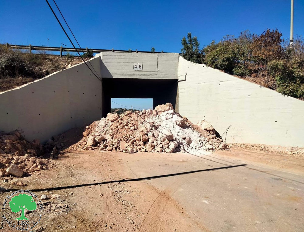
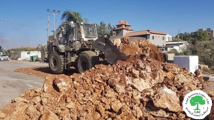
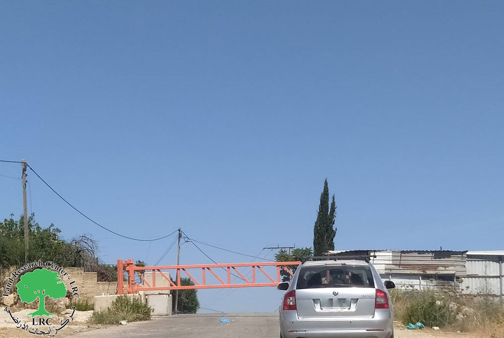
- Violation: Closing an agricultural road.
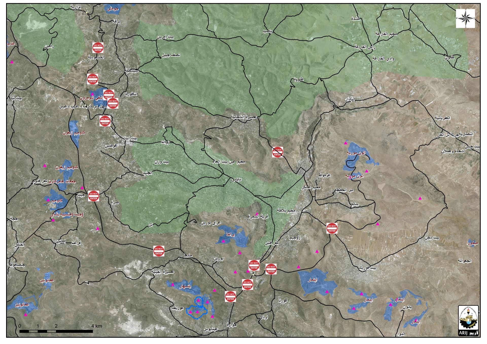
- Location: Deir Istiya village / North Salfit.
- Date: 23/09/2019.
- Perpetrator : The Israeli occupation forces.
- Victims: number of farmers from the village.
Description:
Monday , September 23, 2019, the Israeli occupation forces close off an agricultural road known as “Ash-She’ab road” south west Deir Istiya in Salfit , the closure came in synchronization with olive harvesting season in October.
The targeted road is vital as it connects Deir Istiya western lands to Wad Qana area , it also serves 80 dunums planted with olive trees , it is also noticed that the town people use the road as an entrance for the village in case the main entrance is sealed off.
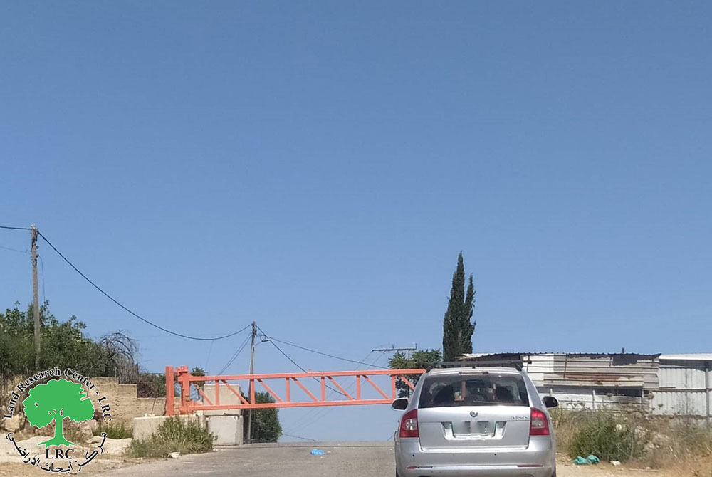
Noteworthy, this is the third time the occupation forces close Ash-She’ab road in the last 12 months , in September 12, 2018 the Israeli occupation forces set up a metal gate partially , and in March 20 ,2019 the Israeli occupation forces closed the road via cement blocks . The road was closed in the Al-Aqsa Intifada eve in 2000 , the closure continued until early 2017 , it was finally opened after popular pressure.
Deir Istiya municipality head told LRC reporter:
“the Israeli occupation forces are imposing difficult conditions on farmers, especially in olive harvesting season, as it is known that olives are an essential part of Palestinian culture and cuisine , it is also a symbol of Palestinian resistance , which made olive trees and groves a hot spot for Israeli violations”
Photos 1-3 : the road after the closure
Deir Istiya village:[1]
10 km north Salfit , Deir Istiya is surrounded by Ematin , Jinsafut and Kafr Laqif (north), Azzun and Kafar Thulth (west), Zita, Jama’en and Kafl Haris (east), Haris and Qaraqwat Bani Hyssan (south)
Deir Istiya has a population of (3,696) people in 2017 census.
The town has a total area of 34,125, of which 640 dunums are a built up area.
- The Israeli occupation confiscated (4,257) dunums for the following purposes:
|
Settlement name |
Establishment year |
Area in dunums |
Number of settlers 2018 |
|
Revava |
1991 |
167 |
2,664 |
|
Yakir |
1981 |
757 |
2,341 |
|
Ginat Shomron |
1985 |
944 |
NA |
|
Karnei Shomron |
1978 |
540 |
8,388 |
|
Novim |
1986 |
663 |
867 |
|
Immanuel |
1981 |
879 |
4,220 |
|
Ma’ale Shomron |
1980 |
52 |
1,002 |
|
Al-Matan |
1981 |
22 |
NA |
- Bypass roads 55 and 5066 devoured 118 dunums.
- The segregation wall (1,148 m ate up115 dunums , in case its construction plan was completed it will isolate 8,408 dunums and eat up 160 dunums.
Oslo accords classified Deir Istiya as the following :
- B area : 6,132 dunums.
- C area 27,993 dunums.
[1] GIS-LRC
Prepared by


