- Violation: extending the validity of a land grab on 5 dunums for “Security claims”.
- Location : Ras Karkar village / Ramallah governorate.
- Date: 07/07/2019.
- Perpetrator: The Israeli occupation forces.
- Victims : People of Ras Karkar.
Description:
The Israeli occupation West Bank army commander “Nidav Alon”, issued military order (04/101/T) extending the validity 4 and modifying borders 2 , which extends the land grab of 4.748 dunums from Ras Karkar and Kafar Ne’ama lands north Ramallah, in order to extend the military base on the southern entrance of Ras Karkar. specifically, on bypass 463.
Noteworthy, the occupation forces established a military base and a watch tower in 1994 , since that day and until this day the land grab’s validity was extended four times with an addition of 48 m2 to the grabbed area.
 Photo 1: The military watch tower


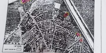
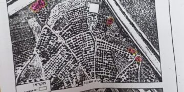
 Photos 2-6: The military order
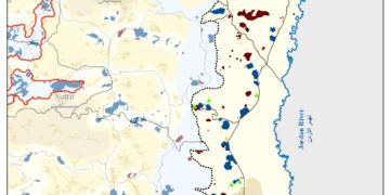
 Photo 7: The location of the confiscated lands
The following table shows the specific location of the targeted land:
|
village |
Natural block |
plot |
|
Kafr Ne’ama |
2 |
Al-Awareed |
|
Ras Karkar |
2 |
Al-Wajeh Al-Gharbi |
|
3 |
Ar-Risan |
Member of Ras Karkar village council Nazih Fukhaitha told LRC reporter:
“There is an Israeli scheme to suffocate the village, through grabbing wide areas of the towns land for the favor of “Nahliel” and “ Talmon” in the northern and eastern sides of the village, the occupation also set up a metal gate and a military watch tower on the village entrance in order to control access to the village. The organizational plan is also relatively small in comparison to demographic expansion and natural resources are limited.”
Ras Karkar: [1]
15 kilometer north west of Ramallah, It is about 500 m above sea level, and has a total area of 5,050 dunums, of which 330 dunums are a built up area.
Ras Karkar is surrounded by Deir ‘Ammar (north), Kafr Ni’ma and Deir Ibziq (south), Al Jania (east), Bani Harth (west).
Ras Karkar has a population of 1956 people according to statistics conducted by the Palestinian Central Bureau of Statistics in 2017.
The Israeli occupation devoured more than 32 dunums of the lands of the village for Talmon C colony which was built in 1989. Moreover, bypass number ‘463 took over 295 dunums of the village lands.
According to Oslo Accords, 19% of Ras Karkar is under Area B (PA has full civil and security control) while most of the village lands (81%) is under Area C (Israel maintains full security and administrative control). Here are the area in dunums:
- Area B (940) dunums
- Area C (4110) dunums
Legal Feedback:
The constringing policy by the Israeli occupation authorities of confiscating Palestinian lands in order to build illegal random outposts and settlements can only be regarded as a violation of all international conventions and agreements like:
The International Covenant on Civil and Political Rights:
- All peoples may, for their own ends, freely dispose of their natural wealth and resources without prejudice to any obligations arising out of international economic co-operation, based upon the principle of mutual benefit, and international law. In no case may a people be deprived of its own means of subsistence.
The universal declaration of human rights 1948 article (17) right to own property:
- Everyone has the right to own property alone as well as in association with others.
- No one shall be arbitrarily deprived of his property
[1] GIS-LRC
Prepared by
The Land Research Center
LRC


