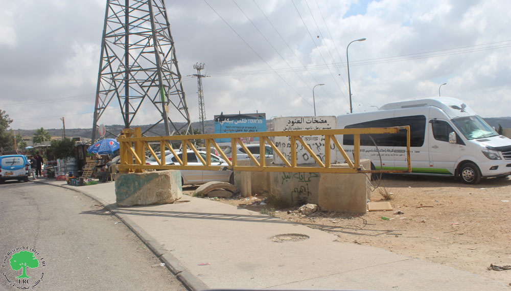
- Violation: Sealing off an agricultural road via cement blocks.
- Location: Deir Istiya / Salfit governorate.
- Date: 20/March/2019.
- Perpetrator: The Israeli occupation army.
- Victims: people of Deir Istiya.
Description:
In the afternoon of Wednesday 20 march 2019, The Israeli occupation forces placed cement blocks on “Ash-She’ab” road west Deir Istiya.
Closing “Ash-She’ab” road , was at the same time with the spread of Israeli troops on the town’s entrance , on claims that someone from the area opened fire towards a bus for settlers. The She’ab road was used as a main bath after closing the main road and spreading troops there.


Deir Istiya municipality head Sa’ed Zidan told LRC reporter:
“ The closure affected at least 4000 people living in Deir Istiya , There are 400 people that take the road daily to their work, now struggling for an alternative as they take a 3 km bath to reach the same destination.”
Zidan asserted: The occupation forces invade the town daily and spread between the village’s houses throwing sonic and light bombs, which frightens villagers mostly children.
Deir Istiya:[1]
It is located 6 km to the north west of Salfit on Mountain Ath-Theeb (the wolf). Its total area is 34, 765 dunums including 1527 dunums of built-up area. 40 % of the total area of Deir Istiya has been subjected to colonial activities. Deir Istiya is surrounded by many Palestinian towns and they are Kafel, Haris , Qarawa Bani Husan, Qira, Zita Jama’aen, Jeensafut, Azun Ash-Shamaliya, Tel , Saneria, Bidya and Amateen.
The town is inhabited by around 3696 people in 2017 census, who depend largely on herding and agriculture in their living knowing that fertile soil and plenty of water are available.

It is considered one of the most concerned towns with education, compared to other surrounding towns and villages.
According to Oslo convention the area is classified to two parts , 18 % of the towns land are classified as B areas (6132 dunums), the rest of the town are C areas with a percentage of 82 % (27997 dunums), 40 % of the towns land is subject to colonial activities and colonies that are sporadic all over it, trying to seize every dunums and invades every place like cancer.
[1] GIS-LRC
Prepared by
The Land Research Center
LRC