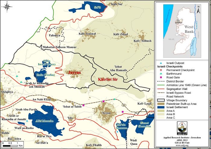
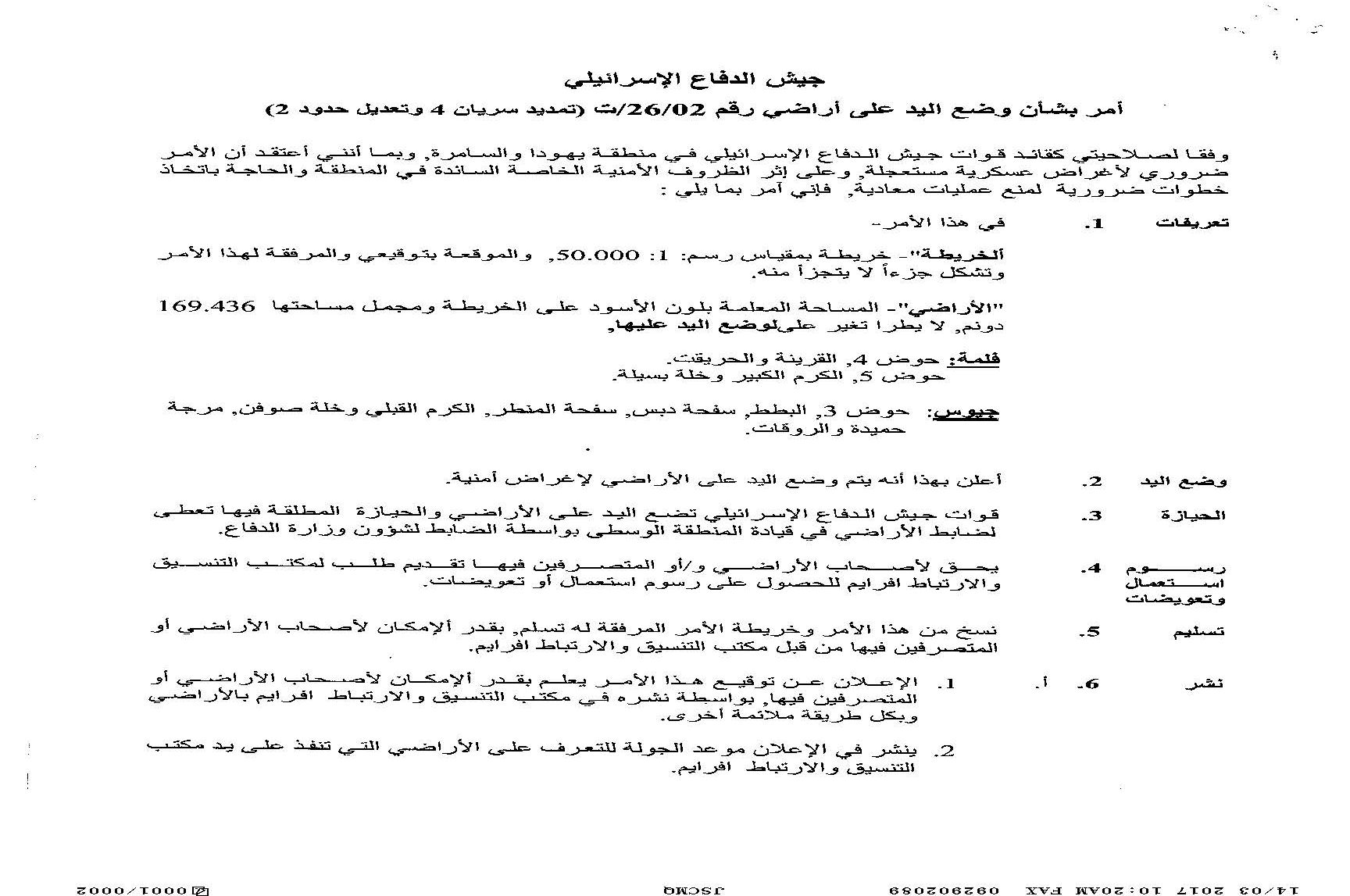
The Israeli Civil Administration issued extensions for two military orders to exploit lands of Jayyous and Falamya within Qalqilya governorate. The targeted land is located behind the segregation wall. The lands in both locations are located within close proximity to the Israeli Army set up “agricultural” gate as part of the movement system designed by the Israeli Army. This is not the first time the targeted locations received an extension orders since it was taken over by the Israeli Army in 2005 for purposes related to construction of the segregation wall. The targeted land encompass 169 dunums spread on parcels 4 and 5 of Falamya village and parcel 3 of Jayyous village.

About Falamya,
Falamya is a Palestinian village located north of Qalqiliya city. According to the Oslo II Interim Agreement signed between the Palestinian Liberation Organization (PLO) and Israel on 28th September 1995, Falamya village was divided into areas “B” and “C”. Approximately 239 dunums (8.5% of the village’s total area) were assigned as area B and the rest of the land is located within what classify as area “C” (2,567 dunums (91.5% of the total area)), which is where most of the agricultural areas and open spaces that belong to the village are located, and also where the Israeli Army retains full control over security and administration related to the territory. It’s worth mentioning that 59% (1507 dunums) of what classify as area “C” is isolated behind the wall. See Map 1

About Jayyus,
Jayyus is a Palestinian town located north-east of Qalqiliya city. According to the Oslo II Interim Agreement signed between the Palestinian Liberation Organization (PLO) and Israel on 28th September 1995, Jayyus town was divided into areas “B” and “C”. Approximately 2,954 dunums (26.6% of the village’s total area) were assigned as area B and the rest of the land is located within what classify as area “C” (8,151 dunums (73.4% of the total area)), which is where most of the agricultural areas and open spaces that belong to the village are located, and also where the Israeli Army retains full control over security and administration related to the territory. It’s worth mentioning that 77% (6228 dunums) of what classify as area “C” is isolated behind the wall. See Map 2

Map 2: Jayyus village
Prepared By
The Applied Research Institute – Jerusalem
ARIJ


