
- Violation: serving stop-work orders
- Location: Yatma village- Nablus
- Date: February 07, 2016
- Perpetrators: Planning and Construction Committee- Israel Civil Administration
- Victims: two Palestinian families
Details:
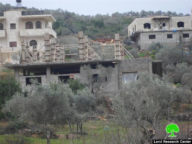
The so-called Planning and Construction Committee- Israel Civil Administration delivered on February 07, 2016 stop-work orders for two families from Yatma village, south Nablus city. The affected structures are reported to be located in the area of Al-Ain. The orders mentioned that the two structures were "unlicensed construction" and gave the affected until February 24, 2016 to complete all licensing procedures. This date comes in time with the hearing session of the Planning and Construction Committee in the Israeli court of Beit El colony to consider the status of the notify structures. It should be marked that the affected people intend to seek Jerusalem Center to legally follow up on the current violation. The following table shows information about the affected people and their properties:
|
Affected citizen |
Family |
Minors |
No. of threatened structures |
Aream2 |
Nature of threatened structure |
No. of order |
Photo |
|
Khalil Najjar |
4 |
0 |
1 |
90 |
One story house |
||
|
Mohammad Najjar |
7 |
5 |
1 |
160 |
Two story house (still under construction) |
||
|
Total |
11 |
5 |
2 |
250 |
|
|
|
Source : Field observation- Department of Monitoring Israeli Violations- Land Research Center-2016

About Yatma:
It is located 14km south of Nablus city. The village is edged by Beta from the north, al-Sawiya and Yasuf from the west, Qabalan from the east and al-Sawiya form the south.
Yatma has a total land area of 2952 dunums of which 392 are built-up area and has a total population of 2853 people until 2007. It should be marked that the bypass roads no. 60&505 looted around 60 dunums from the village lands.
The village lands are classified as C&B according to Oslo Accords. Area classified B represent around 31% of the total land area whereas C area represent 69%. The area in dunums is follows:
- 912 dunums are classified as area B
- 2,040 dunums are classified as area C
Prepared by
The Land Research Center
LRC


