
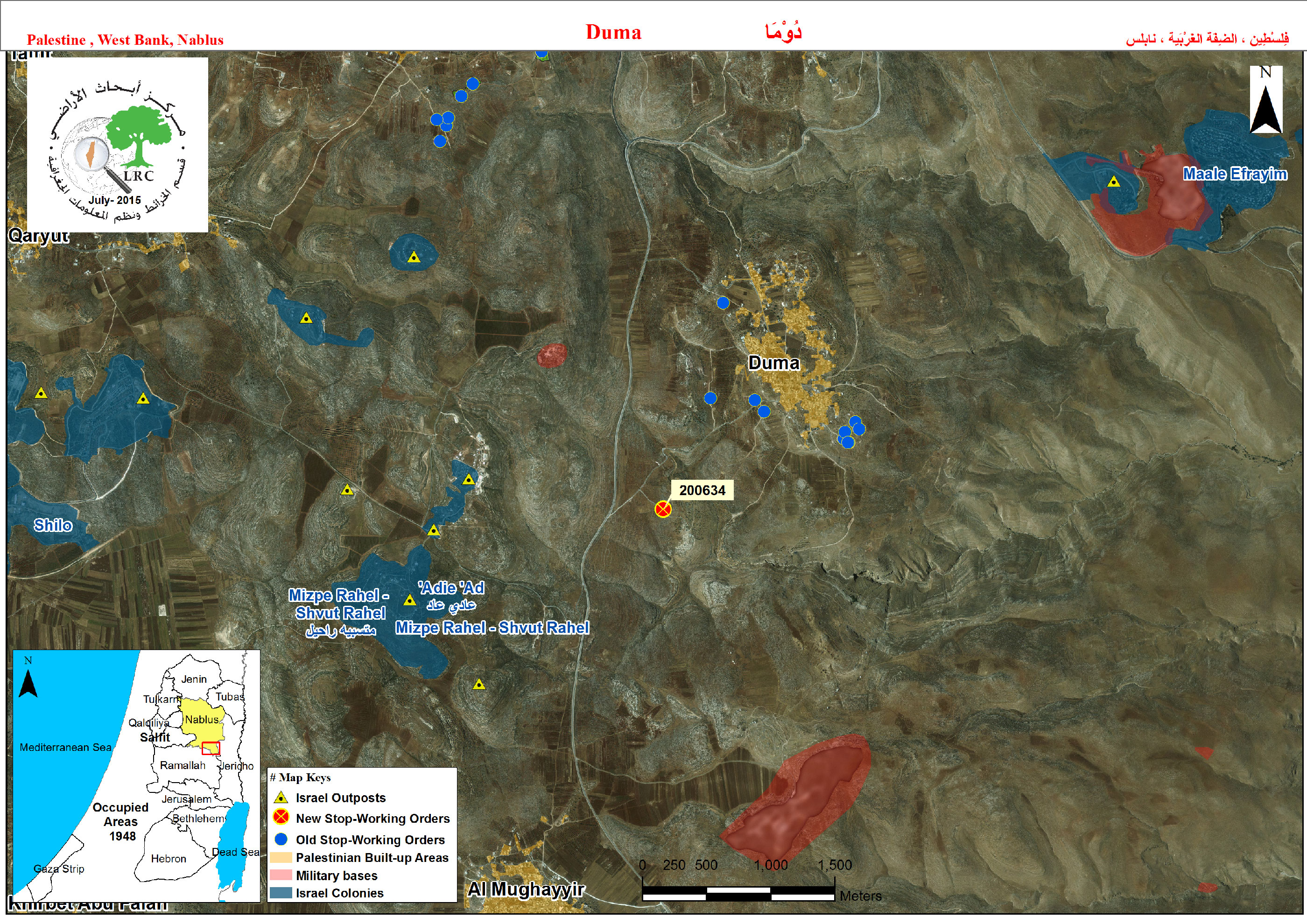
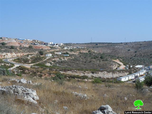
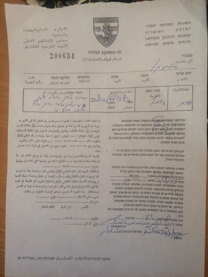
Violation: serving stop-work orders on structures
Location: Duma village- Nablus
Date: 17/07/2015
Perpetrators: Planning and Construction Committee- Israel Civil Administration
Victims: two Palestinian families
Details:
The so-called Planning and Construction Committee- Israel Civil Administration on July 14, 2015 served two families from the Nablus village of Duma stop-work orders on their structures under the claim of “unlicensed constructions”
The military order gave the affected a deadline until August 03, 2015 to complete all licensing procedures. This comes in time with the hearing session of the Inspection and Planning Committee of Israel in the court of Beit El colony. The following table shows information about the affected people due to the orders:
|
Affected citizen |
Family |
Minors |
Aream2 |
No. of military order |
Photo |
Remarks |
|
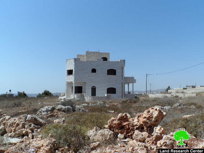
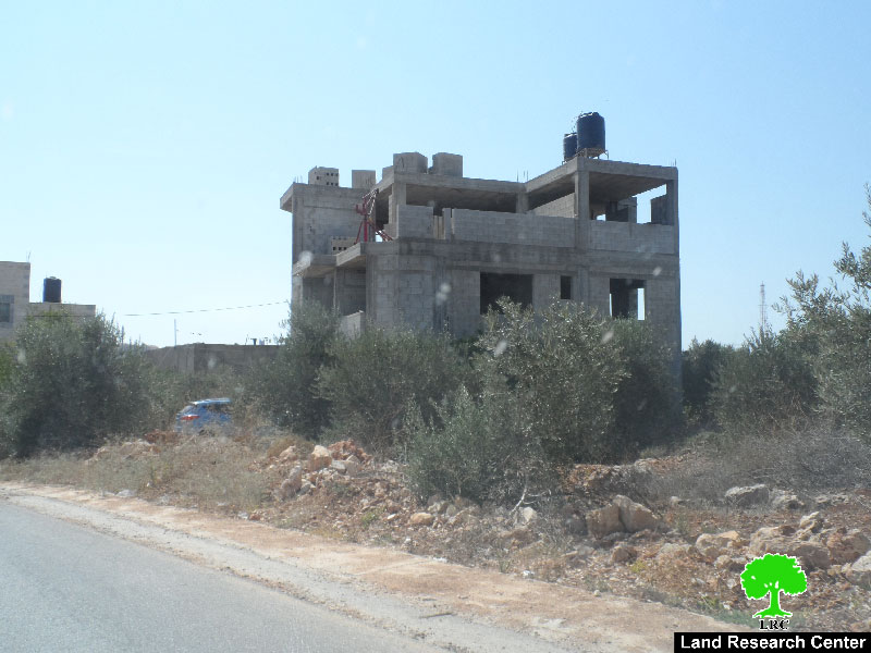
Jamal Al Tawil |
5 |
2 |
280 |
Still under construction- first time notified |
||
|
Adnan Dawabshih |
8 |
4 |
210 |
N/A |
Inhabited- first time notified |
|
|
Total |
13 |
6 |
490 |
|
|
|
Source : Field observation- Department of Monitoring Israeli Violations- Land Research Center-2015
About Duma Village
Duma village is located 24 km to the southeast of Nablus city, and is bounded by Majdal Bani Fadil village to the north, Jordan Valley to the east, Khirbet Mughayyir to the south, Qusra and Jalud villages to the west. Duma has a total built-up area of 200 dunums where its area totals around 18000 dunums.
The village has a total population of 3400 residents (PCBS – 2011). Residents of Duma depend on plantation of fruitful trees such like olive and other different summer crops in addition to poultry and sheep husbandry
According to the village council of Duma, around 17 agricultural and residential structures are notified with stop-work since the year of 2008 in Duma village.
Prepared by
The Land Research Center
LRC


