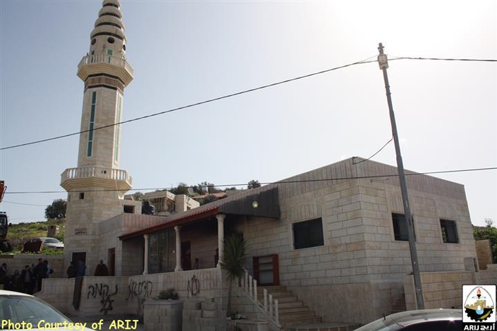
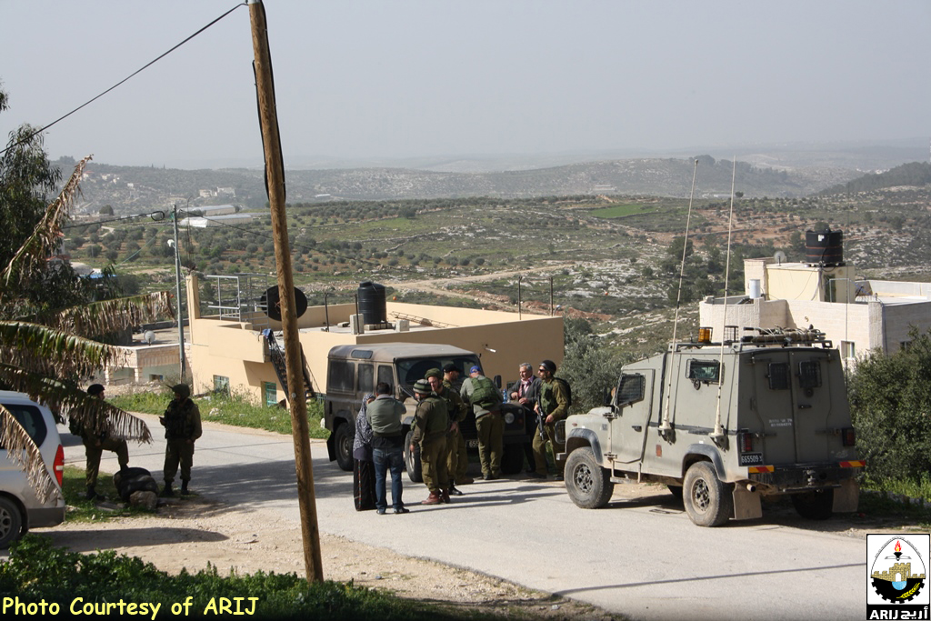
At the early morning of February 25, 2015, a herd of Israeli settlers from what is so-called “Price Tag” groups infiltrated to the Palestinian village of Jab’a west of Bethlehem and set fire in the village mosque “Al-Huda”.
In an interview with ARIJ field workers, local residents from Jab’a , indicated that the worshippers arriving for praying in the early morning and discovered the fire and put it down.
The fire ended with considerable financial losses where all of the mosque from inside get burned including (carpets and walls) , while a price-tag hate slogans graffiti written in Hebrew on the outside walls of the mosque. See Photos below
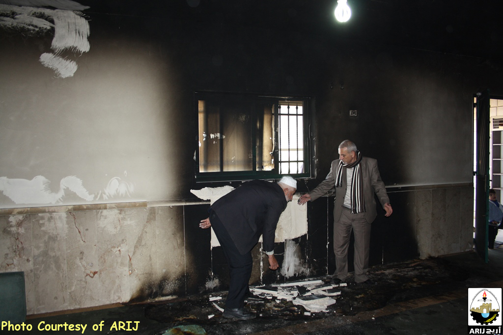

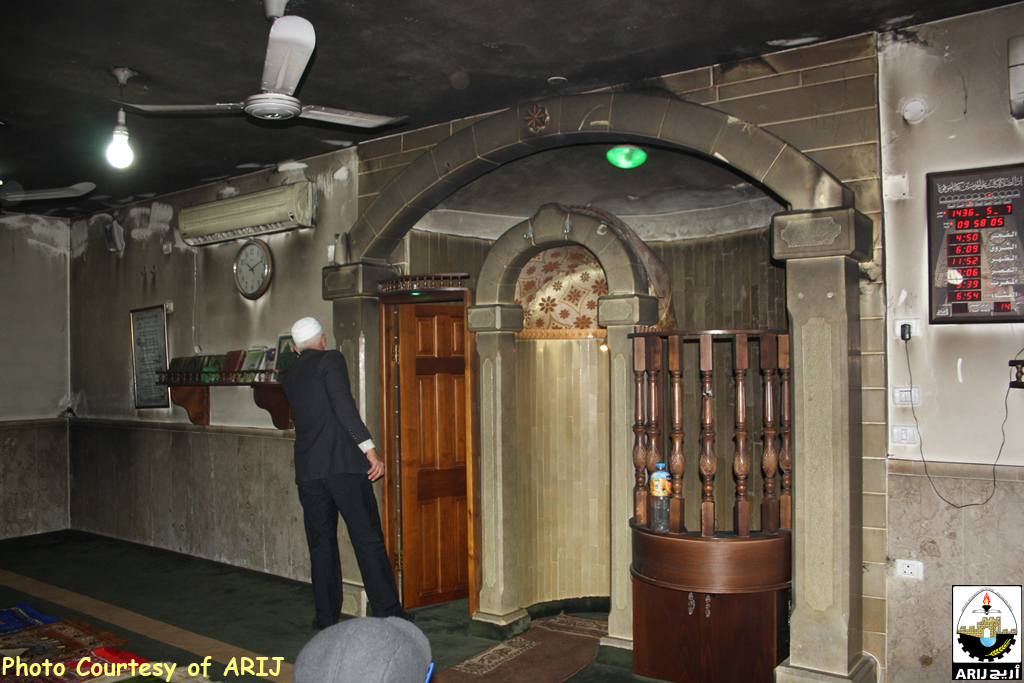
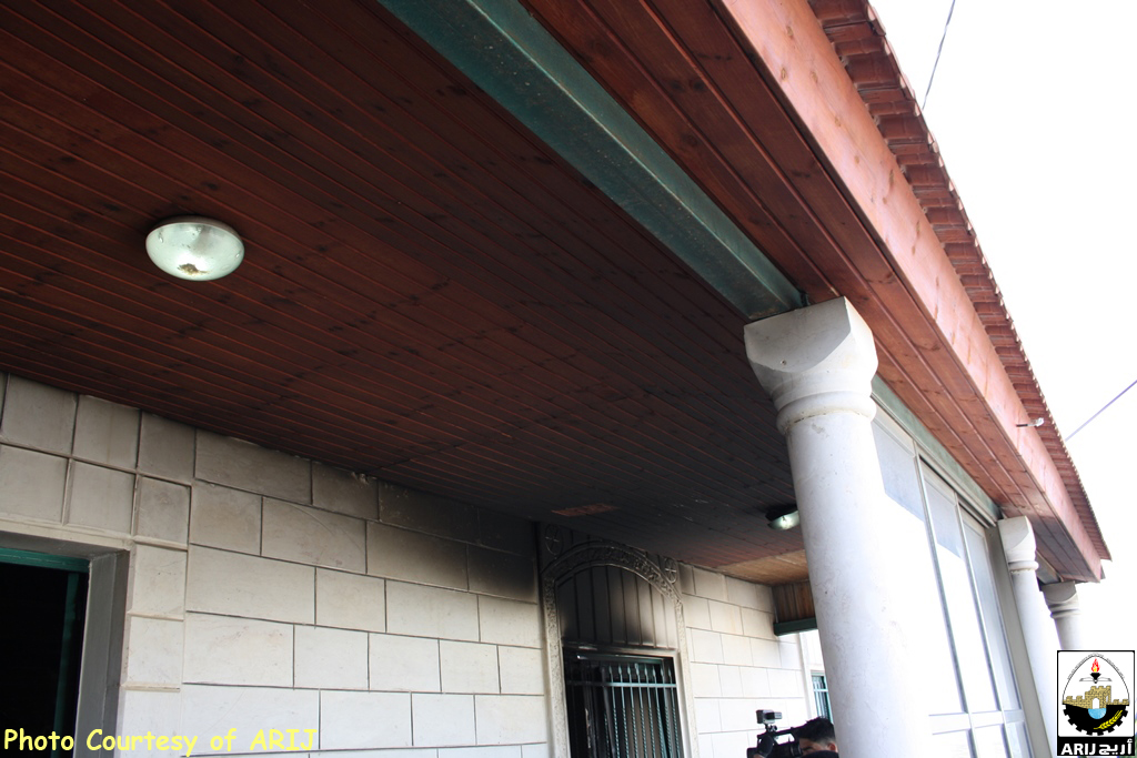
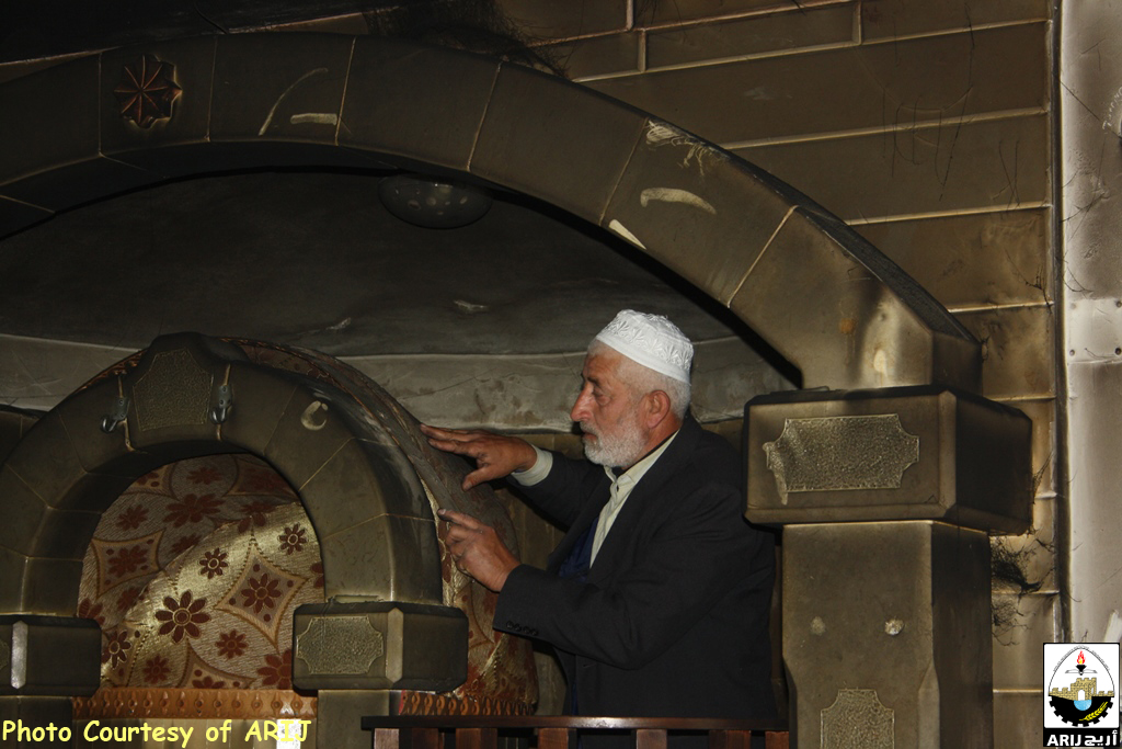
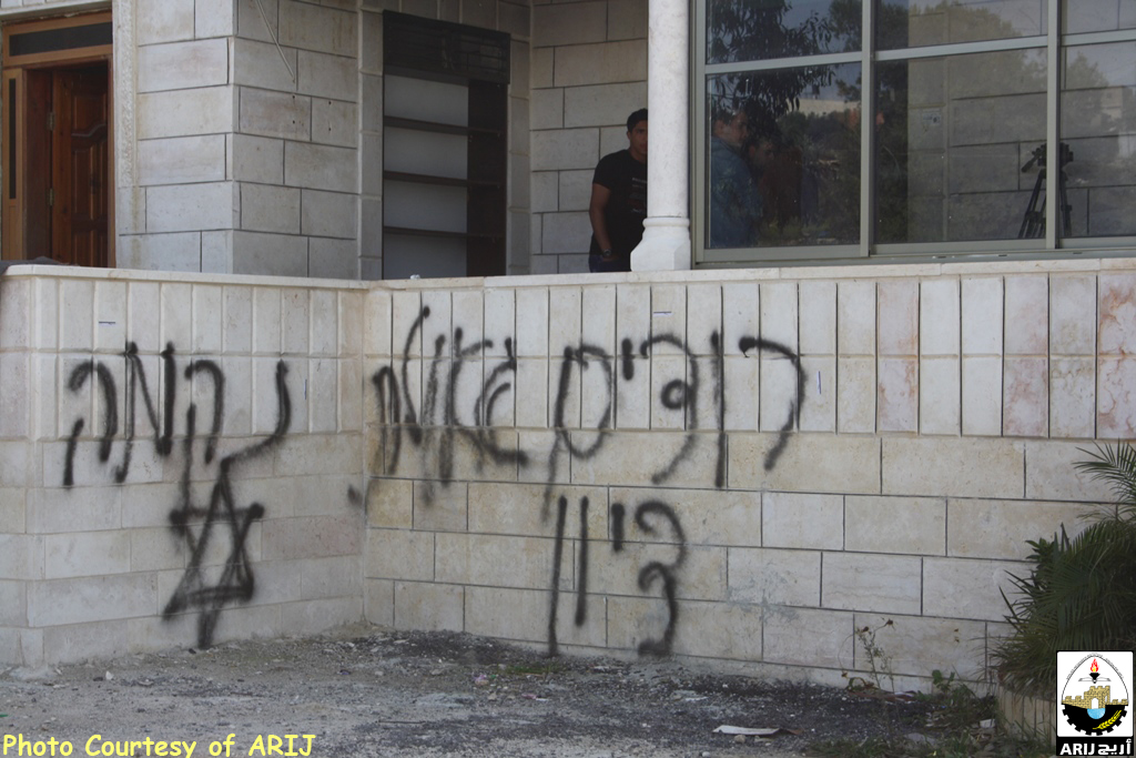
Photos 1-7: The attack on the Mosque captured by ARIJ field workers
Al -Jab'a is a Palestinian village located 12.5 Kilometers to the southwest of Bethlehem city. It has a total area of 7120 dunums and the built-up area constitutes 150 dunums. The village is situated 1100 meters from the 1949 Armistice line (Green Line).
Before the 1948 war, Al Jab'a village used to have 7345 dunums of lands mostly planted with Olives, but after the war 225 dunums came to lie west of the Green line. After the 1967 war the village was targeted due to its location close to the Armistice line and its mountainous topographic nature. Out of the 7120 dunums inside the village boundary of Al Jab'a, 666 dunums were confiscated for the construction of the Israeli settlement of Beit 'Ain (Tsoref).
Today, the village is the home of 1,099 residents (PCBS- 2015 Projections) . Al-Jab’a is bordered by Wadi Fukin village and the illegal settlement of Bitar ‘Ilit from the north and the northwest, Surif village from the south, and the Segregation Wall path as well as Beit ‘Ein settlement from the southeast, the Green Line(Armistice line of 1949 from the west, the illegal settlements of Geva’ot and Rush Tzurim from the east.
Israeli Colonization Activities In Al-Jab’a Village
Al Jab'a village is one of the Palestinian villages whose part of its fertile lands was confiscated during the 1948 war. After the 1967 war the village was targeted due to its location in the proximity of the green line and its mountainous topographic nature. Out of the 7120 dunums inside the village boundary of Jab'a, 666 dunums were confiscated for the construction of the Israeli settlement of Beit 'Ein (Tzurif). Since then the village was going under harsh Israeli measures such as house demolition, uprooting of trees in addition to land confiscation. Many houses in the village were demolished by the Israeli troops claiming that they were built without having building permits.
60% of Jab’as Lands Segregated Behind the Segregation Wall
According to the updated Segregation Wall path published on February 20, 2005 by the Israeli Ministry of defense, 59% (4168 dunums) of Jab'a's lands will be isolated east and northwest of the Segregation Wall leaving only 2952 dunums for the village. 33% of the agricultural lands in the village that are cultivated with permanent crops will be isolated in addition to 91% of the permanent crops which mainly consist of Olive trees will be isolated which will severely affect the villager's economic wellbeing as they depend on agriculture as their main source of living, especially their dependence on Olive trees
Moreover the forest that lies on the lands of Al Jab'a will be entirely isolated behind the Wall and the local villagers will no longer be able to access it. Also, 59% of the open space in the village will be isolated, which will impose pediments to future development of the village. Table 1 below shows the land classification inside the village boundary and the land that will be isolated behind the Wall. See Map 1
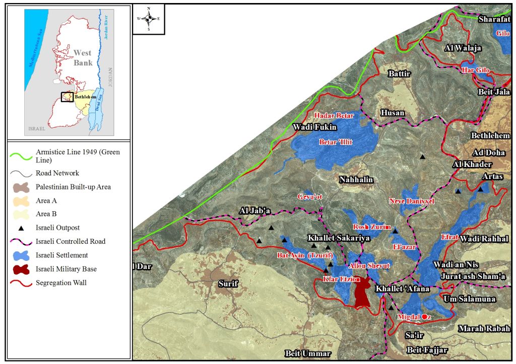
Photo 1: The Israeli Segregation Wall plan in Al Jab'a village – Bethlehem Governorate
New under-construction Settlement units in the Vicinity
The illegal settlement city of Bittar I’lit witnessing accelerated housing units construction . See Photos 8-11
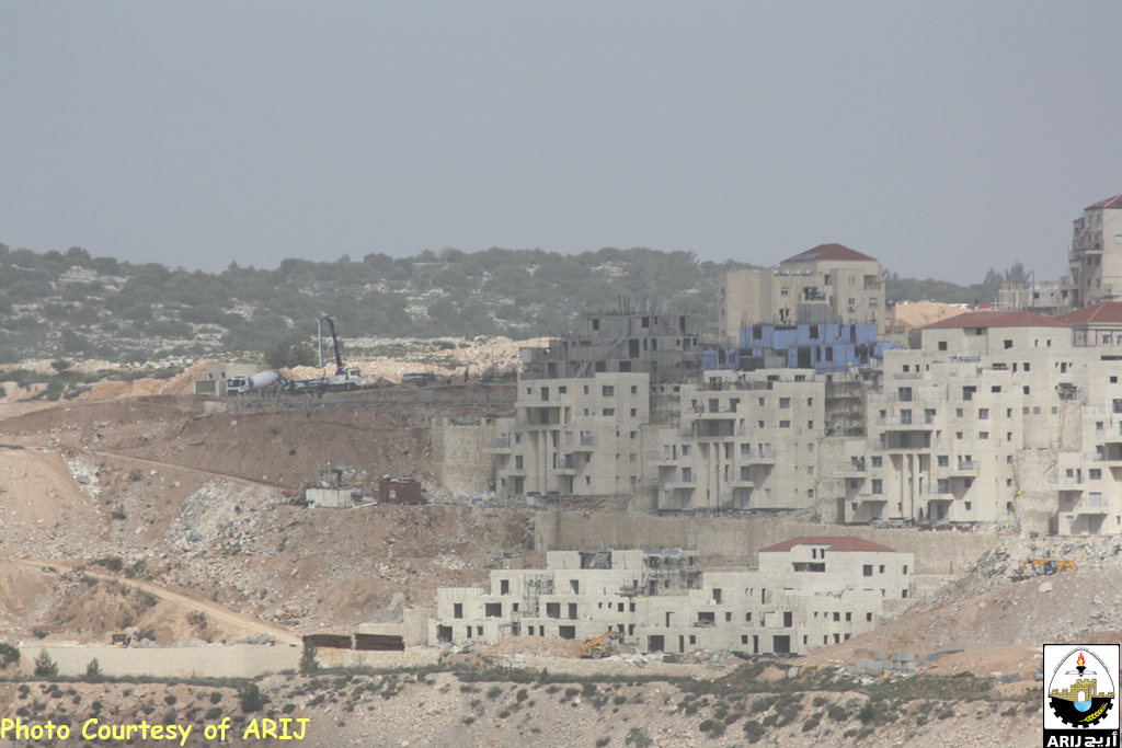
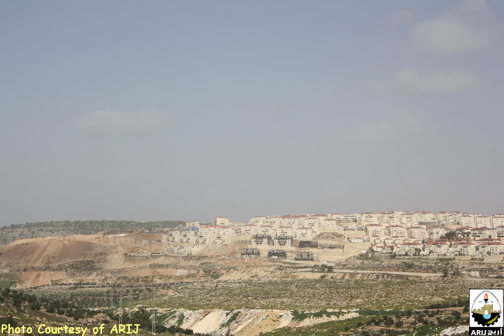
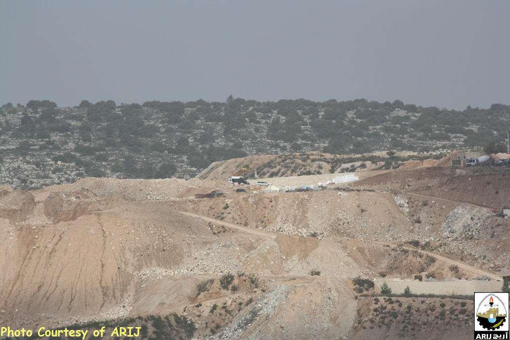
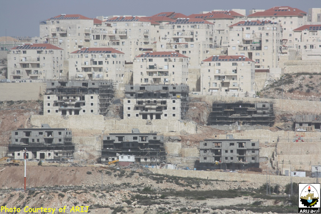
Photos 8-11: Betar Ellit settlement expansion captured captured by ARIJ field workers
Beitar Illit settlements stands on a total land area of 4685 dunums of land originally confiscated from Husan, Nahalin and Wad Fukin villages in year 1985. See table 1 below:-
|
Table 1: Palestinian lands expropriated for the construction of Bitar ‘Illit |
|||
|
Bitar ‘Illit Settlement |
Expropriated Area-Dunums |
Palestinian Community |
Total Land Area |
|
3431 |
Husan |
4686 |
|
|
567 |
Wadi Fukin |
||
|
688 |
Nahalin |
||
|
Source: ARIJ Database 2015 |
|||
In addition to being identified as the fastest growing settlement in the West Bank; Bitar Illit settlement is considered one of the largest Israeli settlements in the West Bank in terms of Area and is inhabited by almost +60,000 Israeli settlers.
In addition to the aforementioned, the settlement witnessed horizontal expansion that was on the expense of the neighboring Palestinian villages which contributed much to an increase in settlement's area throughout the years of Israeli occupation, hence the settlement of Bitar Illit original in 1985 (150 dunums) has increased by 3000%.
Prepared by:
The Applied Research Institute – Jerusalem