Violation: agricultural barracks notified with stop work
Location: Bardala/ Tubas governorate
Date: 16/09/2014
Perpetrators: the Planning Committee of the occupation
Victims: two families(13 member including6 minors) from the village
Details:
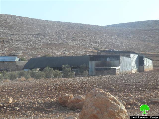
On September 16th 2014, the so-called Planning Committee of the Civil Administration served two families from Bardala stop work orders on their agricultural barracks under the pretext of unlicensed construction within area classified C according to Oslo Accords.
According to the military orders, the owners of the two barracks were given a deadline until 24/09/2014 to complete the licensing procedures. This comes in time with the session of the Planning Committee in the court of Beit EL. Noteworthy, the structures were established on February 2014 to be used for sheep husbandry, taking into consideration that they were built by metal slabs and wood. The following table shows information about the damaged resulted|:
|
Affected citizen |
Family |
Minors |
No. of sheep |
No. of order |
Area of the barrack |
No. of photo |
Notes |
|
Hamid Sawafta |
5 |
3 |
68 |
60 m2 |
|
||
|
Ahmad Daraghmah |
8 |
3 |
90 |
90 m2 |
had a structure demolished before |
||
|
Total |
13 |
6 |
158 |
|
|
|
|
Source: Monitoring Israeli Violation Department- Land Research Center, 2014
About Bardala
Bardala is located in the northeastern part of the Jordan Valley; the village is situated 25 km to the north of Tubas. It is surrounded by the Green Line (north), Raba (west), Ain al Baeda (east) and Tubas (south). It has a population of 2112 people according to a 2014 census. It's total area is 18329 dunum, 404 of which is built-up area.
The Israeli occupation devoured 252 dunums of its land to open the bypasses road #'90. It also confiscated 819 dunums to build the Separation Wall(8197 in length) and isolated 2100 dunums of Bardala land as a result. According to Oslo Accords, 90% of the village is area C, i.e. under Israeli authority while only 5% is area B.
- Area B (910 dunum)
- Area C (16845 dunum)
Prepared by
The Land Research Center
LRC


