Violation: a road network to devour more Palestinian lands.
Location: western Deir Istiya.
Perpetrators: the West Bank Colonies Council.
Victims: residents of Wadi Qana.
Preface:
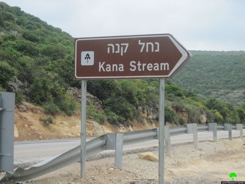
Wadi Qana is known for its fertile land, beautiful nature, and availability of water. It is edged by Jinsafut, Kafr Laqif, ‘Azzun (north), Sniriya, Kafr Thulth (west), Qarawat Bani Hassan (south), Amatin and Deir Istiya (east). Most of the lands in Wadi Qana are property of farmers of Deir Istiya.
Wadi Qana is more than 10000 dunums in area; it is mostly planted with olive trees, citrus, and many others. It is also known for the availability of water; 11 natural springs exist in Wadi Qana making it convenient for cultivation; thus, a source of income for tens of families living in the surrounding villages. The Israeli Occupation classified Wadi Qana as a natural reserve in the seventies, preventing any cultivation activities.
Details:
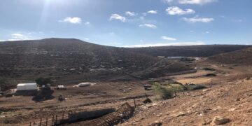
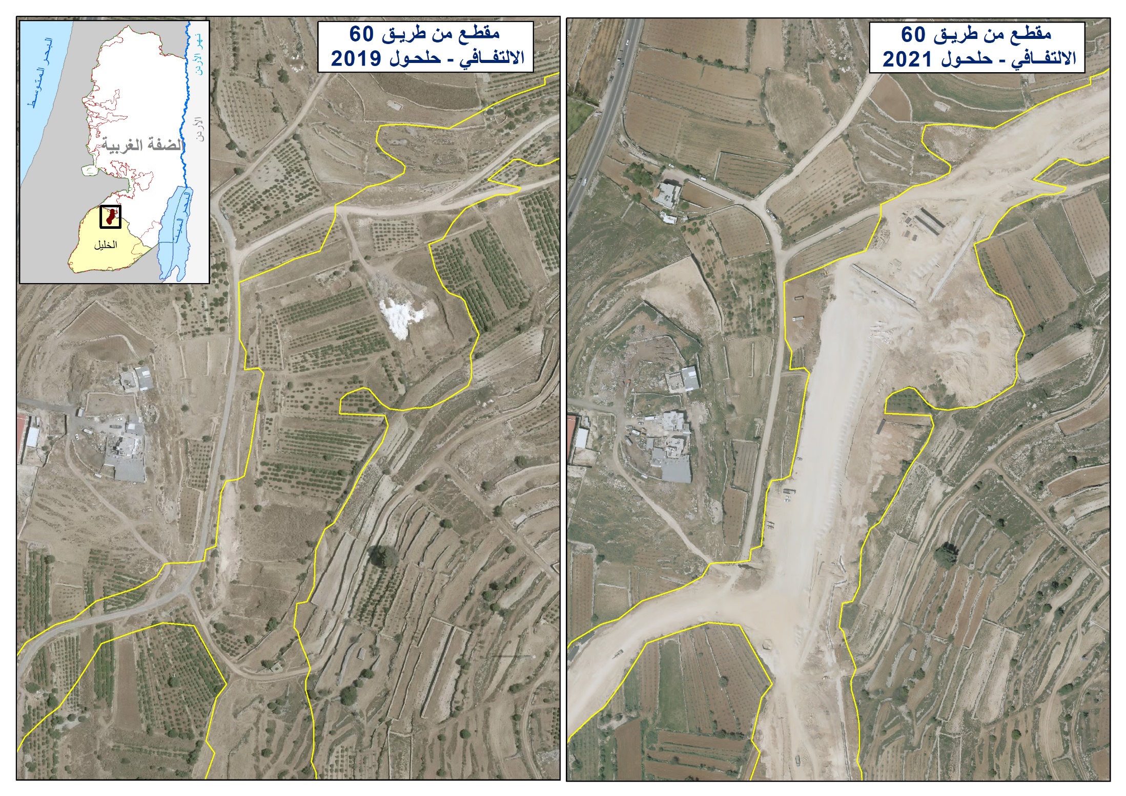
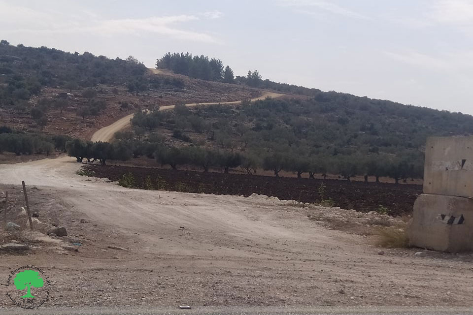
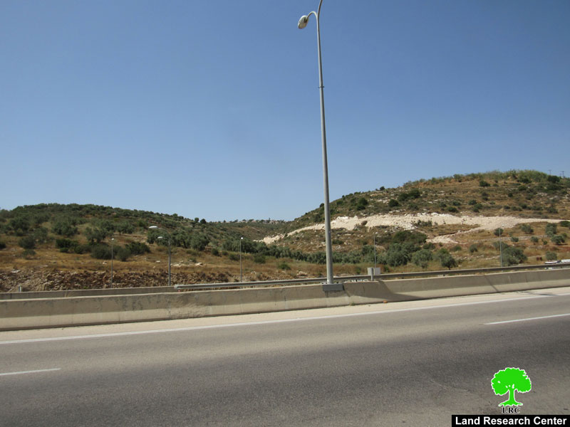
Recently, the West Bank Colonies Council approved the opening of a road network connecting 7 Israeli colonies as well as two outposts in Wadi Qana.
Nazmi Salman, Deir Istiya Governor, stated to an LRC observer: ‘the Israelis are targeting the Palestinian existence in Wadi Qana. Since the signing of the Oslo Accord Agreement in 1993, Wadi Qana is considered a Natural Reserve and is classified as area ‘C’, which Palestinians are not allowed to exploit in any way according to the Israelis. The road network is a way to enforce the Israeli colonial presence in the area; it is a step towards merging all the colonies in one on the expense of Palestinian lands‘.

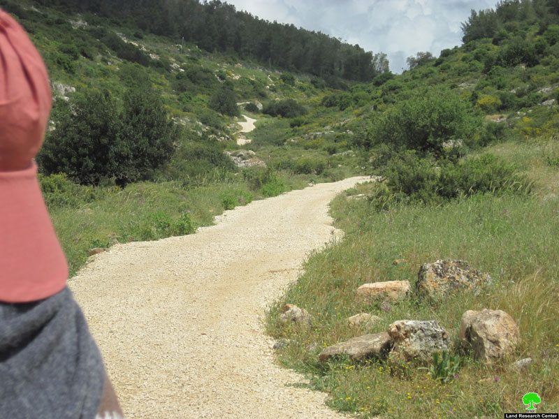

Picture 1-4: roads opened by colonists
Blocking Palestinian roads:
Meanwhile, the Israeli Army and colonists are blocking Palestinian roads serving threatened Palestinian lands. In recent years, most of the agricultural unpaved roads have been blocked, especially those edging Emmanuel Colony, in addition to the deconstruction of Al Salam road (paved) twice in recent months. Since 1967, the Israeli Governments set rules and regulations aimed to laying full control over Wadi Qana. Lands that benefited from various reclamation projects which include the plantation of thousands of trees where hit by claiming that most of the lands of Wadi Qana are ‘state property’ and the Israelis demanded returning to the status quo.
Nazmi stated: ‘this claim is based on an old law that was put by the Ottoman rulers to encourage cultivation of lands; the law said that any land that has been left uncultivated for over five years will automatically become property of the state. In order to make best use of this law, the Israelis set huge areas as ‘security buffer zones’ or ‘military zones’ disallowing hundreds of Palestinian farmers from reaching hundreds of dunums, five years later, these lands become ‘state property’. ‘
In recent years, 7 Israeli colonies have been built in and around Wadi Qana including Emmanuel (east), Yakir (south), Nufim (center), Karni Shmaron, Genat Shamron, Maale Shamron (north), and Revava (west) in addition to tens of military posts and watch towers. It must be pointed that these colonies stand as an obstacle in the way of any possibility of a permanent solution.
Prepared by
The Land Research Center
LRC
The Land Research Center
LRC