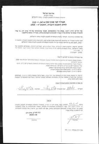
On May 11, 2011, the Israeli Occupation Army handed over seven Palestinian residents from Al Walajeh village northwest of the city of Bethlehem demolition orders notifying them that their houses will be demolished under the pretext of lacking building license. The demolition orders issued by what is so-called “The Israeli Planning and Construction Committee of Jerusalem District” related to the Israeli Ministry of Interior. The owners of the threatened houses and according to the demolition orders have only 48 hours to demolish their houses by themselves, otherwise the Israeli bulldozers will do so, and they will pay about 12,000 NIS for the demolition fees. See the table below:
|
Table of the details about Targeted houses
|
|||
|
Name of the Owner
|
Date of Construction
|
Area – m2
|
Cost- NIS
|
|
Mahmoud Mohammad Radwan
|
2011
|
260
|
120,000
|
|
Kamal Mohammad Radwan
|
2011
|
120
|
60,000
|
|
Nidal ‘Adel Abu Sorour
|
2010
|
200
|
150,000
|
|
‘Alaa Ahmad Shihadeh Khaliefeh
|
2010
|
306
|
500,000
|
|
Mahmoud Youseph Shihadeh
|
2011
|
200
|
100,000
|
|
Rizeq Atallah
|
2011
|
80
|
80,000
|
|
Mohammad Shihadeh Hassan Shihadeh
|
2011
|
140
|
120,000
|
|
Source: ARIJ Field Workers
|
|||

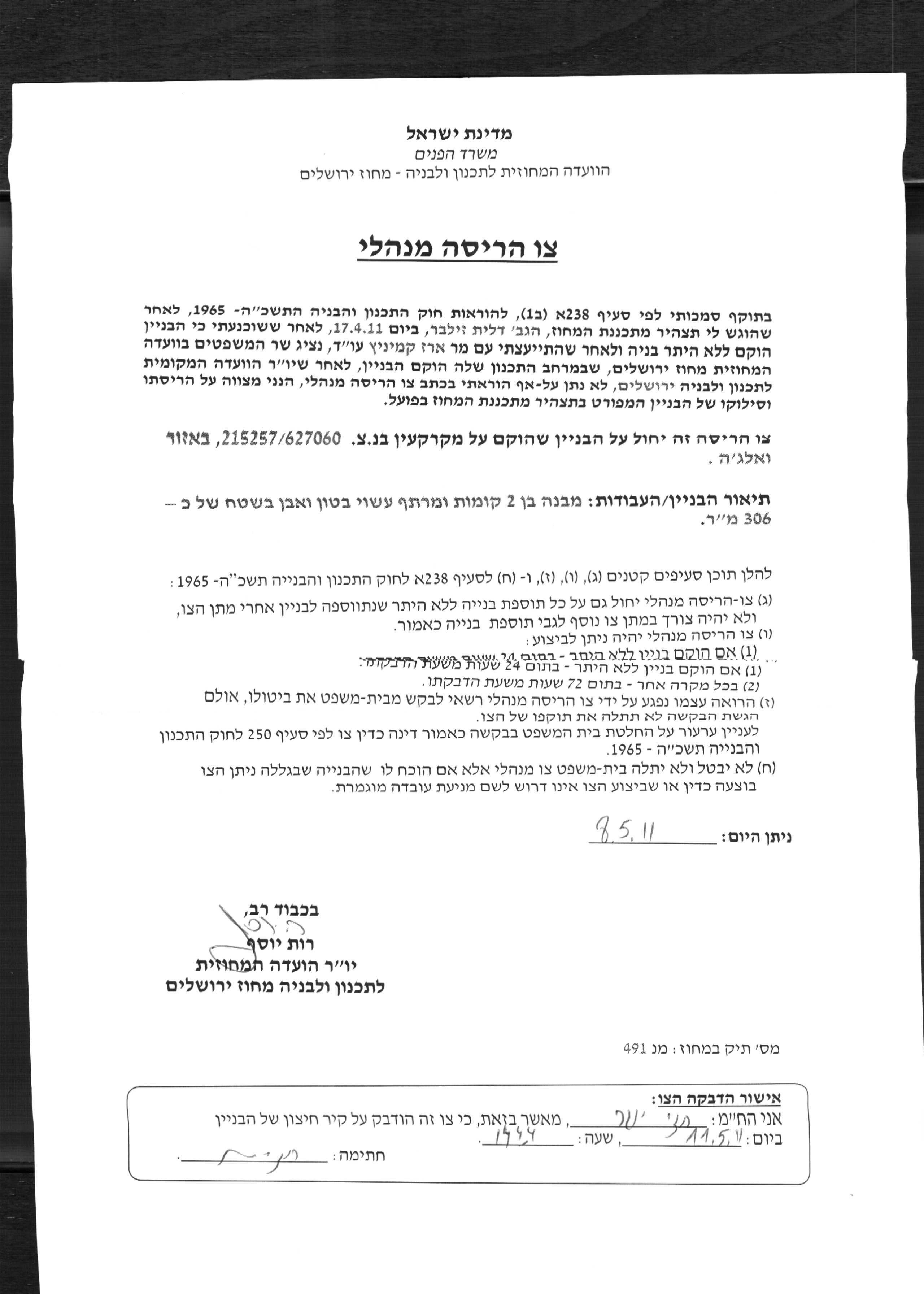
Photocopy of one of the demolition orders

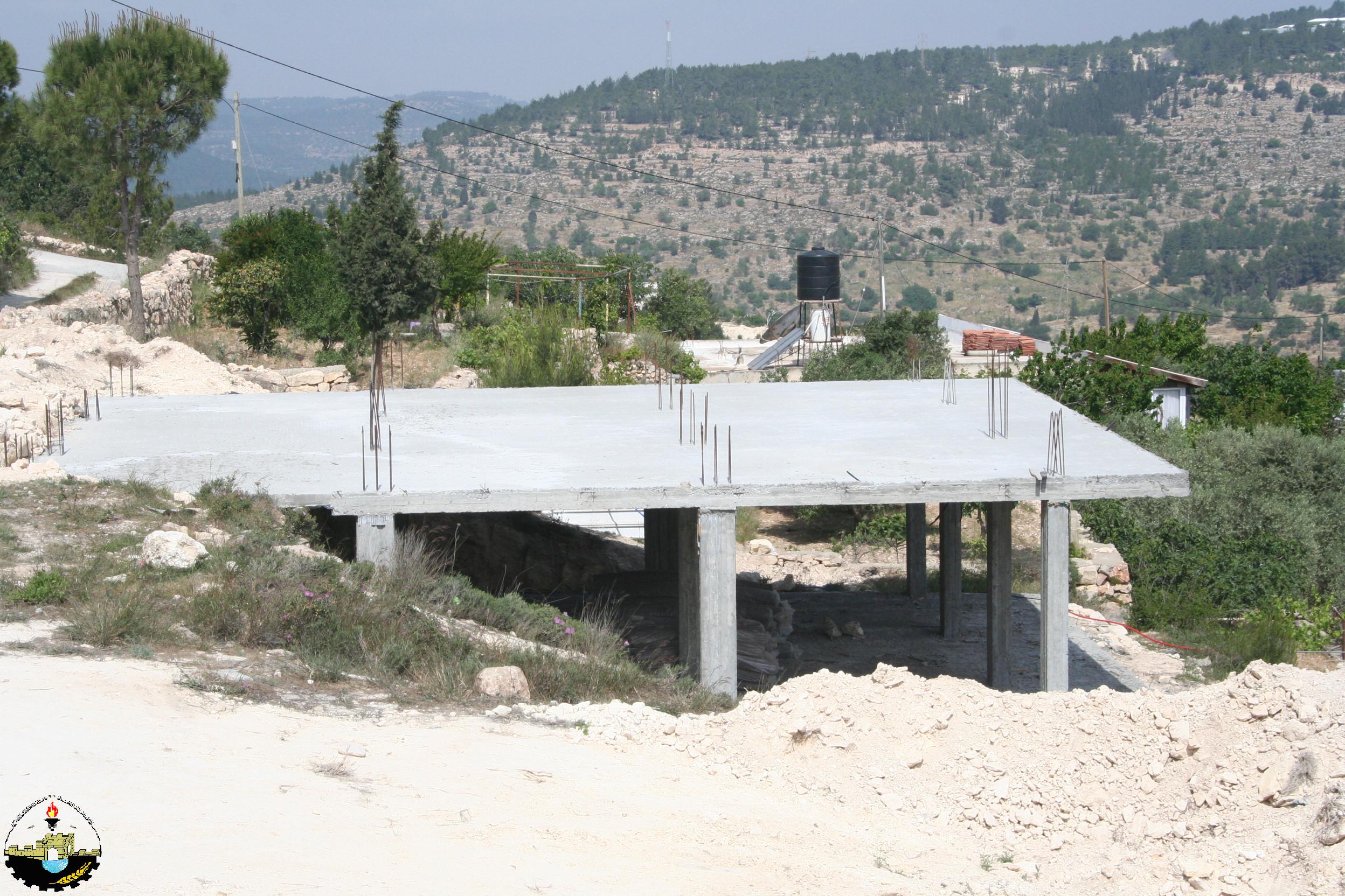
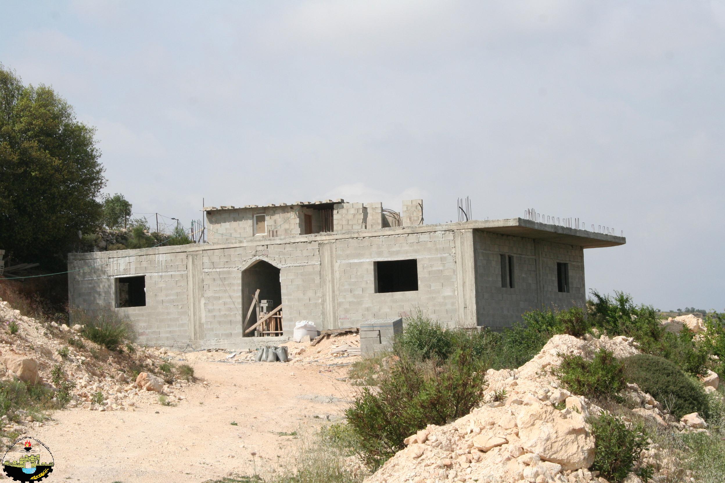
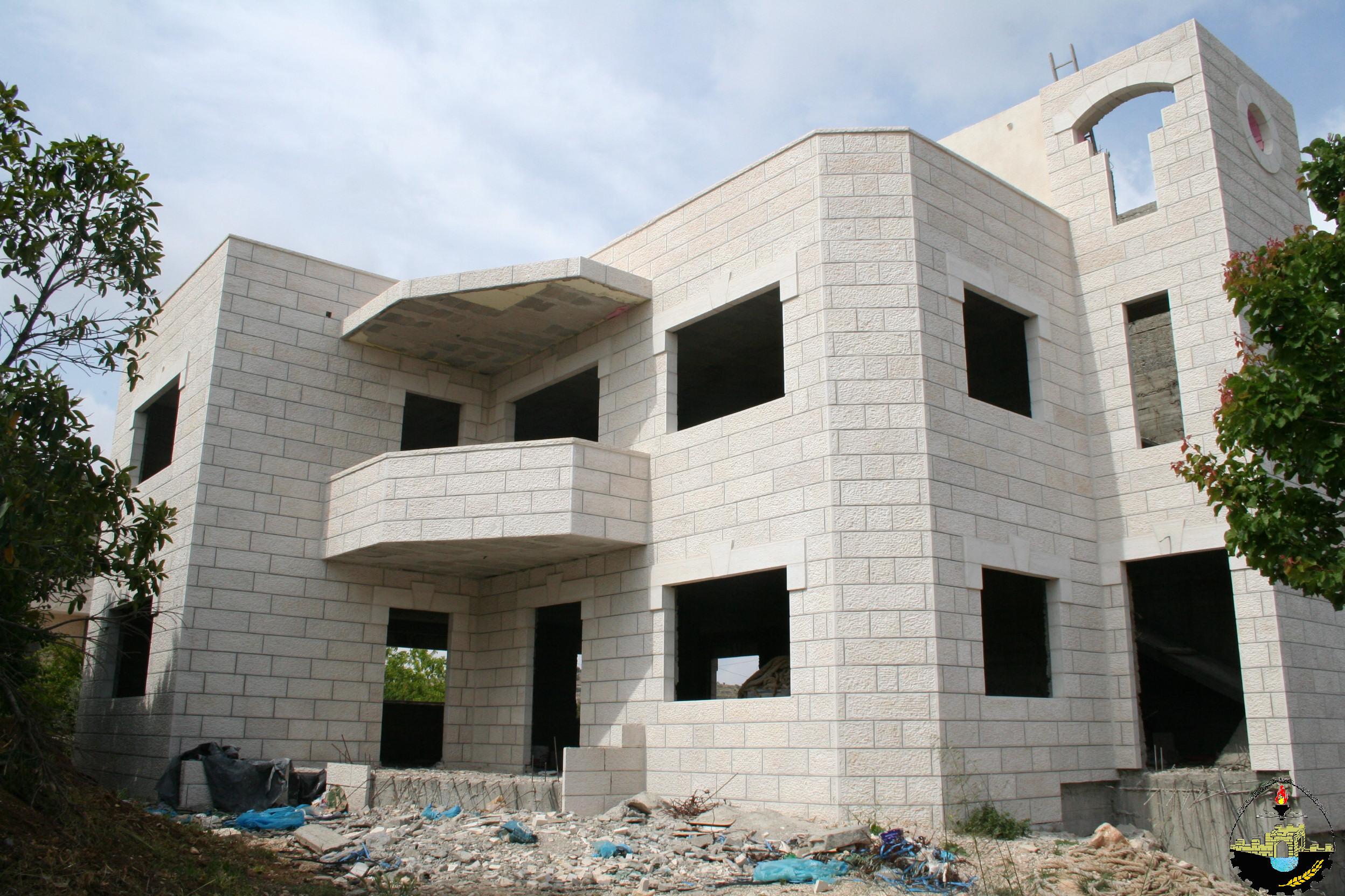
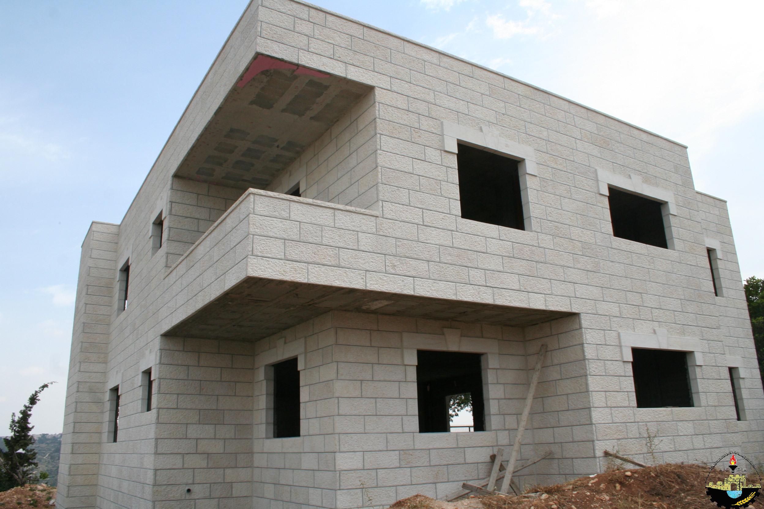


Photos of the Threatened Houses in Al Walajeh Town
Al Walajeh ………Location & Population
Walajeh Village is located 8.5 km southwest of Jerusalem city, and about 4 kilometers northwest of Bethlehem city. It has a population of 2,130 (PCBS 2010) and is bordered by Battir and Husan villages from the southwest, by Sharafat village and Gilo settlement (established in 1971) from the east and by Har Gilo settlement (established in 1972) from the southeast. Before the 1948 war, the village spread over an area of 17.8 km2 and its boundary spread westwards beyond the Armistice Line of 1949 (Green Line). After the 1948 the village lost 75% of its lands and came to spread over a total land of 4.4 km2.
In 1967 after the Israeli occupation of the West Bank and the Gaza Strip, the Israeli government unilaterally expanded Jerusalem Municipal boundary from 6.5 km² to 71 km² to include lands from nearby villages, these lands where then annexed to the state of Israel. Part of Al-Walajeh village -Ein-Juwaiza neighborhood- an area of 2.095 km2 –almost 48% of the remaining area-was included within this annexed land.
Al Walajeh Lands’ Classification
According to the Oslo IIInterim Agreement of 1995 which was signed between Israel and the PLO (Palestinian Liberation Organization) on September 24, 1995, Al Walajeh town lands as well as the rest of the Palestinian Territory was divided into areas A, B and C. See the table below:
|
Section 1
|
Areas Definition according to Oslo II Interim Agreement of 1995
|
|
|
Area A
|
the Palestinian Authority have complete autonomy over administrative and security issues;
|
|
|
Area B
|
the Palestinians have only civil responsibilities
|
|
|
Area C
|
Israel has full control over the area which constitutes 61% of the total West Bank area
|
|
|
Section 2
|
Area- Dunums
|
% From the village Area
|
|
Area A
|
0
|
0
|
|
Area B
|
140
|
2.6
|
|
Area C
|
4289
|
97.4
|
|
Total
|
4403
|
100
|
The impracticality of attaining a building license (permit) is another story, as Palestinians must meet a list of demands set by the Israeli Civil Administration to prove ownership of the land where premises are to be constructed. However, the permits are frequently rejected, thus the Palestinian residents at such areas -C- have no choice but to build without the authorization, which happen frequently by the Palestinians who are compelled to take such action to deal with the population growth and other necessities to their daily lives.
The Segregation Wall Plan in Al-Walajeh
According to the updated Wall plan of April 30, 2006, the Wall will place Al Walajeh town in an isolated enclave, sealed off from all directions, east, west, north and south and from the neighboring Palestinian communities; Battier, Hussan, Beit Jala and from Bethlehem city center.
The Wall, according to the map, was shifted northwards to include the neighborhood of ‘Ein Al Juwaiza on the Palestinian side of the Wall, but sealed off the town completely from its southern part with a 2.5 km long Wall that will run alongside bypass road number 436, and will be protected from both sides with barbed wires and ditches (ranging between 80 and 100 meters wide).The road protection will cause the isolation of an additional 1100 dunums of lands from Al Walajeh town, where these lands will fall south of the Wall and will be inaccessible to the Palestinian residents.
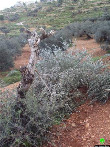
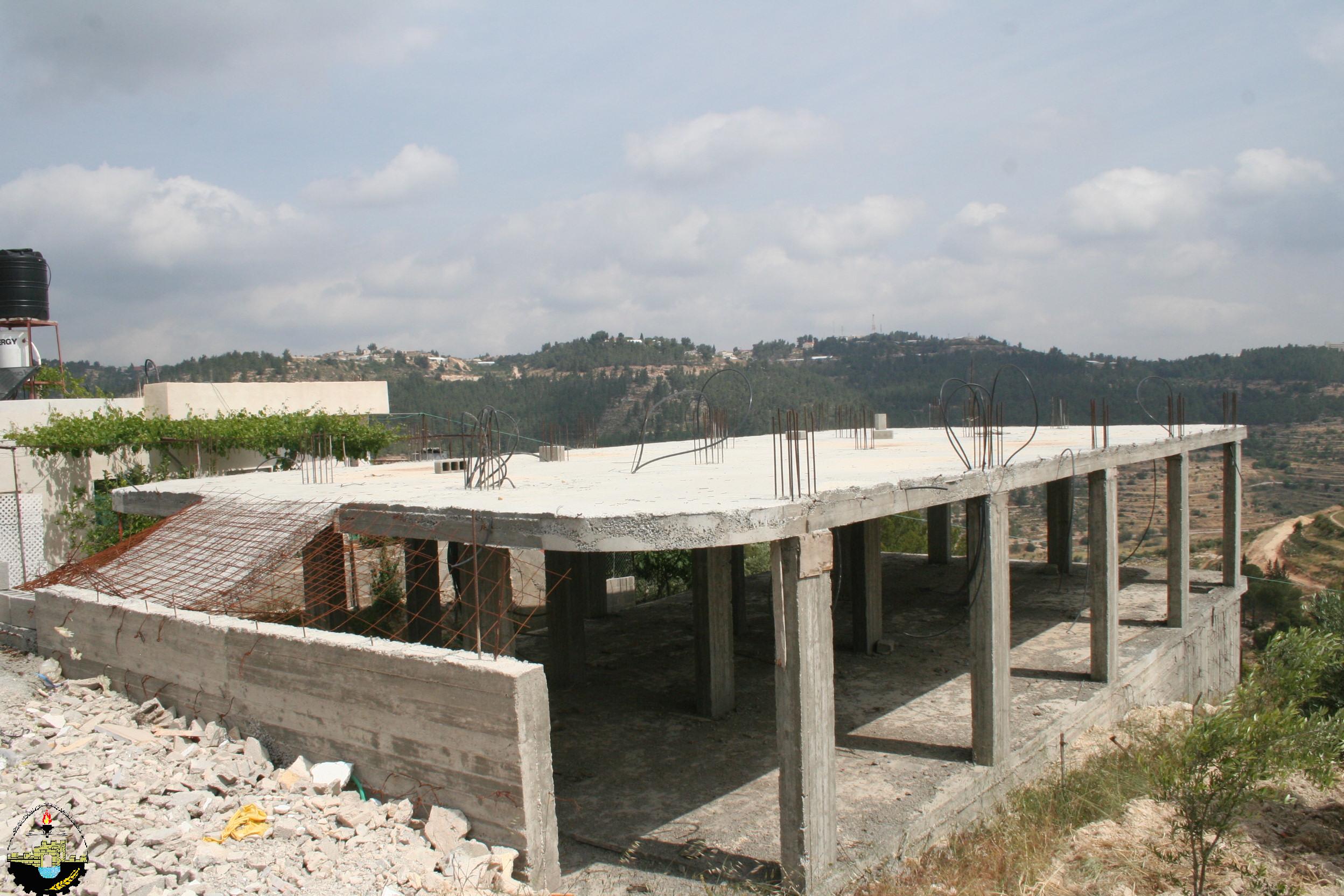
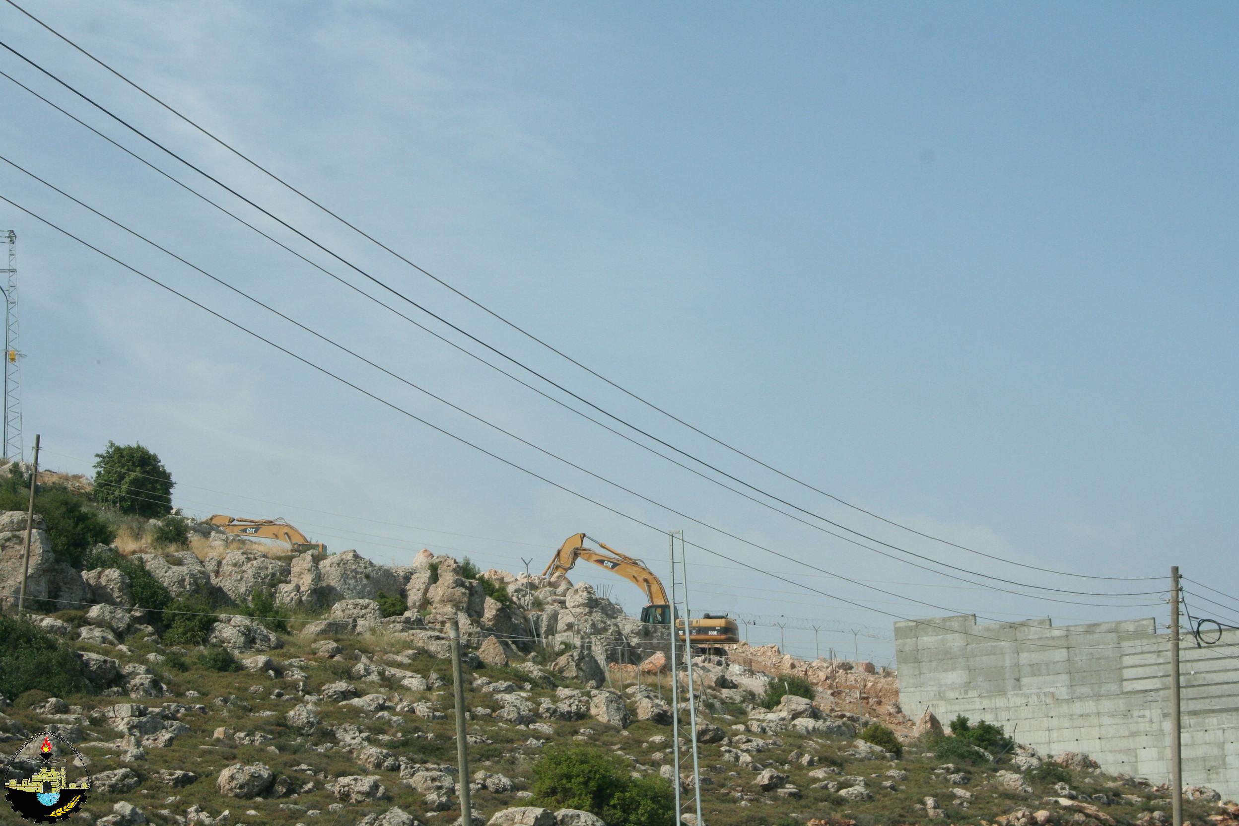
In Total, the Israeli segregation Wall plan will extend for 7.2 km on the lands of Al Walajeh, of which 3.5 km will be barbed wires. The Wall will isolate a total sum of 1980 dunums of the town’s lands that is 45 % of the total town area. Currently 0.5 km of concrete wall exists around the town, 1.2 km are under construction and 5.5 km are in planning phase. Below photos for the building of the Segregation Wall in Al Walajeh town captured by ARIJ field workers in May, 12, 2011:

Al Walajeh Terminal
On February 19, 2006, the Israeli Occupation Army issued a new military order (#25/06/T) to confiscate 39.8 dunums from Al-Walajeh town (parcel Block 3) and Beit Jala city (parcel Block 2). The order identified the reason for the confiscation to “military purposes,” which was later defined for the construction of a new Terminal in the area, (Har Gilo Terminal).
The terminal aims to control movement of Al-Walajeh residents between their town and the center of services in Bethlehem Governorate and beyond. The military order comes in parallel to the Israeli Segregation Wall plan, which is set to encircle Al-Walajeh. Residents of the town will only have this terminal to move in and out of their town. The terminal will be under the Israeli Army’s control, which virtually makes the residents prisoners in their own village. See the map below:
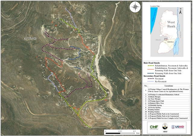
Map of Al Walajeh Terminal
Legal & International Status
Enclaved and strangulated by an Apartheid Wall form its three sides and by a bypass road –military controlled road- from the fourth side, Al Walajeh town transformed into a prison for its residents where the only access to/from the village will be through an Israeli controlled terminal.
Accordingly, the daily life of the residents of Al Walajeh town became an ever-ending suffering with a disastrous consequences imposed on them economically, socially and humanly, where they arbitrarily deprived from their legitimate rights to live and move freely in their own lands.
These unjustified, Illegal, colonial, practices conducted by the Israeli Occupation clearly violate the Universal Declaration of human rights, the International covenants as well as the rules of International Humanitarian Law.
-
Article 2 in the Universal Declaration of Human Rights reads that: ‘Everyone is entitled to all the rights and freedoms set forth in this Declaration, without distinction of any kind, such as race, color, sex, language, religion, political or other opinion, national or social origin, property, birth or other status. Furthermore, no distinction shall be made on the basis of the political, jurisdictional or international status of the country or territory to which a person belongs, whether it is independent, trust, non-self-governing or under any other limitation of sovereignty.’
-
Article 3 states that ‘everyone has the right to life, liberty and security of person’.
-
Article 13 states also that ‘(1) Everyone has the right to freedom of movement and residence within the borders of each state.’
-
Article 25 states that ‘(1) Everyone has the right to a standard of living adequate for the health and well-being of himself and of his family, including food, clothing, housing and medical care and necessary social services, and the right to security in the event of unemployment, sickness, disability, widowhood, old age or other lack of livelihood in circumstances beyond his control.’
In addition, the Israeli practices violate:
-
Hague Convention IV (18 October 1907): Convention Respecting the Laws and Customs of War on Land: Article (23): ‘To destroy or seize the enemy’s property, unless such destruction or seizure be imperatively demanded by the necessities of war;’
-
Convention (IV) relative to the Protection of Civilian Persons in Time of War. Geneva, 12 August 1949, Article 53: Any destruction by the Occupying Power of real or personal property belonging individually or collectively to private persons, or to the State, or to other public authorities, or to social or cooperative organizations, is prohibited, except where such destruction is rendered necessary by military operations.
Prepared by: