Violation: The demolition of 14 water cistern
Affected: The clans of Al Saraya’a, Al Hathalin, Al Ka’abna, Tibna and Al Tu’eimat.
Date: December 15th, 2010.
Details:
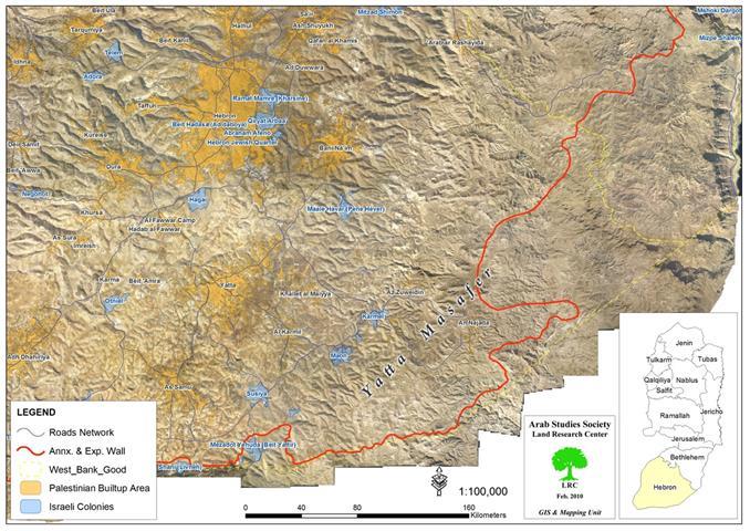
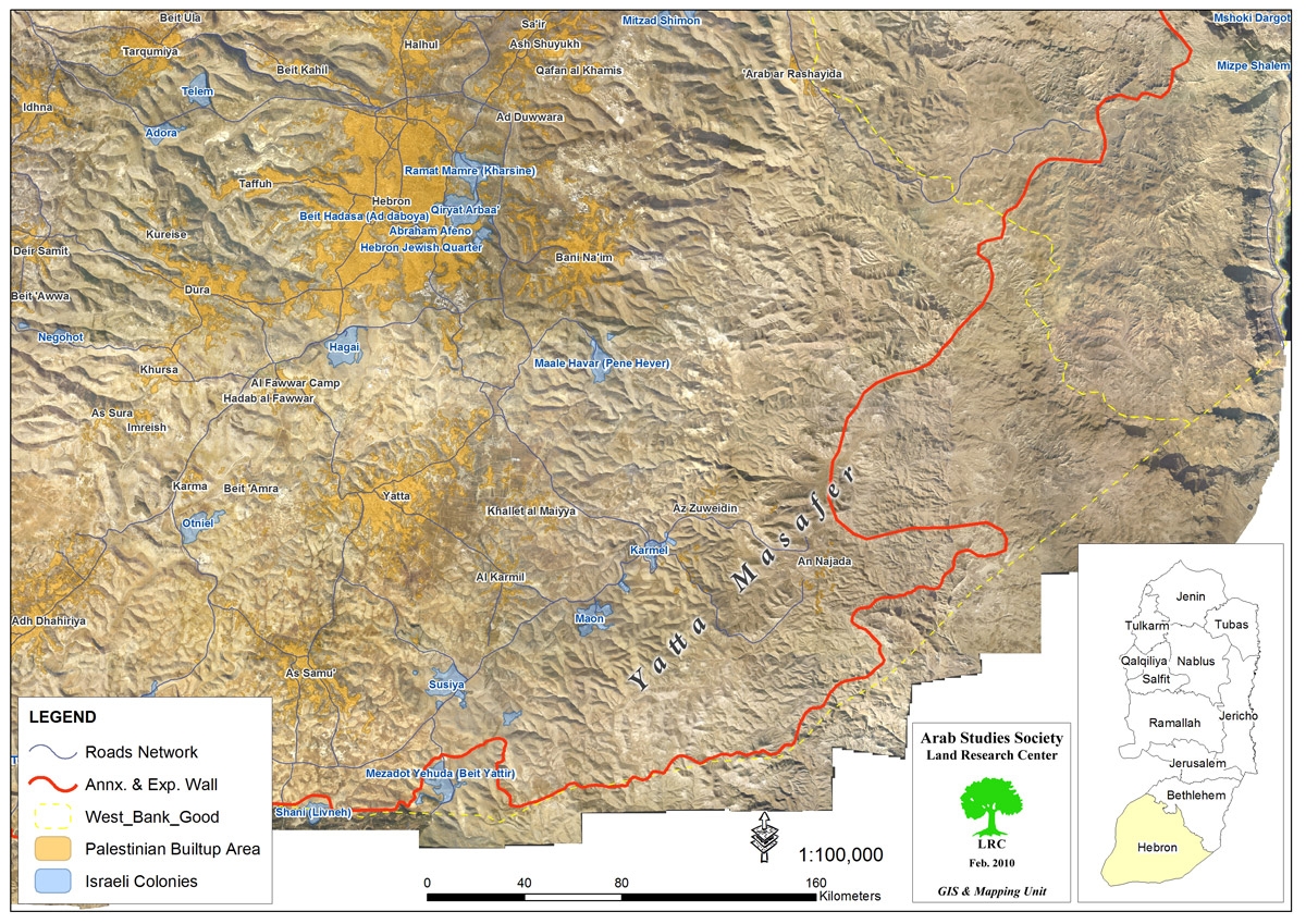
Israeli occupation forces demolished on the 15th of December, 2010, in the area of Umm Al Daraj and Khashm Al Daraj in Massafer Yatta 14 water cisterns. The area is located in the southern parts of the Governorate of Hebron. According to the residents of the area, Israeli occupation forces were accompanied by military bulldozers during the large-scale demolition operation which affected a total of 14 water cisterns. The occupation forces have also ploughed lands and water channels located in the vicinity of the targeted cisterns.

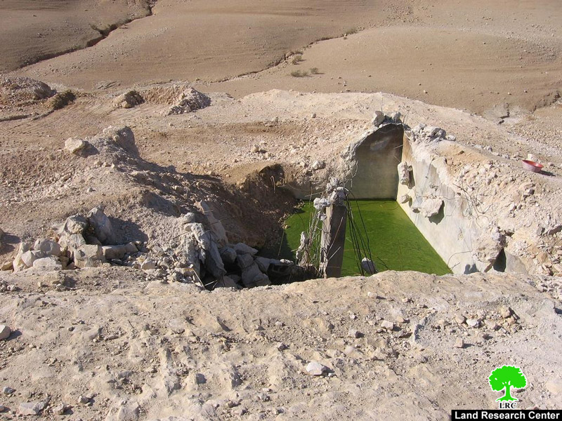
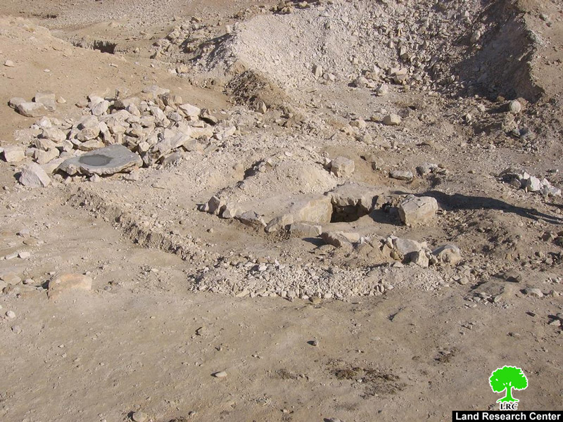
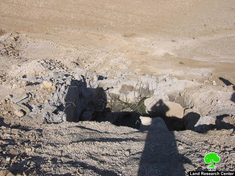
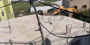
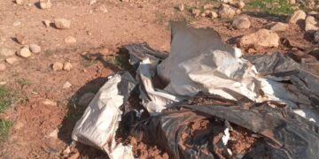
Pic.1-4: Pictures of some destroyed cisterns.
The Palestinian residents of the affected area depend on collecting water in these cisterns as to meet their drinking needs as well as those of their sheep and herds which can reach as high as 5,000 sheep. The demolition has severely affected the ability of the population to cope with water shortage especially during this year of unprecedented drought.
The residents have also indicated that the occupation forces did not deliver to them any demolition orders vis-à-vis the targeted cisterns. Some of these cisterns are more than 70 years old which predated the establishment of Israel. Other cisterns, according to the residents, were built during the years of the 1980’s and 1990’s. The average capacity of the destroyed cisterns is between 200 and 450 m3.
The following table lists the owners of the destroyed cisterns. It has to be emphasized, though, that most of the population of the area use these cisterns in coordination with the owners.
|
No.
|
Name
|
Area
|
|
1
|
Suleiman Saleem Al Saraya’a
|
Khashm Al Daraj
|
|
2
|
Khalil mohammad Al Saraya’a
|
Khashm Al Daraj
|
|
3
|
Ei’liyyan Ahmad Al Hathalin
|
Khashm Al Daraj
|
|
4
|
Marzooq Khalil Al Hathalin
|
Khashm Al Daraj
|
|
5
|
Salem Khalil Al Hathalin
|
Khashm Al Daraj
|
|
6
|
Abdullah Ahmad Tiban
|
Khashm Al Daraj
|
|
7
|
Mostafa Salem Tibna
|
Khashm Al Daraj
|
|
8
|
Ramadan Suleiman Ka’abneh
|
Umm Al Daraj
|
|
9
|
Suleiman Ramadan Ka’abneh
|
Umm Al Daraj
|
|
10
|
Mohammad Yousef Al Tu’eimat
|
Umm Al Daraj
|
|
11
|
Khalil Yousef Al Tu’eimat
|
Umm Al Daraj
|
|
12
|
Nayef Ali Ka’abneh
|
Umm Al Daraj
|
|
13
|
Khalil Abdel Fattah Ka’abneh
|
Umm Al Daraj
|
|
14
|
Abdullah Abdel Fatthah Ka’abneh
|
Umm Al Daraj
|
The areas of Umm Al Daraj and Khashm Al Daraj have been a frequent target of Israeli demotion orders until the year 2008 when a Master Plan was issued for the residents of the area. On the Plan, Israeli occupation forces outlined the borders of these two communities and placed cement blocks after which building is prohibited.
The blocks have the phrase “Firing Area” written on them as it prohibits entry into the said area. Yet, despite that, there are about 15 structures and houses that are currently outside of the boundaries of the Master Plan. The owners of these structures live under the constant threat that their property will be demolished leading to leaving more than 100 Palestinians homeless.
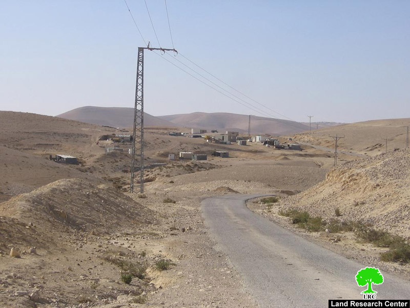
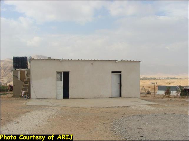
Pic.5: Part of the threatened neighborhood located beyond the blocks.

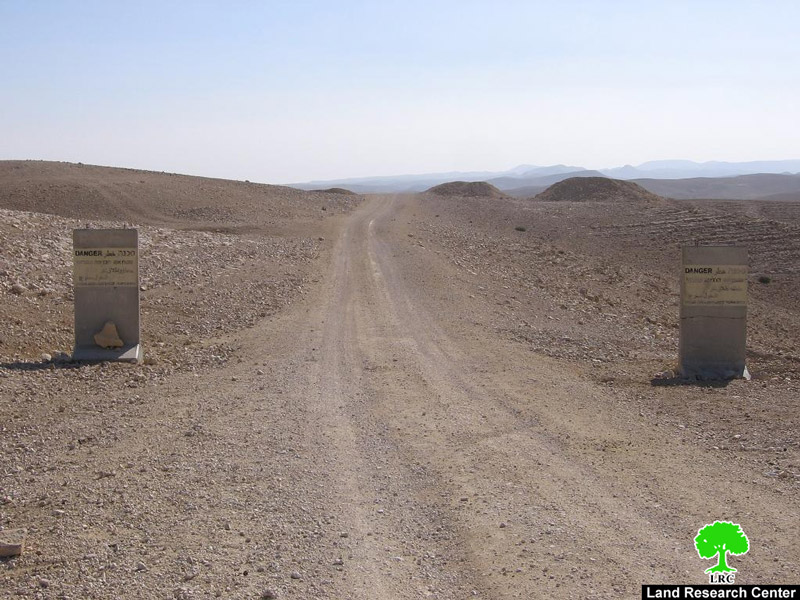
Pic.6+7: The cement blocks placed by occupation forces east of Umm Al Daraj.
According to Mr. Ouda Al Najada, the Master Plan designated by occupation forces covers a mere one-third of the actual area of the community. More than two-thirds (thousands of dunums) were overtaken by occupation forces to be used as a military training area. Also, occupation forces have worked on building a road in the area for the purpose of building the Racist Isolation Wall. Yet, work on the road and the Wall was suspended about two years ago.
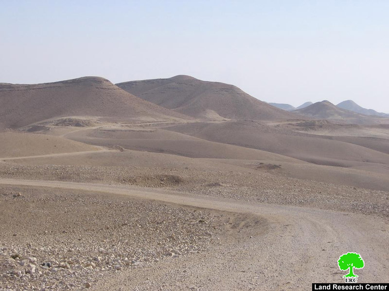
Pic.8: The road leading to the supposed location of the Racist Wall.
Prepared by
The Land Research Center
LRC
The Land Research Center
LRC