• About The Project
  • Palestine in Century
  • Selected Maps
  • Glossary
  • About ARIJ
  • About LRC
  • By Year
    • Case Studies By Year
    • Daily Report By Year
Thursday, April 30, 2026
POICA
No Result
View All Result
  • Home
  • Settlements
    • New Israeli Settlements
    • Settlement Expansion
  • Israeli Violations
    • Agriculture
    • Confiscation
    • Demolition
    • Environment
    • Eviction of Palestinians
    • Settlers Attacks
  • Bypass Roads
  • Israeli Plans
  • Segregation
    • Checkpoints
    • Closure
    • Separation Plans
  • Military Orders
  • Reports
    • Daily Report
    • Monthly Report
    • Quarterly Report
No Result
View All Result
POICA
No Result
View All Result

The Declaration of 130 Dunums of Palestinian Lands in the Village of Ifqiqis in Hebron as “State Land” by Israeli Occupation Forces

December 23, 2010
in Military Orders
Violation: An Israeli military order calling for the confiscation of 130 dunums to become “State Lands”
Location: The village of Ifqiqis in the town of Dura – Hebron Governorate.
Affected: Members of the clans of Al Awwawdeh and Al Natsheh.
 
Details:
Israeli occupation forces issued a military order calling for the evacuation of agricultural lands in the area of Khallet Jaber, south of the village of Ifqiqis which is located south of the town of Dura in Hebron Governorate.
 

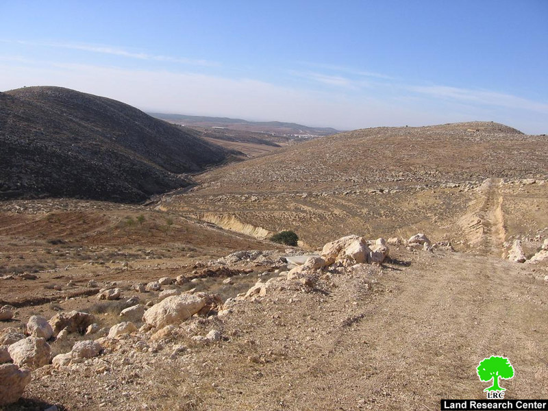
Photo 1: Khallet Jaber in the village of Ifqiqis
 
Mr. Jamal Jaber Al Awwawdeh, one of the affected land owners, indicated that he found the Order along with the associated map in his land. The Order called for the removal of the “violation” as the lands are considered to be “State Land.” The “violations” include, according to the Order, walls and agricultural roads established in the land by Mr. Awwawdeh. According to Mr. Awwawdeh, the Order targeted around 130 dunums owned by himself along with Mr. Taha Ali Al Awwawdeh and Mr. Ishraf Sa’eed Al Natsheh. The land has two water cisterns with a combined capacity of 70 m3 built in the year 2008.
 
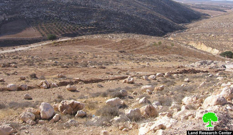
Photo 2: The land of Mr. Jamal Al Awwawdeh.
 
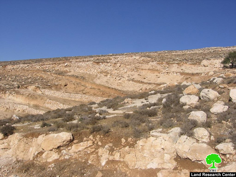
Photo 3: The lands of Mr. Ashraf Sa’eed Al Natsheh


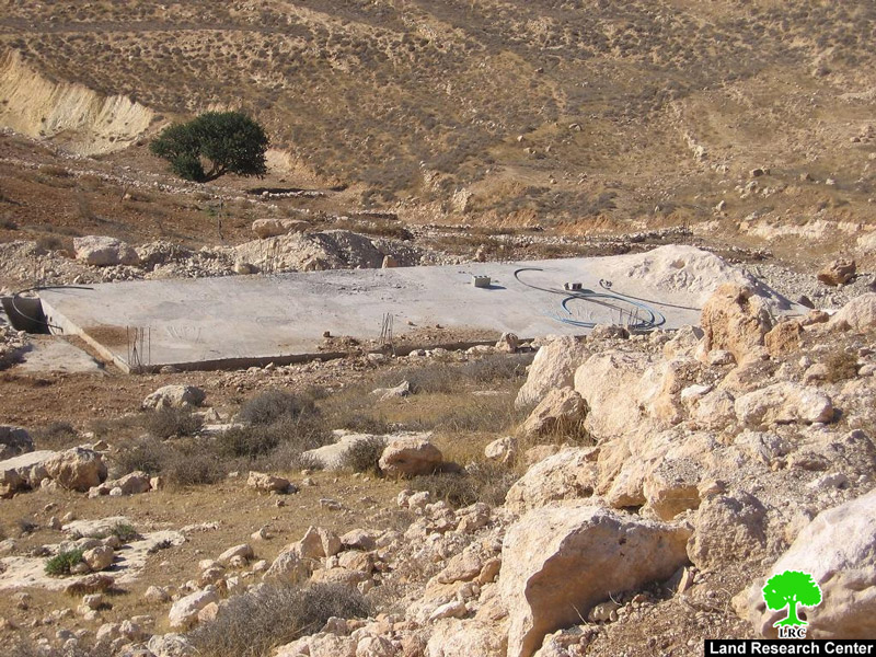
Photo 4: The water cistern of Mr. Jamal Al Awwawdeh.
 
 
With financing from the Union of Agricultural Work Committees (UAWC), the owners have started a land rehabilitation project in the said lands. Yet, Israeli occupation forces have harassed the owners throughout the rehabilitation process as the workers have been chased off the land a number of times. Also, heavy equipment used in the rehabilitation were confiscated; the bagger of Mr. Abdel Hameed Al Rajoub was confiscated by occupation forces in October 2009 while working in the lands of Mr. Al Natsheh. It is worth pointing out that the targeted lands are located near the Israeli colony of Negohot as some of its houses overlook the said lands.
 
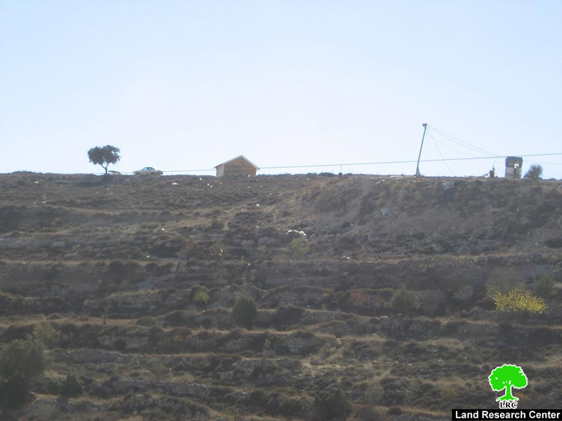
Photo 5: A colonial house from the colony of Negohot overlooking Khallet Jaber.
 
The Military Order is seen as part of a continuous campaign waged by occupation forces in the area including the lands of Marah Al Baqqar and the lands located close to the Beit Awwa junction. The campaign consists stopping any rehabilitation effort under the pretext that the targeted lands are “State Land.”
 
 
Prepared by
The Land Research Center
LRC


Recommended For You

مناطق نفوذ المستوطنات ودورها في إعادة تشكيل الجغرافيا الفلسطينية

by arij
April 23, 2026
0
مناطق نفوذ المستوطنات ودورها في إعادة تشكيل الجغرافيا الفلسطينية

أصدرت سلطات الاحتلال الإسرائيلي في العاشر من شهر نيسان 2026 الكراسة رقم (273)، وهي وثيقة تضم مجموعة من المناشير والأوامر والتعيينات الإسرائيلية المتعلقة بالجوانب الأمنية والعسكرية والإدارية، إضافة...

Read moreDetails

INFOGRAPHIC: Mapping Control – Israeli Militray Orders across the occupied West Bank – 2025

by arij
April 16, 2026
0

    Prepared by:   The Applied Research Institute – Jerusalem

Read moreDetails

سلطات الاحتلال الإسرائيلي تستهدف قرية الجيب بأمر عسكري جديد

by arij
March 17, 2026
0
سلطات الاحتلال الإسرائيلي تستهدف قرية الجيب بأمر عسكري جديد

نشر المسؤول عن الأملاك الحكومية وأملاك الغائبين في الإدارة المدنية الإسرائيلية في الحادي عشر من شهر اذار من العام 2026 اعلاننا مفاده نية ما يسمى " المسؤول عن...

Read moreDetails

سلطات الاحتلال الإسرائيلي تستخدم الأوامر العسكرية لتعمق المشروع الاستيطاني في الضفة الغربية المحتلة

by arij
February 26, 2026
0
سلطات الاحتلال الإسرائيلي تستخدم الأوامر العسكرية لتعمق المشروع الاستيطاني في الضفة الغربية المحتلة

تقديم منذ احتلال الضفة الغربية عام 1967، اعتمدت سلطات الاحتلال الإسرائيلي منهجية واسعة عبر استخدام الأوامر العسكرية كأداة "قانونية" لفرض الوقائع الجغرافية والديموغرافية على الأرض الفلسطينية. وأصبحت هذه...

Read moreDetails

بين مطرقة الأوامر العسكرية وسندان التقييد الجغرافي, أوامر عسكرية إسرائيلية جديدة تطال أكثر من 1000 دونم في طوباس

by arij
November 26, 2025
0
بين مطرقة الأوامر العسكرية وسندان التقييد الجغرافي, أوامر عسكرية إسرائيلية جديدة تطال أكثر من 1000 دونم في طوباس

في الحادي والعشرين من شهر تشرين الأول لعام 2025، تسلّم أهالي محافظة طوباس سلسلة من الأوامر العسكرية الإسرائيلية التي استهدفت مساحات واسعة من الأراضي الفلسطينية في المحافظة. وقد...

Read moreDetails
Next Post

إخطارات بوقف العمل والبناء في 6 منشآت سكنية وزراعية في قريتي الديرات والرفاعية شرق يطا

LATEST NEWS

مناطق نفوذ المستوطنات ودورها في إعادة تشكيل الجغرافيا الفلسطينية

مناطق نفوذ المستوطنات ودورها في إعادة تشكيل الجغرافيا الفلسطينية

by arij
April 23, 2026
0

........................................................

التمدد الاستيطاني الإسرائيلي في الضفة الغربية المحتلة وأثره في تقويض مقومات الدولة الفلسطينية

التمدد الاستيطاني الإسرائيلي في الضفة الغربية المحتلة وأثره في تقويض مقومات الدولة الفلسطينية

by arij
April 16, 2026
0

........................................................

INFOGRAPHIC: ISRAELI SETTLER VIOLENCE IN 2025

by arij
April 16, 2026
0

........................................................

العدالة المؤجلة ورأي بلا تنفيذ: من قرار المحكمة إلى واقع الضم

أدوات غير مباشرة للاستيطان الإسرائيلي في مناطق (أ) و(ب) لإعادة تشكيل الجغرافيا والسيطرة في الضفة الغربية   

by arij
April 16, 2026
0

........................................................

flag_yellow_lowEU-PfP-Logo

This website and its content were initiated in 1993 by the Applied Research Institute – Jerusalem (ARIJ) and the Land Research Center (LRC) with the support from the European Union up until 2023. Since then, the Applied Research Institute – Jerusalem (ARIJ) has taken over the continued development and maintenance of the website. The views expressed remain solely those of ARIJ) and do not necessarily reflect those of the European Union.

© 2026 Copyright | ARIJ | All Rights reserved.

No Result
View All Result
  • Home
  • Settlements
    • New Israeli Settlements
    • Settlement Expansion
  • Israeli Violations
    • Agriculture
    • Confiscation
    • Demolition
    • Environment
    • Eviction of Palestinians
    • Settlers Attacks
  • Bypass Roads
  • Israeli Plans
  • Segregation
    • Checkpoints
    • Closure
    • Separation Plans
  • Military Orders
  • Reports
    • Daily Report
    • Monthly Report
    • Quarterly Report

© 2026 Copyright | ARIJ | All Rights reserved.