
On the 16 of the last month the Israeli army announced that it began to remove 100 barriers in the West Bank in implementation of the decisions of the political level in Israel claiming that the target barriers are mainly earth mounds.
An Israeli military spokesperson said the removal of these barriers would take some days and the process has to be completed before Eid Al Fetter ( the feast of the slaughtering) in November.
The spokesperson claimed that this decision came as “a continuation of the Israeli government’s efforts to improve the economic situation for the Palestinians of the West Bank while maintaining the operational flexibility of the Israeli army and security apparatuses”.
He went on to say that “this decision is an implementation of the improvements that were initiated by Ehud Barrak, the minister of defense, based on security evaluations done by the commander of the central leadership of the Israeli army and by the chief of staff, Jabi Ashkenazi”.
Is this what has been done?
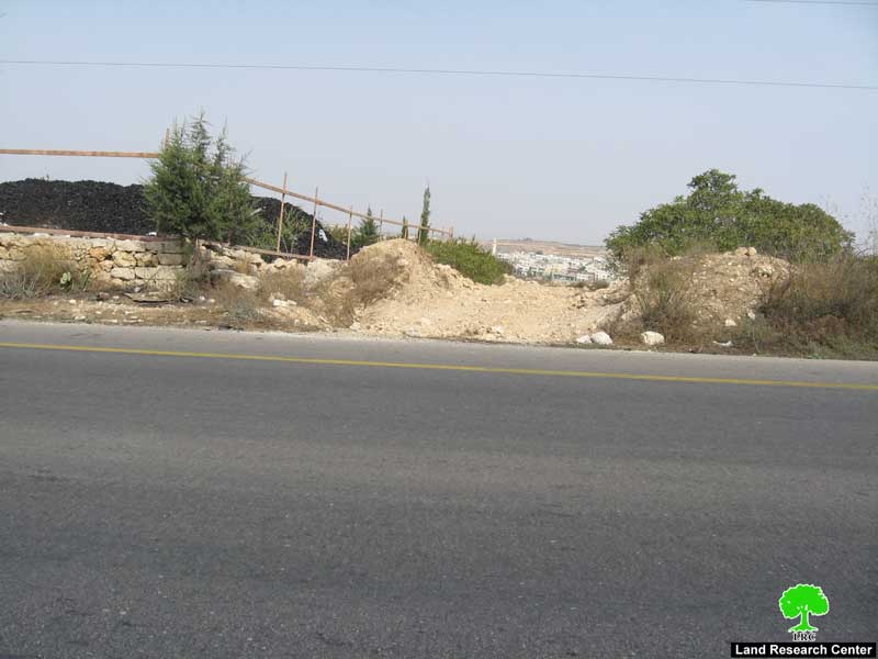
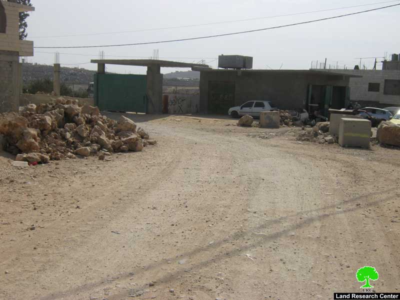
After having a number of field trips by LRC field researchers it was found that only 23 barriers as followed:
1. 19 in Hebron governorate along roads number 60 and 35;
2. 2 in Bethlehem governorate;
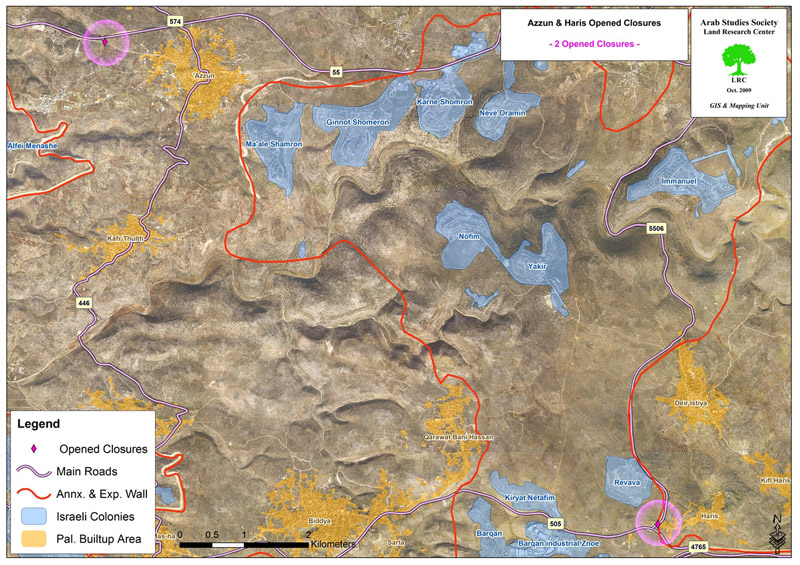
3. 1 in Haris village, Salfit;
4. 1 in Azzun as Shamaliya, Qalqiliya.
Out of this big fuss the Palestinians were allowed to use only seven roads at the time they are prohibited from using the most vital roads whose opening facilitates their movement to a great extent and whose number is about 637. Is this the Barrak’s improvements made after nine years of torment and closure?! No real impact has been noticed on the life of Palestinians as a result of the “generous Israeli improvements”.
One Palestinian affected by these barriers compared the Israeli “improvements” to a mountain’s birth to a mouse”, adding that “Barrak offers use only misleading media bubbles and thousands of bombs against Gaza”. All of the removed barriers, except seven, lead to arid land or to agricultural fields and they shouldn’t have been closed in the first place. The Israeli move is meaningless in compare to the Palestinians’ daily suffering at the Israeli checkpoints.
To support what are we saying, table one offers detailed information and photographs about the removed barriers:
Is it necessary to have these barriers?!
Table 1: Barriers recently removed in Hebron governorate on roads 35, 60 and 317
|
#
|
Location
|
Barrier type
|
Nearby colony
|
Areas connected by barrier
|
Notes
|
|
|
From
|
To
|
|||||
|
1
|
Khirbet Hasaka
|
Earth mound
|
None
|
Hasaka
|
Bir Mahjar
|
It is located three meters from Road No.35
|
|
2
|
Bir Nahjar-Farsh Al Hawa
|
Iron gate
|
None
|
Idhna
|
Farsh Al Hawa-Bir Mahjar
|
Connecting between Hebron and road No.35
|
|
3
|
Farsh Al Hawa
|
Earth mound
|
Before Telem colony’s Military camp
|
Arid land affiliated to Hebron
|
Road No. 35
|
 |
|
4
|
Farsh Al Hawa
|
Earth mound
|
Before Telem colony
|
Arid land affiliated to Hebron
|
Road No. 35
|
This barrier is only few meters from the one mentioned in point three
|
|
5
|
Farsh Al Hawa
|
Earth mound
|
Before Telem colony
|
Arid land affiliated to Hebron
|
Road No. 35
|
This barrier is only few meters from the one mentioned in point four
|
|
6
|
Tayba-Tarqumiya
|
Earth mound
|
Before Telem colony
|
Arid land affiliated to Tarqumiya
|
Road No. 35
|
Not used by Palestinians
|
|
7
|
Suba Junction
|
Earth mound
|
Telem and Idora colonies
|
Suba and the land to the north east of Idhna
|
Road No. 35
|
Next to Suba gate which is opened during daily work hours only
|
|
8
|
Zaghayer quarter
|
Earth mound
|
None
|
Zaghayer quarter
|
Road No. 35
|
A minor entrance that leads to some houses and barley used
|
|
9
|
Halhul bridge
|
Iron gate
|
Military watch tower
|
Halhul
|
Hebron
|
Vital road that can be re-closed at any time by soldiers manning the nearby watch tower
|
|
10
|
Ar Ramah quarter
|
Earth mound
|
None
|
Land to the north of the living quarter
|
Road No. 35
|
Dirt road linking between Ar Ramah quarter and Halhul and Road No. 35
|
|
11
|
Hahul-Wadi Qabun
|
Earth mound
|
None
|
Wadi Qabun quarter in Halhul
|
Road No. 35
|
Opposite Barrier mentioned in point ten separated by Road No. 35
|
|
12
|
Qayzon-Hebron
|
Earth mound
|
None
|
Qayzon agricultural land
|
Road No. 35
|
|
|
13
|
Bani Nai’m
|
Earth mound
|
Kiriyat Arba’
|
Wadi Al Juz Land west of Bani Na’im
|
Road No.60
|
An uneven dirt road connecting between arid land
|
|
14
|
Al Hijra
|
Earth mound
|
Hagai
|
Al Hijra south land
|
Road No.60
|
|
|
15
|
Wadi ash Shajna
|
Earth mound
|
None
|
Wadi ash Shajna land
|
Road No.60
|
A dirt road leading to arid land
|
|
16
|
Karma
|
Earth mound
|
Otne’il
|
Khirbet Basim
|
Road No.60
|
|
|
17
|
Wadi Qabun
|
Earth mound
|
None
|
Agricultural land
|
Road No.60
|
Leads to agricultural land
|
|
18
|
Wadi Qabun
|
Earth mound
|
None
|
Agricultural land
|
Road No.60
|
Leads to agricultural land
|
|
19
|
Ar Radeem land
|
Earth mound
|
Shema and nearby outpost
|
Ar Radeem land
|
Road 317
|
It connects a Radeem with as Samu’ town and is only used by one family and there is a nearby open road in better condition
|
Source: LRC field work on 17.10.2009

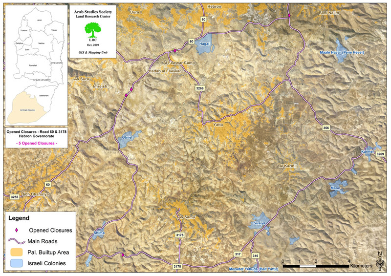
Table 2: Barriers recently removed in Bethlehem governorate
|
#
|
Location
|
Barrier type
|
Nearby colony
|
Areas connected by barrier
|
Notes
|
|
|
From
|
To
|
|||||
|
1
|
Artas
|
Earth mound
|
Efrata
|
Artas
|
Road No. 60
|
 |
|
2
|
Talita
|
Earth mound
|
None
|
Talita
|
Beti Jala
|
Once removed the street was paved
|
Source: LRC field work on 20.10.2009
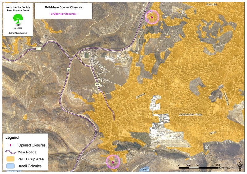
Table 3: Barriers recently removed in Salfit and Qalqiliya governorates
|
#
|
Location
|
Barrier type
|
Nearby colony
|
Areas connected by barrier
|
Notes
|
|
|
From
|
To
|
|||||
|
1
|
Haris
|
Earth mound
|
Revava
|
Haris
|
Road No. 505
|

|
|
2
|
Azzun ash Shamaliya
|
Earth mound
|
Ma’ale Shomron
|
Azzun ash Shamaliya
|
Road No. 55
|
|
Source: LRC field work on 20.10.2009
Map 4
Prepared by:
The Land Research Center
LRC
The Land Research Center
LRC


