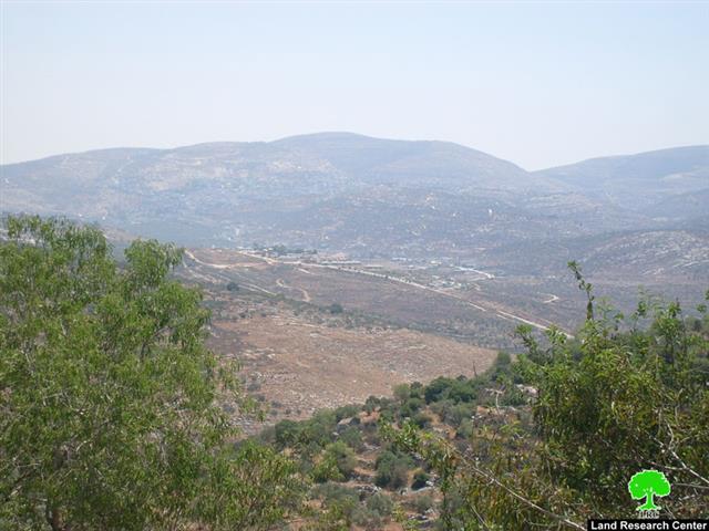

Photo 1: The expansion of the colony of Avni Hefets.
The Violation:
Israeli occupation bulldozers plowed large areas of Kufr Al Labad village south of the city of Tulkarem for the purpose of placing a number of colonial mobile caravans in the vicinity of the colony of Avni Hefets. The plowing, which took place in an area known as Wad Ras Al Masseid located 5 kilometer west of the village, also aims at establishing a road connecting between the colony and the newly-established outpost.
Land Research Center (LRC)’s field researcher visited the site of the violation. The area of the targeted lands is estimated to be 18 dunums that were used before 1987 (i.e. before the establishment of the colony) for planting wheat and as a grazing area. After the establishment of the colony it became extremely difficult to access the said lands due to frequent attacks by the colonists on Palestinian farmers and herders.
The new expansion is seen as part of the occupation’s policy and the right-wing government’s inclination to accelerate building in West Bank colonies (including East Jerusalem) under ridiculous pretexts (such as meeting the natural growth). A massive wave of construction in West Bank colonies and its associated outposts has been documented recently. The expansion took the form of placing a number of mobile caravans on Palestinian lands in addition to the development of the basic infrastructure of these colonies.
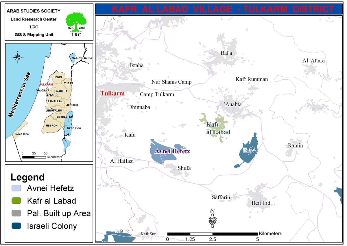
Kufr Al Labbad:
The village is located 9 kilometers east of the city of Tulkarem and 2 kilometers south of the town of Anabta. Its lands are surrounded by the villages and towns of Rameen, Anabta, Beit Lid, Safarein, Shofa and Thannaba.The total area of the village is 11,917 dunums of which 732 dunums are its build-up area. Currently, the village has a population of 4,074 Palestinians.. See Map1
The lands of the village are used to plant fruits and wheat in addition to olive trees. Around 25% of the overall area of the village is used for agricultural purposes.
Kufr Al Labbad; a Victim for Israeli Colonization:
a) The Colony of Avni Hefets:
The colony was established in 1987 atop lands confiscated by Israeli occupation forces from the villages of Kufr Al Labbad, Al Hafasi and Shofa. The built-up area of the colony is 1,397 dunums of which 355 dunums were confiscated from Kufr Al Labbad. The population of the colony is estimated to be 964.
The colony has expanded over a number of stages as it started with only 12 mobile caravans only to expand to include 110 houses. In the year 2000 the colony witnessed a major expansion spree despite the fact that only a small number of colonists live there. The over-looking position of the colony atop Tulkarem gave the colony a special value as it was used (like others in the West Bank) as a base from which Israeli bulldozers, tanks and jeeps raided Palestinian cities and villages.
It is worth mentioning that some lands of Kufr Al Labbad (called Deir Ibban site located south west of the village) were also confiscated for the purpose of establishing a telecommunication tower atop it.
b) The Colony of Einav:
The eastern parts of the village of Kufr Al Labbad (located close to the villages of Beir Lid and Rameen) were confiscated by Israeli occupation authorities in the early 1980’s. The lands were used in 1981 to establish the said colony. Its current area is 1566 dunums of which 696 dunums are its build-up area. The number of colonists reached 550 in the year 2006. About 20 dunums of Kufr Al Labbad lands were confiscated for the purpose of creating this colony.
:::::::::::____
[1] Kufr Al Labbad village council.
[2] LRC’s GIS Unit
[3] The village council
[4] LRC’s GIS Unit
[5] Foundation for Middle East Peace.
Prepared by:
The Land Research Center
LRC
The Land Research Center
LRC