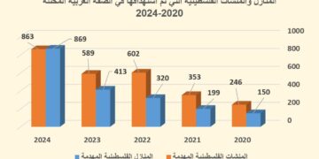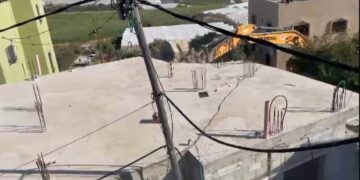
On April 20th, 2009, owners of 8 residential and agricultural buildings from Khirbet at Tawil ( Lifgim basin) Nablus district, received demolition orders issued by the so-called Israeli civil administration in the West Bank. The orders were issued under the pretext that the buildings were constructed in a closed military zone without licensing. The owners were given an ultimatum for only one day to evacuate their belongings prior to demolition. Actually, all of the notified buildings were demolished on April 22 and 25, 2009. The following table provides detailed information about these installations:
|
No. |
Name of owner |
Area M2 |
Type |
Attached related photo |
|
1 |
Jamil Mohammed Abdullah Bani Jaber |
130 |
Agricultural barrack |
|
|
2 |
Zayed Mahmud Qasem Bani Jaber |
90 |
Agricultural barrack |
|
|
3 |
Firas Sayel Rabie' Bani Jaber |
140 |
Residence |
|
|
4 |
Khalil Rabie' Bani Jaber |
200 |
Residence |
|
|
5 |
Abdullah Abdul Ghani Bani Jaber |
140 |
Agricultural barrack |
|
|
6 |
Allan Ibrahim Mohammed Miameh |
127 |
Residence |
|
|
7 |
Mohammed Ibrahim Mohammed Miameh |
140 |
Agricultural barrack |
|
|
8 |
Wasif Ibrahim Mohammed Miameh |
137 |
Agricultural barrack |
|
|
Total |
1104 |
|
|
|


Background to Khirbet at Tawil
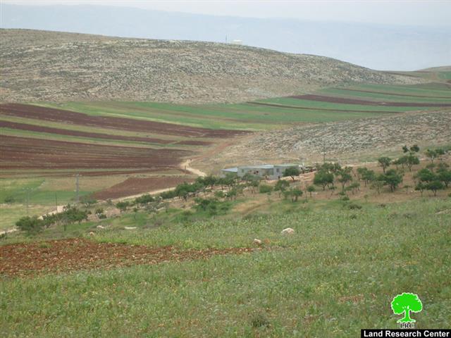
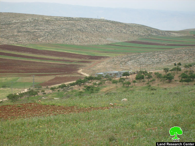
It is located one km to the east of 'Aqraba village and eight km to the west of Gittit (photo 4) colony in Jordan valley. Its total population is about 580 farmers' families who totally and solely depend on agriculture and animal rearing as main income. See Map 1

The people of Khirbet at Tawil have been living there since the beginning of the fifties of the last century due to the suitable climate, fertile soil and abundance of water and pastures for their cattle and cultivation. After the six day war of 1967 the Israeli army announced the area as a closed military zone inaccessible for Palestinians. Ever since, the Israeli occupation authorities have been chasing shepherds and imposing strict measures and heavy fines on 'violators'. On the other hand, the Israeli water carrier ( Mekharot) imposed many restrictions over the use of water by Palestinians in that particular area, including, to mention but a least, the prevention of the digging of wells and cisterns and the rehabilitation of any water surface springs. Meanwhile, the occupation authorities went ahead with their plans to build Israeli colonies in the area, especially agricultural colonies with a lot of incentives and encouragements on the part of the government, including:
1. Provision of 10 dunums of agricultural land for each farmer settler;
2. Provision of all the needed infrastructure;
3. Full tax exemption.
As a result, the following colonies were established:
|
No. |
Colony name |
Date of establishment |
Population by the end of 2007 |
Municipal area Dunum |
Built up area Dunum |
|
1 |
Gittit |
1973 |
214 |
1607 |
113 |
|
2 |
Ma'ale Efrayim |
1970 |
1377 |
4257 |
512 |
|
3 |
Itamar |
1984 |
750 |
6936 |
253 |
|
Total |
2341 |
12800 |
878 |
||
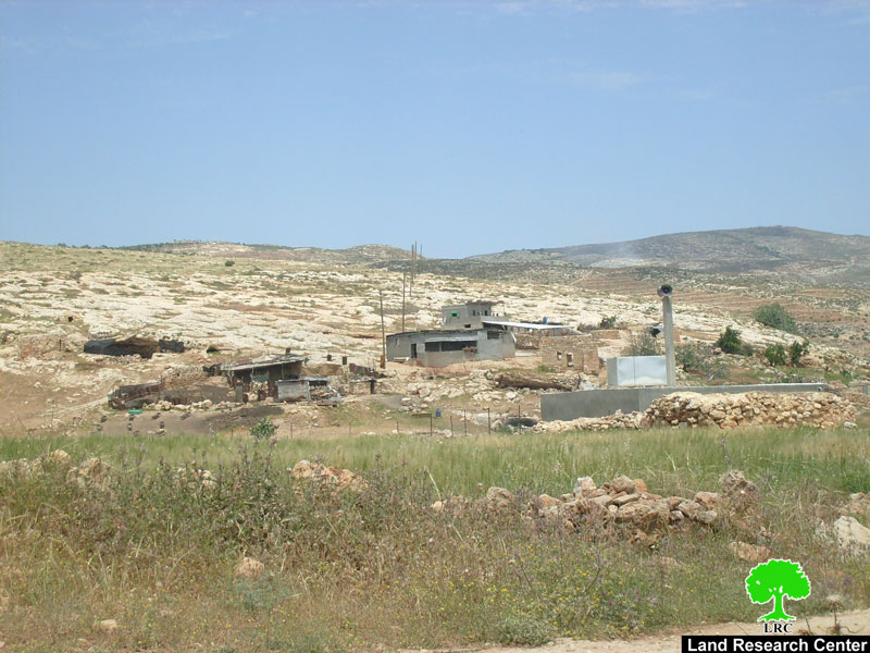
( Photos 4 + 5: two general views of Khirbet at Tawil )
It is worth mentioning that the above-mentioned colonies control about 8000 dunums out of 30000 the total land area of 'Aqraba village. The lost land was mainly used for the cultivation of the seasonal land crops such as cereals and vegetables.
Fear of population decreases
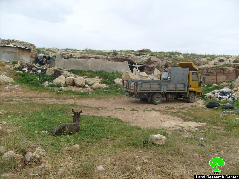
In case the Israeli occupation authorities continue with their repressive measures of house and barrack demolition, land confiscation, water deprivation and movement restriction in the area it is likely that the number of Khirbet at Tawil population decreases in the future. So far, 27 residential and agricultural buildings have been notified for demolition apart form those demolished.
On the other hand, the Israeli army continues to close the military checkpoint and all the other roads leading to the area as part of its policy of closure with the aim of forcing people out of the area.
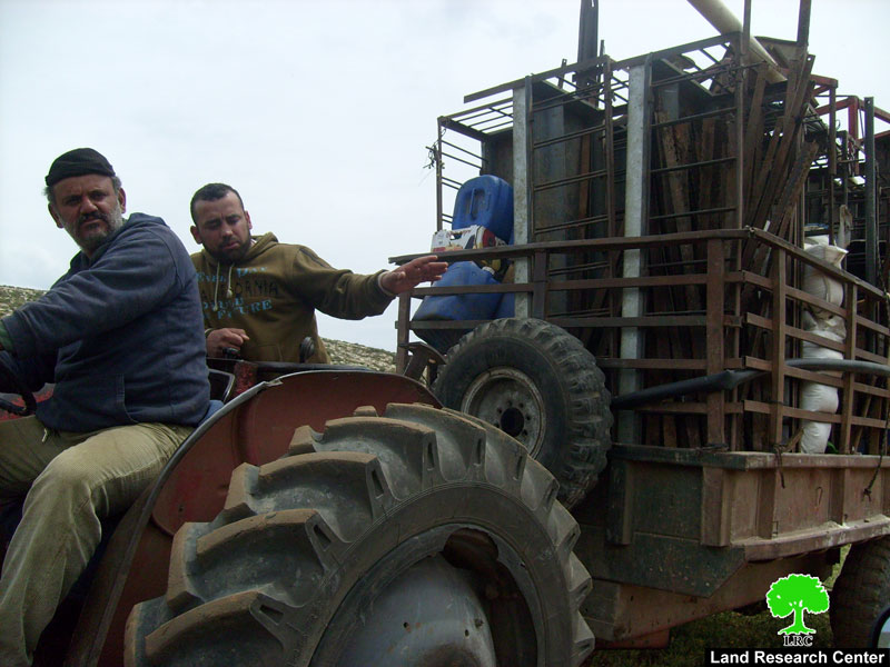
( Photo 6: tractors are the main transportation means for Khirbet at Tawil)
Related case study:
Prepared by:
The Land Research Center
LRC