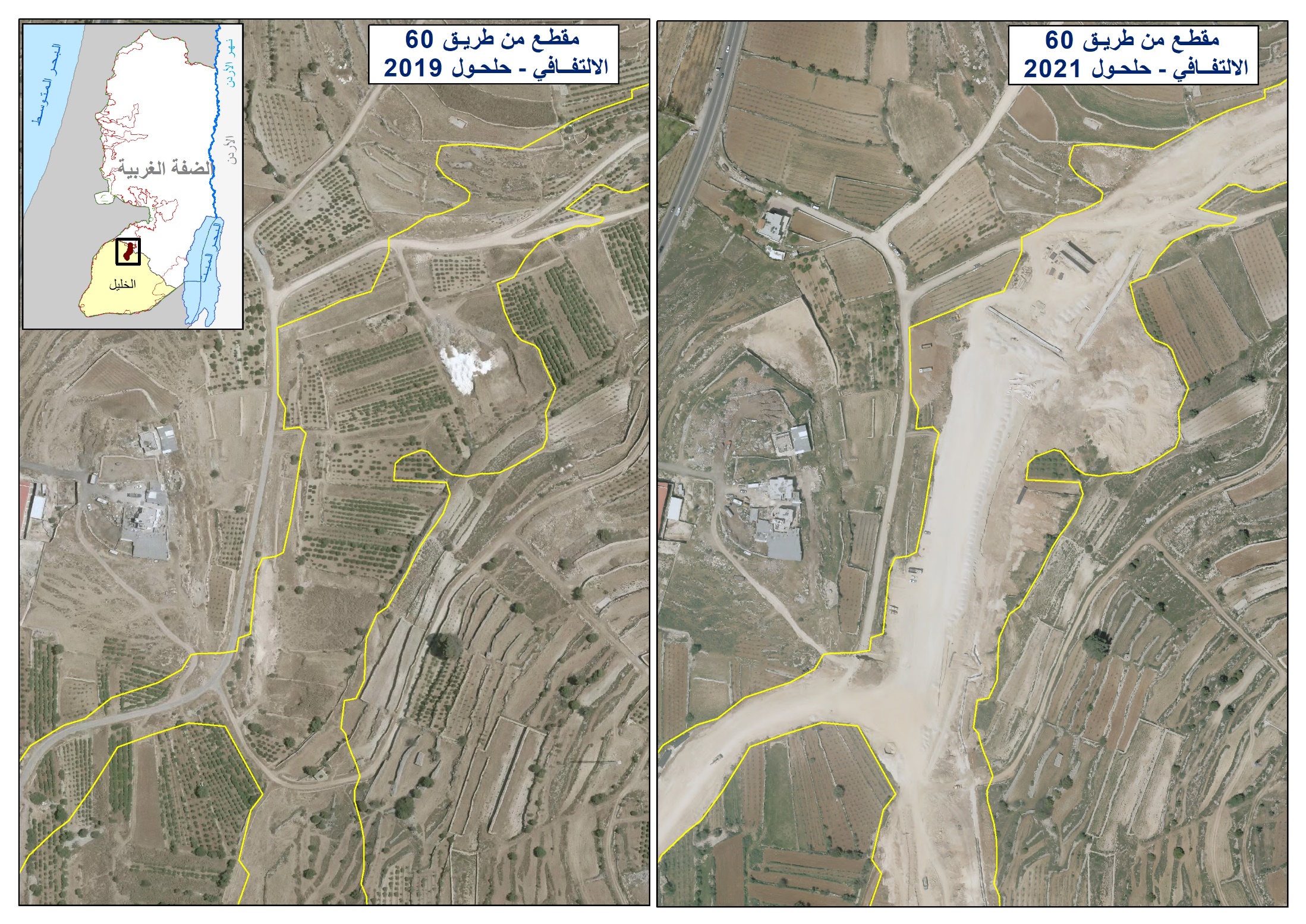
On the 14th of January, 2009 a group of colonists from the colony of Shilo used bulldozers to establish a 650-m road to connect between the colonies of Shilo and Eli. The road went through Palestinian lands planted with around 3,000 olive trees and is located around 500 meters away from the villages’ houses. Upon its completion, around 4,000 dunums of Qaruit lands will be isolated behind it to which Palestinians will not be able to reach.

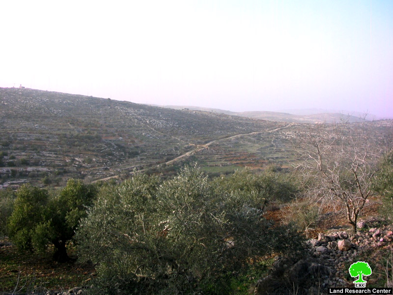
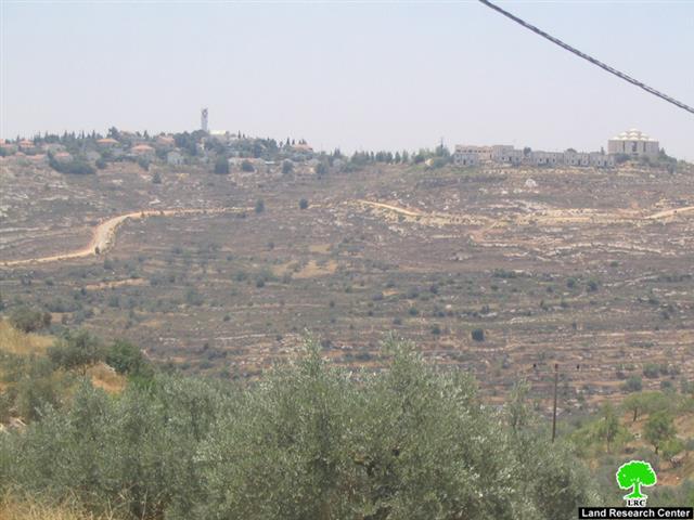
Photo 1 & Photo 2: Shilo colony
The people of Qaruit fear that the establishment of the road is a prelude for the expansion of the two colonies at the expense of the agricultural lands of the village especially that Shilo colonists have in the past carried out similar expansions. It is worth pointing out here that during the construction of the road Israeli occupation soldiers encircled the village and threw teargas at stone throwing Palestinians protesting the construction while other soldiers were busy providing protection to the bulldozers during its operation
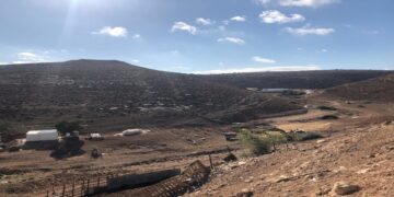
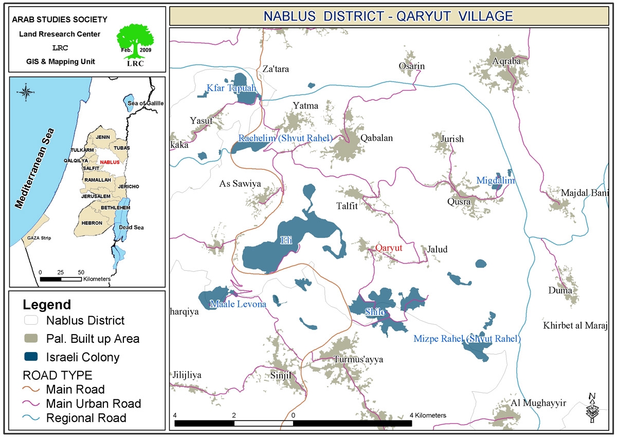
The village of Qaruit suffers from the presence of 3 colonies on its lands. The colonies are Rahil (located south east of the village), Eli (located south west of the village) and Shilo (located south of the village). The village used to be the most productive in Nablus, yet its decline started since the establishment of these colonies as early as 1977.
The Colony of Shilo: A Cancer Devouring Qaruit Lands
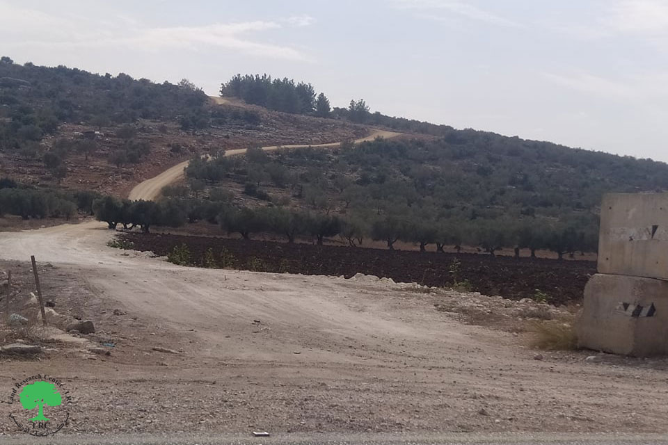
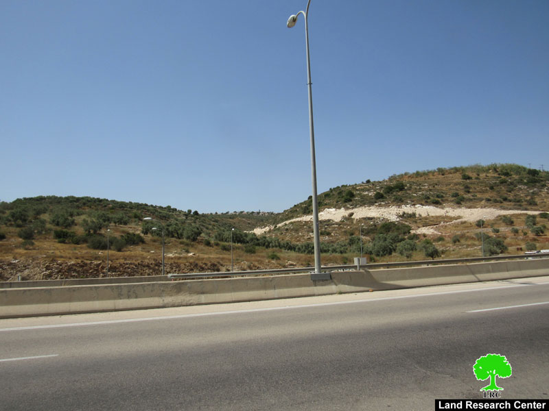
The colony was built atop a historical and archeological site south of the village of Qaruit called Khirbet Silon. Shilo colonists overtook the site which was known to be the most fertile in the village. The colonists were not satisfied with only controlling Silon; rather, they have extended their control to the locations of Al Marah, Ein Murra, Ras Mweis, Al Surrara in addition to Al Dufoof and other locations in the vicinity of the colony.
The colony is located atop lands of a number of hilltops overlooking the villages of Qaruit, As Sawiya and Al Laban. These hilltops include Jabal Al Rahawat, Jabal Al Sana’, Jabal Al Marah Al Gharbi in addition to Qala’at Al Hamra. The distribution of the colony over these hills formed a constant threat to the population of the village due to the violent nature of the colonists. Moreover, it caused financial loss as colonists prevented the access of land owners to their olive trees in the locations of Al Qalila, Marah Dar Abu Murra, Al Sana’, Al Khilla, Al Khawaneq, Al Sha’ab, Harayeq Al Shirk, Sahel Ein Murah in addition to Al Tiff.
The Colony of Shavot Rahil Separates Between Nablus and Ramallah Governorates:
The afore-mentioned colony is located south east of the village of Qaruit near a location known as Khirbet Sirra. Its colonists took control of the most fertile lands in the village which is a valley famous for its wheat, lentils, wheat and vegetable production. The controlled lands include the locations of Sahel Jaloud, Al Mubashir, Dira’a Kassab in addition to all the lands east of the village until it reaches the main road leading to Ramallah and the Jordan Valley. As such, the colony is strategically located on the line separating between the governorates of Ramallah and Nablus.
The Village of Qaruit:
The village is located 26 kilometers south east of the city of Nablus. It used to be connected to the main Nablus-Jerusalem Road via a 4.5 kilometer road. This road has been closed down by the Israeli occupation forces since the beginning of the current Intifada in 2000. The area of its lands is 7491 dunums of which 25% are controlled by the three nearby colonies. The village is surrounded by the Palestinian villages of Talfeet, Turmosayya, Jaloud and Allaban Al Sharqiya, Its 2007 population stood at 2,536.
Prepared by:
The Land Research Center
LRC