A) The Confiscation: Israeli occupation forces have issued a military order to confiscate 20 dunums owned by Mr. Mohammad Khalil Mahmoud Abu Qbeita located in the area of Lassefer south of the town of Yatta.
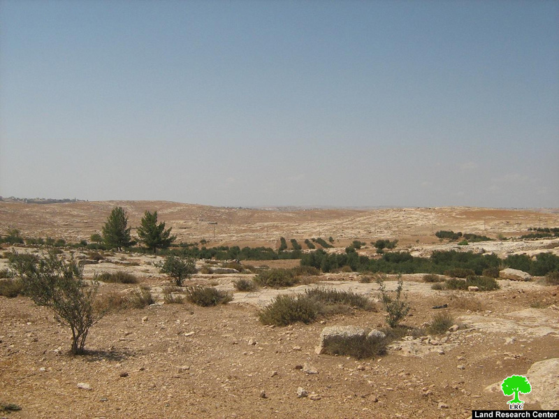
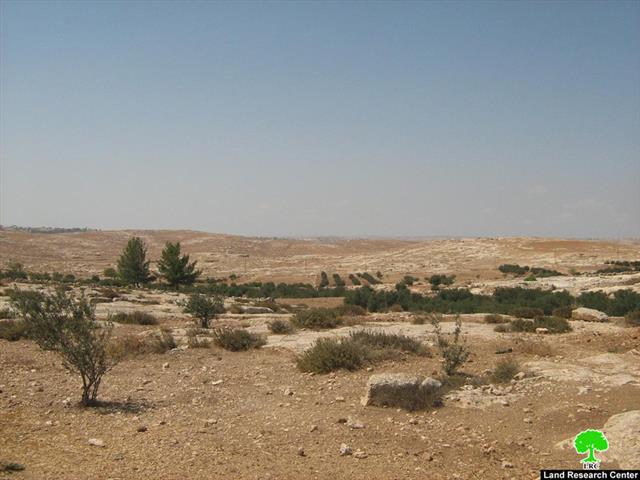
Photo 1: Olive trees in Al Nawaja'a lands inside the Closed Military Area.
The military order, titled “Land Confiscation Number T/05/08 Judea and Samaria”, indicated the confiscation of 21.846 dunums located in Parcel Number 1 (in the area of Arqoob Shalal and Wadi Al Khalil) and in Parcel Number 2 (in the khirbets of Imneizel, Al Nabi and Arqoob Bir Al Idd). The Order places the land under the total and direct authority of the occupation forces for the purpose of placing concrete blocks for “security reasons.”
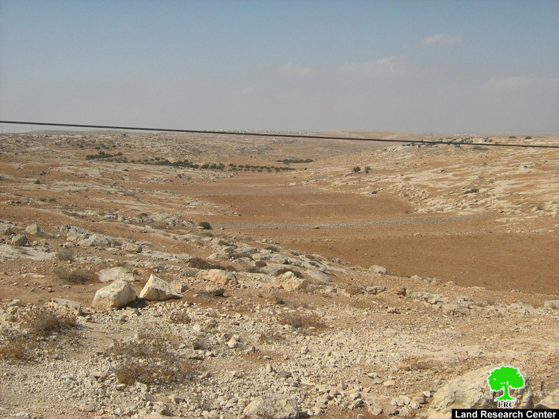
Photo 2: Lands that have been declared as Closed Military Area.

Photo 3: Closed lands in the vicinity of the colony of Suseya
Mr. Mohammad Khalil Abu Qbeita indicated that the so-called Israeli Area Commander, known as Captain Anwar, delivered the Order to him and informed him about the intention of the occupation forces. Mr. Abu Qbeita pointed out that the confiscated lands are filled with olive trees and vegetables. It also has a water cistern used for drinking and irrigation purposes.
In accordance with the military order, the occupation forces have brought the cement blocks and placed them in a way they prevented his access to his land isolated behind the blocks. Mr. Abu Qbeita continued by saying that Captain Anwar informed him that no structure can be placed in the confiscated lands and no building is allowed on it.
B) The Closed Area:
On November 1st, 2008 Israeli occupation forces informed the residents of the Khirbet of Susiya that hundreds of dunums of their lands were declared as “Closed Military Areas” and, as such, they are not allowed to access or to use it. According to the residents, Captain Haim of the so-called “Civil Administration” verbally notified them of the order and clarified for them the boundaries of the closed zone.
The area of the closed area is approximately 1,000 dunums of lands that were used for planting and grazing purpose. It also has a number of water cistern that are essential for meeting the drinking needs of the community that is currently facing a real water crisis due to the drought that hit the area in 2008.
The main goal of declaring the area as a closed area is to force the Palestinian residents of the khirbet to leave the area and, then, annex its lands. The Israeli occupation forces claimed that the purpose of this order is to “protect” the residents as the area will be used by these forces for military trainings. Yet, it is the clear that the area will be used as a buffer zone for the nearby Suseya colony especially if we took into consideration that that boundaries of the closed area are east of Road 317, the road branching from Road 317, the Israeli military camp and Shieb Wadi Al Rajeem west of the Khirbet; i.e. all of the lands surrounding the colony.
The land ownership of the closed area is divided among the clans of Al Nawaja’a, Al Hraini and Al Halleis according to the following classification:
1) Al Nawaja’a:
About 400 dunums belong to Al Nawaja’a clan are located within the Close Area. Around 250 olive trees more than 35 years old as well as a cistern with a capacity of 500 cubic meters lay within the Closed Area. Owners of the land include:
-
Mohammad Ahmad Nassaer Al Nawaja’a
-
Hammad Abdel Hamid Al Nawaja’a
-
Mohammad Jaber Al Nawaja’a
-
Adnan Shihda Al Nawaja’a
-
Omar Awad Al Nawaja’a
2) Al Hraini:
About 400 dunums belonging to Al Hraini clan is also located within the boundaries of the Closed Area. The lands are agricultural and are also used for grazing purposes. Two water cisterns are also located within Al Hraini confiscated lands. Israeli colonists from the nearby colony of Suseya planted in the past fig and kharooub trees on part of the land. They have been seen lately trying to lay down the basic infrastructure for additional colonial units in an effort to expand the colony. Owners of the confiscated lands include:
-
Talal Al Hraini
-
Khalil Mohammad Al Hraini
-
Mohammad Hamdan Al Hraini.
3) Al Hallies:
About 200 dunums of the confiscated lands belong to this clan. Israeli colonists have used the land in the past to plant fig trees and establish a grape orchard. They have also ploughed the land and took its soil to be used for their gardens. The area contains 4 water cisterns.
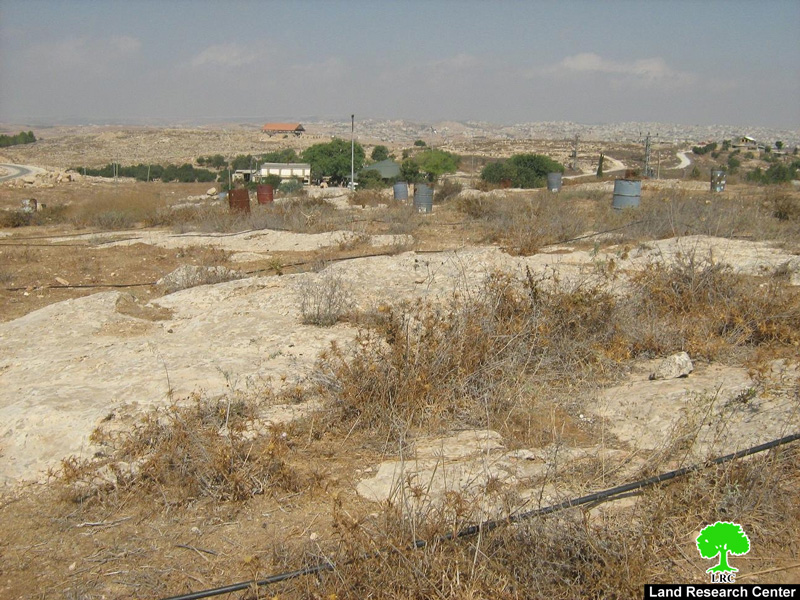
Photo 4: Olive tree inside protective barrels planted by colonists on lands declared as Closed Areas in 2006.
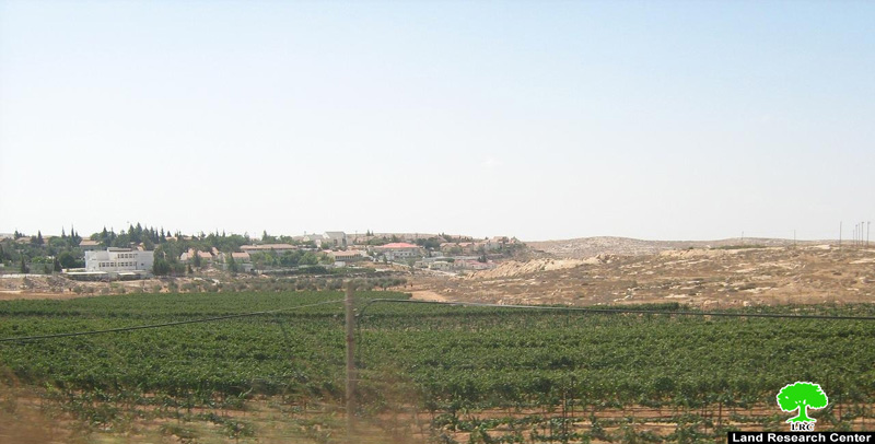
Photo 5: Grape orchards planted by colonists in Closed Areas.
Past Closures:
The current declaration of land closure in Susyia is not the first one; in 2006 Israeli colonists took over about 100 dunums owned by the clans of Al Nawaja’a , Abu Jundiya, Abu Qbeita and Shreiteh. The colonists prevented Palestinians from entering the land or to use its 13 cisterns. They have also planted olive trees in it and protected it by placing iron barrels and a colonial outpost on the land.

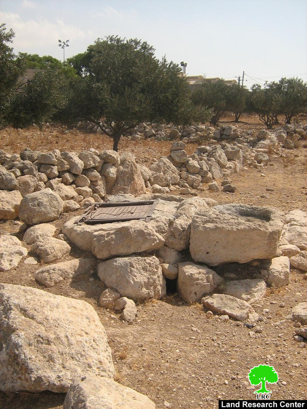
Photo 6 & Photo 7: Water cisterns located in areas declared as 'Closed' since 2006.
These confiscated lands contain about 100 olive trees owned by the family of Mr. Nasser Al Nawaja’a who are prevented from taking care of the land or even to harvest its olives. Mr. Al Nawaja’a has indicated that an officer in the so-called Israeli “Civil Administration” has informed him that he could access the land and collect the olives after prior coordination with the Administration. However, when coordination was obtained colonists went into the land and destroyed and stole the harvested olives under the watchful eyes of the occupation forces.
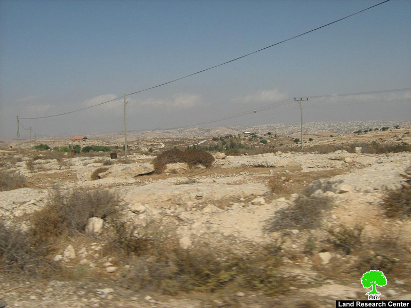
Photo 8: Closed Areas since 2006.
Military Camp on Susiya Lands:
Additional lots of lands from Susiya were confiscated in 1995 (after the Oslo Accords) for the purpose of establishing an Israeli military camp there. The military camp that used to be stationed inside the town of Yatta was relocated to the outskirts of Susiya on a 7 dunum piece of land. Since then, its continuous expansion has led to cutting off the only road connecting between the Khirbet and its main service center in the town of Yatta. It has also led to preventing the Palestinian shepherds from reaching their lands for grazing and planting purposes as well as their cisterns located in the vicinity of the camp. That is not to mention the frequent searching campaigns carried out by occupation forces of the Palestinian tents under the pretext of “protecting the security” of the colony of Suseya.
The Orders’ Implications:
When an Israeli military order is issued declaring some areas as Closed Military Areas, it implies that Palestinian land owners, as well as the colonists, are forbidden from entering the said areas; i.e. only the occupation forces can enter it. Past experiences, however, indicate that colonists usually “sneak” into these areas while the prohibition would still stand against the entry of any Palestinian. After a short period of time colonists begin cultivating the land and establishing outposts atop of it under the watchful eye of occupation soldiers and their protection. This typical “double maneuvering” style adopted by both the colonists and the soldiers is typical; Israeli occupation authorities declare some lands as “Closed Military Areas” only to be used afterwards for colonial purposes by the colonists.
Israeli occupation soldiers, as illustrated in the following picture, usually watch all the movements of the Palestinians as to prevent them from accessing their lands while allowing the colonists to do so under the full protection of the occupation forces. In time, these measures will lead to the loss of Palestinian lands for the benefit of the Israeli colonists.
A Series of Attacks Against the Palestinians of Susiya:
Like other small Palestinian villages, Susiya had its share of colonial attacks including the following:
1. Semi daily attacks in the form of preventing the Palestinians from accessing their lands using, sometimes, weapons and live ammunition.
2. The uprooting of trees belonging to Mr. Yaser Radi Al Nawaja’a in 2007.
3. The demolishing of caves and agricultural huts and the transfer of its residents 7 consecutive times between 1994 and 1998.
4. The killing of two residents of Susiya by Israeli colonists; Mr. Mahmoud Al Jamal who was killed in 1989 by a settler after being handcuffed by Israeli soldiers as well as Mr. Musa Abu Sabha in 1998.
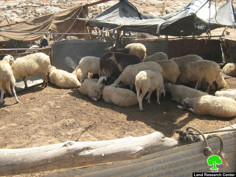
Photo 9: The sheep of Susiya shepered in their animanl pens after being
refused to graze in Al Nawaja'a lands near the colony of Suseya.
5. The attack that took place four months ago and was recorded by B’tselem’s Shooting Back Project in which masked colonists attacked Mrs. Tamam Khamis Al Nawaja’a , her husband Khalil and his nephew Imran Isma’eil.
6. The closed road near the military camp since 1995 has prevented the residents of Susiya from reaching Yatta easily. It forced them to use hilly alternative roads that made the transportation of goods and fodder difficult. Residents of Susiya still remember the time when an ambulance was requested to transport one of the residents of the khirbet to Yatta. Yet, the soldiers at the camp prevented the ambulance from reaching the khirbet via the camp. As a result, the patient had to use the hilly rough roads on the back of a donkey to reach the ambulance.
7. The inaccessibility of Susiya residents to their cisterns located in the Closed Areas forced them to pay at least NIS 300 for 10 cubic meters of water due to the inability to reach Susiya easily and to the dangers a truck driver places himself trying to reach there.
It is worth noting that the residents of the khirbet have expressed their amazement when occupation media outlets declared the removal of tens of closures in the Yatta area. They indicated that it should have been a priority to remove the military gate near the Susiya Camp as it causes a lot of agony to the residents of Susiya and other nearby khirbets whose residents want to access Yatta easily. Since the establishment of the Camp, the 20-minutes drive to Yatta was replaced with an agonizing trip through the hills and mountains over a period of one hour through the villages of Twani, Al Mufaqara, Al Karmek and Khillet Al Mai before reaching the final destination of Yatta. Residents fear to use Road 317as their vehicle are usually stopped by the Israeli Police who does not find it difficult to issue fines against their vehicles for one reason or the other.

Photo 10: An Israeli checkpoint separating between the khirbet of Susiya and the town of Yatta.
Khirbet Susiya
The khirbet of Susiya is located southeast the town of Yatta in the Governorate of Hebron. Its population reaches 200 people most of which are farmers and shepherds. The khirbet has no sign of modern life, especially water and electricity. The residents of the khirbet are from the clans of Al Nawaja’a, Al Jboor, Shatat and Al Hraini who are living in caves and plastic tents as they are not allowed to build any permanent structures. The affairs of the khirbet are run by a local committee.
Geographically, the khirbert is bounded from the east by the colony of Suseya, from the west by the old khirbet of Susiya, from the north by the khillet Saleh, Road 317, As Samu town as well as by the outpost of Neve Nesher.
It is worth noting that the residents of Susiya used to live in another location also named Susiya until they were forced out in 1967. They, then, moved eastwards to the current location that they named also as Susiya. One can still see the old houses and the destroyed mosque (transformed later to a synagogue) in the old Susiya which testify to the identity of the true owners of the land who are currently facing the ghost of displacement yet again.

Photo 11: A picture of Old Susiya in which the old mosque that was
transformed to a Jewish synagogue appears.
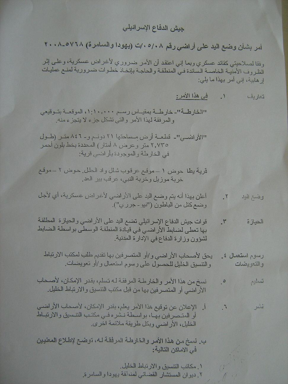
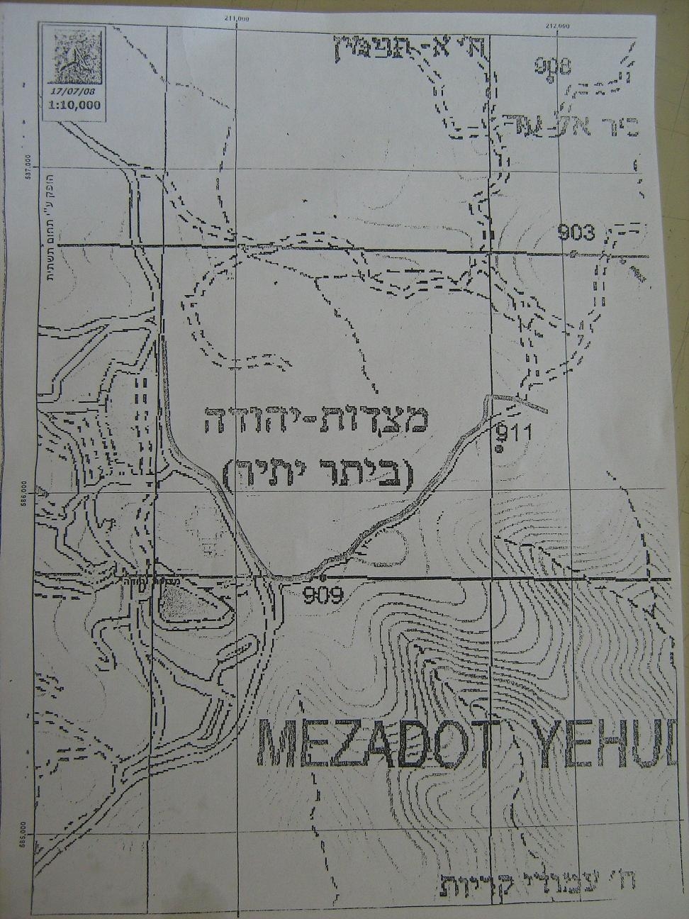
The confiscation order of Mr. Mohammad Khalil Abu Qbeita's land along with the associated map.
Prepared by:
The Land Research Center
LRC