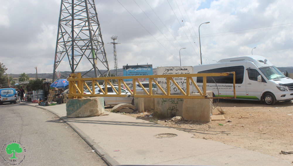
Israeli forces recently carried out extensive Curetting around Al Container checkpoint that located in the north-east of Bethlehem city. Excavations have led to serious damage to the land of Alsarkhy and Atrash family in As Sawahra Ashrkyah village. The Israeli army did not explain the reason for this Curetting, but it is clear that there is a designed plan to enlarge the checkpoint, and converted into crossing point, or as a commercial crossing.
The bulldozed land estimated to 6 dunums, located beside Al-Container checkpoint. The Israeli army bulldozed the ground with no one of the owners reach a confiscation military order, said Othman Al sarkhy one of the land owners. Othman was conducting petrol station in the area, licensed by the Palestinian Authority, but the Israeli army closed the station eight years ago in the wake of Al-Container checkpoint
The 'Container' checkpoint
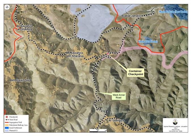
At the beginning of nineties, the Israeli authorities prevented Palestinians from entering Jerusalem, This action led to hinder the passage of persons and goods between north and south of the West Bank. Also it forced the Palestinians to search for alternative routes for the main street that connects Bethlehem to Ramallah. The result was Wadi An Nar road that links between Obedia village (east of Bethlehem) with Asawahra Asharrekaya (east Jerusalem). Since that time this road considered the only linking point between the northern and southern West Bank. But even this road has been closed with the beginning of the second Palestinian Intefada which broke out on in 2000, the Israeli authorities placed a military checkpoint in this road; called 'Al Container checkpoint'. This Checkpoint isolates one Palestinian area from another and controls traffic between north and south of the West Bank. Prevention of transit here cuts the two parts of the West Bank off from each other. See Map 1
Map 1: The Container checkpoint
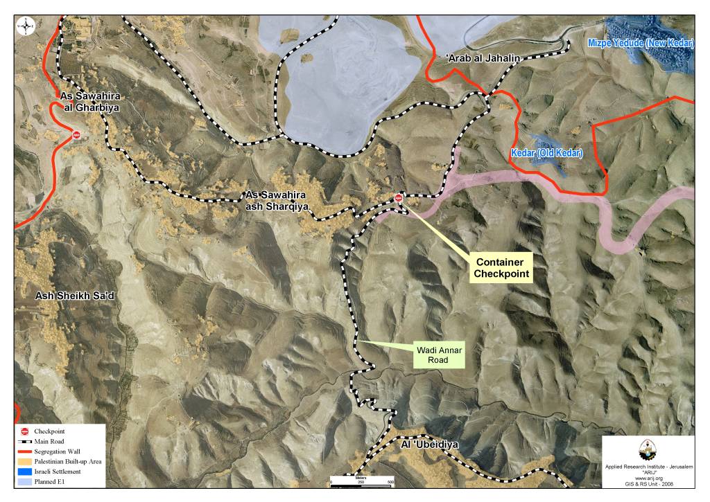
So far the Palestinians still using Maale Adumim road to transport between Ramallah and Bethlehem. But in September 24, 2007 the Israeli army issued a military order # 07/19/T which seizure 1722 dunums from As Sawahira ash Sharqiya, As Sawahira al Gharbiya and Abu Dis to construct fabric of life road. The Israeli designed this road for the Palestinians, i.e. the Palestinians will not be allowed any more to use Maale Adomim road, and this also mean that the Israeli Government runs ahead with its plan to annex Maale Adumim area to Jerusalem. See Map 2
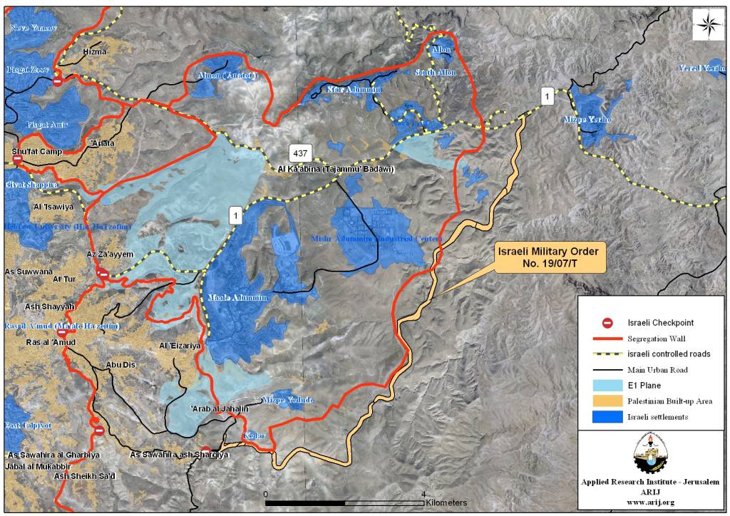
Map 2: Fabric of Life Road
Until this moment, the reasons for these excavations remain unknown. This calls many speculations in what behind the Israelis motives to expand the checkpoint. These extensions may be to build an army camp near the checkpoint or to expand the barrier to become a central crossing point for the industrial zone to be established in the Jordan valley. In both cases, these expansions will not be in the sake of the Palestinians.
At this point of the Palestinian – Israeli conflict, one fact remains constant and that is only a Palestinian state with a contiguous territorial area with East Jerusalem as its capital is the only solution to put an end to the conflict. What Israel is doing forcing facts on the ground and manipulate the geographic and demographic balance of the occupied territory, particularly in occupied East Jerusalem; will only serve to destroy the chances of fruitful negotiation between the two sides to reach a peace agreement based on a two-state for two nations solution, with Jerusalem as the capital to both.
Prepared by
The Applied Research Institute – Jerusalem