
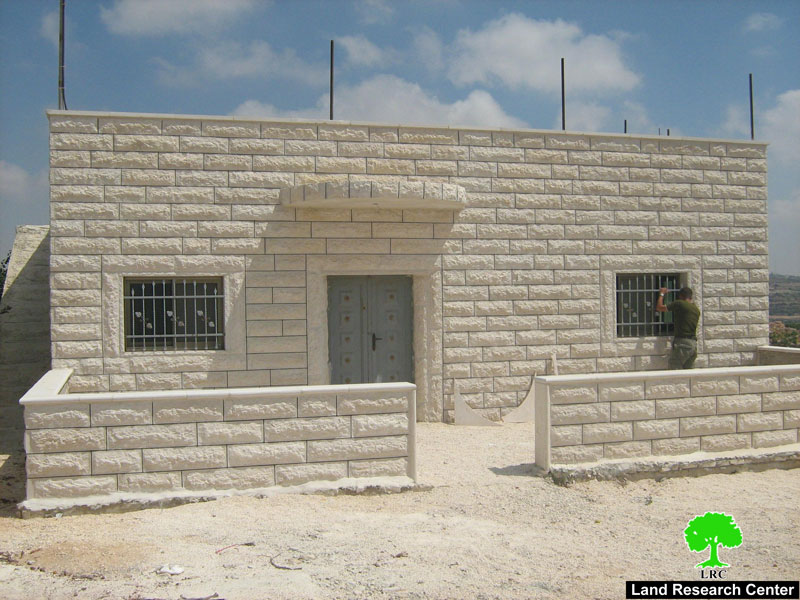
Photo1: Khirebt Al Mfaqara, Yata: the only village mosque threatened with demolition
]On June 26, 2008, the Israeli occupation authorities handed over a number of notifications to halt construction in residential houses, a mosque and a public cistern in the towns of Yatta and Beit Ummer in the south and north of Hebron city. The notifications were issued under the pretext of building without permission from the Israeli occupation.
In Yatta, the following Khirbets were affected by the latest Israeli measure:
1) Khirbet Al Mfaqara:
The first punch of notifications were issued against five houses in Khirbet Al Mfaqara south east of Yatta. The target houses were built of stone and mud and roofed with plastic and tent. In addition, the only mosque in the Khirbet was notified as well a room that houses an electric generator which provides the whole village with electricity.
Table 1: Notified structures by owner's name, type, area and family member
|
No. |
Owner's name |
Type of structure |
Area M2 |
No. Family mem. |
|
1 |
Mahmud Hussein Al Hamamda |
Agricultural house built in 2001 |
45 |
17 |
|
2 |
Adla, the widow if Maher Khalil Al Hamamda |
Agricultural house built in 2004 |
20 |
12 |
|
3 |
Hatim Mohammed Al Hamamda |
Agricultural house still under construction |
30 |
10 |
|
4 |
The Khirbet's mosque |
Built in 2002 |
40 |
|
|
5 |
Room for electric generator |
Buil in 2003 |
9 |
|
|
Total |
|
144 |
39 |
|
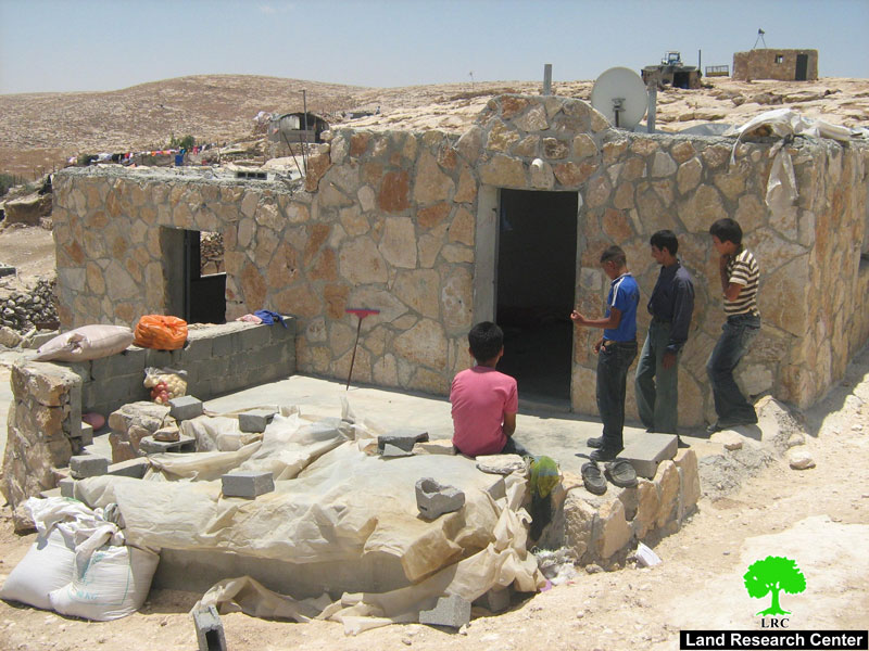
Photo 2: the house of Mr. Mahmud Al Hamamda
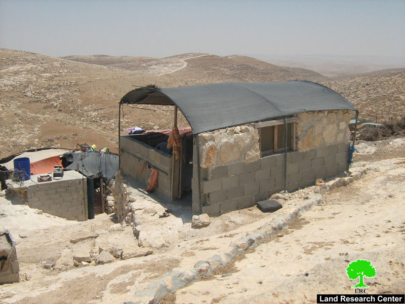
Photo 3: the house of Mrs. Adla Al Hamamda
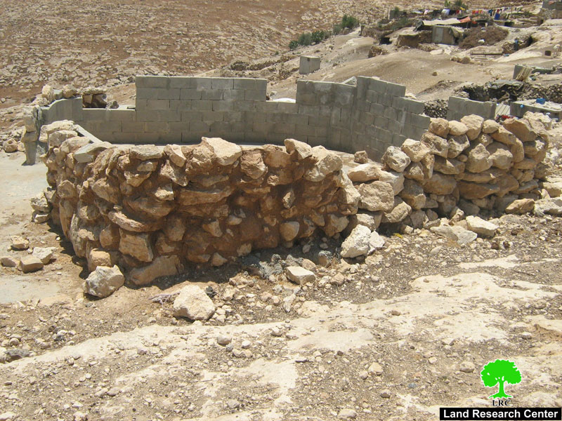
Photo 4: the under construction house of Mr. Hatem Al Hamamda
Introduction to Khirbet Al Mfaqara
It is a primitive human settlement located about 17 km to the south east of Yatta town and affiliated to Yatta. It has been continuously inhabited from ancient times. Currently, it has the total population of 150 people from 22 nucleus families who all derive from the two big clans of Al Hamamda and Al Yatawiya. It is run by a joint local council with Khirbet at Tuwani and headed by Mr. Saber Al Hureini.
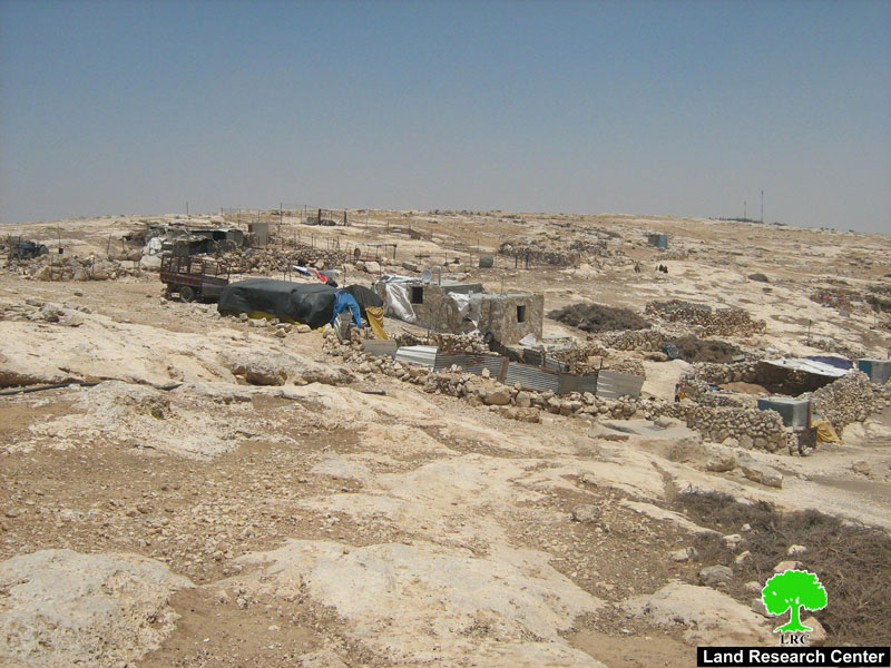
Photo 5: a general view of Khirbet Alfaqara
The village is bordered from north by the colony of Khafat Maon, from west by the colony of Avi Ghal and bypass road number 317, from south by the colony of Yacoub Daliya and from east by the colony of Maon.
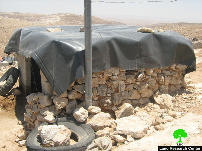
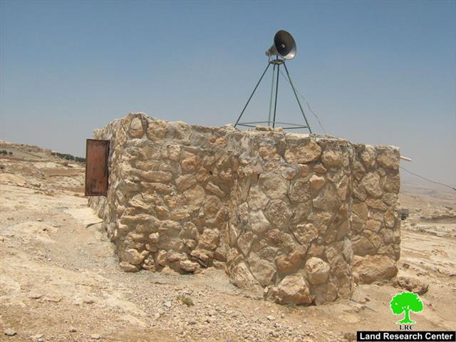
Photo 6: the electric generator's room
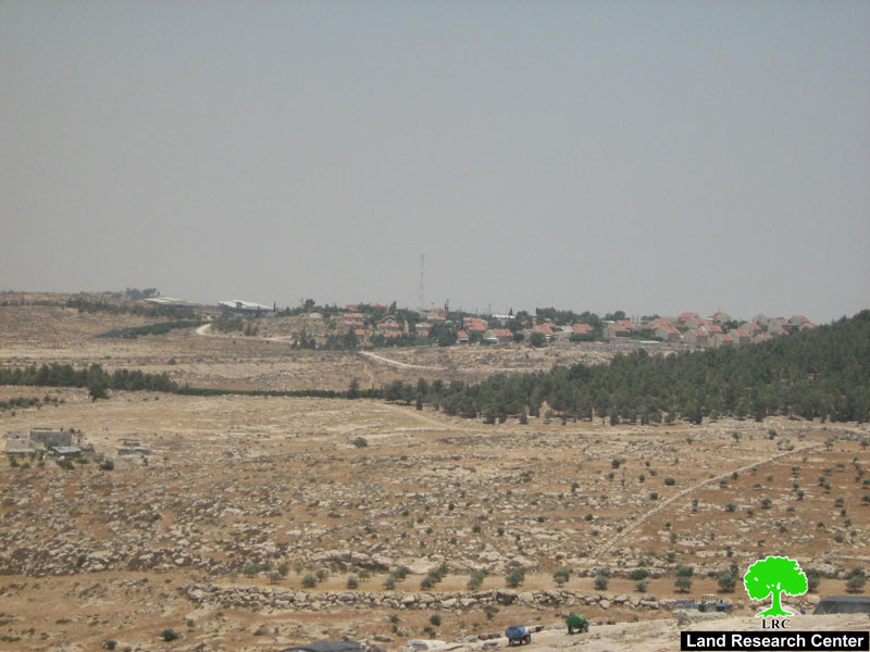
Photo 7: a view of Maon colony
The community depends on agriculture and animal breeding as only income. The Khirbet has no modern infrastructure or services whatsoever. It is connected with Yatta by a dirt road.
Previous violations
1- In the year 2000 the Israeli occupation authorities dismissed all the citizens
of Khirbet's Al Mfaqara and Khibet at Tuwani from their hamlets in the southern side of road number 317 to the northern side of it in the direction of Yatta under the pretext of safeguarding the Israeli settlers traveling on this road. However, only after appealing to the Israeli high court the citizens were allowed to go back to their original hamlets and lands.
2- In the year 2004, settlers from Khafat Maon sprayed toxic material in the grazing land of the Khirbet leading to the death of 22o heads of sheep.
3- The continuous detention and interrogation on the part of the Israeli occupation forces of the Khirbet's men.
4- The continuous confiscation and detention of cattle.
5- The continuous harassment and physical beating of shepherds from the Khirbet at the hands of settlers.
6- The continuous aggression and harassment of the school children crossing road number 317 on their way to schools in the other side the road.
2) Khirbet at Tuwani:
A public cistern was notified in the Khirbet for the same pretext – building without permission. In an interview with LRC field worker, The head of the local council, Mr. Saber Al Hureini gave the following account : ' Israeli forces arrived at the scene and handed over the halt-of-construction notification after one week of the completion of work which commenced in March, 2008. The cistern has the capacity of 750 M3 and aimed at providing the Khirbet with water collected from rain fall during winter time. The project was a gift from a Spanish organization. The Israeli measure is just a continuation of the all out war being waged against our presence in this area ever since the beginning of the Israeli occupation of the West Bank in 1967'.
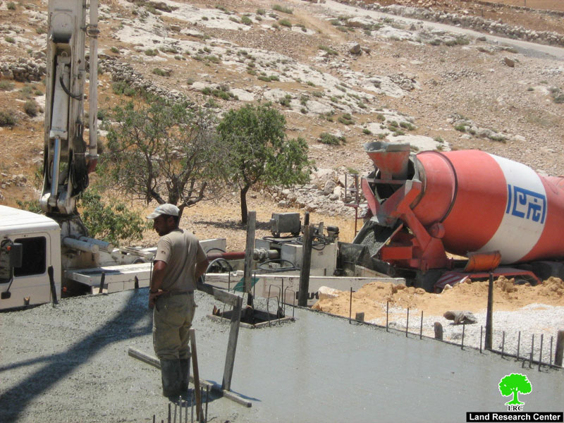
Photo 8: The threatened under construction public cistern
Mr. al Hureini called upon all the concerned parties to take responsibility and deter the Israeli occupation authorities from carrying on with their war crimes against the Palestinian people.
Introduction to at Tuwani
It is located east of Yata and inhabited by 280 persons from the clans of Al Hureini, Al 'Mur, Al Adra and Raba'i. The Khirbet has a mixed school until grade seven, a clinic and a local council.
At Tuwani is bordered from east by the colony of Khafat Maon, from north by the colony of Maon, from south by the colony of Avi Ghal and from west by the bypass road number 317.

Map1 : Location of Khirbet at Tuwani
Previous violations against at Tuwani
1. The demolition of the only mosque in the Khirbet in the year 1991;
2. The demolition of a residential barrack house owned by Mr. Ghanim Hussein Al Hureini in the year 2004 bringing 7 people to homelessness;
3. The demolition of a poultry farm owned by Mr. Khalil Al Hureini in the year 2004;
4. The demolition of a proper house owned by Mr. Hussein Al Hureini in the year 2006 making 7 persons homeless;
5. Closing the only entrance to village with earth mounds and rocks forcing citizens to look for other alternative roads;
6. Destroying agricultural fields and uprooting olive trees owned by Mr. Mohammed Al 'Mur at the hands of settlers.

Photo 9: Mr. Al 'Mur's destroyed olive field
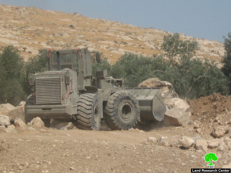
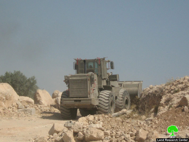
Photos 10+ 11: An Israeli army bulldozers closing the road to at Tuwani
3) Beit Ummer case:
In related development, the Israeli occupation authorities handed over two orders to halt construction in two houses; the first, is owned by Mr. Awad Hasan Hussein Awad, and the second, owned by his brother Sami. Both houses are located in Sh'ib As Sayer to the west of the town and were notified under the pretext of un-licensing although they are located within the municipal boundaries of the town. The two notifications were handed over on June 26th, 2008.
More details on the two houses
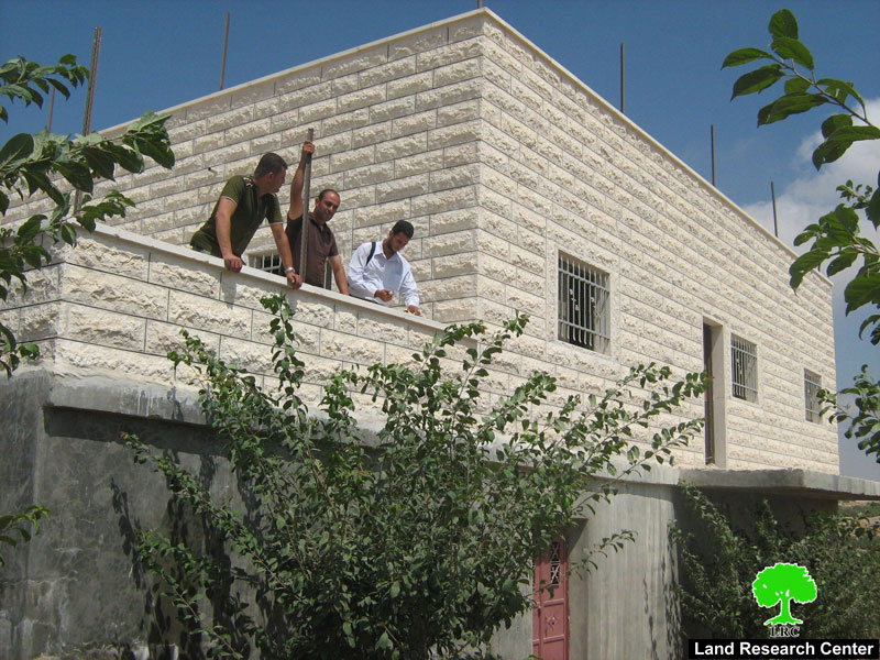
1- The house of Mr. Awad Hasan Awad is built of two floors with a total surface area of 260M2 and inhabited by Mr. Awad, his wife and four children. He started to get his house built in the year 2006 without any interference from the Israeli side. Once he moved with his family to settle it, he received the halt –of-construction notification from the occupation authorities.
2- The house of Mr. Sami Hasan Awad is still under construction and has the total surface area of 150M2. It is uninhabited yet.
Photos 12+13: the houses of brothers Awad and Sami Awad in Beit Ummer
Beit Ummer
It is located 12 km to the north of Hebron city and has the total population of 15000 people. Its surface land area is about 22000 dunums, of which 3126 dunums area built up area. The town is renowned for its best quality production of grape, peach, apple and almond.
The town is bordered from north by Gush Etzion colonial block, from south by the colony of Karme Tzur and the town of Halhul, from east by Al Aroub refugee camp and the town of Beit Fajjar and from west by the town of Surif and Khirbet Jala.
More than 1000 dunums have been confiscated from the village land for the construction of Gush Etzion colonial block which is situated at the northern edge of the town. Another 4000 dunums of fertile agricultural land are threatened with confiscation and/or separation once the Wall path is built between the town and Gush Etzion colonies.
Prepared by:
The Land Research Center
LRC