About Deir Jarir village
Deir Jarir, aPalestinian village located 11 kilometers northeast of Ramallah city on a hilltop overlooking the Jordan Valley and sited approximately 900 meters above sea level. The village�s population recorded 739 inhabitants in the year 1922, and according to Deir Jarir village council, the population continued to grow and reached up to 1275 and 2005 inhabitants in the years 1967 and 1987 respectively. Today, the village's population is 4303 according to the Palestinian Central Bureau of Statistics (PCBS 2006).
The Palestinian villages of Kafr Malik, Al Mazra�a Al Sharqiya, Silwad, and Al Tayba surrounds Deir Jarir village. It spreads on an area of 33357 dunums, mostly cultivated with Olives, Figs and Vines groves.
Deir Jarir and the Israeli settlements
Today, three illegal Israeli settlements surrounds the Palestinian village of Deir Jarir and were established on 4222 dunums of lands originally owned by the Palestinian villagers of Deir Jarir and the nearby villages of Silwad, 'Ein Yabroud and At Tayba. The Israeli authorities confiscated about 935 dunums from the village�s lands to construct the three settlements listed in table-1 below
|
Table 1: Israeli settlements surrounding Deir Jarir |
||||
|
Settlement's Name |
Date of Establishment |
Population 2006 |
Area/ Dunums |
Area seized from Deir Jarir/ Dunums |
|
Kokhav Hashahar |
1977 |
1500 |
1593 |
888 |
|
Rimmonim |
1977 |
561 |
343 |
45 |
|
Ofra |
1975 |
2500 |
2286 |
2 |
|
Total |
4561 |
4222 |
935 |
|
Source: ARIJ GIS_ Data Base 2008
Furthermore, during the period between 1999 and 2004, the Israeli settlers managed to set up three illegal Israeli outposts on lands from Deir Jarir village. See table-2 below.
|
Table 2: Israeli outposts surrounding Deir Jarir |
|||
|
Mother Settlement |
No. of Structures |
Outpost Name |
Period |
|
Kokhav Hashahar |
18 |
Mizpe Shlomo Ma'ale Shlomo |
January 1999 |
|
Kokhav Hashahar |
0 |
Mizpe Shlomo South |
January 2003 |
|
Rimmonim |
3 |
West Rimmonim |
June 2003- January 2004 |
Source: ARIJ GIS_ Data Base 2008
General social services in Deir Jarir
The village has one Elementary and two Secondary Schools accommodating more than 680 students, in addition to one Mosque and one clinic that provide basic medical services to the villagers. The village lacks specialized clinics, rehabilitation and recreational centers except for one women society and a youth club.
Deir Jarir's Village Land Classification
The Oslo II Interim Agreement signed in September 1995 between the Palestinian Liberation Organization (PLO) and Israel, concluded Israel withdrawal from areas of the West Bank, and that the Occupied Territory be classified into Areas 'A,' 'B' and 'C,' designating varying levels of control. See table 3-section1.
Under the signed agreement, Deir Jarir village was fragmented to areas 'B' and 'C.' sees table 3-section 2.
Area B constitutes the 17.2% of the land (5763 dunums) of the total area of the village, and includes the urban area of the village.
Area C constitutes the remaining 82.8% (27594 Dunums) of the total area of the village, and includes all the agricultural lands, the open spaces, and all the lands suitable for future expansion. Moreover, about 21700 dunums of area 'C' are illegally classified as an Israeli State Lands.
Table 3: Classification of Deir Jarir Village Lands
|
Section1 |
Areas Definition in Oslo II Interim Agreement of September 1995 |
||
|
Area A |
The Israeli army has pulled out fully and Palestinians hold all responsibilities for internal security and Public order. |
||
|
Area B |
Palestinians have full control over the civil administration and Israel continues to have overriding responsibility for security. |
||
|
Area C |
The Palestinians have responsibility for civil life such as economics, health, and education; while, Israel retains full control over security and administration related to the territory. |
||
|
Section2 |
Area in Dunums |
% |
|
|
Area B |
5763 |
17.2 |
|
|
Area C |
27594 |
82.8 |
|
|
TOTAL |
33357 |
100 |
|
Source: ARIJ GIS_ Data Base 2008
Deir Jarir village is a well known as an agricultural community where its lands are cultivated with a wide variety of fruitful trees. However, some 76% of the village's lands classifies as open spaces, which fall within Area 'C'. See table-4 below for the village's Land Use/ Land Cover.
Table 4: Deir Jarir Land Use/ Land Cover
|
Land classification Land Use Land Cover |
Area / Dunums |
Percentage |
|
Arable land |
2359 |
7% |
|
Mine, dump and construction |
40 |
0% |
|
Open spaces with little or no vegetation |
25225 |
76% |
|
Permanent crops |
3035 |
9% |
|
Palestinian Built-up |
1705 |
5% |
|
Israeli settlements |
935 |
3% |
|
Israeli Military Base |
58 |
0% |
|
Total |
33357 |
100% |
Source: ARIJ GIS Database 2006
About Silwad village
Silwad village is located northwest of Deir Jarir village and northeast of Ramallah city and home to 7253 Palestinians (PCBS 2006). The village has a total area of 18881 dunums mostly cultivated with Figs. According to the Oslo II Interim Agreement signed in September 1995 between the Palestinian Liberation Organization (PLO) and Israel, the village�s lands were classified to Area 'A' (149 Dunums), Area 'B' (6540 Dunums) and Area 'C' (12192 Dunums). See table-5.
|
Items |
Area in Dunums |
% |
|
Area A |
149 |
0.8 |
|
Area B |
6540 |
34.6 |
|
Area C |
12192 |
64.6 |
|
TOTAL |
18881 |
100 |
Source: ARIJ GIS Database – 2008
Area A constitutes the main concentration of the village�s built-up area.
Area B constitutes additional part of the village's urban area, some industries, and the agricultural lands.
Area C is where the villages agricultural lands, the open spaces, and all the lands suitable for future expansion. Moreover, it is the area where the settlements are built. Area C also contain 499 Dunums, which Israel claim it a 'State Land' property.
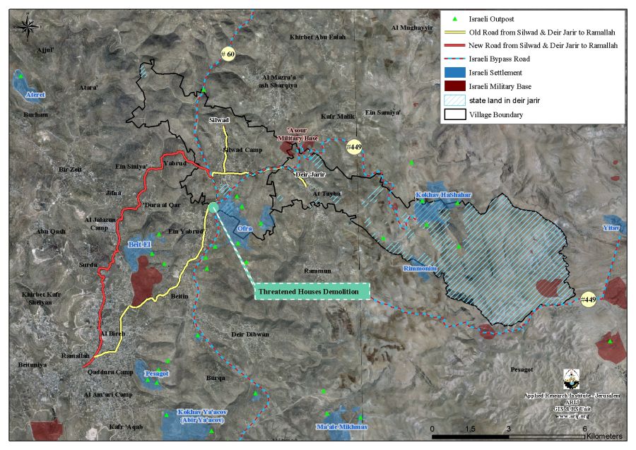
Throughout the years the Israeli Authorities managed to seize more than 1319 Dunums (7%) of Silwad's agricultural lands and established 'Ofra', which is an Israeli settlement partially, built on Silwad�s lands. Moreover, three Israeli outposts in the area where established by Ofra settlers since 2002. See table 6 for details and Map 1.
|
Table 6: Israeli outposts surrounding Silwad |
|||
|
Mother Settlement |
No. of Structures |
Outpost Name |
Period |
|
Ofra |
1 |
Ofra East |
February 2001- November 2002 |
|
Ofra |
45 |
Amona |
January 1997 |
|
Ofra |
13 |
Ofra North East |
January 2004 |
Source: ARIJ GIS Database – 2008
Silwad's Village Landuse/ Landcover classification
Most of Silwad's lands are classified as agricultural lands; 46% of its lands are cultivated with Fruitful trees mostly Figs. In addition, 38% of the village's lands are classified as open spaces, which are the only areas available for the village to expand and develop in the future. Table 7 below illustrates the Land Use and Land Cover of Silwad village.
Table 7: The land classification inside the village boundary
|
Land classification Land Use Land Cover |
Area / Dunums |
Percentage |
|
Arable land |
2074 |
11% |
|
Open spaces with little or no vegetation |
7184 |
38% |
|
Permanent crops |
6593 |
35% |
|
Palestinian Built-up |
1555 |
8% |
|
Israeli settlements |
1319 |
7% |
|
Israeli Military Base |
156 |
0.8% |
|
Total |
18881 |
100% |
Source: ARIJ GIS Database 2006
Bypass roads # 60 and 449
Bypass road #60 is an Israeli controlled road that extends in the occupied West Bank territory for 174 kilometers stretching from Jenin Governorate north to Hebron Governorate in the south. Currently Palestinians have limited access to some sections of the road, at least until the Israelis complete their plan to separate the Israeli roads network from the Palestinians. In Silwad village, bypass road 60 stretches 5 Km inside Silwad village boundary and consumed some 850 dunums of lands, which is the area used to construct the road and the so-called buffer zone.
Bypass road #449, this Israeli controlled bypass road is designated for the Israeli settlers' use to access bypass road 60, and the Israeli Army military base called 'Al-�Asour'. The bypass road stretches 5 Km inside the two villages of Silwad and Deir Jarir. It uses nearly 1000 dunums of land from both villages and break up the territorial contiguity of several Palestinian villages in the area.
Limiting Palestinian Movements
The villagers of Deir Jarir and Silwad were barred from accessing the bypass # 60 in order to reach Ramallah city. Their traditional road to access Ramallah city is 13 Kilometres; only 10 minuets drive but now the villagers are forced to go through six Palestinian villages (Yabroud, �Ein Sinya, Dura Al Qar', Al Jalazun camp, Surda, Al Bireh) to reach Ramallah; more than 25 minutes drive on an unfitted 25+ kilometres road.
Moreover, repercussions of the Israeli decision to prevent Palestinians from accessing road 60, is that five Palestinian houses were trapped between the road and Ofra settlements and are allowed conditional access to Silwad village once they acquire special permits from the Israeli side.
Al-'Asour military base
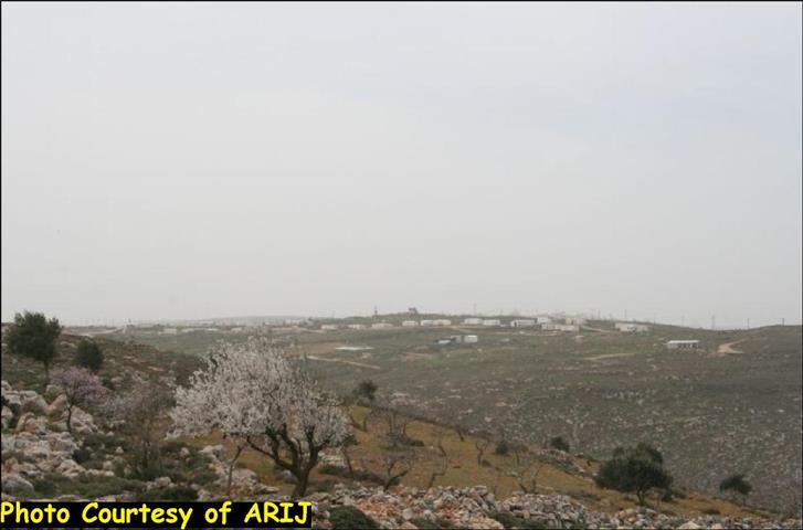
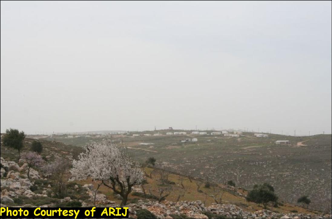
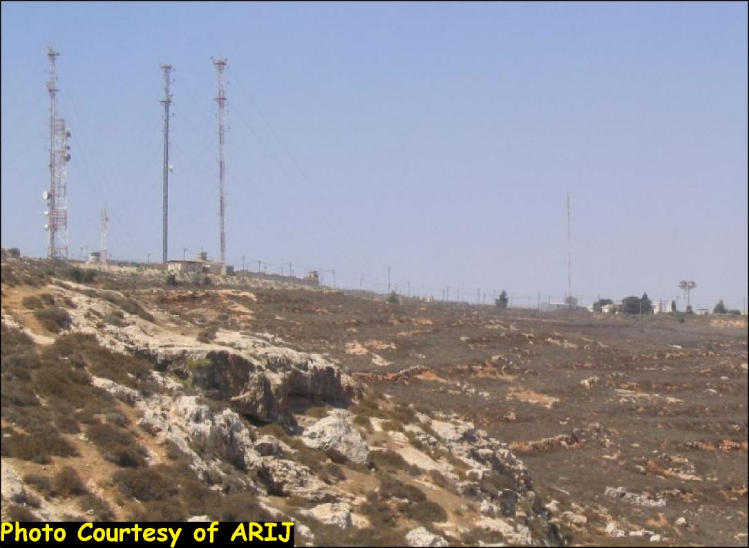
Al-'Asour military base is located north of Deir Jarir village and is set-up on 470 Dunums, more than half of the area confiscated from Deir Jarir and Silwad villages, it was established in 1968 and served as an early warning station with watchtowers. The military base is situated on a hilltop overlooking the Jordan Valley, and is one of the first Israeli military bases established after the 1967 Israeli occupation of the West Bank territory. Al-'Asour military base is one of the biggest military bases constructed by the Israeli Army in the West Bank and has very confidential military operations. See Photo 1 & Photo 2


Since the construction of the military base, the landowners were prevented from accessing their agricultural lands in the surrounding area. Thousands of dunums of agricultural lands were forcibly abandoned due to the Israeli military practices in the area.
Recently, the Union of Agricultural Work Committees (UAWC) attempted to restore the agricultural lands located within Area B but the Israeli Army forbid them from carrying out any work there under claims of 'security reasons' and warned them that they might be subject to fine, imprisonment and to have their equipments confiscated. More than that, the Israeli settlers who claimed ownership of the land attacked the residents and the UAWC workers every time they attempted to reach their lands.
Prepared by
The Applied Research Institute – Jerusalem