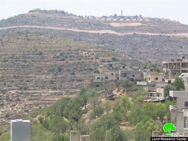

(Photo 1: Above is the colony of Ma'ale Levona, down is the village of Al Lubban
ash Sharqiya and in the middle are olive orchards that have been attacked by colonists)
A group of colonists carried out a series of destructive acts and olive tree uprooting along the road connecting the colony of Ma’ale Levona and the by-pass Road 60 located parallel to the village of Al Lubban Ash Sharqiya south of the governorate of Nablus. Around 30 olive trees, all located in the region of Houd Al Baten, were sawed off which led to its complete destruction. The trees were owned by both Mr. Mohammad Abdel Fattah Shihada, 32 years old, and Mr. Abdulla Abdel RahmanDaraghma, 71 years old. The sawed-off trees were located around 500 meters away from the colony’s fence as well as 600 meters away from the road that connects it to by-pass Road 60.
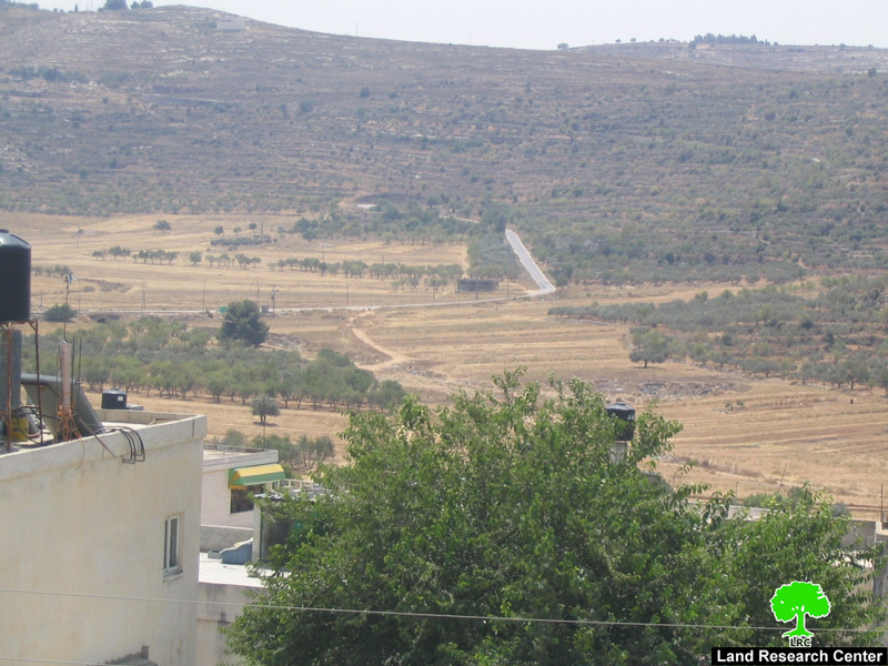
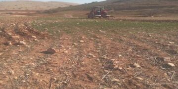
( Photo 2: The bypass road that connects the colony with road No. 60 passing through olive orchards)
Moreover, the colonists also sawed off in September 2007 around 81 olive trees in the region of Wadi Al Oyoon located south of the colony. The trees were owned by Mr. Khaled Sameeh Daraghma , 55 years old, from the same village.
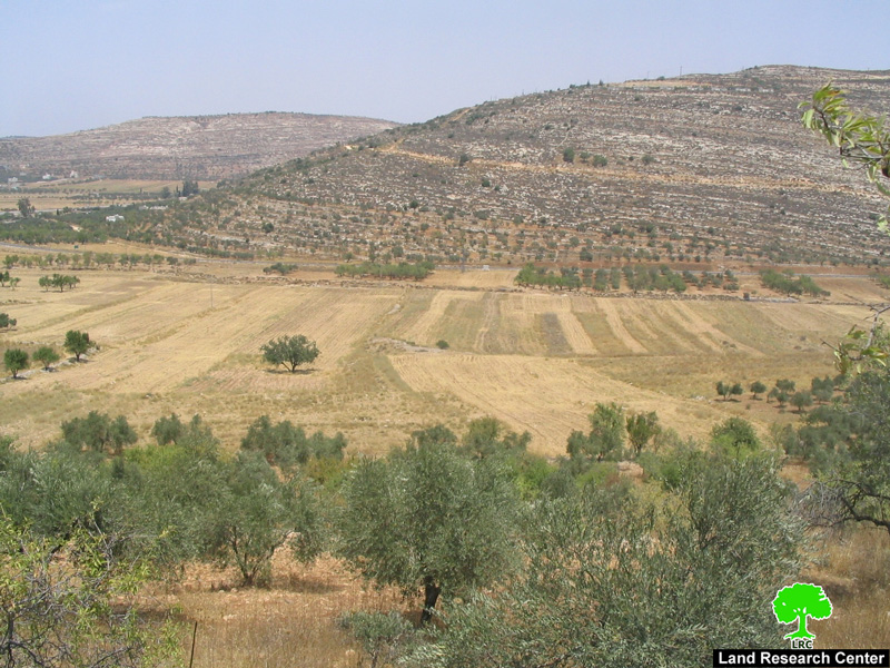
( Photo 3: Wadi Al Oyoon area to the west of the colony that has become under attack as well)
Complaint and Neglect:
In the aftermath of these destructive acts, Palestinian owners filed a written complaint to the Israeli Police against the colonists charging them with tree cutting. However, the Police dealt with the issue with neglect and even demanded that the land owners prove first their ownership of the land before processing the case. Such demand has made it impossible to continue the case as most of the affected lands are written in the name of the original owner, not any one of hisher heirs.
Colonial Activity in the Al Lubban Ash Sharqiya Village:
There are two colonies on the lands of Al Lubban Ash Sharqiya village that are the source of daily suffering for the Palestinian villagers. The two colonies are Ma’ale Levona (located in the southern part of the village) as well as the colony of Eli (located in south east of the village).
A) Ma’ale Levona:
The colony was established in 1983. According to Foundation for Middle East Peace statistics, there were 545 colonists living in the colony in 2005. The built-up area is 251 dunums while the municipal boundaries of the colony are about 1942 dunums. The colony was established as an outpost on the village’s land and specifically in the region of Houd Al Batin. Soon after, it grew at an alarming rate on the lands of the villages of Sinjil, Al Lubban Ash Sharqiya and Ibwein. The colony was established by the Gush Emunim Movement’s prominent member Hanan Porat on lands expropriated from the villages of Al Lubban Ash Sharqiya and Ibwein. It is located 789 meters above sea level on the tip of the hill of Al Baten. All of the initial “temporary” caravans were replaced by fancy villas an area of each nears half a dunum ( one dunums equals 1000 M2). Services provided in the colony includes children nurseries, student apartments, a techno eligious educational center, a Hebrew language center, a medical unit, a synagogue as well as a large aluminum factory.
During the year 2005 Israeli occupation forces surrounded the colony with a “security belt” under the pretext of providing protection for the colony. These forces confiscated 500 dunums from the village of Al Lubban Ash Sharqiya for that purpose. The confiscated lands used to be planted with seasonal crops which led to the deprivation of tens of families of their only source of income. In addition, colonists’ attacks take place on daily basis especially during the olive harvest season.
B) Eli Colony:
The colony was established in 1984 on Ali hilltop. The name was later changed to Eli. Ever since its establishment, the colony kept on growing through the constant addition of mobile caravans. Currently, the colony rests atop seven hilltops belonging to the villages of Qaryut, Talfit, Az Zawiya and Al Lubban Ash Sharqiya. Services in the colony include a religious college, a tourist hotel in addition to a grave yard. In the year 2005 it had 2420 colonists living in a built-up area of 776 dunums while its municipal area was 2430 dunums, according to the Foundation for Middle East Peace.
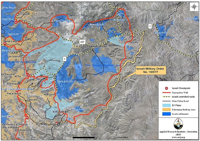
( Map 1: the village of Al Lubbna ash Sharqiya surrounded by the colonies of Ma'ale Levona and Eli)
It is worth noting that the colony has also a wastewater treatment plant which became dysfunctional lately. In response, colony authorities got rid of the wastewater through dumping in on the lands of the village of Al Lubban Ash Sharqiya which led to environmental pollution and the destruction of the crops of the village. As a result, the village council of Al Lubban Ash Sharqiya submitted a complaint to the so-called the “Civil Administration” in Beit Eil near Ramallah in which it listed the problems caused by the dumping. However, “Civil Administration”, as usual, promised to solve the problem. No progress is reported on that front.
The Closure of Main Roads in the Village:
Ever since the beginning of the recent Intifada in 2000, Israeli occupation forces opted to clamp on the movement of the residents of the village using a number of methods including the closure of all main roads leading from the village to Road 60. These forces closed the Road using cement blocks as it took advantage of the death of one of the colonists on Road 60 in 2002 to accomplish this mission. The closure has led to magnifying the agony of the villagers as they were forced to use a 7-kilometer alternative road through the village of Az Zawiya located to the north of the village to enter or exit it. In addition, Israeli occupation forces have prevented school students from reaching their schools located right on Road 60 for “security reasons.” In response, the village council found itself obliged to open up a new alternative sandy road connecting the village with the schools.
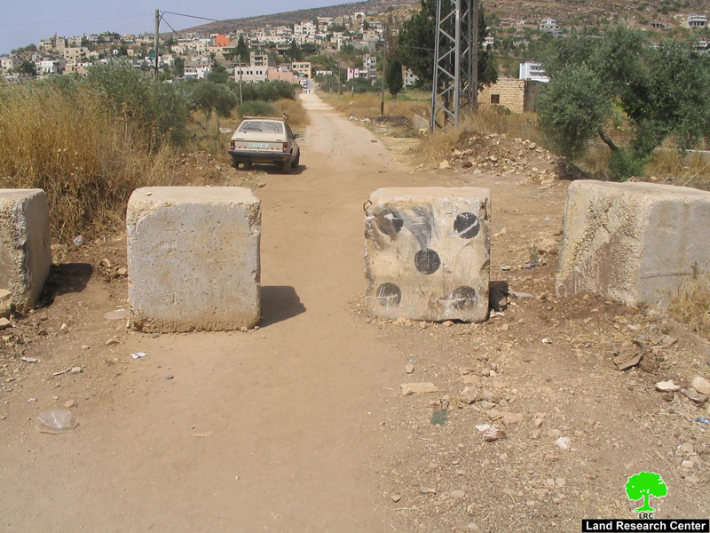
(Photo 4: an entrance to Al Lubban ash Sharqiya village which has been closed
with cement blocks since the beginning of the second uprising in the year 2000)
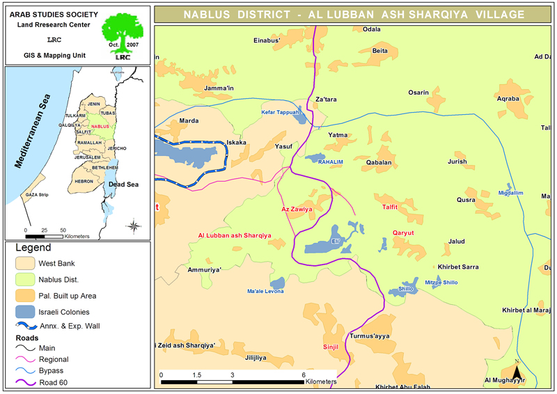
General Information About the Al Lubban Ash Sharqiya Village:
The village is located in the southwestern part of the Governorate of Nablus at a distance of 20 kilometers south of the City of Nablus. It is considered to be the last village south of the governorate. The village is surrounded by a number of villages including Az Zawiya, Qaryyut, Ammuriya, Yasuf, Sinjil, Ibwein, Salfit and Iskaka. The total of its surface area is 12,075 dunums of which 150 dunums are used as the Master Plan of the village. About 240 dunums are hilly lands used to plant vegetables and wheat while 700 dunums are used for Israeli colonial purposes and an additional 200 dunums were demolished before being used for the extension of Road 60. The remaining dunums are usually planted with almonds, figs and olive trees
(source: LRC’s GIS Unit).
There are two main clans in the village; Awaysa and Dharaghma. The current population stands at about 2900 Palestinians. The unemployment rate hovers around 51% due to Israeli occupation closure policies and land confiscations. Only around 14% of the work force in the village works in private and public jobs as the main source of income (Source: Village Council).
Prepared
by The Land Research Center
LRC