The town of Aqraba, located south east of the Governorate of Nablus and 18 kilometers away from Nablus City, is considered to be an example of the barbarism and the ugliness of the Israeli occupation. The town has lost about 76% on its total surface area which used to be 144,000 dunums before the Israeli occupation of 1967. Nowadays, the town has retained only 34,659 dunums of its original lands. The confiscated lands have been transformed into colonies, 'Closed Natural Areas' as well as 'Closed Military Areas' used to serve the goals of the occupation. In the past, the boundaries of the village used to be stretched between the Jordan River in the east and the villages of Qabalan, Beita and 'Awarta in the west. Southward, its boundaries reached the villages of Majdal Bani Fadel, Qusra and Jurish while in the north its boundaries reached the villages of Yanoun and Beit Furik.
Israeli colonies in the area has become the main source of agony and anguish for the residents of the village and other nearby villages (such as Awarta, Beit Furik and Yanoun) due to the daily attacks by the colonists especially those from the colony of Itamar. Such attacks usually increase in frequency during the olive picking season in the months of October and November of each year in addition to what these colonies represent as an obstacle for the demographical expansion and development of the nearby Palestinian communities.
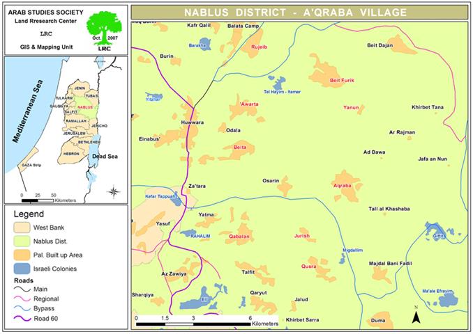
In the case of Aqraba, the town is currently surrounded by four colonies; Jetit in the east, Ma'ale Ifrayim and Migdalimin the south and Itamar in the north of the town.
(Map 1: Location of Aqraba and surrounding colonies)
The Colony of Itamar and its Impact on Nearby Palestinian Communities
The corner stone for the colony of Itamar was put in place in 1984 when the so-called Israeli 'High Court of Justice' issued a decision to remove the colonial nuclei from where it used to be (near the village of Rujib) and to transfer it to the lands of Jabal Bilal near the village of Deir Al Hatab. The colony was established at the hands of religious students from the Ma'eir Institute in Jerusalem. To begin with, the colony was called 'Hayeem Hill' as a sign of the resumption of Jewish life in the location which they consider to be of religious importance due to their claim of the presence of Ala'zar Itamar Binhas and the 70 sheikhs, according to the Jewish history. Soon after the colony started to expand and was later re-named Itamar. The expansion process took place slowly and quietly until it has become many times multiple its original size during the past 23 years. The expansion has taken place on the expense of the lands of the villages and towns of Awarta, Beit Furik, Yanun and Rujib. Its current size is 6,963 dunums with a build-up area of 253 dunums. At the end of year 2005, it housed 651 colonists according to the Foundation for Middle East Peace.
A Colonial Geographical Continuation
The colony is currently connected geographically from the northern direction with the Israeli forces' controlled Huwwara Camp with a series of by-pass roads. These roads also connect it from the northern direction with the colony of Elon Moreh as well as with thousands of dunums of lands in the Jordan Valley. These lands are closed by the occupation army for 'military purposes' since the beginning of the current Intifada in the year 2000. Such interconnection between the colonies and Israeli military establishments provides a clear indication that currently there is no intention by the Israeli occupation to withdraw from the area in the near or far future.
Expansion with Israeli Official Collusion
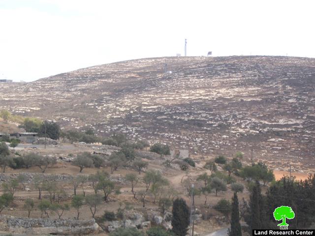
In continuation of the policy of land grabbing practiced by the 'Local Council' of the colony of Itamar, expansion works has been carried out since the beginning of July 2007 as a number of mobile caravans have been placed on the mountaintops north of the town of Aqraba in an area known as Arma. The expansion is looked upon as a prelude for further and more complex expansion works at the expense of the lands of the town.
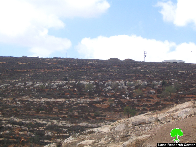
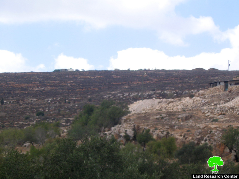
(Photos 2 & 3: Aqraba- Nablus: On going Israeli expansion works over the lands of the town)
Due to these works, there are currently more than 2000 dunums of the northern lands of the towns (in locations such as Al Arma, Sha'eb Al Ward, Katef Abu Azza, Karma and the Nortren Ridge) that are isolated due to its close proximity to the colony of Itamar as no Palestinians can reach it for safety reasons. Such fear by the Palestinians of reaching these lands has been reinforced by the death of the 61-year old Aqraba resident Mr. Mohammad Hamdan Ibrahim Bani Jaber last winter as a result of an attack by Itamar colonists while he was grazing his sheep near Arma location. The colonists took advantage of the fear of the Palestinians and cut down around 700 olive trees during the month of June 2006 in addition to replanting the land for their own benefit. Israeli occupation forces have facilitated this land grab by the shut down of Aqraba-Nablus Road in the face of Palestinian traffic. The road used to connect the villages and towns of Aqraba, Awarta and Yanun with Nablus City which isolated all of the lands that it used to link it to.
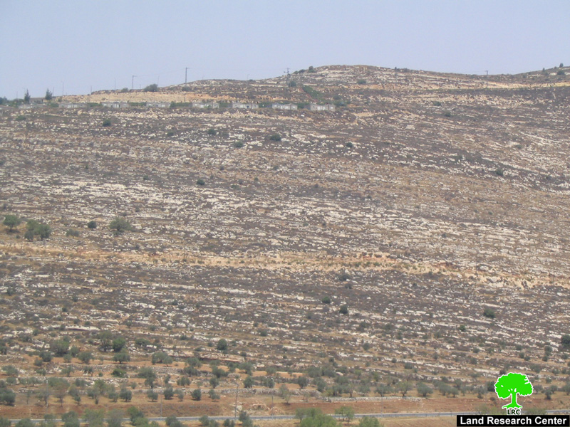
( Photos 4: Aqraba- Nablus: portions of the lands that have been
taken over and prepared for annexation to the colony by road opening)
General Information about Aqraba
The population of Aqraba is about 8,900 according to the Palestinian Central Bureau of Statistics. Its remaining lands are about 35,000 dunums of which 1783 dunums are its built-up area (source: GIS unit at LRC). Around 62% of its lands are planted with olive and almond trees, 8% with fruits and vegetables and 30% of its lands are used for grazing purposes.
There are a number of small farms and villages associated with the town including Khirbet Al Arma, Al Kroom, Khirbet Abu Al Reisa, Khirbet Al Rujman, Khirbet Firas Al Dien in addition to Khirbet Tal Al Khashaba. The total population of these associated villages can reach up to 500 people.
A number of extended families live in the town including Bani Jaber, Al Mayadma, Bani Jame'a, Bani Fadel and Al Deili. It is worth mentioning that the unemployment rate in the town has surpassed 50% due to the occupation policies since the beginning of the current Intifada in 2000. Due to the inability of the Palestinian work force to reach Israeli suburbs for work, the workers in the town are currently holding public and private jobs as well as depending on agriculture and industrial workshops as the main sources of income in the town.
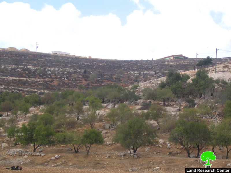
(Photos 5: Aqraba- Nablus: More colonial expansion works at the expense of the lands of the town )
Prepared by
The Land Research Center
LRC